Safety Score: 2,5 of 5.0 based on data from 9 authorites. Meaning we advice caution when travelling to Ireland.
Travel warnings are updated daily. Source: Travel Warning Ireland. Last Update: 2024-05-08 08:04:21
Delve into Killadoon
Killadoon in County Kildare (Leinster) is located in Ireland about 2,713 mi (or 4,366 km) north-west of Qeshlaq, the country's capital town.
Current time in Killadoon is now 04:46 PM (Wednesday). The local timezone is named Europe / Dublin with an UTC offset of one hour. We know of 10 airports close to Killadoon, of which 5 are larger airports. The closest airport in Ireland is Dublin Airport in a distance of 14 mi (or 22 km), North-East. Besides the airports, there are other travel options available (check left side).
There is one Unesco world heritage site nearby. It's Brú na Bóinne - Archaeological Ensemble of the Bend of the Boyne in a distance of 49 mi (or 78 km), North-East. Also, if you like playing golf, there are some options within driving distance. We encountered 1 points of interest near this location. If you need a hotel, we compiled a list of available hotels close to the map centre further down the page.
While being here, you might want to pay a visit to some of the following locations: Naas, Tallaght, Dublin, Navan and Swords. To further explore this place, just scroll down and browse the available info.
Local weather forecast
Todays Local Weather Conditions & Forecast: 16°C / 61 °F
| Morning Temperature | 10°C / 49 °F |
| Evening Temperature | 16°C / 61 °F |
| Night Temperature | 12°C / 54 °F |
| Chance of rainfall | 0% |
| Air Humidity | 70% |
| Air Pressure | 1027 hPa |
| Wind Speed | Gentle Breeze with 8 km/h (5 mph) from North-East |
| Cloud Conditions | Overcast clouds, covering 85% of sky |
| General Conditions | Overcast clouds |
Thursday, 9th of May 2024
17°C (62 °F)
13°C (55 °F)
Overcast clouds, gentle breeze.
Friday, 10th of May 2024
19°C (66 °F)
11°C (52 °F)
Overcast clouds, gentle breeze.
Saturday, 11th of May 2024
19°C (66 °F)
12°C (53 °F)
Scattered clouds, gentle breeze.
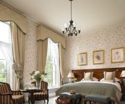
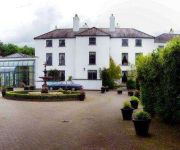
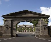
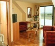
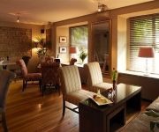
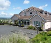
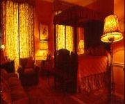
Hotels and Places to Stay
K Club
Barberstown Castle
Courtyard
Celbridge Manor
Glenroyal Hotel & Leisure Club
Springfield
Becketts Hotel
Bearna Rua Lodge
MOYGLARE MANOR HOTEL
Videos from this area
These are videos related to the place based on their proximity to this place.
Mk4 Intercity train + 201 Class Loco - Hazelhatch & Celbridge
Irish Rail Mark 4 intercity train number 4006 + 201 class loco number 234 speeding eastbound through Hazelhatch & Celbridge station on its way from Cork to Heuston station in Dublin, Ireland.
IE 201 Class Loco 218 + IWT freight Liner - Hazelhatch & Celbridge
Irish Rail 201 Class locomotive number 218 and IWT freight liner passing westbound through Hazelhatch & Celbridge station in county Kildare, Ireland.
Wedding Dresses at Village at Lyons
Watch a preview of our wedding shoot in the Wonderful Village at Lyons with fabulous gowns from Belleza Bridal, Edel Tuite Bridal Designs and Protocol Bridal. Full shoot is in our Autumn Issue...
IE 22000 Class ICR Train number 22139 - Hazelhatch & Celbridge
Irish Rail 22000 class DMU intercity train number 22139 heading eastbound through Hazelhatch & Celbridge station, on its way to Heuston station in Dublin, Ireland.
Dublin Heuston -Athlone , Class 22000,passing Hazelhatch & Celbridge station
17:10 Commuter service Dublin Heuston -Athlone ,Class 22000 , No.22341 passing Hazelhatch and Celbridge ATHLONE STATION:Athlone railway station serves the town of Athlone in County ...
Waterford Plunkett - Dublin Heuston,22000 class,passing Hazelhatch & Celbridge
15:00 Waterford Plunkett - Dublin Heuston,22000 class,passing Hazelhatch & Celbridge,No. 2220 WATERFORD PLUNKETT:Waterford railway station (Plunkett Station) serves the city of Waterford...
Videos provided by Youtube are under the copyright of their owners.
Attractions and noteworthy things
Distances are based on the centre of the city/town and sightseeing location. This list contains brief abstracts about monuments, holiday activities, national parcs, museums, organisations and more from the area as well as interesting facts about the region itself. Where available, you'll find the corresponding homepage. Otherwise the related wikipedia article.
Celbridge
Celbridge (from Irish: Cill Droichid, meaning "church bridge") is a town and townland on the River Liffey in County Kildare, Ireland. It is 23 km west of Dublin. As a town within the Dublin Metropolitan Area and the Greater Dublin Area, it is located at the intersection of the R403 and R405 regional roads. In recent years Celbridge has expanded dramatically, yet most of the towns services and amenities still centre around the single main street.
Castletown House
Castletown House, Celbridge, County Kildare, Ireland, is a Palladian country house built in 1722 for William Conolly, the Speaker of the Irish House of Commons. It formed the centrepiece of a 550-acre estate. Sold to developers in 1965, the estate is now divided between State and private ownership.
Ardclough
Ardclough, officially Ardclogh (Irish: Ard Cloch, meaning "high stone"), is a village and community in the parish of Kill County Kildare, Ireland, two miles (3 km) off the N7 national primary road. Amongst its buildings today are a national school, a church, Ardclough GAA Club, and one shop "Buggys". Ardclough also contains the historic round tower at Oughterard.
Lyons Hill
Lyons Hill is a restored village, and former parish with church, now part of the community of Ardclough in north County Kildare. At a time when canal passenger boats travelled at 3 mph Lyons was the nearest overnight stop to Dublin on the Grand Canal. On the hilltop is a trigonometrical point used by Ireland's Ordnance Survey. The name derives from the Irish language name for elm tree, Liamhan.
Ardclough GAA
50x40pxThis article includes a list of references, related reading or external links, but its sources remain unclear because it lacks inline citations. Please improve this article by introducing more precise citations. Ardclough GAA Ard ClochFounded: 1936County: KildareNickname: The ClocksGrounds: Dan Graham Memorial ParkCoordinates: {{#invoke:Coordinates|coord}}{{#coordinates:53.296324|N|6.565962|W|region:IE_type:landmark|||| |primary |name= }}Playing kits File:Kit left arm.
Celbridge GAA
Celbridge is a Gaelic Athletic Association club in Celbridge, County Kildare, Ireland. They were awarded Kildare GAA club of the year in 2008, winners of the Kildare senior football championship of 2008, finalists in the senior football league of 1923, 1988 and 2008 and won the Kildare senior hurling and camogie championships in 2005.
Collegiate School Celbridge
Celbridge Collegiate School {{#invoke:Coordinates|coord}}{{#coordinates:53.33504|-6.55309|type:city_region:IE|||||| |primary |name= }} is a former Protestant girls school situated outside Celbridge in County Kildare in Ireland located 22 kilometres (13 miles) from Dublin. It was known as a nursery of teachers for the Church of Ireland training college and for the proficiency of the Irish language among students.
Lyons Demesne
Lyons Demesne, also Lyons Estate, is a country house and estate in Lyons Hill, County Kildare, Ireland. It is located near Newcastle Demesne and Celbridge, to the northeast of Tipperstown, 24.8 kilometres west of the city centre of Dublin. The Georgian house, completed in 1797 under architect Oliver Grace, is set in 600 acres . Historically, Lyons was the setting of a notable duel between Daniel O'Connell and John D'Esterre.


