Safety Score: 3,4 of 5.0 based on data from 9 authorites. Meaning please reconsider your need to travel to Guatemala.
Travel warnings are updated daily. Source: Travel Warning Guatemala. Last Update: 2024-05-06 08:04:52
Touring Delicias
Delicias in Departamento de Jutiapa is a town located in Guatemala about 37 mi (or 60 km) south-east of Guatemala City, the country's capital place.
Time in Delicias is now 02:22 PM (Monday). The local timezone is named America / Guatemala with an UTC offset of -6 hours. We know of 8 airports nearby Delicias. The closest airport in Guatemala is La Aurora Airport in a distance of 35 mi (or 56 km), North-West. Besides the airports, there are other travel options available (check left side).
There are several Unesco world heritage sites nearby. The closest heritage site in Guatemala is Antigua Guatemala in a distance of 58 mi (or 93 km), North-East. Need some hints on where to stay? We compiled a list of available hotels close to the map centre further down the page.
Being here already, you might want to pay a visit to some of the following locations: San Jose Acatempa, Oratorio, Quesada, Santa Maria Ixhuatan and Jalpatagua. To further explore this place, just scroll down and browse the available info.
Local weather forecast
Todays Local Weather Conditions & Forecast: 33°C / 91 °F
| Morning Temperature | 21°C / 69 °F |
| Evening Temperature | 27°C / 80 °F |
| Night Temperature | 23°C / 73 °F |
| Chance of rainfall | 0% |
| Air Humidity | 40% |
| Air Pressure | 1012 hPa |
| Wind Speed | Gentle Breeze with 8 km/h (5 mph) from North-East |
| Cloud Conditions | Scattered clouds, covering 41% of sky |
| General Conditions | Light rain |
Monday, 6th of May 2024
32°C (89 °F)
23°C (73 °F)
Light rain, gentle breeze, overcast clouds.
Tuesday, 7th of May 2024
32°C (90 °F)
23°C (73 °F)
Light rain, gentle breeze, overcast clouds.
Wednesday, 8th of May 2024
33°C (91 °F)
23°C (73 °F)
Light rain, gentle breeze, overcast clouds.
Hotels and Places to Stay
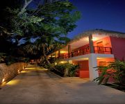
Hotel Camino Real Tikal
Videos from this area
These are videos related to the place based on their proximity to this place.
Chico negro en: Locuras Chapinas de Quesada, Jutiapa
Chingaderas en Buena Vista, Quesada, Jutiapa, Guatemala, Centroamerica, america y el mundo entero..... etc jajajaja.
TERMINATOR DE GUATEMALA
El exterminador del sur-oriente de Guatemala, gracias a la cobertura de los brujos de la región extermina al que se le ponga enfrente.
Lo Mejor de Guatemala, JUTIAPA, Departamento # 11
Cuevas de Anda Mira (Jalpatagua) Laguna de Atescatempa, Playa la Varrona.
San Jose Pineda
Después del los sismos que afectaron oriente de Guatemala en la segunda semana de septiembre, la estructura de muchas casas se ha dañado severemante. en la alde de San José Pineda del ...
Creciente en el Río Pululá El Jicaral
El Río Pululá que cruza la Aldea El Jicaral, Jalpatagua, Jutiapa año con año crece a gran escala lo cual no permite paso hacia la cabecera municipal. Muchas personas arriesgan sus vidas...
Cueva Andá Mirá, Guatemala
Te invitamos a conocer nuestra aventura en la Cueva de Andá Mirá, ubicada en la Aldea El Coco, Jalpatagua, Jutiapa, Guatemala, cerca de la frontera con El ...
Sandblast y recubrimiento industrial
Repinca, expertos en recubrimientos industriales y comerciales.
Videos provided by Youtube are under the copyright of their owners.
Attractions and noteworthy things
Distances are based on the centre of the city/town and sightseeing location. This list contains brief abstracts about monuments, holiday activities, national parcs, museums, organisations and more from the area as well as interesting facts about the region itself. Where available, you'll find the corresponding homepage. Otherwise the related wikipedia article.
San José Acatempa
San José Acatempa is a municipality in the Jutiapa department of Guatemala. One of the first towns founded by the Spanish conquistadors in 1525 under the command of Capitán General Don Pedro de Alvarado y Contreras, which was on route to conquer the region of the old kingdom of Cuzcatlan, now parts of southeastern Guatemala and the republic of El Salvador. The town was previously known by the name of Azacualpa, and during the colonial period, the region was known as Valle de Zacualpa.
Oratorio, Santa Rosa
Oratorio is a municipality in the Santa Rosa department of Guatemala. On the outskirts of the regional centerplace, Cuilapa, Oratorio is mainly an agricultural worker habitat. It is surrounded by vast coffee bean and banana plantations. Oratorio sits in a deep valley, so the sun rises late and sets early. The small city is stretched along one of the international two-lane highways that leads to El Salvador. The stretch of land makes for a very narrow but long city outline.


