Safety Score: 2,8 of 5.0 based on data from 9 authorites. Meaning we advice caution when travelling to Canada.
Travel warnings are updated daily. Source: Travel Warning Canada. Last Update: 2024-05-19 08:11:23
Explore Kennebecasis Park
The district Kennebecasis Park of Torryburn in New Brunswick/Nouveau-Brunswick is located in Canada about 469 mi east of Ottawa, the country's capital.
If you need a place to sleep, we compiled a list of available hotels close to the map centre further down the page.
Depending on your travel schedule, you might want to pay a visit to some of the following locations: Fredericton, Machias, Houlton, Ellsworth and Halifax. To further explore this place, just scroll down and browse the available info.
Local weather forecast
Todays Local Weather Conditions & Forecast: 14°C / 58 °F
| Morning Temperature | 10°C / 50 °F |
| Evening Temperature | 15°C / 59 °F |
| Night Temperature | 11°C / 51 °F |
| Chance of rainfall | 0% |
| Air Humidity | 69% |
| Air Pressure | 1019 hPa |
| Wind Speed | Gentle Breeze with 8 km/h (5 mph) from West |
| Cloud Conditions | Overcast clouds, covering 99% of sky |
| General Conditions | Overcast clouds |
Monday, 20th of May 2024
18°C (65 °F)
9°C (49 °F)
Few clouds, gentle breeze.
Tuesday, 21st of May 2024
17°C (62 °F)
9°C (49 °F)
Moderate rain, moderate breeze, overcast clouds.
Wednesday, 22nd of May 2024
17°C (63 °F)
11°C (52 °F)
Moderate rain, gentle breeze, overcast clouds.
Hotels and Places to Stay
Delta Hotels Saint John
Hilton Saint John
Shadow Lawn Inn
Hampton Inn - Suites by Hilton Saint John
HOWARD JOHNSON FORT HOWE PLAZA
Homeport Historic Bed & Breakfast/Inn c 1858
Park Plaza Motel
UNB Saint John Summer Hotel
Colonial Inn Saint John
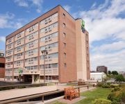
Holiday Inn Express & Suites SAINT JOHN HARBOUR SIDE
Videos from this area
These are videos related to the place based on their proximity to this place.
Saint John Toyota Pay it forward III
Surprising commuters at the Westside Simms Corner Tim Hortons location on Monday Feb.3rd, 2014. Thank you for making us Saint Johns largest volume dealer once again.
Water Polo Dal Gold vs Saint John (Consolation Game)
Saint John 10th Annual Fall Water Polo Tournament 22-23 November 2014 - Consolation Game Dal Gold vs Saint John.
Snowstorm in Uptown Saint John, NB - December 19th, 2012
In what was supposed to be a rainy day, turned out to be a slog in the snow as about 6 inches fell on the City in a matter of hours. Join me for a walk up historic King St as I slog through the snow.
Visite touristique de Saint John (New Brunswick - Canada)
EN City of Saint John (French: Ville de Saint Jean), or commonly Saint John, is the largest city in the province of New Brunswick, and the second largest in the maritime provinces after Halifax....
Killer Whales at New Brunswick Museum, Saint John, Canada
Quite an interesting museum, full of skeletons and other 'bits and bobs' in Saint John, New Brunswick. Blog: http://cricketsaunty.com Photos: https://www.facebook.com/CricketsAunty.
The market of Saint John (New Brunswick - Canada)
(EN) City of Saint John (French: Ville de Saint Jean), or commonly Saint John, is the largest city in the province of New Brunswick, and the second largest in the maritime provinces after Halifax....
Exploring Howe's Cave in Saint John, NB
Part of our exploration of Howe's cave located in Saint John, New Brunswick. This cave has dates going back to 1730. It was blocked in 1842 and then re-opened in the 1860's by a man looking...
Historica | Saint John, New Brunswick Uptown Apartment Living
Historica provides unique commercial and residential space in Saint John, New Brunswick. Historica specializes in bringing back historic buildings to a modern finish while still maintaining...
Videos provided by Youtube are under the copyright of their owners.
Attractions and noteworthy things
Distances are based on the centre of the city/town and sightseeing location. This list contains brief abstracts about monuments, holiday activities, national parcs, museums, organisations and more from the area as well as interesting facts about the region itself. Where available, you'll find the corresponding homepage. Otherwise the related wikipedia article.
Saint John, New Brunswick
City of Saint John, is the largest city in the province of New Brunswick, and the second largest in the maritime provinces. The Fundy City was the first incorporated city in Canada. and is situated along the north shore of the Bay of Fundy at the mouth of the Saint John River. The Saint John Metro covers an area of 323 square kilometers across the Caledonia Highlands, which lie in the core of the city.
Saint John County, New Brunswick
St. John County (2011 population 76,550) is located in southern New Brunswick, Canada. The city of Saint John dominates the county. In the rest of the county, tourists flock to see the many scenic views on the Bay of Fundy.
Fernhill Cemetery
Fernhill Cemetery, originally known as the Rural Cemetery at the time it opened in 1848, is located at 200 Westmorland Road in Saint John, New Brunswick, Canada. Renamed Fernhill in 1899, the 125 acre (0.5 km²) cemetery has a special section for veterans of both World War I and World War II, and is the burial site of one of only a few Canadians to ever receive the United States highest military decoration, the Medal of Honor.
Rothesay, New Brunswick
Rothesay is a Canadian town located in Kings County, New Brunswick. It is a suburb of Saint John along the Kennebecasis River.
Harbour Station
For other uses, see Harbour station (disambiguation). Harbour Station 250pxLocation 99 Station Street, Saint John, New Brunswick, E2L 4X4Opened October 1993Renovated 2005Surface 200' X 85'Capacity 6,200 (seated, hockey) 6,603 (seated, basketball) 7,205 (concert)Tenants Saint John Flames (1993–2003) Saint John Sea Dogs (2005-Present)Saint John Mill Rats (2010-Present) Harbour Station is an arena located in the uptown area of Saint John, New Brunswick.
Saint John Portland
Saint John Portland is a provincial electoral district for the Legislative Assembly of New Brunswick, Canada. 2006 New Brunswick election Party Candidate Votes % ±% Progressive Conservative Trevor Holder 2987 49.97 * Liberal Colleen Knudson 2710 45.33 * NDP Clare Mudge 281 4.7 *
Saint John Harbour
Saint John Harbour is a provincial electoral district for the Legislative Assembly of New Brunswick, Canada. It was represented from its creation for the 1995 election until October 13, 2005 by Elizabeth Weir, the leader of the New Democratic Party of New Brunswick from 1988 to September 25, 2005. Liberal Ed Doherty had then taken the spot by winning a by-election on November 14, 2005 and was re-elected in the 2006 general election.
Cathedral of the Immaculate Conception (Saint John, New Brunswick)
The Cathedral of the Immaculate Conception in Saint John, New Brunswick, Canada is located on 91 Waterloo Street. The building was initiated by the second Bishop of New Brunswick, The Most Rev. Thomas Connolly. Realising that the Catholic population required a larger facility, Bishop Connolly on November 14, 1852 announced to the congregation his intention to proceed immediately with the erection of the Cathedral.
Ministers Face
Ministers Face is a cliff face on Long Island in the community of Kingston, in New Brunswick's Kennebecasis River northwest of the town of Rothesay. The cliff is the source of local folklore, ranging from ghost stories to tales of volcanic activity. Ministers Face is home to several endangered species of plants, as well as a nesting site for Peregrine falcons.
Chapel Grove, New Brunswick
Chapel Grove is a Canadian rural community in Kings County, New Brunswick. It is adjacent to Summerville and lies south of Clifton Royal on the Kingston Peninsula on the northwest bank of the Kennebecasis River opposite the towns of Quispamsis and Rothesay. The community is served by New Brunswick Route 845. The community is framed by steep hills directly west of Long Island.
New Brunswick Museum
The New Brunswick Museum, located in Saint John, New Brunswick, is Canada's oldest continuing museum. The New Brunswick Museum was officially incorporated as the "Provincial Museum" in 1929 and received its current name in 1930, but its history goes back much further. Its lineage can be traced back another eighty-eight years to 1842 and to the work of Dr. Abraham Gesner.
Renforth, New Brunswick
Renforth is a Canadian suburban community and former village in Kings County, New Brunswick. It is situated on the south bank of the Kennebecasis River southwest of the neighbouring town of Rothesay and northeast of Saint John. It is named after James Renforth, a rower from Britain who had died of heart failure during a match against Saint John's famous Paris Crew in August 1870 in the waters of the Kennebecasis River off the community.
Canada Games Stadium
Canada Games Stadium is a multi-purpose, fully lit stadium in Saint John, New Brunswick. It was built on the campus of UNB Saint John for the 1985 Canada Summer Games and has a seating capacity of 5,000 spectators. Canada Games Stadium features a 400m synthetic rubberized track surface, as well as separate areas for long jump/triple jump, high jump, pole vault, discus, hammer, shot put, and javelin. Inside the track is a synthetic turf soccer/football field.
Millidgeville, New Brunswick
Millidgeville is a Canadian neighbourhood in the city of Saint John, New Brunswick. Millidgeville is situated on the northern edge of the city, on Brothers Cove off the Kennebecasis River at the point where that westerly flowing river meets the southerly flowing Saint John River.
Saint John City Market
The Saint John City Market is the oldest continuing farmer's market in Canada, with a charter dating from 1785. Located in Saint John, New Brunswick and completed in 1876, the current market building has a unique roof structure that resembles an inverted ship's keel. Made of wooden trusses, the structure was reportedly built by unemployed ship carpenters of the day. Also, the floor slopes with the natural grade of the land. The architecture is in the Second Empire style.
Rothesay Railway Station (European and North American)
The Rothesay Railway Station is one of the oldest standing railway stations in Canada, built between 1858 and 1860. It is a National Historic Site of Canada located in Rothesay, New Brunswick. The building offers an example of the standard station design of its era with its wooden two storey configuration. It was erected during construction of the European and North American Railway which connected Saint John to Shediac, New Brunswick and which was completed in August 1860.
Fairvale, New Brunswick
Fairvale was a community in Kings County, New Brunswick, Canada. It was incorporated into the town of Rothesay on January 1, 1998.
Kennebecasis Island Ferry
The Kennebecasis Island Ferry is a cable ferry crossing the Kennebecasis River in the Canadian province of New Brunswick. The ferry links Summerville on the Kingston Peninsula with Kennebecasis Island. The crossing is 0.5 kilometres in length, takes 5 minutes, and is free of tolls. The single ferry carries up to 12 cars at a time, and operates during the ice-free period, generally from May to November. The service runs from 0700 until 1900 or later, depending on the day and time of year.
Battle of Fundy Bay
The Battle of Fundy Bay took place on July 14, 1696 between France and England toward the end of King Williams War in the Bay of Fundy off present-day Saint John, New Brunswick. The English ships were sent from Boston to interrupt the supplies being taken by French officer Pierre Le Moyne d'Iberville from Quebec to the capital of Acadia, Fort Nashwaak on the Saint John River.
Fort Howe
Fort Howe was built by the British during the American Revolution shortly after the American Siege of Saint John (1777), to protect Saint John from further American raids. The 18th and 19th century British Army fortification is built in present-day New Brunswick, Canada at the mouth of the Saint John River where it empties into the Bay of Fundy. The site of the fort is now located within the city of Saint John. Fort Howe includes a replica of the blockhouse that once stood at Fort Howe.
Port of Saint John
The Port of Saint John is a port complex that occupies 45 hectares of land along 3,900 m of waterfront. The port is located at the mouth of the Saint John River in Saint John, New Brunswick, Canada, with facilities on both sides of the river. The Port of Saint John is noted for its extreme tidal range and river currents. Because of the semi-diurnal tides and the river influence, slack water occurs at approximately half tide and not at high or low water as at most other ports.
Loyalist House
Loyalist House is a museum and National Historic Site located in uptown Saint John, New Brunswick. It was the home of the prosperous Merritt family, who occupied from its completion in 1817 until 1958. It was taken over by the New Brunswick Historical Society in 1961. Its current address is 120 Union Street.
Saint John Jewish Historical Museum
The Saint John Jewish Historical Museum in Saint John, New Brunswick, Canada, preserves and displays the history of the Jewish community in the city of Saint John. The Museum was opened by founder Marcia Koven in 1986. A Jewish Historical Society had already been established in the congregation.
Rothesay Parish, New Brunswick
Rothesay is a Canadian parish in Kings County, New Brunswick.
Greater Saint John
Greater Saint John (French: Grand Saint John) is the name given to the area encompassing Metro Saint John. Greater Saint John is also known as Greater Saint John Census Metropolitan Area, or Saint John CMA, and is located in New Brunswick, Canada. Greater Saint John has a population of 138,644 (2011). The Census Metropolitan Area of Saint John consists of 16 municipalities and parishes in addition to the City of Saint John.


