Safety Score: 2,8 of 5.0 based on data from 9 authorites. Meaning we advice caution when travelling to Canada.
Travel warnings are updated daily. Source: Travel Warning Canada. Last Update: 2024-05-08 08:04:21
Explore Seeleys Cove
Seeleys Cove in New Brunswick/Nouveau-Brunswick is located in Canada about 440 mi (or 708 km) east of Ottawa, the country's capital.
Local time in Seeleys Cove is now 08:37 PM (Wednesday). The local timezone is named America / Moncton with an UTC offset of -3 hours. We know of 9 airports in the wider vicinity of Seeleys Cove, of which one is a larger airport. The closest airport in Canada is Saint John Airport in a distance of 41 mi (or 65 km), North-East. Besides the airports, there are other travel options available (check left side).
Also, if you like golfing, there are multiple options in driving distance. If you need a place to sleep, we compiled a list of available hotels close to the map centre further down the page.
Depending on your travel schedule, you might want to pay a visit to some of the following locations: Fredericton, Machias, Houlton, Ellsworth and Bangor. To further explore this place, just scroll down and browse the available info.
Local weather forecast
Todays Local Weather Conditions & Forecast: 15°C / 59 °F
| Morning Temperature | 6°C / 43 °F |
| Evening Temperature | 8°C / 46 °F |
| Night Temperature | 7°C / 45 °F |
| Chance of rainfall | 7% |
| Air Humidity | 43% |
| Air Pressure | 1007 hPa |
| Wind Speed | Moderate breeze with 9 km/h (6 mph) from West |
| Cloud Conditions | Broken clouds, covering 65% of sky |
| General Conditions | Moderate rain |
Wednesday, 8th of May 2024
6°C (44 °F)
4°C (40 °F)
Moderate rain, moderate breeze, overcast clouds.
Thursday, 9th of May 2024
11°C (53 °F)
5°C (40 °F)
Scattered clouds, gentle breeze.
Friday, 10th of May 2024
10°C (51 °F)
7°C (45 °F)
Light rain, moderate breeze, overcast clouds.
Hotels and Places to Stay
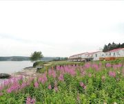
Clipper Shipp Beach Motel
Videos from this area
These are videos related to the place based on their proximity to this place.
Magaguadavic River Flood of 2010 - Update No. 3, Dec. 17 @ 5pm
Update No. 3 on the Flood of the Magaguadavic River: Water level decreasing at a very good rate. Many roads have been reopened though the main road into Bonny River is still closed. Relief...
Rough Surf - Tropical Storm/Hurricane Bill
The Bay of Fundy coast feels effects of Tropical Storm/Hurricane "Bill" on August 23, 2009.
Videos provided by Youtube are under the copyright of their owners.
Attractions and noteworthy things
Distances are based on the centre of the city/town and sightseeing location. This list contains brief abstracts about monuments, holiday activities, national parcs, museums, organisations and more from the area as well as interesting facts about the region itself. Where available, you'll find the corresponding homepage. Otherwise the related wikipedia article.
RCAF Station Pennfield Ridge
RCAF Station Pennfield Ridge was a Royal Canadian Air Force training base located in coastal Charlotte County, New Brunswick in the hamlet of Pennfield Ridge.
Pennfield Ridge, New Brunswick
Pennfield Ridge is a Canadian rural community in Charlotte County, New Brunswick.
Pennfield, New Brunswick
Pennfield is a Canadian rural community in Charlotte County, New Brunswick. Pennfield is also referred to sometimes as Pennfield Corner. Pennfield intersects with Route 785, Route 1, Route 778, Route 176, and Route 795.


