Safety Score: 2,8 of 5.0 based on data from 9 authorites. Meaning we advice caution when travelling to Canada.
Travel warnings are updated daily. Source: Travel Warning Canada. Last Update: 2024-04-26 08:02:42
Discover Indiantown
Indiantown in New Brunswick/Nouveau-Brunswick is a city in Canada about 467 mi (or 751 km) east of Ottawa, the country's capital city.
Local time in Indiantown is now 03:35 AM (Saturday). The local timezone is named America / Moncton with an UTC offset of -3 hours. We know of 9 airports in the vicinity of Indiantown, of which one is a larger airport. The closest airport in Canada is Saint John Airport in a distance of 10 mi (or 15 km), East. Besides the airports, there are other travel options available (check left side).
Also, if you like golfing, there are a few options in driving distance. Looking for a place to stay? we compiled a list of available hotels close to the map centre further down the page.
When in this area, you might want to pay a visit to some of the following locations: Fredericton, Machias, Houlton, Ellsworth and Halifax. To further explore this place, just scroll down and browse the available info.
Local weather forecast
Todays Local Weather Conditions & Forecast: 10°C / 50 °F
| Morning Temperature | -1°C / 31 °F |
| Evening Temperature | 6°C / 43 °F |
| Night Temperature | 2°C / 35 °F |
| Chance of rainfall | 0% |
| Air Humidity | 34% |
| Air Pressure | 1032 hPa |
| Wind Speed | Light breeze with 5 km/h (3 mph) from South |
| Cloud Conditions | Clear sky, covering 0% of sky |
| General Conditions | Sky is clear |
Saturday, 27th of April 2024
11°C (51 °F)
4°C (40 °F)
Overcast clouds, gentle breeze.
Sunday, 28th of April 2024
11°C (52 °F)
7°C (45 °F)
Light rain, gentle breeze, overcast clouds.
Monday, 29th of April 2024
10°C (50 °F)
6°C (42 °F)
Light rain, gentle breeze, scattered clouds.
Hotels and Places to Stay
Hilton Saint John
Delta Hotels Saint John
Homeport Historic Bed & Breakfast/Inn c 1858
HOWARD JOHNSON FORT HOWE PLAZA
Hampton Inn - Suites by Hilton Saint John
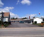
Hillcrest Motel
Park Plaza Motel
Island View Motel
Econo Lodge Inn & Suites
Regent Motel
Videos from this area
These are videos related to the place based on their proximity to this place.
Saint John Toyota Pay it forward III
Surprising commuters at the Westside Simms Corner Tim Hortons location on Monday Feb.3rd, 2014. Thank you for making us Saint Johns largest volume dealer once again.
NB Southern Railway - Mill Street Stall
A newly painted 3703 is out helping 9802 & 3702 haul a transfer up the Mill Street grade in Saint John. They only make it about half way up the hill before having to stop to shut down 3703.
Water Polo Dal Gold vs Saint John (Consolation Game)
Saint John 10th Annual Fall Water Polo Tournament 22-23 November 2014 - Consolation Game Dal Gold vs Saint John.
Visite touristique de Saint John (New Brunswick - Canada)
EN City of Saint John (French: Ville de Saint Jean), or commonly Saint John, is the largest city in the province of New Brunswick, and the second largest in the maritime provinces after Halifax....
Killer Whales at New Brunswick Museum, Saint John, Canada
Quite an interesting museum, full of skeletons and other 'bits and bobs' in Saint John, New Brunswick. Blog: http://cricketsaunty.com Photos: https://www.facebook.com/CricketsAunty.
The Queen Mary 2 leaving the port of Saint John.
Time lapse showing the Queen Mary 2 cruise ship leaving Saint John. The Queen Mary 2 was the first of three ships into Saint John this morning but it is the last to leave. My Gigapixel Panoramas...
Historica | Saint John, New Brunswick Uptown Apartment Living
Historica provides unique commercial and residential space in Saint John, New Brunswick. Historica specializes in bringing back historic buildings to a modern finish while still maintaining...
Historica | Commercial and Retail Space for rent in Saint John, New Brunswick
Historica provides unique commercial and residential space in Saint John, New Brunswick. Historica specializes in bringing back historic buildings to a modern finish while still maintaining...
Organic Facial Cleanser Review | Honey Do's - Saint John NB (506) 653-0113
http://bit.ly/honeydos Organic Facial Cleanser Review | Honey Do's - Saint John NB The Bee Clean Organic Scrub is gentle enough to use as a facial cleanser. Here's Proof! "I've been using...
Videos provided by Youtube are under the copyright of their owners.
Attractions and noteworthy things
Distances are based on the centre of the city/town and sightseeing location. This list contains brief abstracts about monuments, holiday activities, national parcs, museums, organisations and more from the area as well as interesting facts about the region itself. Where available, you'll find the corresponding homepage. Otherwise the related wikipedia article.
Saint John, New Brunswick
City of Saint John, is the largest city in the province of New Brunswick, and the second largest in the maritime provinces. The Fundy City was the first incorporated city in Canada. and is situated along the north shore of the Bay of Fundy at the mouth of the Saint John River. The Saint John Metro covers an area of 323 square kilometers across the Caledonia Highlands, which lie in the core of the city.
Harbour Station
For other uses, see Harbour station (disambiguation). Harbour Station 250pxLocation 99 Station Street, Saint John, New Brunswick, E2L 4X4Opened October 1993Renovated 2005Surface 200' X 85'Capacity 6,200 (seated, hockey) 6,603 (seated, basketball) 7,205 (concert)Tenants Saint John Flames (1993–2003) Saint John Sea Dogs (2005-Present)Saint John Mill Rats (2010-Present) Harbour Station is an arena located in the uptown area of Saint John, New Brunswick.
Reversing Falls Bridge
The Reversing Falls Bridge is a two-lane highway bridge crossing the Saint John River at Saint John, New Brunswick, Canada. It carries New Brunswick Route 100 (Bridge Road) across the river and there is no toll for its use.
Reversing Falls Railway Bridge
The Reversing Falls Railway Bridge is the name given to two different steel truss bridges crossing the Saint John River at the same location in Saint John, New Brunswick, Canada. The original bridge was constructed in 1885 immediately upstream of a highway crossing known as the Reversing Falls Bridge. Measuring 372 metres in length, the railway bridge carried a single-track main line.
Saint John Harbour Bridge
The Saint John Harbour Bridge is a hollow box, haunched girder bridge crossing Saint John Harbour at the mouth of the Saint John River in Saint John, New Brunswick, Canada.
New Brunswick Museum
The New Brunswick Museum, located in Saint John, New Brunswick, is Canada's oldest continuing museum. The New Brunswick Museum was officially incorporated as the "Provincial Museum" in 1929 and received its current name in 1930, but its history goes back much further. Its lineage can be traced back another eighty-eight years to 1842 and to the work of Dr. Abraham Gesner.
Navy Island, New Brunswick
Navy Island was a small island situated within the Inner Harbour of Saint John, New Brunswick in Canada. For centuries, Navy Island existed as a narrow, oval shaped hunk of rock sitting roughly at the turning point of the harbour where the deep open water ends and the harbour approaches the Reversing Falls. However, the island ceased to exist in its traditional form when the construction of the Saint John Harbour Bridge linked the island to the mainland in the 1970s.
Battle of Fundy Bay
The Battle of Fundy Bay took place on July 14, 1696 between France and England toward the end of King Williams War in the Bay of Fundy off present-day Saint John, New Brunswick. The English ships were sent from Boston to interrupt the supplies being taken by French officer Pierre Le Moyne d'Iberville from Quebec to the capital of Acadia, Fort Nashwaak on the Saint John River.
Fort Howe
Fort Howe was built by the British during the American Revolution shortly after the American Siege of Saint John (1777), to protect Saint John from further American raids. The 18th and 19th century British Army fortification is built in present-day New Brunswick, Canada at the mouth of the Saint John River where it empties into the Bay of Fundy. The site of the fort is now located within the city of Saint John. Fort Howe includes a replica of the blockhouse that once stood at Fort Howe.
Port of Saint John
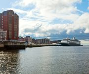
The Port of Saint John is a port complex that occupies 45 hectares of land along 3,900 m of waterfront. The port is located at the mouth of the Saint John River in Saint John, New Brunswick, Canada, with facilities on both sides of the river. The Port of Saint John is noted for its extreme tidal range and river currents. Because of the semi-diurnal tides and the river influence, slack water occurs at approximately half tide and not at high or low water as at most other ports.
St. John River expedition
The St. John River expedition was an attempt by a small number of militia commanded by John Allan to bring the American Revolutionary War to Nova Scotia in late 1777. With minimal logistical support from Massachusetts and approximately 100 volunteer militia and Natives, Allan's forces occupied the small settlement at the mouth of the St. John River in June 1777. The settlement's defense was weakened by the war effort and that Americans quickly occupied it and took prisoner British sympathizers.
Loyalist House
Loyalist House is a museum and National Historic Site located in uptown Saint John, New Brunswick. It was the home of the prosperous Merritt family, who occupied from its completion in 1817 until 1958. It was taken over by the New Brunswick Historical Society in 1961. Its current address is 120 Union Street.


