Delve into Wattleup
The district Wattleup of in City of Cockburn (Western Australia) with it's 842 habitants Wattleup is a subburb in Australia about 1,917 mi west of Canberra, the country's capital town.
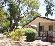
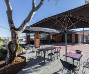
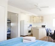
If you need a hotel, we compiled a list of available hotels close to the map centre further down the page.
While being here, you might want to pay a visit to some of the following locations: City of Cockburn, Rockingham, Perth, and . To further explore this place, just scroll down and browse the available info.
Local weather forecast
Todays Local Weather Conditions & Forecast: 25°C / 78 °F
| Morning Temperature | 20°C / 67 °F |
| Evening Temperature | 22°C / 71 °F |
| Night Temperature | 19°C / 66 °F |
| Chance of rainfall | 0% |
| Air Humidity | 30% |
| Air Pressure | 1026 hPa |
| Wind Speed | Fresh Breeze with 13 km/h (8 mph) from South-West |
| Cloud Conditions | Clear sky, covering 0% of sky |
| General Conditions | Sky is clear |
Sunday, 19th of May 2024
25°C (76 °F)
20°C (68 °F)
Overcast clouds, moderate breeze.
Monday, 20th of May 2024
25°C (76 °F)
20°C (68 °F)
Overcast clouds, moderate breeze.
Tuesday, 21st of May 2024
23°C (73 °F)
19°C (66 °F)
Overcast clouds, gentle breeze.
Hotels and Places to Stay
Discovery Parks - Woodman Point
Gallery Hotel
Discovery Parks - Coogee Beach
Videos from this area
These are videos related to the place based on their proximity to this place.
Top Fuel Drag 1/4 mile - 8000 HP - Kwinana Motorplex - Awesome Header Flames - December 2008
Top Fuel Kwinana Motorplex - December 2008 - Awesome header flames- one 4 second pass with one 5 second pass and an engine detonation. Filmed on day 1 of a 2 day meet.
Smart Car vs Smart Car at Quit Motorplex Kwinana Beach
Smart Car vs Smart car at the WA Kwinana Beach Quit Motorplex on a Whoop-Ass Wednesday gathering.
Nitro Funny Cars - Kwinana Motorplex Speedway
Anthony Begley in the Chemical Warfare Chev Camaro vs Mark Sheehan (Closest to Camera) in the Red Ford Mustang Kwinana Motorplex Nitro Funny Cars Rocked up for my first drag meet, took...
Burnouts in the Snakepit - Kwinana Motorplex Perth WA
Burnouts on the snakepit, and some awesome footage of George Separovichs HK Monaro doing a burnout...
S13 Silvia Drag Race Redback Nissan RB26 Perth Motorplex Pro Stock. Kwinana Oct 2009
My Nissan S13 Silvia competing in the pro stock event October 2009.
Nitro Funny Car crash...Ash Bailey .Chemical Warfare .Quit motorplex Kwinana
Ash Bailey drops his lunch on the line oils up rear tyres turns right and hits the wall. "well thats the end of that one"!!! nobody gets hurt except maybe the guy running with the fire...
Torana HB v Chev C10 supercharged drags.Quit motorplex , Kwinana.
Woods v Hudson. gets it crossed up in the burnout !!! another "hand held production"
308 V8 LJ Torana drag racing.Quit Motorplex Kwinana.whoopass wednesday
300m one wheel burnout by Barry Boucher . another "hand held production"
Videos provided by Youtube are under the copyright of their owners.
Attractions and noteworthy things
Distances are based on the centre of the city/town and sightseeing location. This list contains brief abstracts about monuments, holiday activities, national parcs, museums, organisations and more from the area as well as interesting facts about the region itself. Where available, you'll find the corresponding homepage. Otherwise the related wikipedia article.
City of Cockburn
The City of Cockburn is a local government area in the southern suburbs of the Western Australian capital city of Perth about 8 kilometres south of Fremantle and about 24 kilometres south of Perth's central business district. The City covers an area of 167.5 square kilometres and has a population of 89,683 (2011).
Yangebup, Western Australia
Yangebup is a southern suburb of Perth, Western Australia. Located in the City of Cockburn, the suburb takes its name from the nearby Yangebup Lake.
The Spectacles, Western Australia
The Spectacles is a mixed use suburb of Perth, Western Australia, located in the Town of Kwinana The Spectacles is also a wetlands area within the suburb of 'The Spectacles' and is considered to be the most valuable asset of Kwinana's natural environment, covering 3.7 square kilometres. It is named 'The Spectacles' because it comprises two lakes connected by a drain, giving it the appearance of a pair of spectacles.
Success Park 'n' Ride
Success Park 'n' Ride was a Transperth bus station located next to the current Cockburn Central Train/Bus Interchange. Bus transfers were provided in Success Park 'n' Ride but this role has now been taken by Cockburn Central Bus Interchange.
Hope Valley, Western Australia
Hope Valley is a suburb of Perth, Western Australia, located within the Town of Kwinana. Its postcode is 6165.
Mandogalup, Western Australia
Mandogalup is a suburb of Perth, Western Australia, located within the Town of Kwinana. Its postcode is 6167. The area of this suburb was originally referred to as "7 Mile Camp", but when a townsite was declared here in 1923 it was named "Balmanup". Lake Balmanup was an alternative name for Mandogalup Swamp. In 1945 it was found that the townsite was more commonly known as Mandogalup and it was changed to Mandogalup in 1946. It is an Aboriginal name, the meaning of which is unknown.
Naval Base, Western Australia
Naval Base is a heavy industrial suburb of Perth, Western Australia, located within the Town of Kwinana.
Postans, Western Australia
Postans is a suburb of Perth, Western Australia, located within the Town of Kwinana. The suburb is named after George Postans who was one of the first settlers in the area. He arrived in the Colony as a convict in 1850 and after he was released he bought 100 acres of land in 1882. The suburb was formerly known as "Caledonia".
Aubin Grove, Western Australia
Aubin Grove is a suburb of Perth, Western Australia, located within the City of Cockburn. The suburb was approved in 2003. Aubin Grove is a new suburb in the City of Cockburn which was formerly part of the rural locality of Banjup. It is named after Henry John Aubin who leased agricultural land in the area in 1897, and was approved in 2003.
Atwell, Western Australia
Atwell is a suburb within the metropolitan area of Perth, Western Australia, Western Australia, situated 21 kilometres south of Perth City, and located in the City of Cockburn local government area.
Beeliar, Western Australia
Beeliar is a suburb of Perth, Western Australia, located within the City of Cockburn. The name refers to the Beeliar people, a tribe of Indigenous Australians who had land usage rights over the southern half of Perth's metropolitan area. The suburb contains the Thomsons Lake Nature Reserve.
Hammond Park, Western Australia
Hammond Park is a southern suburb of Perth, Western Australia, located within the City of Cockburn. Hammond Park was previously part of Banjup, and the suburb created in March 2002.
Henderson, Western Australia
Henderson is a suburb of Perth, Western Australia, located within the City of Cockburn.
Munster, Western Australia
Munster is a suburb of Perth, Western Australia, located within the City of Cockburn.
Wattleup, Western Australia
Wattleup is a southern suburb of Perth, Western Australia, located within the City of Cockburn. As of 2001, it has been part of the Hope Valley-Wattleup development program, which has meant the demolition of most of the houses in the area for future industry. Wattleup had many market gardens in the past. They provided agricultural produce for the town of Fremantle.
Success, Western Australia
Success is a southern suburb of Perth, Western Australia, located within the City of Cockburn. The name Success comes from Captain James Stirling's ship HMS Success.
Cockburn Central railway station
Cockburn Central Station is a railway station located in Jandakot, Western Australia. Situated in the Kwinana Freeway median strip, and just north of the Beeliar Drive/Armadale Road interchange, it is also integrated with the Success Park 'n' Ride bus station. It is served by the interburban Mandurah line, with services to both the Perth CBD and the neighbouring city of Mandurah. When the station was commissioned, Cockburn Central became a suburb of its own.
Cockburn Power Station
Cockburn Power Station (CKB) is a power station in Cockburn, Western Australia. It has one natural gas powered gas turbine and one steam turbine that together generate a total capacity of 240 MW of electricity. The station was commissioned in 2003. It has a 160 MW combined cycle gas turbine which provides steam to a 80 MW steam turbine.
Beeliar Wetlands
The Beeliar Wetlands are made up of two chains of lakes and wetlands that run parallel to the west coast of Western Australia. They are situated on the coastal plan between the Darling Escarpment and the Indian Ocean. The name "Beeliar" was the name given to the area by the Aboriginal people that lived and hunted in the area. The first chain of lakes and wetlands lies about 1–3 km inland from the Indian Ocean.
Perth Motorplex
Perth Motorplex is a motorsport venue located at Kwinana Beach, Western Australia. It caters mainly for drag racing and speedway, although other events are held there regularly. Over 275,000 patrons attend the venue each year to many varied events. The Perth Motorplex holds rounds of the ANDRA Drag Racing Championship and World Series Sprintcars championship.
Cockburn Central, Western Australia
Cockburn Central is a suburb of Perth, the capital city of Western Australia, and is 24 kilometres south of Perth's central business district (CBD) along the Kwinana Freeway. Its Local Government Area is the City of Cockburn, and it is intended by the Government to serve as a regional centre for the area. It was approved as a name by the Geographic Names Committee in 2007. At present, it contains an industrial area, a commercial area and a railway station.
Thomsons Lake
Thomsons Lake is a lake nature reserve in the City of Cockburn, Western Australia, approximately 25 km south of the central business district of Perth, the state capital, and on the southern fringes of the Perth metropolitan area. It in the suburb of Beeliar, 7 km south-west of Jandakot Airport.
Forrestdale and Thomsons Lakes Ramsar Site
The Forrestdale and Thomsons Lakes Ramsar Site comprises two separate nature reserves, totaling 754 ha in area, protecting two shallow fresh to brackish, seasonal lakes in a suburban and agricultural landscape in south-western Western Australia. It is used mainly for birdwatching and walking. It lies in the Swan Coastal Plain bioregion.
Canning Land District
Canning Land District is a land district (cadastral division) of Western Australia, located within the South West Division in the eastern and south-eastern suburbs of metropolitan Perth.
Atwell College
Atwell College is a public co-educational high school in Western Australia. The school is located on Brenchley Drive in the suburb of Atwell. The school was established in 2008 and caters for students in Year 7 to 12. The college was opened in 2008 with Stage 1 of building program being completed in 2010 which housed the 680 Year 7 to Year 10 students. Facilities included in Stage 1 of the project include a two-storey building for classrooms, a large gymansium and a performing arts centre.


