Touring Yalyalup
The district Yalyalup of Reinscourt in Busselton (Western Australia) is a subburb located in Australia about 1,914 mi west of Canberra, the country's capital place.
Need some hints on where to stay? We compiled a list of available hotels close to the map centre further down the page.
Being here already, you might want to pay a visit to some of the following locations: Rockingham, City of Cockburn, Perth, and . To further explore this place, just scroll down and browse the available info.
Local weather forecast
Todays Local Weather Conditions & Forecast: 23°C / 73 °F
| Morning Temperature | 17°C / 63 °F |
| Evening Temperature | 21°C / 70 °F |
| Night Temperature | 19°C / 66 °F |
| Chance of rainfall | 0% |
| Air Humidity | 41% |
| Air Pressure | 1017 hPa |
| Wind Speed | Fresh Breeze with 13 km/h (8 mph) from South-West |
| Cloud Conditions | Overcast clouds, covering 100% of sky |
| General Conditions | Light rain |
Friday, 10th of May 2024
21°C (70 °F)
17°C (63 °F)
Moderate rain, strong breeze, broken clouds.
Saturday, 11th of May 2024
19°C (67 °F)
13°C (55 °F)
Few clouds, moderate breeze.
Sunday, 12th of May 2024
18°C (64 °F)
17°C (62 °F)
Overcast clouds, gentle breeze.
Hotels and Places to Stay
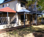
Observatory Guesthouse
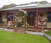
Busselton Marina Bed and Breakfast
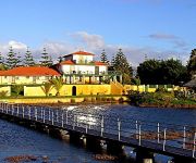
Martin Fields Beach Retreat
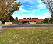
Comfort Inn Busselton River Resort
The Esplanade Hotel Busselton
Royal Palms Resort
Videos from this area
These are videos related to the place based on their proximity to this place.
2014 Sunsmart Ironman 70.3 Busselton - Official Highlights
All the action from the amazing 2014 Sunsmart Ironman 70.3 Busselton. You must not miss this clip showing this must-not miss event! Like Nothing You've Ever Experienced Before busseltonfestivalof...
2013 Sunsmart Ironman 70.3 Busselton
Highlights of the amazing 2013 Sunsmart Ironman 70.3. Congratulations to all competitors, teams and individuals who took on the challenge. Thanks go to all involved especially sponsors, volunteers...
TigerMoth Adventure Flights Busselton WA
Tiger Moth Adventure Flights operates out of Busselton Airfield. Your pilot, Steven Millington, has over 7500 flying hours, of which over 5000 were conducting low level operations as an Agricultur...
2012 Sunsmart Ironman 70.3 Busselton
Falling Leaf Video's highlight production of the 2012 Sunsmart Ironman 70.3 Busselton. With the imminent threat of storms and gale force winds on the day before the event, mother nature kindly...
Aquatastic Busselton Jetty Aqua Park 2
Have fun and get really fit at the Aquatastic Aqua Park - Busselton Jetty. Opens December 15th! Jumping off the Iceberg is really cool!
Margaret River Busselton Jetty | Margaret River WA | 08 9757 4569
http://margaretriverguide.com.au/attractions/busselton-jetty/busselton-jetty/ Margaret River Busselton Jetty - The Interpretative Centre and Cultural Heritage Museum, Ride the Jetty Train,...
Chris Casey Ride for SAFE Busselton Albany to Perth 10th - 17th November 2014
Support Chris on his mission to raise much needed funds for S.A.F.E. Busselton. Please donate to S.A.F.E. Busselton using Credit Card or PayPal by visiting: www.gofundme.com/ride4safebusselton...
Mandalay Resort, 5 star family accommodation Busselton, Western Australia
Mandalay Holiday Resort is a 5 STAR family beach resort, caravan park and camping park located in Busselton, Western Australia. When you are looking for your next family holiday destination...
2013 Busselton Sprint Run 4
My last and quickest run of the day. For those unfamiliar with the event, the track is a set of closed roads around Barnard Park on the Busselton Foreshore, a couple of hundred metres from...
Triumph TR8 busselton sprints 2009 fastest lap, TR7 V8
2009 busselton sprints in my tr8 triumph 5.2l rover v8 fastest lap ,TR7 V8.
Videos provided by Youtube are under the copyright of their owners.
Attractions and noteworthy things
Distances are based on the centre of the city/town and sightseeing location. This list contains brief abstracts about monuments, holiday activities, national parcs, museums, organisations and more from the area as well as interesting facts about the region itself. Where available, you'll find the corresponding homepage. Otherwise the related wikipedia article.
Busselton, Western Australia
Busselton is a city in the South West region of Western Australia. Founded in 1832 by the Bussell family, Busselton has been one of the fastest growing regions in Australia in the last decade and has a population of approximately 20,000. Busselton is 220 kilometres south west of Perth, the capital of Western Australia. Busselton has been voted Western Australia's top tourist town three times in 1995, 1996 and 2005.
Capel, Western Australia
Capel is a town in the South West region of Western Australia, located 212 kilometres south of Perth and midway between Bunbury and Busselton. The town is located on the Capel River and is approximately 19 metres above sea level. Capel has a Mediterranean climate, with hot dry summers and cool wet winters. Daily temperatures range from 13 °C to 40 °C in summer, and from 5 °C to 27 °C in winter. Average annual rainfall is about 830 mm.
Wonnerup, Western Australia
The townsite of Wonnerup is located 219 kilometres south of Perth and 10 kilometres east of Busselton. It was gazetted a townsite in 1856, deriving its name from the nearby Wonnerup Inlet. The name is Aboriginal, having been shown on maps of the region since 1839. The meaning of the name is "place of the woman's digging or fighting stick"; the Noongar word for fighting stick is wonna, while the suffix -up denotes place of.
Geographe Bay
Geographe Bay is located in the south-west of Western Australia around 220 km southwest of Perth. The bay was named in May 1801 by French explorer Nicolas Baudin; Baudin named the bay after his ship, Géographe. The bay is a wide curve of coastline extending from Cape Naturaliste past the towns of Dunsborough and Busselton, ending near the city of Bunbury.
Busselton Jetty
Busselton Jetty is the longest wooden jetty (pier) in the southern hemisphere, stretching almost 2 km out to sea from the town of Busselton, Western Australia. Because the shallow waters of Geographe Bay restricted ship movement, a long jetty was required so that the cut timber could be transported to the ships. In 1839 Governor Hutt appointed "the place in Geographe Bay opposite the Settlement at The Vasse to be the legal place for the loading and unloading of goods".
City of Busselton
The City of Busselton is a local government area in the South West region of Western Australia, approximately 230 kilometres south of Perth, the state capital. The City covers an area of 1,455 square kilometres and has a estimated population of 31,767. It contains two large towns, Busselton and Dunsborough, and a number of smaller towns. The city office is located on Southern Drive, Busselton.
Acton Park, Western Australia
Acton Park is a small town and agricultural district located in the South West of Western Australia inland from Busselton along Jalbarragup Road. It contains a hall and B&B farmstay accommodation. At the 2011 Australian Census the area had a population of 257.
Vasse, Western Australia
Vasse is a town in the South West region of Western Australia, 10 kilometres west of the town of Busselton and 240 kilometres southwest of Perth. Its Local Government Area is the Shire of Busselton. At the 2006 census, Vasse had a population of 1,316. The town is named after the Vasse River and Vasse Estuary, both of which in turn are named after French seaman, Thomas Vasse, that disappeared in the area in June 1801 during Nicolas Baudin's expedition.
Shire of Capel
The Shire of Capel is a local government area in the South West region of Western Australia, taking in the land between the cities of Bunbury and Busselton about 200 kilometres south of the state capital, Perth. The Shire covers an area of 557.6 square kilometres, and its seat of government is the town of Capel. The Shire of Capel has 29 km of beach frontage onto Geographe Bay including Forrest, Peppermint Grove, Minninup and Dalyellup beaches.
Georgiana Molloy Anglican School
Georgiana Molloy Anglican School is a private school located in Busselton, Western Australia, and named after the notable early Western Australian settler Georgiana Molloy. The school was established in 2003 under the guidance of Reverend Tom Wilmot, who recognised the need for an Anglican School on "the Cape". The school is expected from 2008 to offer full K-12 education.
Sabina River
The Sabina River is a river in the South West of Western Australia. The headwaters of the river rise in the Whicher Range near the edge of the Millbrook State Forest and then flowing in the northerly direction. The river crosses the Vasse Highway then Sues Road and finally Bussell Highway before discharging into Vasse Estuary near Busselton and finally into the Indian Ocean via Wonnerup Inlet and Geographe Bay.
Vasse River
The Vasse River is a river in the South West of Western Australia. The headwaters of the river are in the Whicher Range below Chapman Hill and flow in the northerly direction until discharging into the Vasse Estuary near Busselton and then the Indian Ocean via Wonnerup Inlet and Geographe Bay. The only tributary to the river is the Sabina River which discharges into Vasse Estuary.
Whicher Range
Whicher Range, also known as Whicher Scarp, is a range in the South West region of Western Australia. The range has an average elevation of 170 metres above sea level. Bounded by the Swan Coastal Plain to the West and the South, the Darling Scarp to the North and the Blackwood Plateau to the East, the range is approximately 20 kilometres South of Busselton. The range has the form of a crescent shaped scarp.
Ludlow River
The Ludlow River is a river in the South West region of Western Australia. The headwaters of the river are in the Whicher Range near Claymore. The river flows in a north-westerly direction through Yoganup then through Ludlow and discharges into the Wonnerup Estuary and thence into Geographe Bay and the Indian Ocean. The Ludlow is located in the Vasse-Wonnerup Conservation District within the Geographe Catchment Area along with the Abba and Sabina Rivers.
Abba River
The Abba River is a river in the South West of Western Australia. The headwaters of the river rise in the Whicher Range in the Millbrook State Forest then flow in a northerly direction. The river crosses the Vasse Highway and then through Wonnerup Siding before discharging into the Vasse Estuary East of Busselton and finally the Indian Ocean. The river was named in 1834 by Frederick Ludlow. The name is Aboriginal in origin and is a greeting word used by the local peoples.
Vasse-Wonnerup Estuary
The Vasse-Wonnerup Estuary is an estuary in the South West region of Western Australia close to the town of Busselton. The estuary is listed with DIWA. It was also recognised as a wetland of international importance under the Ramsar Convention on 7 June 1990 when an area of 1115 ha was designated Ramsar Site 484 as an important dry-season habitat for waterbirds. It is also the main part of the 2038 ha Busselton Wetlands Important Bird Area.
Ambergate, Western Australia
Ambergate is a town in the South West region of Western Australia. It is located 238 km south south west of Perth and the closest populated town is Busselton. Bushfires threatened homes in the town in 2013 when a blaze started under suspicious circumstances. The fire claimed 40 hectares of nearby bushland before being contained.
Peppermint Grove Beach, Western Australia
Peppermint Grove Beach is a residential subdivision and beachside town in the South West region of Western Australia. Its local government area is the Shire of Capel and it is located 8 kilometres northwest of Capel on the Geographe Bay coast near the Capel River mouth. Peppermint Grove Beach, sometimes called Peppermint Grove Beach Estate, is situated on land that was first farmed by James McCourt, an Irish Catholic settler in the 19th century.
Busselton Senior High School
Busselton Senior High School is a comprehensive public high school located in Busselton, a regional centre 220 kilometres south of Perth, Western Australia. The school was established in 1958 and by 2012 had an enrolment of 562 students between Year 8 and Year 12, approximately 6) of whom were Aboriginal.
Wonnerup House
Wonnerup House is a Heritage-listed farm precinct in Wonnerup, Western Australia. The current house was built in 1859 by George Layman Jr. , one year after the original house built in 1837 by his father, George Layman Sr. , was destroyed by fire. The dairy and kitchen survived the fire because they were separate from the house. Stables and a blacksmith workshop were later additions to the farm.
Cape Naturaliste College
Cape Naturaliste College is a comprehensive public high school located in Vasse, a regional centre 240 kilometres south of Perth, Western Australia. The school was established in 2008 admitted 95 foundation Year 8 students in February of that year. The Minister of Education, Mark McGowan, announced later the same year that the school would become a senior high school and enrol students for Year 11 courses in 2011 and Year 12 in 2012.


