Safety Score: 2,7 of 5.0 based on data from 9 authorites. Meaning we advice caution when travelling to United States.
Travel warnings are updated daily. Source: Travel Warning United States. Last Update: 2024-05-19 08:11:23
Discover Riverside Park
Riverside Park in Merrick County (Nebraska) is a city in United States about 1,116 mi (or 1,796 km) west of Washington DC, the country's capital city.
Local time in Riverside Park is now 05:17 AM (Sunday). The local timezone is named America / Chicago with an UTC offset of -5 hours. We know of 8 airports in the vicinity of Riverside Park, of which one is a larger airport. The closest airport in United States is Central Nebraska Regional Airport in a distance of 20 mi (or 32 km), South-West. Besides the airports, there are other travel options available (check left side).
Also, if you like golfing, there are a few options in driving distance. Looking for a place to stay? we compiled a list of available hotels close to the map centre further down the page.
When in this area, you might want to pay a visit to some of the following locations: Central City, Aurora, Fullerton, Grand Island and Osceola. To further explore this place, just scroll down and browse the available info.
Local weather forecast
Todays Local Weather Conditions & Forecast: 17°C / 63 °F
| Morning Temperature | 13°C / 55 °F |
| Evening Temperature | 21°C / 69 °F |
| Night Temperature | 16°C / 61 °F |
| Chance of rainfall | 17% |
| Air Humidity | 86% |
| Air Pressure | 1010 hPa |
| Wind Speed | Fresh Breeze with 14 km/h (9 mph) from North-West |
| Cloud Conditions | Overcast clouds, covering 100% of sky |
| General Conditions | Heavy intensity rain |
Sunday, 19th of May 2024
24°C (74 °F)
18°C (64 °F)
Light rain, moderate breeze, scattered clouds.
Monday, 20th of May 2024
14°C (57 °F)
10°C (50 °F)
Moderate rain, fresh breeze, overcast clouds.
Tuesday, 21st of May 2024
18°C (64 °F)
14°C (57 °F)
Light rain, gentle breeze, broken clouds.
Hotels and Places to Stay
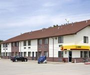
Rodeway Inn Central City
Videos from this area
These are videos related to the place based on their proximity to this place.
Incredible Lightning! - Central City, NE May 7th, 2005
This amazing lightning storm came on the heels of an incredible storm chase in south central Nebraska! We tracked a supercell thunderstorm near Central City, and as the sun went down, were...
Fire Fight in Pasture
A fire started in a pasture north of Marquette, NE on a hot, dry and windy day. It took 6 local fire departments and Aurora Aviation Traudt Aerial to get it under control.
Forum_09b.wmv
January 31 - February 3, 2009 League Legislative Forum Crystal Gateway Marriott 1700 Jefferson Davis Highway Arlington, VA 22202 postmasers.org.
UP West Bound Z Train Headed for West Coast. Near Grand Island, NE.
Z train headed to San Francisco.
The Dark Island Trail Day Hiking, Mushroom Hunting, Photography
I meet up with my best buds at the Dark Island Trail. The trail was used by the Pawnee Native Americans to travel to the Platte River, and was near 1 of their 5 ...
Videos provided by Youtube are under the copyright of their owners.
Attractions and noteworthy things
Distances are based on the centre of the city/town and sightseeing location. This list contains brief abstracts about monuments, holiday activities, national parcs, museums, organisations and more from the area as well as interesting facts about the region itself. Where available, you'll find the corresponding homepage. Otherwise the related wikipedia article.
KMMJ
KMMJ (AM 750 is a radio station broadcasting a Christian talk and information format. Licensed to Grand Island, Nebraska, USA, the station serves the Grand Island, Hastings, Kearney area. The station is currently owned by The Praise Network, Inc. and features Christian Talk programming. ref> {{#invoke:citation/CS1|citation |CitationClass=web }} Prior to the switch to religious programming, the station broadcast a news/information format.
Overland, Nebraska
Overland is a census-designated place (CDP) in Hamilton County, Nebraska, United States. The population was 153 at the 2010 census.


