Safety Score: 2,7 of 5.0 based on data from 9 authorites. Meaning we advice caution when travelling to United States.
Travel warnings are updated daily. Source: Travel Warning United States. Last Update: 2024-04-29 08:03:39
Delve into Garden Valley Courts
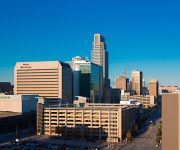
Garden Valley Courts in Douglas County (Nebraska) is located in United States about 1,011 mi (or 1,626 km) west of Washington DC, the country's capital town.
Current time in Garden Valley Courts is now 01:59 PM (Monday). The local timezone is named America / Chicago with an UTC offset of -5 hours. We know of 8 airports close to Garden Valley Courts, of which 3 are larger airports. The closest airport in United States is Eppley Airfield in a distance of 2 mi (or 4 km), East. Besides the airports, there are other travel options available (check left side).
Also, if you like playing golf, there are some options within driving distance. We encountered 1 points of interest near this location. If you need a hotel, we compiled a list of available hotels close to the map centre further down the page.
While being here, you might want to pay a visit to some of the following locations: Omaha, Council Bluffs, Papillion, Blair and Plattsmouth. To further explore this place, just scroll down and browse the available info.
Local weather forecast
Todays Local Weather Conditions & Forecast: 16°C / 60 °F
| Morning Temperature | 8°C / 46 °F |
| Evening Temperature | 18°C / 65 °F |
| Night Temperature | 13°C / 56 °F |
| Chance of rainfall | 0% |
| Air Humidity | 50% |
| Air Pressure | 1011 hPa |
| Wind Speed | Moderate breeze with 10 km/h (6 mph) from East |
| Cloud Conditions | Scattered clouds, covering 39% of sky |
| General Conditions | Scattered clouds |
Monday, 29th of April 2024
24°C (75 °F)
15°C (58 °F)
Moderate rain, fresh breeze, broken clouds.
Tuesday, 30th of April 2024
23°C (73 °F)
16°C (61 °F)
Moderate rain, moderate breeze, overcast clouds.
Wednesday, 1st of May 2024
17°C (62 °F)
10°C (51 °F)
Moderate rain, fresh breeze, overcast clouds.
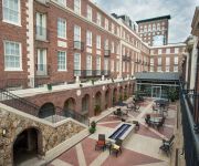
Hotels and Places to Stay
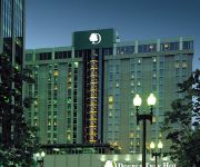
DoubleTree by Hilton Omaha Downtown
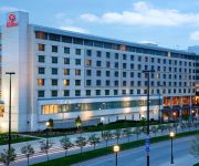
Hilton Omaha
Element Omaha Midtown Crossing
Magnolia Omaha
Hotel Deco XV LIFESTYLE
Omaha Marriott Downtown at the Capitol District
Redick Plaza Hotel Omaha
Courtyard Omaha Downtown/Old Market Area
Hilton Garden Inn Omaha Downtown-Old Market Area
Residence Inn Omaha Downtown/Old Market Area
Videos from this area
These are videos related to the place based on their proximity to this place.
Omaha Public Schools Board Meeting - July 21st, 2014
Omaha Public Schools Board Meeting - July 21st, 2014.
The Mastercraft Building 1111 N 13th St Omaha, NE
For more details click here: http://www.visualtour.com/showvt.asp?t=2506324 1111 N 13th St Omaha 68102 The Mastercraft is: Unique/Creative/Urban/Artistic/Eclectic. Professional environment...
Hot Shops Open House - Omaha Nebraska Wegener Images Panasonic AG-HMC 40/41 Mark Wegener
Hot Shops Open House 2010 - Artist collective Painting Metalworking Sculpture Photography Weaving Glassworks Omaha Nebraska Wegenerimages.com Mark Wegener Panasonic AG-HMC40/41.
Omaha Storm 6/27/08 Part 1
Part 1 of the Severe Thunderstorm that hit the Omaha area. I'm in Council Bluffs near Downtown Omaha at home. First 5-6 minutes are a little boring since I had to close my sliding door so the...
Hail Storm At Omaha Airport.
Sitting on the plane waiting to head back to NJ filming the lightning storm. Then a hail storm roles through dropping hail the size of golf balls and up to softballs. Shattered the windshield...
Missouri River Flood, under the Mormon Bridge in Omaha - 6/23/2011
Under the Mormon Bridge in northeast Omaha, Nebraska. 8:30am. June 23, 2011,
City Of O Weeds & Litter-Episode 1 (What it's Like)
This is the first of what I hope to be many videos of what we have to deal with on a daily basis. Keep in mind the grass is very tall so I have to start and stop to build up the R.P.M. and...
City Of O Weeds & Litter-Episode 2 (Gravely Trouble)
Here we see me running the Gravely. at the end I hit a tree root.
Videos provided by Youtube are under the copyright of their owners.
Attractions and noteworthy things
Distances are based on the centre of the city/town and sightseeing location. This list contains brief abstracts about monuments, holiday activities, national parcs, museums, organisations and more from the area as well as interesting facts about the region itself. Where available, you'll find the corresponding homepage. Otherwise the related wikipedia article.
Trans-Mississippi Exposition
The Trans-Mississippi and International Exposition was a world's fair held in Omaha, Nebraska from June 1 to November 1 of 1898. Its goal was to showcase the development of the entire West, stretching from the Mississippi River to the Pacific Coast. The Indian Congress was held concurrently. Over 2.6 million people came to Omaha to view the 4,062 exhibits during the four months of the Exposition.
Saratoga, Nebraska Territory
Saratoga Springs, Nebraska Territory, or Saratoga, was a boom and bust town founded in 1856 that throve for several years. During its short period of influence the town grew quickly, outpacing other local settlements in the area including Omaha and Florence, and briefly considered as a candidate for the Nebraska Territorial capitol. Saratoga was annexed into Omaha in 1887, and has been regarded a neighborhood in North Omaha since then.
Kountze Park (Omaha, Nebraska)
Kountze Park is an urban public park located at 1920 Pinkney Street in the Kountze Place neighborhood of North Omaha, Nebraska, in the United States, and is historically significant as the site of the Trans-Mississippi Exposition of 1898.
Miller Park (Omaha, Nebraska)
The Miller Park neighborhood in North Omaha, Nebraska is a historically significant community housing a historic district and several notable historic places. It is located between Sorenson Parkway on the south and Redick Avenue on the north, Florence Boulevard on the east and 30th Street on the west. The Minne Lusa neighborhood borders on the north, and the Saratoga neighborhood is on the south. Fort Omaha borders the neighborhood on the west.
Miller Park Elementary School
Miller Park Elementary School is located at 5625 North 28th Avenue in the Miller Park neighborhood of north Omaha, Nebraska. The school is credited for creating the original Junior Forest Club concept.
Sorensen Parkway
Sorensen Parkway is a modern link in the boulevard system in Omaha, Nebraska. The Parkway flows west from North 30th Street to North 90th Street, and has been viewed as the northern boundary that defines the area called North Omaha.
Levi Carter Park
Levi Carter Park is located at 3100 Abbott Drive in East Omaha, Nebraska. It was named after one of Omaha's original industrialists, Levi Carter, who ran a white lead smelter in the area.
Miller Park (park)
Miller Park is located at 6201 North 30th Street in North Omaha, Nebraska. Bounded by Redick and Kansas Avenues on the north and south and 24th and 30th Streets on the east and west, respectively, the park was added to the city of Omaha in 1891.
Saratoga Elementary School (North Omaha, Nebraska)
For the school district in Saratoga, California, see Saratoga Union School District Saratoga Elementary School Location 2504 Meredith AvenueOmaha, NE 68112 Coordinates coord}}{{#coordinates:41|18|03|N|95|56|56|W|type:edu_region:US-NE primary name= }} Information Type public, elementary school Motto Raising the level of achievement through a caring and cooperative environment.
Sherman Elementary School
Sherman Elementary School is located at 5618 North 14th Avenue in East Omaha, Nebraska. Founded in 1888 at 16th and Jaynes Streets for 21 students, today Sherman is home to over 275 students in prekindergarten through sixth grade. The school has absorbed several smaller local schools, was included in Omaha Public Schools' court-ordered desegregation plan, and was one of the first schools in Omaha to become 100% Title I recipients.
Redick Mansion
The Redick Mansion, also known as the Mayne Mansion and Redick Hall, was located at 3612 North 24th Street in North Omaha, Nebraska. It served as the first home of Omaha University, now known as the University of Nebraska at Omaha, from 1909 through 1917. A five story tower on the front of the mansion was a notable landmark throughout the area.
King Science and Technology Magnet Center
King Science and Technology Magnet Center is a district-wide magnet school middle school of the Omaha Public Schools system in Omaha, Nebraska, United States. The school was constructed in 1969 and opened in 1973 in predominantly black North Omaha as Martin Luther King Middle School. In 1976, the school, under the Omaha Public Schools' Desegregation Plan became a site of forced busing from non-local neighborhoods.


