Safety Score: 2,7 of 5.0 based on data from 9 authorites. Meaning we advice caution when travelling to United States.
Travel warnings are updated daily. Source: Travel Warning United States. Last Update: 2024-04-18 08:12:24
Explore Saint Paul
Saint Paul in Ramsey County (Minnesota) with it's 285,068 inhabitants is located in United States about 923 mi (or 1,485 km) north-west of Washington DC, the country's capital.
Local time in Saint Paul is now 10:15 PM (Thursday). The local timezone is named America / Chicago with an UTC offset of -5 hours. We know of 11 airports in the wider vicinity of Saint Paul, of which 5 are larger airports. The closest airport in United States is St Paul Downtown Holman Field in a distance of 2 mi (or 3 km), East. Besides the airports, there are other travel options available (check left side).
Also, if you like golfing, there are multiple options in driving distance. We found 1 points of interest in the vicinity of this place. If you need a place to sleep, we compiled a list of available hotels close to the map centre further down the page.
Depending on your travel schedule, you might want to pay a visit to some of the following locations: Minneapolis, Stillwater, Hastings, Hudson and Anoka. To further explore this place, just scroll down and browse the available info.
Local weather forecast
Todays Local Weather Conditions & Forecast: 6°C / 42 °F
| Morning Temperature | 3°C / 38 °F |
| Evening Temperature | 6°C / 43 °F |
| Night Temperature | 3°C / 38 °F |
| Chance of rainfall | 0% |
| Air Humidity | 35% |
| Air Pressure | 1019 hPa |
| Wind Speed | Moderate breeze with 12 km/h (8 mph) from East |
| Cloud Conditions | Broken clouds, covering 57% of sky |
| General Conditions | Broken clouds |
Friday, 19th of April 2024
5°C (42 °F)
6°C (42 °F)
Overcast clouds, moderate breeze.
Saturday, 20th of April 2024
13°C (55 °F)
10°C (51 °F)
Sky is clear, gentle breeze, clear sky.
Sunday, 21st of April 2024
16°C (61 °F)
11°C (52 °F)
Overcast clouds, gentle breeze.
Hotels and Places to Stay
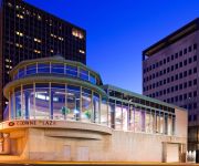
InterContinental Hotels SAINT PAUL RIVERFRONT
Embassy Suites by Hilton St Paul Downtown
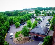
Holiday Inn MINNEAPOLIS AIRPORT SE - EAGAN
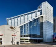
DoubleTree by Hilton St Paul Downtown
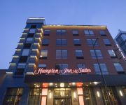
Hampton Inn and Suites by Hilton Downtown St Paul MN
Holiday Inn ST. PAUL DOWNTOWN
BEST WESTERN PLUS CAPITOL RIDG
MN Country Inn and Suites Roseville
Courtyard Minneapolis-St. Paul Airport
Fairfield Inn & Suites Minneapolis-St. Paul Airport
Videos from this area
These are videos related to the place based on their proximity to this place.
C-SPAN Cities Tour - Saint Paul: Gangster Era in Saint Paul
Learn about Saint Paul's gangster history. Saint Paul became a safe haven for the most wanted men and women in the country in the early 20th century. Visit the court room where John Dillinger'...
City of Saint Paul - The Year In Review 2013
The video producers of the City of Saint Paul's Communications Services show off their best video from the year 2013. These clips highlight the year in accomplishments, events, and people in...
Saint Paul Firefighters: Living the Legacy
Experience some of the Saint Paul Fire Department's history through the words of 102 year old "Red" Haslach and his grandson Matt -- two firefighters who began their careers in Saint Paul almost...
2015 Saint Paul Winter Carnival Grande Day Parade
Watch more videos at http://www.SPNN.org From Rice Park in downtown Saint Paul, its the 2015 Grande Day Parade, filmed live with announcers Tom and Brent Lasalle. Like SPNN on Facebook:...
Saint Paul Urban Tennis
Watch this video highlighting Saint Paul Urban Tennis produced by SPNN Youth in collaboration with the Sprockets program! Saint Paul Urban Tennis provides tennis and education programming...
2015 Saint Paul Winter Carnival Torchlight Parade
The colorful 2015 Vulcan Victory Torchlight Parade and Overthrow Ceremony, closing the St. Paul Winter Carnival.
Saint Paul Winter Carnival Royal Coronation 2015
Highlights from the live broadcast of the 2015 Royal Coronation.
2014 Saint Paul Winter Carnival Torchlight Parade & Overthrow of King Boreas
Vulcanus Rex uses his wily ways to light up the streets of downtown Saint Paul for the Vulcan Victory Torchlight Parade presented by Metropolitan State University. After the parade, Rex and...
Saint Paul DWI Attorney
http://www.dwiminneapolislawyer.com If you just got an DWI charge in Saint Paul, MN call us at (952) 835-6314 for a FREE consultation regarding your case.
Videos provided by Youtube are under the copyright of their owners.
Attractions and noteworthy things
Distances are based on the centre of the city/town and sightseeing location. This list contains brief abstracts about monuments, holiday activities, national parcs, museums, organisations and more from the area as well as interesting facts about the region itself. Where available, you'll find the corresponding homepage. Otherwise the related wikipedia article.
Xcel Energy Center
The Xcel Energy Center (also known as "The X") is a multi-purpose arena, located in Saint Paul, Minnesota. It is named for its locally based corporate sponsor Xcel Energy. With an official capacity of 18,064, the arena has four spectator levels: one suite level and three general seating levels. The arena is owned by the city of Saint Paul and operated by Minnesota Sports & Entertainment.
RiverCentre
The RiverCentre is a large convention center located in Saint Paul, Minnesota, USA. It has twice been honored as "Best Convention Center" by Minnesota Meetings and Events Magazine. It hosts a large variety of events and has been the home of the annual Festival of Nations since 1934.
Tyson Events Center
The Gateway Arena is a multi-purpose arena inside the Tyson Events Center, located in Sioux City, Iowa and sponsored by Tyson Foods and Gateway, Inc.. The arena has three spectator levels: one suite level and two general seating levels named the 100 level and the 200 level. Its official capacity is 10,000. Owned and operated by the City of Sioux City, it is located on the riverfront overlooking the Missouri River.
Cray Plaza
Cray Plaza (formerly Galtier Plaza), located in the Lowertown historic district of St. Paul, Minnesota, provides space for working, living, eating, and recreating in a self-contained project on one square city block. Features include 365 apartments, 121 luxury condominiums, 16 townhomes, a YMCA facility, 192,000 square feet of retail and restaurant space, 100,000 square feet of office space, and an underground parking garage for 800 cars.
Roy Wilkins Auditorium
The Roy Wilkins Auditorium is a 5,000-seat multi-purpose arena in St. Paul, Minnesota. Designed by renowned African American municipal architect Clarence W. Wigington, it was built in 1932 as the St. Paul Auditorium, and was renamed for Roy Wilkins in 1985. It is located next door to the Xcel Energy Center, home of the National Hockey League's Minnesota Wild.
Robert Street Bridge
The Robert Street Bridge is a reinforced concrete multiple-arch bridge that spans the Mississippi River in downtown St. Paul, Minnesota. The bridge is notable for its complex design that was required to accommodate river traffic, the St. Paul Union Pacific Vertical-lift Rail Bridge crossing underneath it at an angle, and roadways on the downtown side of St. Paul. The bridge is also notable for a monumental reinforced concrete rainbow arch.
Wabasha Street Bridge
The Wabasha Street Bridge is a segmental bridge that spans the Mississippi River in downtown St. Paul, Minnesota. There are actually two separate bridges, one for northbound and one for southbound traffic. The use of a concrete segmental box girder bridge provided a construction advantage because no falsework needed to be built beneath the bridge. The bridge was built in 1996 by Lunda Construction Company and was designed by Toltz, King, Duvall, Anderson & Associates, Inc..
St. Paul Union Pacific Vertical-lift Rail Bridge
The St. Paul Union Pacific Vertical-lift Rail Bridge is a vertical-lift bridge that spans the Mississippi River in downtown St. Paul, Minnesota. This is one of only three vertical-lift bridges along the Mississippi River, along with the Hastings Rail Bridge in Hastings, Minnesota and the Wabash Bridge in Hannibal, Missouri. It was built in 1913 and was designed by Waddell & Harrington. In 1925, the north end of the bridge was raised about 16 feet to tie in with tracks that served the St.
Central (Metro Transit station)
Central (formerly known as 4th & Cedar until November 2011) is a light rail station under construction along the Central Corridor line in Saint Paul, Minnesota. It will be unique among Central Corridor stations in that it is not located in the middle of or directly adjacent to a road, but rather at a 45° angle to surrounding streets like the Downtown East/Metrodome Station on the Hiawatha Line.
Robert Street (Metro Transit station)
Robert Street (called Capitol East until November 2011) is a light rail station under construction along the Central Corridor line in Saint Paul, Minnesota. According to a preliminary engineering draft from June 2010, it will be located on the west side of Robert Street, largely between 14th Street and Columbus Avenue. This is in an area of government buildings a short distance from the Minnesota State Capitol. Initial construction in this area began in August 2010.
10th Street (Metro Transit station)
10th Street Station is a planned light rail stop along the Central Corridor line in downtown Saint Paul, Minnesota. According to a preliminary engineering draft from June 2010, it will be located along Cedar Street between 11th Street and 10th Street. This will be just south of Interstate 94. Construction in this area is expected to begin in June 2011. The station is expected to open along with the rest of the line in 2014.
Rice Park, Saint Paul, Minnesota


