Safety Score: 2,7 of 5.0 based on data from 9 authorites. Meaning we advice caution when travelling to United States.
Travel warnings are updated daily. Source: Travel Warning United States. Last Update: 2024-05-17 08:07:57
Discover Mark Twain
Mark Twain in St. Louis (Missouri) is a city in United States about 711 mi (or 1,144 km) west of Washington DC, the country's capital city.
Local time in Mark Twain is now 07:28 PM (Friday). The local timezone is named America / Chicago with an UTC offset of -5 hours. We know of 10 airports in the vicinity of Mark Twain, of which 4 are larger airports. The closest airport in United States is Lambert St Louis International Airport in a distance of 8 mi (or 13 km), North-West. Besides the airports, there are other travel options available (check left side).
There is one Unesco world heritage site nearby. It's Cahokia Mounds State Historic Site in a distance of 16 mi (or 26 km), East. Also, if you like golfing, there are a few options in driving distance. We discovered 1 points of interest in the vicinity of this place. Looking for a place to stay? we compiled a list of available hotels close to the map centre further down the page.
When in this area, you might want to pay a visit to some of the following locations: St Louis, Clayton, Saint Charles, Belleville and Edwardsville. To further explore this place, just scroll down and browse the available info.
Local weather forecast
Todays Local Weather Conditions & Forecast: 26°C / 80 °F
| Morning Temperature | 17°C / 62 °F |
| Evening Temperature | 27°C / 81 °F |
| Night Temperature | 22°C / 72 °F |
| Chance of rainfall | 0% |
| Air Humidity | 52% |
| Air Pressure | 1011 hPa |
| Wind Speed | Light breeze with 4 km/h (2 mph) from North |
| Cloud Conditions | Clear sky, covering 1% of sky |
| General Conditions | Sky is clear |
Saturday, 18th of May 2024
29°C (84 °F)
24°C (75 °F)
Scattered clouds, gentle breeze.
Sunday, 19th of May 2024
29°C (84 °F)
25°C (77 °F)
Overcast clouds, moderate breeze.
Monday, 20th of May 2024
33°C (91 °F)
27°C (80 °F)
Sky is clear, moderate breeze, clear sky.
Hotels and Places to Stay
a Tribute Portfolio Hotel Magnolia Hotel St. Louis
THE MOONRISE HOTEL
Marriott St. Louis Grand
Embassy Suites by Hilton St Louis Downtown
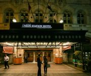
St. Louis Union Station a Curio by Hilton
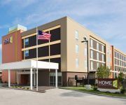
Home2 Suites St Louis -Central West End - Forest Park
Courtyard St Louis Downtown West
Residence Inn St. Louis Downtown
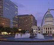
Hyatt Regency St Louis At The Arch
Hotel Lumiere
Videos from this area
These are videos related to the place based on their proximity to this place.
Rare Chrysler Turbine Car
Easter Car Show forest park St Louis Missouri Sure beats church. this car is owned by st louis county. OK OK LETS ALL COMMENT ON HOW THE GUY SHOOTING THE VID IS SHAKING OOOO ...
St. Louis U-City Soldiers J.F.L. Super Bowl Championship Game pt. 2
Part 2 of U-City vs BCLC Mustang @ Herbert Hoover Boys and Girl Club. U-City Soldiers J.F.L. 9 Heavy Undefeated Foot ball Camps in 2006-2007 showing what they do and how they do it. Filmed...
Rare Groove & Rollerskating - Act: XVIII
My mother's day '09 trip to St. Louis netted some good footage and this is the first of the videos from that trip. My man Alex gets a solo spot while groovin' to Nowhere by the combined efforts...
Fast Unsecured Loans | (818) 981 - 7777 | Lines of Credit $50k - $250k Jennings, MO
Please Call: (818) 981 - 7777 | Call Now: (818) 981 - 7777 Fast Unsecured Loans | (818) 981 - 7777 | Lines of Credit $50k - $250k Jennings, MO 0% APR to 24 M...
The History Of River Roads Mall
River Roads Mall was an enclosed shopping mall in Jennings, Missouri a suburb of St. Louis, It opened in 1962, The mall declined in the 1990's and in 2006, They demolished the whole mall?
#35 Anthony Goodland First High School Home Run
Jennings Warriors vs. Cleveland JROTC baseball game April 25, 2012. I hit my first home run in my high school career as a 6'2 ,190 pound sophomore at the age of 16. Watch out beacuse I plan...
The Hair Cut
This short film shows first timer Alonzo 'Greedy' Finger III getting a fresh cut after 7 years of growing his hair.
Dustin Wallace acoustic
Just learning how to play, but bare with me cause its been 4 years and check out my new stuff to come.
Videos provided by Youtube are under the copyright of their owners.
Attractions and noteworthy things
Distances are based on the centre of the city/town and sightseeing location. This list contains brief abstracts about monuments, holiday activities, national parcs, museums, organisations and more from the area as well as interesting facts about the region itself. Where available, you'll find the corresponding homepage. Otherwise the related wikipedia article.
Bellefontaine and Calvary Cemeteries
Bellefontaine Cemetery (established in 1849) and the Roman Catholic Calvary Cemetery (established in 1857) in St. Louis, Missouri are adjacent burial grounds, which have numerous historic and extravagant tombstones and mausoleums. They are the necropolis for a number of prominent local and state politicians, as well as soldiers of the American Civil War. Founders planned Bellefontaine Cemetery to make room for development in the business area before the cholera epidemic of 1849.
St. Louis Truck Assembly
St. Louis Truck Assembly was a General Motors automobile factory. Opened in the 1920s, it closed on August 7, 1987 when the R- and V-series crew cab and cab/chassis truck production moved to Janesville.
Mark Twain, St. Louis
Mark Twain is a neighborhood of St. Louis, Missouri. It is located between Interstate 70 and Calvary Cemetery.
Mark Twain/I-70 Industrial, St. Louis
Mark Twain/I-70 Industrial is a neighborhood of St. Louis, Missouri. It is bound by I-70 to the north, North Kingshighway to the east, Natural Bridge Road to the south, and the city limit to the west.
O'Fallon, St. Louis
O'Fallon is a neighborhood of St. Louis, Missouri. The neighborhood is located on the north side of the City of St. Louis, nestled between O'Fallon Park and Fairground Park. It is bounded by West Florissant, Harris Avenue, Algernon Street and Adelaide on the north, Pope Avenue on the northwest, Kossuth and Natural Bridge Avenues on the south via Fair Avenue, Warne on the east, and Newstead on the west.
Penrose, St. Louis
Penrose is a neighborhood of St. Louis, Missouri. The neighborhood is located on the north side of the city just south of Interstate 70 and west of O’Fallon Park. It is bounded by Florissant Avenue and I-70 on the north, Natural Bridge on the south, North Newstead and Pope Avenue on the east, and Kingshighway Boulevard on the west.
Walnut Park East, St. Louis
Walnut Park East is a neighborhood of St. Louis, Missouri. Walnut Park East is one of several neighborhoods in northwest St. Louis. Its borders are West Florissant Avenue (Calvary Cemetery) to the northeast, Emerson Avenue to the southeast, Interstate 70 (I-70) to the southwest and west, and Riverview Boulevard to the northwest.
Luther Yard
Luther Yard is a rail yard operated by the Norfolk Southern Railway in St. Louis, Missouri. It is located at 333 East Carrie Avenue, several miles north of downtown. The yard was built in 1890 by the Wabash Railroad, a precursor line to the Norfolk Southern, which used it as its central classification yard. Built on 30.65 acres of land, the yard included a 15-stall roundhouse, coal chutes, a sand house, an oil house, scales. The railroad spent $71,400.48 on the yard in fiscal year 1890.


