Safety Score: 2,7 of 5.0 based on data from 9 authorites. Meaning we advice caution when travelling to United States.
Travel warnings are updated daily. Source: Travel Warning United States. Last Update: 2024-05-21 08:19:37
Discover Kingsway East
Kingsway East in St. Louis (Missouri) is a city in United States about 711 mi (or 1,145 km) west of Washington DC, the country's capital city.
Local time in Kingsway East is now 09:19 PM (Tuesday). The local timezone is named America / Chicago with an UTC offset of -5 hours. We know of 10 airports in the vicinity of Kingsway East, of which 4 are larger airports. The closest airport in United States is Lambert St Louis International Airport in a distance of 8 mi (or 14 km), North-West. Besides the airports, there are other travel options available (check left side).
There is one Unesco world heritage site nearby. It's Cahokia Mounds State Historic Site in a distance of 17 mi (or 27 km), East. Also, if you like golfing, there are a few options in driving distance. We discovered 1 points of interest in the vicinity of this place. Looking for a place to stay? we compiled a list of available hotels close to the map centre further down the page.
When in this area, you might want to pay a visit to some of the following locations: St Louis, Clayton, Saint Charles, Belleville and Edwardsville. To further explore this place, just scroll down and browse the available info.
Local weather forecast
Todays Local Weather Conditions & Forecast: 23°C / 74 °F
| Morning Temperature | 15°C / 60 °F |
| Evening Temperature | 22°C / 72 °F |
| Night Temperature | 18°C / 64 °F |
| Chance of rainfall | 4% |
| Air Humidity | 51% |
| Air Pressure | 1013 hPa |
| Wind Speed | Gentle Breeze with 7 km/h (5 mph) from North-East |
| Cloud Conditions | Clear sky, covering 0% of sky |
| General Conditions | Moderate rain |
Wednesday, 22nd of May 2024
23°C (74 °F)
22°C (71 °F)
Light rain, gentle breeze, overcast clouds.
Thursday, 23rd of May 2024
29°C (85 °F)
23°C (73 °F)
Light rain, gentle breeze, few clouds.
Friday, 24th of May 2024
21°C (70 °F)
18°C (65 °F)
Sky is clear, gentle breeze, clear sky.
Hotels and Places to Stay
Marriott St. Louis Grand
THE MOONRISE HOTEL
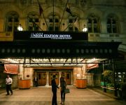
St. Louis Union Station a Curio by Hilton
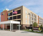
Home2 Suites St Louis -Central West End - Forest Park
Hotel Ignacio Saint Louis
Courtyard St. Louis Downtown/Convention Center
Holiday Inn ST. LOUIS - DOWNTOWN CONV CTR
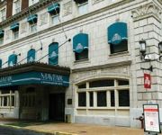
MAYFAIR HOTEL
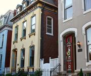
Napoleon's Retreat Bed and Breakfast
St Louis City Center Hotel
Videos from this area
These are videos related to the place based on their proximity to this place.
St. Louis: Dusk & Dark
A collection of clips from the St. Louis area where we were dodging raindrops.
St Louis Zoo Part 2
Part 2 of a 4 part video shot on location at the St. Louis Zoo. Special thanks to Curator Jeff Ettling.
Laclede Gas - Fireplaces
All natural gas fireplaces have two basic components -- logs and a natural gas burner module. The logs are fashioned after actual wood logs using lifelike ceramic fiber, concrete or refractory...
UMW Annihilation - Uncensored Massacre Wrestling Debut Commercial
This is the new radio commercial spot for UMW Annihilation. Tickets available at all MetroTix locations. Charge by phone (314) 534-1111 or online at metrotix.com Search keyword: umw on metrotix.c...
Phyllis Grey - Central West End Real Estate - St. Louis, Mo
Phyllis Grey is a Realtor specializing in the Central West End. The Central West End is the best-known neighborhood in St. Louis - easy walking distance to the Washington University medical...
Life Center Sings The Light
Life Center International Church of God in Christ's Mega Choir sings, "The Light" at their 9th Church Anniversary/Birthday Celebration.
MY FISH MOE AND LARRY
my fish Moe and Larry are real active in the newly changed water. you the viewer get to see if I can be successful at managing 2 goldfish in a 3 gallon tank.!!
UP 844 steam excursion day 1 preview Discoverlivesteam.com
A preview of Jim and Mike's first day on the Union Pacific steam excursion!
Rare Chrysler Turbine Car
Easter Car Show forest park St Louis Missouri Sure beats church. this car is owned by st louis county. OK OK LETS ALL COMMENT ON HOW THE GUY SHOOTING THE VID IS SHAKING OOOO ...
St. Louis U-City Soldiers J.F.L. Super Bowl Championship Game pt. 2
Part 2 of U-City vs BCLC Mustang @ Herbert Hoover Boys and Girl Club. U-City Soldiers J.F.L. 9 Heavy Undefeated Foot ball Camps in 2006-2007 showing what they do and how they do it. Filmed...
Videos provided by Youtube are under the copyright of their owners.
Attractions and noteworthy things
Distances are based on the centre of the city/town and sightseeing location. This list contains brief abstracts about monuments, holiday activities, national parcs, museums, organisations and more from the area as well as interesting facts about the region itself. Where available, you'll find the corresponding homepage. Otherwise the related wikipedia article.
St. Louis Truck Assembly
St. Louis Truck Assembly was a General Motors automobile factory. Opened in the 1920s, it closed on August 7, 1987 when the R- and V-series crew cab and cab/chassis truck production moved to Janesville.
The Ville, St. Louis
The Ville is a historic neighborhood located in North St. Louis, Missouri. This neighborhood is bounded by St. Louis Avenue on the North, Martin Luther King drive on the South, Sarah on the East and Taylor on the West. Prior to the United States Civil Rights movement, the use of restrictive covenants and other legal restrictions prevented African-Americans from finding housing in many areas of the city. As a result, the African American population of St.
Academy, St. Louis
Academy/Sherman Park is a neighborhood in North St. Louis, just outside Central West End. The official boundaries of the area are Dr. Martin Luther King Drive on the north, Delmar Boulevard on the south, North Kingshighway Boulevard on the east, and Union Boulevard on the west. As of the census of 2010, there were 2,816 people residing in the neighborhood, which contained 1,401 housing units.
Sumner High School (St. Louis)
Sumner High School, also known as Charles E. Sumner High School, is a St. Louis public high school that was the first high school for African-American students west of the Mississippi River. Together with Vashon High School, Sumner was one of only two segregated public high schools in St. Louis City for African-American students. Established in 1875 only after extensive lobbying by some of St. Louis' African-American residents, Sumner moved to its current location in 1908.
Fountain Park, St. Louis
Fountain Park is a neighborhood of St. Louis, Missouri. Originally the Aubert Place subdivision, it was laid out by John Lay in 1857. The Fountain Park neighborhood is located in north St. Louis, Missouri with Martin Luther King on the north, Delmar on the south, Walton on the east, and Kingshighway on the west. It is just two blocks north of the Central West End of the city. The Fountain Park neighborhood is named after Fountain Park, an oval shaped city park near its center.
Greater Ville, St. Louis
The Greater Ville is a neighborhood of St. Louis, Missouri. The area is bounded by Marcus Avenue on the northwest, Natural Bridge Avenue on the northeast, Dr. Martin Luther King Drive and St. Louis Avenue on the south via North Taylor Avenue and Sarah Street, and North Vandeventer Avenue on the southeast. The Greater Ville surrounds The Ville.
Kingsway East, St. Louis
Kingsway East is a neighborhood of St. Louis, Missouri. The neighborhood is generally defined by Natural Bridge on the North, Martin Luther King on the South, Marcus Avenue on the East, and Kingshighway on the West.
Kingsway West, St. Louis
Kingsway West is a neighborhood of St. Louis, Missouri. The Kingsway West neighborhood is defined by Union Boulevard to its north-west and Dr. Martin Luther King Drive to its south-west. Natural Bridge Avenue forms its north-east boundary and North Kingshighway its south-east boundary.
Lewis Place, St. Louis
Lewis Place is a neighborhood of St. Louis, Missouri. Lewis Place is defined by Martin Luther King Drive on the North, Delmar Boulevard on the South, Newstead Avenue on the East, and Walton on the West.
Penrose, St. Louis
Penrose is a neighborhood of St. Louis, Missouri. The neighborhood is located on the north side of the city just south of Interstate 70 and west of O’Fallon Park. It is bounded by Florissant Avenue and I-70 on the north, Natural Bridge on the south, North Newstead and Pope Avenue on the east, and Kingshighway Boulevard on the west.
Vandeventer, St. Louis
Vandeventer is a neighborhood of St. Louis, Missouri. The area is bounded by Dr. Martin Luther King Drive on the North, Delmar Boulevard on the South, Vandeventer Avenue on the East, and Newstead Avenue on the West.


