Safety Score: 2,7 of 5.0 based on data from 9 authorites. Meaning we advice caution when travelling to United States.
Travel warnings are updated daily. Source: Travel Warning United States. Last Update: 2024-05-19 08:11:23
Delve into De Soto Village
The district De Soto Village of Horn Lake in De Soto County (Mississippi) is a district located in United States about 766 mi west of Washington DC, the country's capital town.
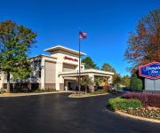
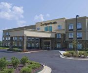
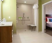
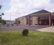
In need of a room? We compiled a list of available hotels close to the map centre further down the page.
Since you are here already, you might want to pay a visit to some of the following locations: Hernando, Memphis, Senatobia, Marion and Tunica. To further explore this place, just scroll down and browse the available info.
Local weather forecast
Todays Local Weather Conditions & Forecast: 28°C / 82 °F
| Morning Temperature | 19°C / 65 °F |
| Evening Temperature | 28°C / 82 °F |
| Night Temperature | 21°C / 70 °F |
| Chance of rainfall | 0% |
| Air Humidity | 53% |
| Air Pressure | 1015 hPa |
| Wind Speed | Light breeze with 5 km/h (3 mph) from South-West |
| Cloud Conditions | Clear sky, covering 0% of sky |
| General Conditions | Sky is clear |
Monday, 20th of May 2024
28°C (83 °F)
22°C (71 °F)
Broken clouds, gentle breeze.
Tuesday, 21st of May 2024
30°C (85 °F)
25°C (78 °F)
Broken clouds, moderate breeze.
Wednesday, 22nd of May 2024
29°C (84 °F)
21°C (71 °F)
Moderate rain, moderate breeze, broken clouds.
Hotels and Places to Stay
Hampton Inn Southaven
Homewood Suites by Hilton Southaven
Hilton Garden Inn Memphis Southaven
Holiday Inn SOUTHAVEN CENTRAL - MEMPHIS
LA QUINTA INN STE HORN LAKE
Courtyard Memphis Southaven
Residence Inn Memphis Southaven
Home2 Suites by Hilton Memphis - Southaven MS
Fairfield Inn & Suites Memphis Southaven
Homegate Inn and Suites.
Videos from this area
These are videos related to the place based on their proximity to this place.
7277 Mallard Creek
For more details click here: http://www.visualtour.com/showvt.asp?t=3067753 7277 Mallard Creek Horn Lake, MS 38637 $69900, 3 bed, 2.0 bath, 1587 SF, MLS# 283959 This Property is a Great...
PRIZEFIGHT 6 - BRIAN DAVIS vs MICHAEL DUVALL - Southaven,Ms MMA
Prize Fight 6 in Southaven,Ms. May,2012. An Professional/Amateur MMA event. This is video of the entire match. Enjoy.
Steppin'Wolf Irish Wolfhounds at Southaven MS July 18, 2010
This video focuses on the Irish Wolfhound Breed ring and the entries. All of the wolfhounds in this video are from the Steppin'Wolf Kennel . Lizzy is first in for Bred-by shown by Donna,...
mago de oz la rosa de los vientos (metal version) ☜.
mago de oz - rosa de los vientos (version metal en vivo) buen audio.
Videos provided by Youtube are under the copyright of their owners.
Attractions and noteworthy things
Distances are based on the centre of the city/town and sightseeing location. This list contains brief abstracts about monuments, holiday activities, national parcs, museums, organisations and more from the area as well as interesting facts about the region itself. Where available, you'll find the corresponding homepage. Otherwise the related wikipedia article.
DeSoto County, Mississippi
DeSoto County is a county located in the U.S. state of Mississippi. DeSoto County is part of the Metropolitan Memphis (TN-AR-MS) Statistical Area. Its county seat is Hernando. It is part of the Mississippi Delta. As of 2000, the population was 107,199. By 2010, the county had grown to a population of 161,252, largely due to migration from Memphis, Tn causing African American growth of over 150%. Also, migration has increased into the area from the North and Midwest because of job growth.
Hernando, Mississippi
Hernando is a city in central DeSoto County, Mississippi. The population was 6,812 at the 2000 census. The 2006 census estimate reflects a population of 10,580. Hernando is the county seat of DeSoto County, the second-most-populous county in the Memphis metropolitan area. U.S. Route 51 and the I-55 freeway traverse the entire city from north to south. Hernando's historic downtown square, which surrounds the county courthouse, sits at the intersection of Commerce St. and US-51.
Lynchburg, Mississippi
Lynchburg is a census-designated place (CDP) in DeSoto County, Mississippi. The population was 2,959 at the 2000 census.
Horn Lake, Mississippi
Horn Lake is a city in DeSoto County, Mississippi. Horn Lake is a suburb of Memphis, Tennessee, which is located just a few miles to the north. As of the 2010 U.S. Census, the city's population was 26,066.
Lander's Center
The Lander's Center, formerly the DeSoto Civic Center, is an 8,400-seat multi-purpose arena in Southaven, Mississippi. It was built in 2000. It is home to the Mississippi RiverKings, a team in the Southern Professional Hockey League. Several now-defunct teams have called the Lander's Center home. These teams include the Memphis Xplorers of the AF2 and the Memphis Houn'Dawgs of the American Basketball Association. It also is used as a concert venue, boxing arena and for ice shows and circuses.
Whitehaven, Memphis, Tennessee
Whitehaven is a predominantly African-American community in Memphis, Tennessee, first organized in the late 19th century. Its current population is about 50,000.
South Memphis, Memphis, Tennessee
South Memphis, one of the oldest portions of Memphis, Tennessee, is a community stretching from downtown to the Mississippi state line. In its early days, it was primarily an agrarian community.
WKQK
WKQK is a classic Hits radio station. It is licensed to Germantown, Tennessee, and serves the Memphis area. The station broadcasts at 94.1 MHz frequency. WKQK is a Class C2 FM station. It transmits with an ERP of 50,000 watts. Its tower is just south of the Mississippi state line, near Olive Branch, Mississippi.
Bishop Byrne High School (Memphis, Tennessee)
Bishop Byrne High School is a private, Roman Catholic high school in Memphis, Tennessee. It is located in the Roman Catholic Diocese of Memphis.
Southaven Towne Center
Southaven Towne Center is an open-air regional lifestyle center located in the Memphis, Tennessee suburb of Southaven, Mississippi. The shopping center is owned and managed by CBL & Associates, who developed the property and opened it in October 2005. It was reported that upon opening, the Southaven Towne Center was expected to contribute 1000 jobs to the local economy. This facility marks a first for CBL & Associates, it is their first foray into the lifestyle center property type.
Southland Mall (Memphis, Tennessee)
Southland Mall is a regional shopping mall in the South Memphis neighborhood of Whitehaven. It was built in 1966, becoming the first enclosed mall in the Mid-South. It is managed and co-owned by Urban Retail Properties. There are over 60 stores and 2 anchors include Macy's (originally Goldsmith's) and Sears.
Mitchell High School (Tennessee)
Mitchell High School, also known as Mitchell Road High School, is a public 9-12 school in Memphis, Tennessee, located at 658 W. Mitchell Road. Its enrollment of 1074 students is 99.4% Black, 0.4% White and 0.2% Hispanic. The school is secured by metal detectors and a posted police officer.
Southaven High School
Southaven High School is a public secondary school located in Southaven, Mississippi. It began in the fall of 1971, when construction was completed enough so that students could start the first classes. The original school taught 6th through 12th grade. The student parking lot had not been finished, so students parked in the street and the dirt in front of the school.
WEBL (FM)
WEBL (95.3 FM, "95.3 The Rebel") is a country music station licensed to Coldwater, Mississippi, USA, and serves the Memphis, Tennessee, area.
Capleville, Tennessee
Capleville is an unincorporated community in Shelby County, Tennessee, United States, southeast of Memphis and just north of the Mississippi border. It is located 0.5 mi. east of the Memphis International Airport, starting 1 mi. west of the intersection of State Routes 176 and 175, and heading east along State Route 175 (Shelby Drive) crossing U.S. Route 78.
WAVN
WAVN is a Gospel formatted broadcast radio station licensed to Southaven, Mississippi, serving Metro Memphis. WAVN is owned and operated by Flinn Broadcasting.
WBBP
WBBP is a radio station licensed to Memphis, Tennessee, USA, the station is currently owned by Bountiful Blessings.
Hernando Village Airpark
Hernando Village Airpark is a civil, privately owned airport open to the public. It is located two miles (3 km) southwest of the central business district of Hernando, MS, a city in DeSoto County, Mississippi, United States. Hernando Village Airpark is an airport that is part of Green Village Residential Airpark in Hernando, MS.
Delta Technical College
Delta Technical College, founded in 2004, is a privately owned career college in Horn Lake, Mississippi, United States. Delta Technical College is a branch campus of Midwest Technical Institute, Based in Springfield, IL. It offers programs in Medical Assisting, HVAC, Medical Coding Specialist, Journeyman Welding, Cosmetology, and Dental Assisting Program in April 2009.
Raines, Tennessee
Raines, Tennessee was a southern suburb of Memphis, Tennessee located between West Junction, Tennessee and Oakville, Tennessee. As of 1950 it had a population of 300. At some point after 1958 it was incorporated into the city of Memphis.
Oakville, Tennessee
Oakville, Tennessee was a community in Tennessee located just west of the current site of the Memphis International Airport. It was centered along the Route of US 78 (Lamar Avenue) just a little northeast of the intersection with Getwell Road. As of 1950 it had a population of 2,000. As of 1958 Nonconnah Creek just to the north of Oakville was very close to being the southern boundary of Memphis. Oakville was located along the SLSF railway, about five miles north-east of Capleville, Tennessee.
Nonconnah, Tennessee
Nonconnah, Tennessee was a populated place along Nonconnah Creek in what is now Memphis. Nonconnah was located just to the east of West Junction, Tennessee.
Westwood, Memphis, Tennessee
Westwood, a neighborhood in South Memphis, has many pleasant homes. Also, the neighborhood is home to several churches, recreation facilities, businesses and schools including the more than 4,000 member Mt Vernon Baptist Church Westwood, Big Momma's Kitchen, Charles Powell Community Center, South Memphis Flea Market (formerly The Twin Drive-In), Westwood Swimming Pool, Westwood Shopping Center, Doubletree Montessori School, Westwood Elementary School and Westwood High School.
Memphis Air National Guard Base
See: Memphis International Airport for civil airport information Memphis Air National Guard Base is the home base of the Tennessee Air National Guard 164th Airlift Wing.
Memphis Defense Depot
The Memphis Defense Depot was a former United States Army supply depot located in Memphis, Tennessee.


