Safety Score: 2,7 of 5.0 based on data from 9 authorites. Meaning we advice caution when travelling to United States.
Travel warnings are updated daily. Source: Travel Warning United States. Last Update: 2024-05-01 08:01:32
Discover South Saint Paul
South Saint Paul in Dakota County (Minnesota) with it's 20,160 citizens is a town in United States about 919 mi (or 1,479 km) north-west of Washington DC, the country's capital city.
Current time in South Saint Paul is now 10:44 PM (Wednesday). The local timezone is named America / Chicago with an UTC offset of -5 hours. We know of 11 airports near South Saint Paul, of which 5 are larger airports. The closest airport in United States is St Paul Downtown Holman Field in a distance of 3 mi (or 5 km), North-West. Besides the airports, there are other travel options available (check left side).
Also, if you like playing golf, there are a few options in driving distance. We discovered 1 points of interest in the vicinity of this place. Looking for a place to stay? we compiled a list of available hotels close to the map centre further down the page.
When in this area, you might want to pay a visit to some of the following locations: Saint Paul, Hastings, Minneapolis, Stillwater and Hudson. To further explore this place, just scroll down and browse the available info.
Local weather forecast
Todays Local Weather Conditions & Forecast: 9°C / 49 °F
| Morning Temperature | 10°C / 50 °F |
| Evening Temperature | 10°C / 50 °F |
| Night Temperature | 10°C / 49 °F |
| Chance of rainfall | 17% |
| Air Humidity | 94% |
| Air Pressure | 1010 hPa |
| Wind Speed | Moderate breeze with 11 km/h (7 mph) from West |
| Cloud Conditions | Overcast clouds, covering 100% of sky |
| General Conditions | Moderate rain |
Thursday, 2nd of May 2024
20°C (68 °F)
14°C (57 °F)
Sky is clear, gentle breeze, clear sky.
Friday, 3rd of May 2024
18°C (64 °F)
12°C (54 °F)
Moderate rain, gentle breeze, broken clouds.
Saturday, 4th of May 2024
20°C (68 °F)
14°C (57 °F)
Sky is clear, gentle breeze, clear sky.
Hotels and Places to Stay
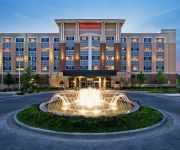
Sheraton St. Paul Woodbury Hotel
Embassy Suites by Hilton St Paul Downtown
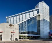
DoubleTree by Hilton St Paul Downtown
InterContinental Hotels SAINT PAUL RIVERFRONT
Doubletree by Hilton St. Paul
an Ascend Hotel Collection Member enVision Hotel St. Paul South
MN Woodbury Country Inn and Suites by Radisson
Holiday Inn ST. PAUL DOWNTOWN
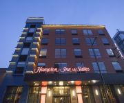
Hampton Inn and Suites by Hilton Downtown St Paul MN
LIVINN HOTEL MAPLEWOOD
Videos from this area
These are videos related to the place based on their proximity to this place.
Inver Grove Heights, MN High School Senior Photographer
Inver Grove Heights, MN Photographer. Our photography studio is located at 710 Southview Blvd. South St. Paul, MN 55075.
South St Paul Auto Repair - 651-455-5089 - Deering Auto Body
South St. Paul Auto Repair http://www.deeringautobody.com Maintaining your vehicle can be frustrating and expensive, which is why you need the Get it Right Guarantee. The Get it Right Guarantee...
Boston Bruins practice in South Saint Paul Minnesota 2012 #2
Practice at Wakota Arena in SSP, MN before they face off against the MN Wild in 2012.
Boston Bruins practice in South Saint Paul Minnesota 2012 #1
Practice at Wakota Arena in SSP, MN before they face off against the MN Wild in 2012.
Boston Bruins practice in South Saint Paul Minnesota 2012 #4
Practice at Wakota Arena in SSP, MN before they face off against the MN Wild in 2012.
Boston Bruins practice in South Saint Paul Minnesota 2012 #5
Practice at Wakota Arena in SSP, MN before they face off against the MN Wild in 2012.
Schwab Family- Newborn and Child Session South St. Paul MN 5
Newborn Baby Photography Session St. Paul Newborn Session South St. Paul Baby Photography studio Rosemount St. Paul baby newborn photography Apple Valley newborn photographer Eagan ...
Videos provided by Youtube are under the copyright of their owners.
Attractions and noteworthy things
Distances are based on the centre of the city/town and sightseeing location. This list contains brief abstracts about monuments, holiday activities, national parcs, museums, organisations and more from the area as well as interesting facts about the region itself. Where available, you'll find the corresponding homepage. Otherwise the related wikipedia article.
South St. Paul, Minnesota
South St. Paul is a city in Dakota County, Minnesota, immediately south and southeast of the city of Saint Paul, Minnesota. It is also southeast of West St. Paul, Minnesota. The population was 20,160 at the 2010 census. It is notable as one of the historic major meat packing cities in the United States. Subsequently, many residents are descendants of immigrants from Southern Europe and Eastern Europe.
Newport, Minnesota
Newport is a city in Washington County, Minnesota, United States. The population was 3,435 at the 2010 census.
Wakota Bridge
The Wakota Bridge is a ten-lane bridge on Interstate 494 between South St. Paul and Newport, Minnesota across the Mississippi River, replacing a four-lane span built in 1959. The name was given to the previous span in the early 1960s, and is derived from the two counties it connects, Washington and Dakota. Lunda Construction Company won the bid to build a new five-lane west-bound span, remove the existing bridge, and build a new five-lane east-bound span, which was completed in 2010.
St. Paul Union Pacific Rail Bridge
St. Paul Union Pacific Rail Bridge is a swing bridge that spans the Mississippi River between South Saint Paul, Minnesota and Saint Paul, Minnesota. It was built in 1910 by the St. Paul Bridge and Terminal Railway, and was rebuilt in 1925, after a flood in 1951, and again in 1982. Access to the bridge is very limited, because there are active railroad yards on both sides of the bridge.
South St. Paul Municipal Airport
South St. Paul Municipal Airport, also known as Richard E. Fleming Field or simply Fleming Field, is a city-owned public-use airport located two miles (3 km) south of the central business district of South St. Paul, a city in Dakota County, Minnesota, United States. It is named for Richard E. Fleming, a United States Marine Corps Naval Aviator during World War II who was posthumously awarded a Medal of Honor. Although most U.S.
Tarek ibn Ziyad Academy
Tarek ibn Ziyad Academy (TIZA) was an elementary school (K-8) in Inver Grove Heights, Minnesota named after Tarek ibn Ziyad, the Berber general of medieval Morocco who entered Gibraltar in 711 CE on behalf of the Umayyad Caliphate and defeated the Visigoths. The school is sponsored by Islamic Relief USA. The school has a primarily Muslim student body and has been embroiled in a number of controversies regarding the separation of church and state. The school has a waiting list of 1,500 students.
Rock Island Swing Bridge
The Rock Island Swing Bridge was a swing bridge that spanned the Mississippi River between Inver Grove Heights, Minnesota and St. Paul Park, Minnesota. It was also known as the Newport Rail Bridge, as it had a spur to Newport, Minnesota, and J.A.R. bridge. after previous owners Joan and Al Roman of Chicago. It was one of the few double-decker bridges on the Mississippi, with the top level formerly used for railroad traffic and the bottom level formerly used as a road crossing.
Battle Creek (Minnesota)
Battle Creek is a stream in Minnesota. It rises in Battle Creek Lake in Woodbury, passing through residential Maplewood and St. Paul before emptying into the Mississippi River via Pigs Eye Lake. It is followed for much of its length by walking paths.


