Safety Score: 2,7 of 5.0 based on data from 9 authorites. Meaning we advice caution when travelling to United States.
Travel warnings are updated daily. Source: Travel Warning United States. Last Update: 2024-08-13 08:21:03
Delve into Spanish Trail Highlands
The district Spanish Trail Highlands of McClane City in Saint Tammany Parish (Louisiana) is a district located in United States about 937 mi south-west of Washington DC, the country's capital town.
In need of a room? We compiled a list of available hotels close to the map centre further down the page.
Since you are here already, you might want to pay a visit to some of the following locations: Chalmette, Covington, New Orleans, Gretna and Bay Saint Louis. To further explore this place, just scroll down and browse the available info.
Local weather forecast
Todays Local Weather Conditions & Forecast: 22°C / 72 °F
| Morning Temperature | 24°C / 76 °F |
| Evening Temperature | 21°C / 71 °F |
| Night Temperature | 21°C / 70 °F |
| Chance of rainfall | 18% |
| Air Humidity | 90% |
| Air Pressure | 1016 hPa |
| Wind Speed | Gentle Breeze with 8 km/h (5 mph) from North-West |
| Cloud Conditions | Overcast clouds, covering 100% of sky |
| General Conditions | Moderate rain |
Monday, 11th of November 2024
22°C (71 °F)
20°C (68 °F)
Light rain, gentle breeze, overcast clouds.
Tuesday, 12th of November 2024
21°C (70 °F)
22°C (71 °F)
Light rain, gentle breeze, overcast clouds.
Wednesday, 13th of November 2024
26°C (78 °F)
22°C (72 °F)
Light rain, moderate breeze, broken clouds.
Hotels and Places to Stay
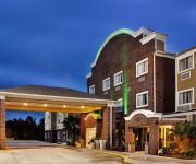
La Quinta Inn and Suites Slidell - North Shore Area
Holiday Inn & Suites SLIDELL - NEW ORLEANS AREA
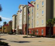
TownePlace Suites Slidell
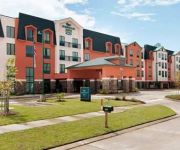
Homewood Suites by Hilton Slidell
BEST WESTERN PLUS SLIDELL HTL
WINGATE SLIDELL NEW ORLEANS EA
La Quinta Inn New Orleans Slidell
Hampton Inn Slidell
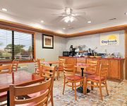
Days Inn Slidell
Candlewood Suites SLIDELL NORTHSHORE
Videos from this area
These are videos related to the place based on their proximity to this place.
Reviews of the top cosmetic dentist and family dentistry in Slidell Louisiana 70458 area
Top Slidell Dentists | Slidell Family Dentistry | Slidell Family Dentists 985-643-6620 Slidell Dentistry At Its Finest With Lisa Loescher, DDS Cosmetic | Cleanings | Cavities | Implants |...
2011 Dodge Journey Slidell LA 70461
Click here for price : http://Lakeshore.vshoc.com/7mh5g8?vin=3D4PG1FG5BT503004 We've been honored to serve the Slidell LA area , we promise that your experience at our dealership...
Bobby your cat is outside
Part 1 of an adventurous journey around Bobby Coffee a rather hip young fellow's apartment. This scene reveals as the oblivious but beautiful young Parker Tamman strolls upon The Beast in some...
2011 Dodge Ram 3500 Slidell LA 70461
Click here for price: http://Lakeshore.vshoc.com/7mh5g8?vin=3D73Y4CL8BG511236 We've been honored to serve the Slidell LA area, we promise that your experience at our dealership will exceed...
2012 Jeep Wrangler Slidell LA 70461
Click here for price : http://Lakeshore.vshoc.com/7mh5g8?vin=1C4AJWAG2CL102208 We've been honored to serve the Slidell LA area , we promise that your experience at our dealership...
2012 Dodge Challenger Slidell LA 70461
Click here for price : http://Lakeshore.vshoc.com/7mh5g8?vin=2C3CDYAG4CH280859 We've been honored to serve the Slidell LA area , we promise that your experience at our dealership will...
1999 Toyota Camry Used Cars Slidell LA
http://www.top2bottommotors.com This 1999 Toyota Camry is available from Top 2 Bottom Motors. For details, call us at 985-707-1111.
2005 Volkswagen Jetta GLI TB - 6034B
www.888candeal.com 985-641-0671 Hyundai of Slidell. This is the ACTUAL walk around for the 2005 VW Jetta.
1985 Ford F-250 Used Cars New Orleans LA
http://www.starmotorsinc.com This 1985 Ford F-250 is available from Star Motors. For details, call us at 985-641-0071.
2014 Hyundai Sonata GLS
www.888candeal.com 985-641-0671 Hyundai of Slidell. This is the ACTUAL walk around for the 2014 Hyundai Sonata GLS.
Videos provided by Youtube are under the copyright of their owners.
Attractions and noteworthy things
Distances are based on the centre of the city/town and sightseeing location. This list contains brief abstracts about monuments, holiday activities, national parcs, museums, organisations and more from the area as well as interesting facts about the region itself. Where available, you'll find the corresponding homepage. Otherwise the related wikipedia article.
Eden Isle, Louisiana
Eden Isle is a census-designated place (CDP) in St. Tammany Parish, Louisiana, United States, on the northeast shore of Lake Pontchartrain. The population was 7,041 at the 2010 census. It is part of the New Orleans–Metairie–Kenner Metropolitan Statistical Area.
Lacombe, Louisiana
Lacombe is a census-designated place (CDP) in St. Tammany Parish, Louisiana, United States. The population was 8,679 at the 2010 census.
Pearl River, Louisiana
Pearl River is a town in St. Tammany Parish, Louisiana, United States. The population was 1,691 at the 2010 census. It is part of the New Orleans–Metairie–Kenner Metropolitan Statistical Area.
Slidell, Louisiana
Slidell is a city situated on the northeast shore of Lake Pontchartrain in St. Tammany Parish, Louisiana, United States. The population was 27,068 at the 2010 census. Greater Slidell has a population of about 90,000. It is part of the New Orleans–Metairie–Kenner Metropolitan Statistical Area.
Pearlington, Mississippi
Pearlington is a census-designated place (CDP) in Hancock County, Mississippi, on U.S. Route 90, along the Pearl River, at the Louisiana state line. It is part of the Gulfport–Biloxi, Mississippi Metropolitan Statistical Area. The population was 1,684 at the 2000 census. On August 29, 2005, Hurricane Katrina made landfall just south of Pearlington.
John C. Stennis Space Center
The John C. Stennis Space Center (SSC) is a NASA rocket testing facility. It is located in Hancock County, Mississippi, on the banks of the Pearl River (Mississippi–Louisiana) at the Mississippi-Louisiana border. As of 2012, it is NASA's largest rocket engine test facility. As of 2007, British manufacturer Rolls-Royce plc has been operating an outdoor aero engine test facility within SSC due to noise pollution concerns at its UK testing facility in Hucknall (near its main UK site at Derby).
WSLA
WSLA is a Sports Talk outlet serving the New Orleans area. The station, which is owned by Mapa Broadcasting, operates at 1560 kHz with 1 kW/Daytime-only power and is licensed to Slidell, Louisiana.
Lake St. Catherine (Louisiana)
Lake St. Catherine is a brackish-water lake that is located in eastern Orleans Parish, within the city limits of New Orleans, between Lake Pontchartrain and Lake Borgne in Louisiana. Between Lake St. Catherine and Lake Borgne was the original Town of Lake Catherine. Established between Unknown Pass and Miller's Ditch, it was settled for railroad workers, trappers, hunters and fishermen. The 1915 Hurricane destroyed the town and thirty-five people lost their lives by remaining in the town.
Rigolets
The Rigolets is a 12.9 kilometer (8 mi) long strait in Louisiana. It begins at {{#invoke:Coordinates|coord}}{{#coordinates:30|10|40|N|89|44|40|W| | |name= }} and follows a generally eastward course to Lake Borgne, which is a lagoon in the Gulf of Mexico, where it ends at {{#invoke:Coordinates|coord}}{{#coordinates:30|09|16|N|89|37|31|W| | |name= }}. Along with nearby Chef Menteur Pass, the Rigolets connects Lake Pontchartrain and Lake St. Catherine to Lake Borgne.
Chef Menteur Pass
The Chef Menteur Pass is a narrow natural waterway which, along with the Rigolets, connects Lake Pontchartrain and Lake Borgne in New Orleans, Louisiana. It begins at {{#invoke:Coordinates|coord}}{{#coordinates:30|5|45|N|89|48|52|W| | |name= }} and follows a generally southeastward course. In the days of sailing ships, much commerce from the Gulf of Mexico came through here and the Rigolets into Lake Pontchartrain to New Orleans and surrounding communities.
Honey Island Swamp
The Honey Island Swamp (French: Marais de l'Île-de-Miel) is a marshland located in the eastern portion of the U.S. state of Louisiana in St. Tammany Parish. Honey Island earned its name because of the honeybees once seen on a nearby isle. The swamp is bordered on the north by U.S. 90, on the south by Lake Borgne, on the east by the Pearl River and the west by the West Pearl River. It is one of the least-altered river swamps in the United States.
National Data Buoy Center
The National Data Buoy Center (NDBC) is a part of the National Oceanic and Atmospheric Administration's (NOAA) National Weather Service (NWS). NDBC designs, develops, operates, and maintains a network of data collecting buoys and coastal stations.
I-10 Twin Span Bridge
The I-10 Twin Span Bridge, known locally as the Twin Spans, consists of two parallel trestle bridges. These parallel bridges cross the eastern end of Lake Pontchartrain in southern Louisiana from New Orleans, Louisiana to Slidell, Louisiana. The current twin spans were constructed in the second half of the 2000s after the original bridges were extensively damaged by Hurricane Katrina in 2005. The first span opened to eastbound traffic on July 9, 2009.
WYLK
WYLK, also known as Lake 94.7, is a Hot Adult Contemporary radio station serving the St. Tammany Parish area. Owned by former Mississippi congressman C. Wayne Dowdy under the company name Northshore Broadcasting, the station is licensed to Lacombe, Louisiana, and broadcasts at 94.7 MHz with an ERP of 2,900 watts.
Fort Pike Bridge
The Fort Pike Bridge (also known as the Rigolets Bridge) carries U.S. Route 90 across the Rigolets on the eastern side of Lake Pontchartrain between New Orleans and Slidell in Louisiana. The bridge opened on June 9, 1930, and along with the Chef Menteur Bridge provided a free route between New Orleans and the Mississippi Gulf Coast. A new span was constructed just to the north of the old span.
St. Genevieve Church
St. Genevieve Church is a parish of the Roman Catholic Archdiocese of New Orleans located along the northeastern edge of Lake Ponchartrain in Slidell, Louisiana, USA. St. Genevieve is one of eight parishes which belongs to Deanery XII - East St. Tammany - Washington Deanery, an ecclesiastical division of the archdiocese.
Pope John Paul II High School (Louisiana)
Pope John Paul II High School is a private, Roman Catholic high school in Slidell, Louisiana. It is located in the Roman Catholic Archdiocese of New Orleans.
Maestri Bridge
The Maestri Bridge (originally known as the Pontchartrain Bridge and later as the Watson-Williams Pontchartrain Bridge and the Five Mile Bridge) carries U.S. Route 11 across Lake Pontchartrain between New Orleans and Slidell, Louisiana. The bridge opened on February 18, 1928 as the first permanent crossing of Lake Pontchartrain. The 4.78-mile bridge was the longest concrete bridge in the world upon completion. The bridge is 35 feet wide and has 2 draw spans for passing vessels and barges.
CSX Rigolets Pass Bridge
The CSX Rigolets Pass Bridge carries one track of CSX rail lines across the Rigolets on the eastern side of Lake Pontchartrain between New Orleans and Slidell, Louisiana.
Chef Menteur Bridge
The Chef Menteur Bridge (also known as the Chef Menteur Pass Bridge) carries U.S. Route 90 across Chef Menteur Pass on the eastern side of Lake Pontchartrain between New Orleans and Slidell, Louisiana.
Slidell High School
Slidell High School is a public school for grades nine through twelve located in Slidell, Louisiana. It is part of the St. Tammany Parish Public School District and serves portions of west and central Slidell.
Naval Meteorology and Oceanography Command
{{#invoke: Navbox | navbox }} The Naval Meteorology and Oceanography Command (COMNAVMETOCCOM) or NMOC, serves as the operational arm of the Naval Oceanography Program. Headquartered at the Stennis Space Center in Mississippi, NMOC is a third echelon command reporting to United States Fleet Forces Command (USFLTFORCOM).
Slidell Airport
Slidell Airport is a city-owned public-use airport located four nautical miles (7 km) northwest of the central business district of Slidell, a city in St. Tammany Parish, Louisiana, United States. Although most U.S. airports use the same three-letter location identifier for the FAA and IATA, this airport is assigned ASD by the FAA but has no designation from the IATA.
Norfolk Southern Lake Pontchartrain Bridge
The Norfolk Southern Lake Pontchartrain Bridge is a bridge that carries a single-track of Norfolk Southern rail line between Slidell and New Orleans, Louisiana. At 5.8 miles long, it is the longest railroad bridge in the United States and likely the longest rail bridge over water on Earth. The Huey P. Long Bridge in New Orleans has sometimes been given that title, but at about 4.4 miles, that bridge is considerably shorter than the Norfolk Southern bridge.
Mississippi Army Ammunition Plant
The Mississippi Army Ammunition Plant was a 13,480-acre government-owned, contractor-operated facility in Hancock County, Mississippi that was dedicated on March 31, 1983. Construction in the northern part of the John C. Stennis Space Center facility began on January 8, 1978. The plant was deactivated on March 4, 2009 as part of the Base Realignment and Closure, 2005. The plant was last operated by Mason Technologies, Inc. , a subsidiary of Mason and Hanger-Silas Co. , Inc.


