Safety Score: 2,7 of 5.0 based on data from 9 authorites. Meaning we advice caution when travelling to United States.
Travel warnings are updated daily. Source: Travel Warning United States. Last Update: 2024-05-18 08:26:29
Discover Gentilly Woods
The district Gentilly Woods of Gentilly in Orleans Parish (Louisiana) is a subburb in United States about 960 mi south-west of Washington DC, the country's capital city.
If you need a hotel, we compiled a list of available hotels close to the map centre further down the page.
While being here, you might want to pay a visit to some of the following locations: New Orleans, Gretna, Chalmette, Davis (historical) and Hahnville. To further explore this place, just scroll down and browse the available info.
Local weather forecast
Todays Local Weather Conditions & Forecast: 26°C / 79 °F
| Morning Temperature | 22°C / 71 °F |
| Evening Temperature | 30°C / 85 °F |
| Night Temperature | 23°C / 73 °F |
| Chance of rainfall | 37% |
| Air Humidity | 67% |
| Air Pressure | 1012 hPa |
| Wind Speed | Moderate breeze with 11 km/h (7 mph) from South |
| Cloud Conditions | Overcast clouds, covering 100% of sky |
| General Conditions | Heavy intensity rain |
Sunday, 19th of May 2024
29°C (85 °F)
26°C (79 °F)
Sky is clear, gentle breeze, clear sky.
Monday, 20th of May 2024
33°C (91 °F)
24°C (76 °F)
Sky is clear, gentle breeze, clear sky.
Tuesday, 21st of May 2024
33°C (91 °F)
24°C (75 °F)
Few clouds, gentle breeze.
Hotels and Places to Stay
ELYSIAN FIELDS INN
Royal Street Inn and R Bar
Maison de Macarty
R&B Bed and Breakfast
La Belle Esplanade
Lamothe House
Lion's Inn Bed and Breakfast
Melrose Mansion
Royal Inn of New Orleans
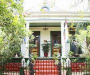
The Lookout Inn of New Orleans
Videos from this area
These are videos related to the place based on their proximity to this place.
From Atop the Industrial Canal Levee in the Lower Ninth Ward
Here's the mini-docu-vid I shot while standing atop the Industrial Canal levee in the Lower Ninth Ward in New Orleans, Louisiana.
NOBTS Funnel Cloud Sighting
On Saturday, May 16th, 2009 a funnel cloud was sighted near the campus of the New Orleans Baptist Theological Seminary. This video captures a sighting from a third floor campus apartment. Watch...
New Orleans Railroad Drawbridge Opening
A railroad drawbridge over the Lake Pontchartrain entrance to the New Orleans Industrial Canal opening after a train has passed.
Seabrook Current vs Tug 2
IHNC at Lake Pontchartrain, New Orleans under Seabrook Bridge, 11 Sept 2008. Hurricane Ike was in the southeastern Gulf of Mexico (~350 miles from New Orleans) as a Category 2 storm at the...
Saints NFC Championship Field Goal from My Seat!!!!!
Video Shot by James Leitz, who as an 8 year old boy attended the first Saints game they ever Won in 1967. We have reached a goal we never thought was attainable. Everything from this point...
Seabrook Current vs Tug 3
IHNC at Lake Pontchartrain, New Orleans under Seabrook Bridge, 11 Sept 2008. Hurricane Ike was in the southeastern Gulf of Mexico (~350 miles from New Orleans) as a Category 2 storm at the...
Seabrook Current vs Tug 4
IHNC at Lake Pontchartrain, New Orleans under Seabrook Bridge, 11 Sept 2008. Hurricane Ike was in the southeastern Gulf of Mexico (~350 miles from New Orleans) as a Category 2 storm at the...
Riding dirty on the Mississippi
This is what happens when you let a n00b at the helm. Initial findings of fact from the Eighth District Coast Guard investigation were: #1 There were no mechanical or electrical issues...
Videos provided by Youtube are under the copyright of their owners.
Attractions and noteworthy things
Distances are based on the centre of the city/town and sightseeing location. This list contains brief abstracts about monuments, holiday activities, national parcs, museums, organisations and more from the area as well as interesting facts about the region itself. Where available, you'll find the corresponding homepage. Otherwise the related wikipedia article.
Camp Leroy Johnson
Camp Leroy Johnson in New Orleans, Louisiana, formerly known as the New Orleans Air Base, is located on the south shore of Lake Pontchartrain in the area bounded west by London Ave. south by Leon C. Simon Dr. and east by Inner Harbor Navigation Canal. The area is occupied today by the University of New Orleans. One former building of the base still remain. The "smokestack" was incorporated into an Alumni Building.
Lakefront Arena
The Senator Nat G. Kiefer University of New Orleans Lakefront Arena (commonly Lakefront Arena or UNO Lakefront Arena) is a 10,000-seat multi-purpose arena, in New Orleans, Louisiana. It was built in 1983 and is named in honor of Nat G. Kiefer, the late state senator who aided UNO’s efforts to obtain state funding for the building. It is part of the university's East Campus, where most of the school's athletic facilities are located.
WBOK
WBOK is a radio station broadcasting a Christian radio format. Licensed to New Orleans, Louisiana, USA, the station serves the New Orleans area. The station is owned by Bakewell Media of Louisiana, LLC. Its current slogan is "Real Talk for Real Times". The station was purchased by Danny Bakewell on behalf of The Bakewell Family in April 2007.
Industrial Canal
The Industrial Canal is a 5.5 mile (9 km) waterway in New Orleans, Louisiana, United States. The waterway's proper name, as used by the U.S. Army Corps of Engineers and on NOAA nautical charts, is Inner Harbor Navigation Canal. The more common "Industrial Canal" name is used locally, both by commercial mariners and by landside residents. The canal connects the Mississippi River to Lake Pontchartrain.
Pontchartrain Park, New Orleans
Pontchartrain Park is a neighborhood of the city of New Orleans. A subdistrict of the Gentilly District Area, its boundaries as defined by the City Planning Commission are: Leon C. Simon Drive to the north, the Industrial Canal to the east, Dreux Avenue to the south and Peoples Avenue to the west.
8th Ward of New Orleans
The 8th Ward is a section of New Orleans, Louisiana. It is one of the Downtown Wards of New Orleans, with a Creole history. The 8th Ward is a narrow strip stretching from the Mississippi River on the south to Lake Pontchartrain in the north. East, or "down," is the 9th Ward, the boundary being Franklin Avene, Almonaster Avenue, then People's Avenue, and a line straight north into the Lake at part of the University of New Orleans campus.
Agriculture Street Landfill
The Agriculture Street Landfill was a dump in New Orleans, Louisiana. The area was later developed for residential use, with unfortunate environmental consequences. It became a Superfund cleanup site.
5th Ward of New Orleans
The 5th Ward or Fifth Ward is a division of the city of New Orleans, Louisiana, one of the 17 Wards of New Orleans.
Elysian Fields Avenue
Elysian Fields Avenue is a broad, straight avenue in New Orleans named after the Avenue des Champs-Élysées in Paris. It courses south to north from the Lower Mississippi River to Lake Pontchartrain, a distance of approximately 5 miles . The avenue intersects with Interstate 610, Interstate 10, and U.S. Highway 90, Gentilly Boulevard passing by Brother Martin High School. The part between North Claiborne Avenue and Gentilly Boulevard (U.S.
Brother Martin High School
Brother Martin High School is an all-male, Catholic, college preparatory school located in New Orleans, Louisiana, United States operated by the Brothers of the Sacred Heart. It was established in 1869 by the Brothers of the Sacred Heart, establishing the school as St. Aloysius College. It is located in the Roman Catholic Archdiocese of New Orleans.
Desire Projects
Desire Projects is a neighborhood and a former housing project of the city of New Orleans. A subdistrict of the Bywater District Area, its boundaries as defined by the City Planning Commission are: Higgins Boulevard to the north, Alvar Street to the east, Florida Boulevard to the south and Desire Street, Oliver White Avenue, Pleasure Street and Piety Street to the west.
Milneburg, New Orleans
Milneburg is a neighborhood of the city of New Orleans. A subdistrict of the Gentilly District Area, its boundaries as defined by the City Planning Commission are: Leon C. Simon Drive to the north, People's Avenue to the east, Filmore Avenue to the south and Elysian Fields Avenue to the west, putting it within the 8th Ward of New Orleans. The Milneburg neighborhood takes its name from Milneburg, a historic town and neighborhood formerly located a short distance north of the modern neighborhood.
Privateer Park
Almonaster Avenue Bridge
The Almonaster Avenue Bridge is a bascule bridge in New Orleans, Louisiana. The bridge has two vehicular lanes of Almonaster Road and two railroad tracks over the Industrial Canal. The bridge is named after Almonaster Avenue on which it is built. It is one of the first four bridges built by the Port of New Orleans and was completed in 1919 in order to provide railroad access across the Inner Harbor-Navigational Canal, locally referred to as the Industrial Canal.
I-10 High Rise Bridge
The I-10 High Rise Bridge, known locally as the High Rise, is a bridge carrying 6 lanes of Interstate 10 over the Industrial Canal in New Orleans, Louisiana.
Danziger Bridge
The Danziger Bridge is a vertical lift bridge named after a New Orleans lawyer and businessman, which carries seven vehicular lanes of U.S. Route 90 (Chef Menteur Highway) across the Industrial Canal in New Orleans, Louisiana. It was built to replace the old Danziger Bridge, a draw bridge constructed in 1931–1932.
Seabrook Bridge
The Seabrook Bridge (officially the Senator Ted Hickey Bridge) is a medium-rise twin bascule, four-lane roadway bridge in New Orleans, Louisiana carrying Lakeshore Drive, connecting Leon C. Simon Drive on the upper side of the bridge with Hayne Boulevard on the lower side. The bridge is operated by the Orleans Levee District. It normally stays in the down position for vehicular traffic, but provides sufficient clearance for most marine traffic
Gentilly Woods, New Orleans
Gentilly Woods is a neighborhood of the city of New Orleans. A subdistrict of the Gentilly District Area, its boundaries as defined by the City Planning Commission are: Dreux Avenue to the north, Industrial Canal to the east, Gentilly Boulevard to the south and People's Avenue to the west.
Maestri Field
Maestri Field at Privateer Park is a baseball stadium in New Orleans, Louisiana more commonly know as Maestri Field. It is the home field of the University of New Orleans (UNO) Privateers baseball team and opened in 1979. The facility is named after Ron Maestri, former UNO head coach, who coached the team from 1970–1984, and athletic director, where he served for 21 years ending his term in 2000.
Gentilly Terrace, New Orleans
Gentilly Terrace is a neighborhood of the city of New Orleans. A subdistrict of the Gentilly District Area, its boundaries as defined by the City Planning Commission are: Filmore Avenue to the north, People's Avenue to the east, Dahlia Walk and Benefit Street to the south and Elysian Fields Avenue to the west.
Lake Terrace/Lake Oaks, New Orleans
Lake Terrace/Lake Oaks is a neighborhood of the city of New Orleans. A subdistrict of the city's Gentilly District Area, its boundaries as defined by the City Planning Commission are: Lake Pontchartrain to the north, the Industrial Canal to the east, Leon C. Simon Drive, Elysian Fields Avenue, New York Street, the London Avenue Canal and Robert E. Lee Boulevard to the south and Bayou St. John to the west.
Desire Area, New Orleans
Desire Area is a neighborhood of the city of New Orleans. A subdistrict of the Bywater District Area, its boundaries as defined by the City Planning Commission are: Gentilly Boulevard to the north, the Industrial Canal to the east, Florida Boulevard, Alvar Street, Higgins Boulevard, Piety Street, Pleasure Street, Oliver White Avenue, and Desire Street to the south and People's Avenue to the west.
St. Roch, New Orleans
St. Roch is a neighborhood of the U.S. city of New Orleans. A subdistrict of the Bywater District Area, its boundaries as defined by the City Planning Commission are: Lafreniere Street, Paris Avenue, I-610, Benefit Street and Dahlia Walk to the north, People's Avenue and Almonaster Avenue to the east, St. Claude Avenue to the south and Elysian Fields Avenue, Hope, Frenchmen, Duels, St. Anthony, Industry, Allen, and Agriculture Streets, A.P.
Danziger Bridge shootings
The Danziger Bridge shootings were police shootings that took place on September 4, 2005, at the Danziger Bridge in New Orleans, Louisiana. Six days after Hurricane Katrina struck New Orleans, members of the city's police department killed two people: 17-year-old James Brissette and 40-year-old Ronald Madison. Four other people were wounded. All victims were unarmed. Madison, a mentally disabled man, was shot in the back.
Seabrook Floodgate
The Inner Harbor Navigation Canal (IHNC) Seabrook Floodgate Structure is a flood barrier in the Industrial Canal in New Orleans, Louisiana. The floodgate is designed to protect the Industrial Canal and the surrounding areas from a storm surge from Lake Ponchartrain. It consists of two 50 ft wide vertical lift gates and a 95 ft wide sector gate.


