Safety Score: 2,7 of 5.0 based on data from 9 authorites. Meaning we advice caution when travelling to United States.
Travel warnings are updated daily. Source: Travel Warning United States. Last Update: 2024-05-20 08:01:38
Delve into California Junction
California Junction in Harrison County (Iowa) with it's 85 habitants is a city located in United States about 1,015 mi (or 1,633 km) west of Washington DC, the country's capital town.
Current time in California Junction is now 01:48 AM (Tuesday). The local timezone is named America / Chicago with an UTC offset of -5 hours. We know of 9 airports closer to California Junction, of which 3 are larger airports. The closest airport in United States is Eppley Airfield in a distance of 18 mi (or 30 km), South. Besides the airports, there are other travel options available (check left side).
Also, if you like playing golf, there are some options within driving distance. We saw 1 points of interest near this location. In need of a room? We compiled a list of available hotels close to the map centre further down the page.
Since you are here already, you might want to pay a visit to some of the following locations: Blair, Logan, Omaha, Tekamah and Council Bluffs. To further explore this place, just scroll down and browse the available info.
Local weather forecast
Todays Local Weather Conditions & Forecast: 27°C / 81 °F
| Morning Temperature | 20°C / 68 °F |
| Evening Temperature | 15°C / 60 °F |
| Night Temperature | 12°C / 54 °F |
| Chance of rainfall | 5% |
| Air Humidity | 60% |
| Air Pressure | 994 hPa |
| Wind Speed | Strong breeze with 19 km/h (12 mph) from East |
| Cloud Conditions | Overcast clouds, covering 100% of sky |
| General Conditions | Moderate rain |
Tuesday, 21st of May 2024
19°C (67 °F)
15°C (60 °F)
Light rain, moderate breeze, few clouds.
Wednesday, 22nd of May 2024
23°C (73 °F)
19°C (66 °F)
Scattered clouds, fresh breeze.
Thursday, 23rd of May 2024
18°C (64 °F)
15°C (59 °F)
Light rain, gentle breeze, overcast clouds.
Hotels and Places to Stay
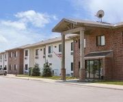
SUPER 8 MISSOURI VALLEY
Videos from this area
These are videos related to the place based on their proximity to this place.
Shiloh Limited UP 844 Missouri Valley, Iowa Mar 23, 2012
last service stop of the day for the second leg of The Shiloh Limited at Missouri Valley, Iowa on March 23, 2012 and departure for the Union Pacific Heritage Shops in Council Bluffs.
Flying my Ultralight Aircraft
Flying my Phantom Ultralight near Missouri Valley, IA. Near I-29 and Hwy 30 intersection. Sticking my arm out and panning from left to right to show how exposed you are in the Phantom cockpit.
midwest medical transport responding
Midwest medical going to Missouri Valley hospital for patient transfer.
Phantom Ultralight
Flying my Phantom Ultralight near Missouri Valley, IA. View from the cockpit of the land below.
UP 6050 and Amtrak 6 HD
UP 6050 leads Amtrak 6 out of Missouri Valley, IA after making a stop for a Medical Incident.
concrete plant demo
Heres a short vid of the local concrete plant (Missouri Valley, Iowa) being knocked down to make room for a new plant.
Missouri River Flood, north of Omaha on 75 - 6/22/2011
Hwy 75 north of Omaha, between Ft. Calhoun and Blair, Nebraska, 8:30am, June 22, 2011.
Videos provided by Youtube are under the copyright of their owners.
Attractions and noteworthy things
Distances are based on the centre of the city/town and sightseeing location. This list contains brief abstracts about monuments, holiday activities, national parcs, museums, organisations and more from the area as well as interesting facts about the region itself. Where available, you'll find the corresponding homepage. Otherwise the related wikipedia article.
Cincinnati Township, Harrison County, Iowa
Cincinnati Township is located in Harrison County, Iowa. The population is 220 with 112 males and 108 females. The land area is 39.0 square miles and the water area is 1.4 square miles.
California Junction, Iowa
California Junction is an unincorporated town in Harrison County, Iowa, United States. It lies just east of the junction between the east-west and north-south lines of the former Sioux City and Pacific Railroad. In the 2010 census it had a population of 85 inhabitants and a population density of 184.38 people per square mile (71.19/km²).


