Safety Score: 2,7 of 5.0 based on data from 9 authorites. Meaning we advice caution when travelling to United States.
Travel warnings are updated daily. Source: Travel Warning United States. Last Update: 2024-05-04 08:22:41
Explore Washoe
Washoe in Payette County (Idaho) is a city in United States about 2,076 mi (or 3,341 km) west of Washington DC, the country's capital.
Local time in Washoe is now 05:10 AM (Saturday). The local timezone is named America / Boise with an UTC offset of -6 hours. We know of 8 airports in the vicinity of Washoe, of which one is a larger airport. The closest airport in United States is Boise Air Terminal/Gowen field in a distance of 50 mi (or 80 km), South-East. Besides the airports, there are other travel options available (check left side).
Also, if you like golfing, there are multiple options in driving distance. If you need a place to sleep, we compiled a list of available hotels close to the map centre further down the page.
Depending on your travel schedule, you might want to pay a visit to some of the following locations: Payette, Weiser, Vale, Caldwell and Emmett. To further explore this place, just scroll down and browse the available info.
Local weather forecast
Todays Local Weather Conditions & Forecast: 18°C / 64 °F
| Morning Temperature | 7°C / 44 °F |
| Evening Temperature | 13°C / 55 °F |
| Night Temperature | 10°C / 50 °F |
| Chance of rainfall | 8% |
| Air Humidity | 35% |
| Air Pressure | 998 hPa |
| Wind Speed | Fresh Breeze with 16 km/h (10 mph) from North |
| Cloud Conditions | Overcast clouds, covering 100% of sky |
| General Conditions | Heavy intensity rain |
Saturday, 4th of May 2024
7°C (44 °F)
8°C (47 °F)
Moderate rain, moderate breeze, overcast clouds.
Sunday, 5th of May 2024
11°C (53 °F)
8°C (46 °F)
Light rain, moderate breeze, overcast clouds.
Monday, 6th of May 2024
10°C (50 °F)
7°C (45 °F)
Light rain, fresh breeze, scattered clouds.
Hotels and Places to Stay
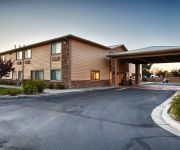
BEST WESTERN PLUS INN AND STES
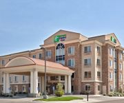
Holiday Inn Express & Suites ONTARIO
RED LION INN ONTARIO
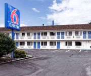
MOTEL 6 ONTARIO
Americas Best Value Inn
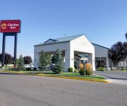
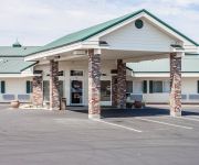
Clarion Inn Ontario
Quality Inn Ontario
Sleep Inn Ontario
ONTARIO INN
Videos from this area
These are videos related to the place based on their proximity to this place.
Sage Donnelly Kayaks North Fork of Payette River, 2014
Kayak junior national champion Sage Donnelly Kayaks North Fork of Payette River, 2014. Subscribe to see more "View from My Helmet" videos and visit SageDonnelly.com to learn more about Sage.
ALS Ice Bucket Challenge, Payette Football Family style
The "Payette Football Family" is a group started last year to organize, support, and have fun with the Payette, ID 5th-6th grade PCRD Tackle Football team. We were challenged to do the Ice...
Watching the thunder storm in Payette Idaho. Video #1 6/19/2010
Watching the thunder storm in Payette Idaho. 6/19/2010.
2015 Flag Game2
Payette Flag (Saylors) vs New Plymouth Final Score 28-6 Player of the game Taber Waters.
A Session With The Ovilus X & DTD At One Of The Local Cemeteries.
I took the Ovilus X & DTD to one of the local cemeteries here in Payette Idaho.
Experimenting With The Ovilus III Part 3
I took the Ovilus III to the Washoe Cemetery between Payette & Fruitland Idaho. I also used the Ovilus III alongside Washoe Road where the old railroad tracks were. I have heard story's over...
Sony Cyber-Shot DSC-HX300 Picture & Video Quality Test
Checking out the Sony Cyber-Shot DSC-HX300 20.4 MP 50X zoom digital camera so I will know if it's going to work for my trip to Nevada to take pictures of Groom Lake (Area 51)
Videos provided by Youtube are under the copyright of their owners.
Attractions and noteworthy things
Distances are based on the centre of the city/town and sightseeing location. This list contains brief abstracts about monuments, holiday activities, national parcs, museums, organisations and more from the area as well as interesting facts about the region itself. Where available, you'll find the corresponding homepage. Otherwise the related wikipedia article.
Fruitland, Idaho
Fruitland is a city in Payette County, Idaho, United States. It lies along U.S. Route 95 in the Treasure Valley of southwest Idaho, about 50 miles west of Boise and near the border with Oregon. Fruitland is named after the apple orchards that surround the community, and its slogan is "The Big Apple of Idaho. " As of the 2010 census, the city had a total population of 4,684, up from 3,805 in 2000. It is part of the Ontario, OR–ID Micropolitan Statistical Area.
Payette, Idaho
Payette is a city in and the county seat of Payette County, Idaho, United States. The population was 7,433 at the 2010 census. It is part of the Ontario, OR−ID Micropolitan Statistical Area.
Treasure Valley
The Treasure Valley is the area of the Western United States where the Payette, Boise, Weiser, Malheur, Owyhee, and Burnt rivers drain into the Snake River. Treasure Valley includes all the lowland areas from Vale, Oregon on the west to Boise, Idaho on the east. Historically, the valley had been known as the Lower Snake River Valley or the Boise River Valley. In 1959, Pete Olesen, president of the valley's association of local Chambers of Commerce, coined the name Treasure Valley.
Treasure Valley Community College
Treasure Valley Community College is a community college located in Ontario, Oregon, at the western edge of the Treasure Valley. It is located near the Four Rivers Cultural Center, which houses the Meyer-McLean theater used by the college to present plays and other purposes. It currently serves approximately 6,000 students a year, 900 of them full-time. TVCC was founded in 1962. Treasure Valley Community College opened in 1962 holding afternoon and evening classes at Ontario High School.
Payette High School
Payette High School is a high school in Payette, Idaho, USA. It is well known for its large domed gymnasium.
Ontario High School (Oregon)
Ontario High School is a public high school located in Ontario, Oregon, United States.
Holy Rosary Medical Center Heliport
Holy Rosary Medical Center Heliport is a private heliport located north of Ontario in Malheur County, Oregon, United States.
KSRV (AM)
KSRV (1380 AM, "Oldies 1380") is a radio station licensed to serve Ontario, Oregon. The station is owned and licensed to Armstrong Radio Group. It airs an oldies format. The station was assigned the KSRV call letters by the Federal Communications Commission.


