Safety Score: 2,7 of 5.0 based on data from 9 authorites. Meaning we advice caution when travelling to United States.
Travel warnings are updated daily. Source: Travel Warning United States. Last Update: 2024-05-07 07:59:51
Delve into Crannell
Crannell in Humboldt County (California) is located in United States about 2,466 mi (or 3,968 km) west of Washington DC, the country's capital town.
Current time in Crannell is now 04:36 PM (Tuesday). The local timezone is named America / Los Angeles with an UTC offset of -7 hours. We know of 9 airports close to Crannell, of which one is a larger airport. The closest airport in United States is Arcata Airport in a distance of 3 mi (or 4 km), South-West. Besides the airports, there are other travel options available (check left side).
Also, if you like playing golf, there are some options within driving distance. We encountered 1 points of interest near this location. If you need a hotel, we compiled a list of available hotels close to the map centre further down the page.
While being here, you might want to pay a visit to some of the following locations: Eureka, Crescent City, Weaverville, Gold Beach and Grants Pass. To further explore this place, just scroll down and browse the available info.
Local weather forecast
Todays Local Weather Conditions & Forecast: 12°C / 54 °F
| Morning Temperature | 7°C / 45 °F |
| Evening Temperature | 11°C / 52 °F |
| Night Temperature | 9°C / 48 °F |
| Chance of rainfall | 0% |
| Air Humidity | 68% |
| Air Pressure | 1023 hPa |
| Wind Speed | Fresh Breeze with 16 km/h (10 mph) from South |
| Cloud Conditions | Few clouds, covering 10% of sky |
| General Conditions | Sky is clear |
Tuesday, 7th of May 2024
15°C (59 °F)
12°C (53 °F)
Sky is clear, fresh breeze, clear sky.
Wednesday, 8th of May 2024
19°C (66 °F)
14°C (57 °F)
Sky is clear, moderate breeze, clear sky.
Thursday, 9th of May 2024
20°C (68 °F)
14°C (57 °F)
Sky is clear, gentle breeze, clear sky.
Hotels and Places to Stay
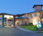
Holiday Inn Express & Suites ARCATA/EUREKA-AIRPORT AREA
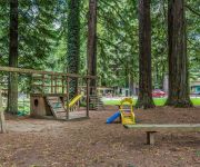
Rodeway Inn Emerald Forest of Trinidad
Videos from this area
These are videos related to the place based on their proximity to this place.
Radian Pro GOPRO McKinleyville CA
Stock Parkzone Radian Pro, with GO - PRO Hero Two, over McKinleyville CA.
Big City Kitties Hunters NOT!! Just Ask Mr. Gopher
So these city kitties moved up to the country and all they have managed to do is ANNOY the gophers!!
2958 Eagle Lane, McKinleyville, California
SOLD*. This luxurious home is alongside Beau Pre Golf Course. 2 private suites, each with its own balcony and bathroom, plus two more bedrooms and 2 more bathrooms. Offered by MikkiMoves Real.
McKinleyville California | Coast Central Realty
United Country Coast Central Realty, of mckinleyville California, offers a fine selection of real estate including homes for sale, waterfront properties, rec...
EurMac
McKinleyville/Eureka High School half-time show. MHS Cheer's first half-time show of the season. It was also my first video of the season and I missed 25% of the routine. BUT! Here's what...
Dale Barton: This is Why We Need to Stand Up
Dale Barton, Chair of the 2010 Affirmation Conference, shares his personal journey and tells Affirmation why we need to stand up to suicide, work for equality, and build bridges of understanding.
Why Do Fools Fall in Love
McKinleyville High School's 2012 Halloween performance of Why Do Fools Fall in Love, Directed by Savanna Padilla.
Secret Views of my Town 2
Secret Views of my Town 2 So as I've said before, I deliver newspapers and last night i decided that my town was equally as beautiful at night and i cover some good ground. I took some close...
X-Plane 10 - IFR landing at Arcata-Eureka Airport in a Cirrus Vision SF50
IFR landing at Arcata-Eureka Airport, RWY 32. ICAO Code: KACV. Aircraft: Cirrus Vision SF50. Flight simulator: X-Plane 10 3.0.
Tsunami originating near Japan hits the Mad River, Arcata, Northern California
A tsunami, originating from the same earthquake event that devastated parts of coastal Japan, strikes the California coast near Arcata, California. 11 March 2011 video previously posted under...
Videos provided by Youtube are under the copyright of their owners.
Attractions and noteworthy things
Distances are based on the centre of the city/town and sightseeing location. This list contains brief abstracts about monuments, holiday activities, national parcs, museums, organisations and more from the area as well as interesting facts about the region itself. Where available, you'll find the corresponding homepage. Otherwise the related wikipedia article.
Arcata-Eureka Airport
Arcata/Eureka Airport, also known as Arcata Airport, is an airport located 15 miles north of Eureka in the unincorporated town of McKinleyville, California. This regional airport serves Humboldt County, including the two primary regional cities that compose its name: Arcata and Eureka. The airport is a federally designated port of entry for civil aircraft arriving in the United States.
Coast Guard Air Station Humboldt Bay
Coast Guard Air Station Humboldt Bay is a United States Coast Guard Air Station located at the Arcata-Eureka Airport in McKinleyville, California, 16 miles north of Eureka in Humboldt County. The station is the site of the command center for all Coast Guard personnel stationed and assets located on the coasts of Humboldt, Mendocino, and Del Norte Counties. It is one of five air stations in the Eleventh Coast Guard District.
Clam Beach, California
Clam Beach is an locality in Humboldt County, California. It is located 8.5 miles north of Arcata, at an elevation of 33 feet .
Crannell, California
Crannell (formerly, Bullwinkel, Bulwinkle, and Crannel) is a former settlement in Humboldt County, California. It is located 4.5 miles southeast of Trinidad, at an elevation of 203 feet (62 m). The location was formerly a company town for sawmill workers of the Little River Redwood Company organized in 1893 by owners in Ottawa, and western New York. Company headquarters were in Tonawanda; and their California sawmill commenced operations in 1908.
Moonstone, California
Moonstone (formerly, Little River) is an unincorporated community in Humboldt County, California. It is located 2.5 miles southeast of Trinidad, at an elevation of 121 feet (37 m). For census purposes, it is aggregated in Westhaven-Moonstone, California. The area is sited adjacent to Pacific Ocean beach and the mouth of the Little River with views of the rugged coastline.
Westhaven, Humboldt County, California
Westhaven is an unincorporated community in Humboldt County, California. It is located 2.5 miles southeast of Trinidad, at an elevation of 328 feet (100 m). For census purposes it is amalgamated into Westhaven-Moonstone. The ZIP Code is 95570.
Little River State Beach
Little River State Beach is a protected beach of California, United States, in Humboldt County. It is located at the mouth of the Little River, 13 miles north of Eureka right off U.S. Route 101. The 152-acre park was established in 1931. The site is a broad, open beach that contains sand dunes. The Little River forms the north boundary of the beach. It is open for day-use only, but the adjacent Clam Beach County Park provides camping.
Metropolitan, California
Metropolitan is an unincorporated community in Humboldt County, California. It is located on McDairmid Prairie, on the north side of the Eel River floodplain three miles downstream of Scotia, at an elevation of 72 feet (22 m).


