Safety Score: 4,7 of 5.0 based on data from 9 authorites. Meaning it is not safe to travel Ukraine.
Travel warnings are updated daily. Source: Travel Warning Ukraine. Last Update: 2024-05-06 08:04:52
Discover Zelena Hirka
The district Zelena Hirka of in Gorod Sevastopol is a district in Ukraine about 429 mi south of Kiev, the country's capital city.
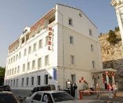
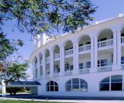
Looking for a place to stay? we compiled a list of available hotels close to the map centre further down the page.
When in this area, you might want to pay a visit to some of the following locations: Sevastopol, Inkerman, Balaklava, Kacha and Verkhnesadovoye. To further explore this place, just scroll down and browse the available info.
Local weather forecast
Todays Local Weather Conditions & Forecast: 15°C / 58 °F
| Morning Temperature | 12°C / 54 °F |
| Evening Temperature | 14°C / 58 °F |
| Night Temperature | 13°C / 55 °F |
| Chance of rainfall | 0% |
| Air Humidity | 54% |
| Air Pressure | 1017 hPa |
| Wind Speed | Moderate breeze with 9 km/h (6 mph) from North-East |
| Cloud Conditions | Clear sky, covering 2% of sky |
| General Conditions | Sky is clear |
Wednesday, 8th of May 2024
15°C (59 °F)
15°C (58 °F)
Overcast clouds, gentle breeze.
Thursday, 9th of May 2024
16°C (60 °F)
15°C (58 °F)
Overcast clouds, light breeze.
Friday, 10th of May 2024
17°C (63 °F)
15°C (59 °F)
Overcast clouds, gentle breeze.
Hotels and Places to Stay
DAKKAR RESORT HOTEL
DOLPHIN HOTEL
Videos from this area
These are videos related to the place based on their proximity to this place.
Взрыв 16 этажки Севастополь
26 декабря в Севастополе взорвали 16-этажку. Взрыв прошёл неудачно. Дом осел на два этажа и накренился в сторо...
Sevastopol Krimea Russia
Поездка по центральному кольцу города-героя Севастополя в день возвращения в состав России Крыма и Севасто...
Увертюра 1812 год. Галаконцерт фестиваля SEVASTOPOL MILITARY TATTOO
14 июня в Севастополе завершился трехдневный Международный фестиваль военных оркестров SEVASTOPOL MILITARY TATTOO,...
Harlem Shake (Sevastopol original)
Что же, прошлым воскресением мы решили поддержать цунами популярных Харлем Шейк видео, и сняли в Севастопол...
Sevastopol 1944
Soviet airforce. May 1944 Истребители Як-9Д из состава 6-го ГвИАП ВВС Черноморского Флота, один из самолетов ведет Геро...
Теплоход Прибывает в Севастополь motor ship arrives in Sevastopol
парковка автомобилей на причале parking of the cars on quay теплоход Принцеса Днепра Одесса - Севастополь.
Sevastopol-2014 (junior) -- 42 kg Dilik-1
Открытое Первенство города Севастополя среди кадетов (1999-2000 г.р.) 11 октября 2014, г.Севастополь 42 кг: Горчица...
Sevastopol-2014 (youngest) -- 32 kg Vanya
Открытое Первенство города Севастополя среди младших юношей (2002 г.р. и моложе) 26 октября 2014, г.Севастополь...
Famous Hero City from the Crimean War Stevelegassick's photos around Sevastopol, Ukraine
Preview of Stevelegassick's blog at TravelPod. Read the full blog here: http://www.travelpod.com/travel-blog-entries/stevelegassick/37/1149006900/tpod.html This blog preview was made by...
Sevastopol-2014 (junior) -- 38 kg Danik-3 (final)
Открытое Первенство города Севастополя среди кадетов (1999-2000 г.р.) 11 октября 2014, г.Севастополь 38 кг (финал):...
Videos provided by Youtube are under the copyright of their owners.
Attractions and noteworthy things
Distances are based on the centre of the city/town and sightseeing location. This list contains brief abstracts about monuments, holiday activities, national parcs, museums, organisations and more from the area as well as interesting facts about the region itself. Where available, you'll find the corresponding homepage. Otherwise the related wikipedia article.
Italian battleship Giulio Cesare
Giulio Cesare, motto Caesar Adest was a Conte di Cavour-class battleship that served in the Regia Marina in both World Wars before joining the Soviet Navy as the Novorossiysk. Her keel was laid down on 24 June 1910 at Cantieri Ansaldo, Genoa. She was launched 15 October 1911, and construction was completed 14 May 1914.
Battle of Inkerman
The Battle of Inkerman was fought during the Crimean War on November 5, 1854 between the allied armies of Britain and France against the Imperial Russian Army. The battle broke the will of the Russian Army to defeat the allies in the field, and was followed by the Siege of Sevastopol. The role of troops fighting mostly on their own initiative due to the foggy conditions during the battle has earned the engagement the name "The Soldier's Battle".
Battle of Balaclava
The Battle of Balaclava, fought on 25 October 1854 during the Crimean War, was part of the Anglo-French-Turkish campaign to capture the port and fortress of Sevastopol, Russia's principal naval base on the Black Sea. The engagement followed the earlier Allied victory in September at the Battle of the Alma, where the Russian General Menshikov had positioned his army in an attempt to stop the Allies progressing south towards their strategic goal.
Mamelon (fort)
A mamelon (from French "nipple") is a French name for a breast shaped hillock. {{#invoke:Footnotes|sfn}} At the Siege of Sevastopol (1854–1855) during the Crimea War the French called a strategic hillock the Mamelon. The British adopted the French name for the hill, but also called it Gordon's Hill. In October 1854 the French attempted to capture the summit of the hillock with a coup de main but were repulsed with casualties of about 600 officers and men.
Military dolphin
A military dolphin is a dolphin trained for military uses. The United States and Russian militaries have trained and employed oceanic dolphins for several reasons. Such military dolphins have been trained to rescue lost naval swimmers or to locate underwater mines. The U.S. Navy trains dolphins and sea lions under the U.S. Navy Marine Mammal Program, which is based in San Diego, California. They get some of their dolphins from the Gulf of Mexico. Military dolphins were used by the U.S.
Siege of Sevastopol (1941–42)
The Siege of Sevastopol took place on the Eastern Front of the Second World War. The campaign was fought by the Axis powers of Germany, Romania, and Italy against the Soviet Union for control of Sevastopol, a port in the Crimea on the Black Sea. On 22 June 1941 the Axis invaded the Soviet Union during Operation Barbarossa. Axis land forces reached the Crimea in the autumn of 1941 and overran most of the area. The only objective not in Axis hands was Sevastopol.
Ukrainian submarine Zaporizhzhia
Zaporizhzhia (U-01) is a project 641 ("Foxtrot" class) diesel-electric powered submarine, the only submarine of the Ukrainian Navy at the moment. She formerly carried the Soviet Navy pennant number B435. Zaporizhia was designed at the Rubin Design Bureau. Zaporizhzhia is run by a naval crew of 78, commanded by 1st Rank Capt. Oleh Orlov.
Baryshivka Raion
Baryshivka Raion is a raion in east-central Kiev Oblast of Ukraine. Its administrative center is Baryshivka. The raions area totals 957.6 km². The raion was formerly known as Baryshivska Rairada from 1923 to 1963.
Brotherhood Cemetery
The Brotherhood cemetery (Russian: Братское кладбище на Северной стороне) is an Imperial Russian military cemetery in Sevastopol, Ukraine. The Brotherhood cemetery was founded in 1854 as a temporary burial place for Russian soldiers and officers who were killed during the first siege of Sevastopol. Three burials were created according to order of admiral Vladimir Kornilov near the Northern fort of Sevastopol.
Berdyansk Raion
Berdyansk Raion is one of the 19 raions of Zaporizhia Oblast in southern Ukraine. The administrative center of the region is Berdyansk which is situated on the northern coast the Sea of Azov.
Charge of the Light Brigade
The Charge of the Light Brigade was a charge of British light cavalry led by Lord Cardigan against Russian forces during the Battle of Balaclava on 25 October 1854 in the Crimean War. Lord Raglan, overall commander, had intended to send the Light Brigade to pursue and harry a retreating Russian artillery battery near the front line, a task well suited to light cavalry.
Balaklava Raion
Balaklavskyi Raion is an administrative raion of the city of Sevastopol, Ukraine.
Gagarin Raion
Gagarin Raion is an administrative raion of the city of Sevastopol, Ukraine, named after cosmonaut Yuri Gagarin.
Nakhimov Raion
Nakhimov Raion is an administrative raion of the city of Sevastopol, Ukraine, named after Russian admiral Pavel Stepanovich Nakhimov.
Sevastopol International Airport
"Belbek" Sevastopol International Airport (Ukrainian: Міжнародний аеропорт "Бельбек"; Russian: Международный аэропорт "Бельбек", г. Севастополь) is AN airport in Belbek, near Sevastopol, Ukraine.
Chersonesus Cathedral
The Saint Vladimir Cathedral is a Neo-Byzantine Russian Orthodox cathedral on the site of Chersonesos Taurica. It commemorates the presumed place of St. Vladimir's baptism.
Naval museum complex Balaklava
Naval museum complex Balaklava (Ukrainian: Морський музейний комплекс "Балаклава") is an underground submarine base in Balaklava, Crimea, Ukraine (originally known as Object 825 GTS). It was a top-secret military facility during the Cold War, located in Balaklava bay. Today it serves as a museum and also houses a museum about the Crimean War.
St. Vladimir's Cathedral, Sevastopol
St. Vladimir's Cathedral is an Orthodox church in Sevastopol which was built in the aftermath of the Crimean War as a memorial to the heroes of the Siege of Sevastopol (1854–1855). It was the admiral Mikhail Lazarev who came up with the idea to build St. Vladimir's Cathedral in Sevastopol rather than in Chersonesus as was originally intended. The church contains the tombs of Lazarev and three of his disciples – Vladimir Kornilov, Vladimir Istomin and Pavel Nakhimov – who died during the siege.
Inkerman Cave Monastery
The Inkerman Monastery of St. Clement is a cave monastery in a cliff rising near the mouth of the Black River, in the city of Inkerman, administered as part of the sea port of Sevastopol. It was founded in 1850 on the site of a medieval Byzantine monastery where the relics of St. Clement were supposedly kept before their removal to San Clemente by Saints Cyril and Methodius.
Sapun-gora
Sapun-gora (Sapun Ridge) — is a ridge (240 m height) to the southeast of Sevastopol, in Crimea, Ukraine. It became the arena of fierce battle during the siege of Sevastopol (1941-1942), and also during its recapturing in 1944. When defending Sevastopol the Soviet troops held the Sapun Ridge and could observe German movements to the city from the south. It took Wehrmacht nearly 2 weeks of desperate fighting to take control over these positions in late June 1942.
Budyonny Raion
Budyonny Raion is an administrative raion of the city of Donetsk, Ukraine, named after Marshal of the Soviet Union Semyon Mikhailovich Budyonny.
Bay of Sevastopol
Bay of Sevastopol is a city harbor that houses series of smaller bays carved out its shores. The bay of Sevastopol splits the city into the Southern side and the Northern side. It serves as an extension of the Chorna River and stretches for 7.5 km which is the longest of them all. Bays appear as a unique attraction of Sevastopol. The city is located as an elevated amphitheater on their shores. Namely those bays give it the extraordinary charm.
Port of Sevastopol
Sevastopol Marine Trade Port of SMTP (Ukrainian: Севастопольський морський торговельний порт, Sevastopolsky morsky torhovelny port) is a port in the city of Sevastopol, Ukraine. It is located mainly at the Bay of Sevastopol, and at smaller bays around the Heracles peninsula. The port infrastructure is fully integrated with the city of Sevastopol and naval bases of the Ukrainian Navy and the Black Sea Fleet.


