Safety Score: 3,0 of 5.0 based on data from 9 authorites. Meaning we advice caution when travelling to Spain.
Travel warnings are updated daily. Source: Travel Warning Spain. Last Update: 2024-04-27 08:23:39
Delve into Monagas
Monagas in Las Palmas (Canary Islands) is a city located in Spain about 1,088 mi (or 1,750 km) south-west of Madrid, the country's capital town.
Current time in Monagas is now 08:52 AM (Sunday). The local timezone is named Atlantic / Canary with an UTC offset of one hour. We know of 8 airports closer to Monagas, of which 3 are larger airports. The closest airport in Spain is Gran Canaria Airport in a distance of 15 mi (or 23 km), South-East. Besides the airports, there are other travel options available (check left side).
There are several Unesco world heritage sites nearby. The closest heritage site in Spain is Teide National Park in a distance of 19 mi (or 31 km), North-East. We saw 10 points of interest near this location. In need of a room? We compiled a list of available hotels close to the map centre further down the page.
Since you are here already, you might want to pay a visit to some of the following locations: Teror, Valleseco, Moya, Firgas and Vega de San Mateo. To further explore this place, just scroll down and browse the available info.
Local weather forecast
Todays Local Weather Conditions & Forecast: 15°C / 59 °F
| Morning Temperature | 12°C / 53 °F |
| Evening Temperature | 14°C / 57 °F |
| Night Temperature | 13°C / 55 °F |
| Chance of rainfall | 0% |
| Air Humidity | 55% |
| Air Pressure | 1019 hPa |
| Wind Speed | Moderate breeze with 11 km/h (7 mph) from South |
| Cloud Conditions | Few clouds, covering 19% of sky |
| General Conditions | Light rain |
Monday, 29th of April 2024
15°C (59 °F)
12°C (54 °F)
Scattered clouds, moderate breeze.
Tuesday, 30th of April 2024
15°C (58 °F)
12°C (54 °F)
Broken clouds, moderate breeze.
Wednesday, 1st of May 2024
15°C (60 °F)
13°C (56 °F)
Broken clouds, moderate breeze.
Hotels and Places to Stay
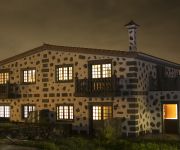
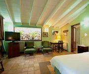
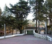
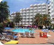
Melva Suite
Las Calas Hotel Rural
Parador de Cruz de Tejeda
Ocean Ponderosa
PosHada Rural
El Refugio Hotel Rural
Hotel Rural Fonda de la Tea
Casa Verde de Guia
Videos from this area
These are videos related to the place based on their proximity to this place.
TEROR TALAYON, TRANSGRANCANARIA 2014
TRAMO DEL KM 13,5 TEROR, HASTA EL AVITUALLAMIENTO DE TALAYON, KM 20, DE LA TRANSGRANCANARIA, MUCHO BARRO, PERO NO RESBALABA,
Rallye Teror 2013 Parte01
Toñi Ponce vence el 33 Rallye Villa de Teror, seguido de Miguel Cabral y vicente Bolaños.
La vision de un Fotografo en El Rally Villa de Teror 2013
SIn duda alguna un video de Rally no son solo las imágenes de los coches, aqui he querido dar a ver lo que es la vision de un fotografo en un rally, lo que camina, los sitios en los que se...
TEROR-VALLESECO D-Race Simcenter
Primera parte del tramo Teror - Los Castillos. Este tramo va desde Teror hasta el cruce de Valleseco. Proximamente veremos la continuacion del tramo que llega hasta Los Castillos. Mas tramos...
Caida en el desceso de Teror.
caida en el salto del descenso ciudad de teror ( a la segunda lo salte pero el camara se quedo sin bateria).
Fútbol Preferente: U. D. Teror - C. D. Raqui San Isidro
Resumen del encuentro de fútbol regional canario de la Promoción a 3ª División Grupo XII canario disputado entre U. D. Teror - C. D. Raqui San Isidro en la temporada 2008-2009. Vídeo del...
Romería del Pino Teror
Cientos de imágenes de la Romería de ofrenda a la Virgen del Pino en Teror, una de las mejores que se recuerda. Ofrecido por http://www.GranCanariaActualidad.com.
Rancho de Ánimas de Arbejales-Teror, 16/12/1989 (1)
Rancho de Ánimas de Arbejales-Teror, salida del 16 de diciembre de 1989. Cantiga en casa de un limosnero en Los Llanos (Teror). "Cantadores de Alante", por orden de intervención: Antonio...
Teror-Valleseco-(WIP-I)
Primera parte del tramo Teror - Los Castillos. A falta de la vegetación y algunas cosas mas. Este tramo es desde Teror hasta el cruce de Valleseco, en Gran Canaria. Para D-Race Simcenters...
Videos provided by Youtube are under the copyright of their owners.
Attractions and noteworthy things
Distances are based on the centre of the city/town and sightseeing location. This list contains brief abstracts about monuments, holiday activities, national parcs, museums, organisations and more from the area as well as interesting facts about the region itself. Where available, you'll find the corresponding homepage. Otherwise the related wikipedia article.
Firgas, Las Palmas
Firgas is a Canary Islands municipality in the province of Las Palmas. Is a suburb of Las Palmas city. It is situated in the north of Gran Canaria. It has an area of 15.77 km², 7,023 inhabitants and the density of 455.34/km². It celebrated its 500th anniversary in 1988. The town was founded in 1488.
Valleseco, Las Palmas
Valleseco is a municipality of Las Palmas province, on the Canary Islands. It is in the northcentral part of Gran Canaria. Valleseco means "dry valley" in Spanish, but its name is misleading, since it is actually one of the wettest municipalities of the island. Valleseco's area is 22.11 km² with a population of about 4,045 and its density is 182.95/km². The elevation is 1,000 m. Valleseco is a municipality situated at 7 km. from Teror and 28 from the city of Las Palmas.
Teror
Teror is a Canarian municipality in the northern portion of the island of Gran Canaria in the Las Palmas province in the Canary Islands. Teror is a suburb of Las Palmas city. September 8 is the local festivity celebrating Virgen del Pino (virgin of the pine, patron of the Gran Canaria). If there were a prize for the 'most Canarian' municipality, Teror would definitely win it! Architecture, piety and culinary delights - everthing here has a special Canaria quality.


