Safety Score: 3,0 of 5.0 based on data from 9 authorites. Meaning we advice caution when travelling to Spain.
Travel warnings are updated daily. Source: Travel Warning Spain. Last Update: 2024-04-27 08:23:39
Explore Huertecillas
Huertecillas in Las Palmas (Canary Islands) is a city in Spain about 1,086 mi (or 1,748 km) south-west of Madrid, the country's capital.
Local time in Huertecillas is now 09:06 PM (Saturday). The local timezone is named Atlantic / Canary with an UTC offset of one hour. We know of 8 airports in the vicinity of Huertecillas, of which 3 are larger airports. The closest airport in Spain is Gran Canaria Airport in a distance of 15 mi (or 25 km), South-East. Besides the airports, there are other travel options available (check left side).
There are several Unesco world heritage sites nearby. The closest heritage site in Spain is Teide National Park in a distance of 18 mi (or 29 km), North-East. We found 10 points of interest in the vicinity of this place. If you need a place to sleep, we compiled a list of available hotels close to the map centre further down the page.
Depending on your travel schedule, you might want to pay a visit to some of the following locations: Firgas, Moya, Teror, Arucas and Valleseco. To further explore this place, just scroll down and browse the available info.
Local weather forecast
Todays Local Weather Conditions & Forecast: 19°C / 65 °F
| Morning Temperature | 12°C / 53 °F |
| Evening Temperature | 16°C / 62 °F |
| Night Temperature | 13°C / 56 °F |
| Chance of rainfall | 0% |
| Air Humidity | 52% |
| Air Pressure | 1013 hPa |
| Wind Speed | Moderate breeze with 10 km/h (6 mph) from South |
| Cloud Conditions | Broken clouds, covering 56% of sky |
| General Conditions | Light rain |
Sunday, 28th of April 2024
15°C (59 °F)
13°C (56 °F)
Light rain, moderate breeze, scattered clouds.
Monday, 29th of April 2024
15°C (59 °F)
13°C (56 °F)
Scattered clouds, moderate breeze.
Tuesday, 30th of April 2024
15°C (59 °F)
13°C (55 °F)
Scattered clouds, moderate breeze.
Hotels and Places to Stay
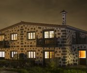
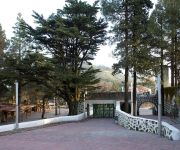
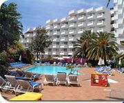
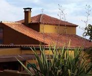
Melva Suite
Parador de Cruz de Tejeda
Santa Brigida Hotel Escuela
Ocean Ponderosa
PosHada Rural
Casa Verde de Guia
El Refugio Hotel Rural
Videos from this area
These are videos related to the place based on their proximity to this place.
Rally Islas Canarias 2014 TC1 Teror
Finalizada la etapa nocturna Fernando Capdevila lidera la general y el autonómico. Yeray Lemes se sitúa primero del Campeonato de España y tercero del Autonómico.
Carrera de Carretones 2012 (El Zumacal - Valleseco - Gran Canaria)
Carrera de carretones con motivo de las Fiestas de El Zumacal (Valleseco - Gran Canaria) (14/07/2012)
Venta de 2 Casa con terreno en El Zumacal ....150 000 Euros
Naturaleza, arboles frutales, tierras de cultivo y mucha agua. La casa Necesita reforma. Es ideal para vivir, alquilar a extranjeros o disfrute fin de semana. Buena inversión para hospedaje...
Taller de Naturaleza 2008 (1/9)
Cinematografía Ariguanabense. Armando Pérez-Jácome Morales. Proyecto Fénix. Primera parte del documental "Taller de Naturaleza", realizado en la Escuela Internacional de Cine y TV de San...
Subida Moya 2013 - Parte02
Enrique Cruz se hizo con la victoria en la rampa de Moya, seguido de Jonathan Suarez y José Manuel Asencio en tercer lugar. Destacar la actuación de David Tenorio con Opel Corsa GSI, que...
Gran Canaria - Firgas
Slideshow/Video from Firgas in Gran Canaria. Visit http://www.grancanariaholiday.org.uk to read more about Gran Canaria. Or visit http://www.travel-grancanaria.com/no for info in Norwegian.
TRAIDA DEL PALO SAN ROQUE 2013
TRAIDA DEL PALO , EN LAS FIESTA DE SAN ROQUE 2013, FIRGAS. SALIENDO DE LAS CANALES , PASANDO POR LAS CASAS BARATAS, PLAZA DE SAN LUIS Y LLEGADA AL PUEBLO.
Videos provided by Youtube are under the copyright of their owners.
Attractions and noteworthy things
Distances are based on the centre of the city/town and sightseeing location. This list contains brief abstracts about monuments, holiday activities, national parcs, museums, organisations and more from the area as well as interesting facts about the region itself. Where available, you'll find the corresponding homepage. Otherwise the related wikipedia article.
Santa María de Guía de Gran Canaria
Santa María de Guía de Gran Canaria is a municipality in Las Palmas province of the Canary Islands. It is located on the north side of Grand Canary island. Santa María's area is 42.59 km², its population of about 14,107 inhabitants and its density is 332.95/km². Its maximum elevation is 180 metres. Santa Maria is situated in a valley setting.
Firgas, Las Palmas
Firgas is a Canary Islands municipality in the province of Las Palmas. Is a suburb of Las Palmas city. It is situated in the north of Gran Canaria. It has an area of 15.77 km², 7,023 inhabitants and the density of 455.34/km². It celebrated its 500th anniversary in 1988. The town was founded in 1488.
Moya, Las Palmas
Moya is a municipality of Las Palmas province, on the Canary Islands. It is in the northern part of the Grand Canary island or Gran Canaria. Moya's area is 31.87 km² with a population of about 8,307 and its density is 250.63/km². Moya is situated in the mountains while the valleys cover the northern part, the mountains cover the southern part. Farmlands are within the coastline, the Atlantic Ocean lies to the north.
Valleseco, Las Palmas
Valleseco is a municipality of Las Palmas province, on the Canary Islands. It is in the northcentral part of Gran Canaria. Valleseco means "dry valley" in Spanish, but its name is misleading, since it is actually one of the wettest municipalities of the island. Valleseco's area is 22.11 km² with a population of about 4,045 and its density is 182.95/km². The elevation is 1,000 m. Valleseco is a municipality situated at 7 km. from Teror and 28 from the city of Las Palmas.
Teror
Teror is a Canarian municipality in the northern portion of the island of Gran Canaria in the Las Palmas province in the Canary Islands. Teror is a suburb of Las Palmas city. September 8 is the local festivity celebrating Virgen del Pino (virgin of the pine, patron of the Gran Canaria). If there were a prize for the 'most Canarian' municipality, Teror would definitely win it! Architecture, piety and culinary delights - everthing here has a special Canaria quality.


