Safety Score: 3,4 of 5.0 based on data from 9 authorites. Meaning please reconsider your need to travel to South Africa.
Travel warnings are updated daily. Source: Travel Warning South Africa. Last Update: 2024-04-28 08:22:10
Discover Earlsfield
The district Earlsfield of in eThekwini Metropolitan Municipality (KwaZulu-Natal) is a district in South Africa about 326 mi south-east of Pretoria, the country's capital city.
Looking for a place to stay? we compiled a list of available hotels close to the map centre further down the page.
When in this area, you might want to pay a visit to some of the following locations: Durban, Ndwedwe, Camperdown, Wartburg and Scottburgh. To further explore this place, just scroll down and browse the available info.
Local weather forecast
Todays Local Weather Conditions & Forecast: 23°C / 73 °F
| Morning Temperature | 16°C / 60 °F |
| Evening Temperature | 23°C / 74 °F |
| Night Temperature | 21°C / 69 °F |
| Chance of rainfall | 0% |
| Air Humidity | 52% |
| Air Pressure | 1016 hPa |
| Wind Speed | Moderate breeze with 12 km/h (7 mph) from South-West |
| Cloud Conditions | Few clouds, covering 10% of sky |
| General Conditions | Sky is clear |
Tuesday, 30th of April 2024
29°C (84 °F)
22°C (72 °F)
Sky is clear, gentle breeze, clear sky.
Wednesday, 1st of May 2024
25°C (76 °F)
22°C (72 °F)
Sky is clear, moderate breeze, clear sky.
Thursday, 2nd of May 2024
24°C (75 °F)
20°C (67 °F)
Overcast clouds, gentle breeze.
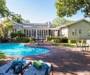
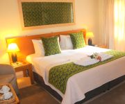
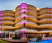
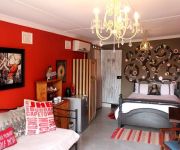
Hotels and Places to Stay
Westville Bed & Breakfast Guest House
Centre Court B&B
COASTLANDS MUSGRAVE HOTEL
Goble Palms Guest Lodge & Urban Retreat
Lambert House
Mandalay B&B
Flintstones Guest House Durban
Terebinte Guest House
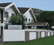
Premier Hotel Pinetown
Tamarisk B & B
Videos from this area
These are videos related to the place based on their proximity to this place.
Africa's HIGEST water slide
Experience Africa's HIGHEST waterslide. Only at uShaka Marine World, Durban.
A.S.K DECOR AND CATERING PORTFOLIO
SOUTH AFRICAN BASED DECOR AND CATERING COMPANY CONTACT +2731 2622998 EMAIL: askdecor@gmail.com or view more at our website www.askdecor.yolasite.com ...
TEDxUKZN - Dr. Francesco Petruccione - Durban: A City Goes Quantum
Francesco Petruccione was born in 1961 in Genova (Italy). He studied Physics at the University of Freiburg i. Br. and received his PhD in 1988. He got his "Habilitation" (Dr. rer. nat. habil.)...
TEDxUKZN - Rosemary Quilling and Craig Blewett - The Journey to Ubun2.0
Avatar Quible (representing Mrs. R. Quilling and Mr. C.Blewett)is a full time Web-based resident, teacher, and researcher. All of Quible's time is spent in Twitter or Facebook or YouTube or...
TEDxUKZN - Dr. Kumi Naidoo - Democratizing Global Governance: A Response to the Perfect Strom
Born in South Africa, Kumi Naidoo became involved in his country's liberation struggle at the age of 15. In 1986, he was arrested and charged for violating the state of emergency regulations....
Beating HIV in South Africa: Paul Kelly at TEDxUKZN
Paul Kelly is a Programme Director at Africaid's WhizzKids United. His major goal in life is to have helped decrease the spread of HIV/AIDS in KZN by 2015 and in 2020 to be one of businessmen...
TEDxUKZN - Joseph Jere - Computer Literacy Outreach Initiative: Tugela Ferry
Joseph Ntabeni Jere graduated from the CISCO academy in 2006 as a Cisco certified networking associate (CCNA) from the University of Zambia. He also holds a B.Sc HONS from the University of...
Street workout South Africa-Power House Destroyers Durban (RISE OF THE UNDER DOGS [AMATURE VID])
This is a start of a new age. The perfect video is coming soon. Keep pushing on your dreams no matter how worthless they are. that's what we doing.
Gumtree Lodge Mount Edgecombe KwaZulu Natal - Africa Travel Channel
Africa Travel Channel - Situated 3 km from Umhlanga Rocks - South Africa's famous beach resort at the Indian Ocean, 15km North of Durban, 15km from King Shaka International Airport. Sheer luxury...
Videos provided by Youtube are under the copyright of their owners.
Attractions and noteworthy things
Distances are based on the centre of the city/town and sightseeing location. This list contains brief abstracts about monuments, holiday activities, national parcs, museums, organisations and more from the area as well as interesting facts about the region itself. Where available, you'll find the corresponding homepage. Otherwise the related wikipedia article.
Westville Boys' High School
Westville Boys' High School, often referred to as WBHS, is a public high school for boys located in Westville, KwaZulu-Natal, South Africa.
Durban University of Technology
The Durban University of Technology (DUT) is a University of Technology in KwaZulu-Natal, South Africa. It was formed in 2002 by the merger of Technikon Natal and ML Sultan Technikon and was previously known as the Durban Institute of Technology. It has four campuses in Durban, and two in Pietermaritzburg. In 2005, around 20 000 students were enrolled.
Kings Park Stadium
Kings Park (previously known as ABSA Stadium and Mr Price Kings Park Stadium for sponsorship reasons and also commercially promoted as The Shark Tank), is a stadium in the Kings Park Sporting Precinct in Durban, South Africa, which was originally built in 1891 and extensively renovated in the 1990s. It has a capacity of 55,000 and is the home ground of the Sharks. The stadium has also been used by Durban based Premier Soccer League football (soccer) clubs, as well as for large football finals.
Kings Park Soccer Stadium
Kings Park Soccer Stadium was a multi-use stadium in Durban, South Africa. It was formerly used mostly for football matches and was the home of Manning Rangers who played in the Premier Soccer League. The stadium had a capacity of 35,000 people. The stadium was demolished in 2006 to make way for the Moses Mabhida Stadium.
Berea, Durban
The Berea is a ridge above the city of Durban, KwaZulu-Natal, South Africa on the northern side which overlooks the city centre and the Indian Ocean. Berea is also used as a collective designation for the suburbs in the area. It has been described as the area between the Howard College Campus of the University of KwaZulu-Natal, and the Burman Bush Nature Reserve. Some of the oldest mansions in Durban were built in this once forested area.
Moses Mabhida Stadium
The Moses Mabhida Stadium is a stadium in Durban, South Africa, named after Moses Mabhida, a former General Secretary of the South African Communist Party. It is a multi-use stadium. It was one of the host stadiums for the 2010 FIFA World Cup. The stadium has a capacity of 62,760 during the World Cup and 54,000 afterwards. The stadium is adjacent to the Kings Park Stadium, in the Kings Park Sporting Precinct, and the Durban street circuit used for the A1GP World Cup of Motorsport.
Clifton School
Clifton School is an independent school for boys located in Durban, Kwazulu-Natal, in the Republic of South Africa.
Princess Magogo Stadium
Princess Magogo Stadium is a multi-purpose stadium in KwaMashu, a suburb of Durban, South Africa. It is currently used mostly for football matches and is set to be utilized as a training field for teams participating in the 2010 FIFA World Cup after being renovated in 2009 and brought up to FIFA standards. The stadium is named after Princess Constance Magogo, a Zulu princess who spent much of her life as a singer and composer while developing an understanding for Zulu tradition and culture.
Battle of Congella
The Battle of Congella, beginning 23 May 1842, was between British and Boer forces.
Kennedy Road, Durban
Kennedy Road is a shack settlement, in the suburb of Clare Estate in Durban, in the province of KwaZulu-Natal in South Africa. It was founded by a Mr. Mzobe in the late 1970s. The land on which the settlement was founded is steep and runs down between the Municipal Dump and the 6 lane Umgeni Road. At the time of the occupation, the suburb of Clare Estate was reserved, under apartheid legislation, for the exclusive use of people of Indian descent.
Kings Park Sporting Precinct
Kings Park Sporting Precinct is a site located in Stamford Hill, Durban, KwaZulu Natal, South Africa. It was developed primarily to host the 2010 FIFA World Cup, but will also form part of the city's long term plan to host the Summer Olympics. The precinct regularly hosts domestic and international rugby union and association football events, as well as national and international swimming galas. The Kings Park Sporting Precinct is managed by the City of Durban.
Al Falaah College
Al Falaah College is an alternative, independent school situated in the coastal city of Durban, in KwaZulu-Natal, South Africa.
Jameson Park and Rose Garden
Jameson Park and Rose Garden {{#invoke:Coordinates|coord}}{{#coordinates:29|49|37|S|31|00|31|E| |primary |name= }} is a rose garden located in Durban, South Africa. Once being a pineapple plantation, it currently possesses about 200 species of roses which are prominent in the South African Spring months of September to November.
Burman Bush
Burman Bush is a nature reserve in Morningside, Durban, situated some 8 km north of the CBD. At about 50 hectares it constitutes a small coastal forest, that forms part of the Durban Municipal Open Space System (D'MOSS). Among the forest trees that populate the reserve are flat-crowns, the forest fever-berry and red beech.
Natal Observatory
The Natal Observatory was an astronomical observatory in the Colony of Natal (now the KwaZulu-Natal province of the Republic of South Africa) from 1882 to 1911. The most important work carried out there was a study of the motion of the moon.
Umbilo River
The Umbilo River is a river in KwaZulu-Natal, South Africa. The mouth of the river is situated in Durban harbour. The Umbilo River forms part of the Durban Metro's d'Moss trail and conservation efforts.
Educor
Educor is a premier supplier of tertiary education in South Africa. Educor is an abbreviation for the Education Investment Corporation Limited. They are the largest provider of private education in Southern Africa. They provide Higher, Further and Vocational education via face-to-face classes, distance learning and online learning. They also offer full-time and part-time studies, providing people from all walks of life with access to education.
Pigeon Valley
Pigeon Valley is a Natural Heritage Park in Durban, South Africa. It was established to provide protection for the Natal White Stinkwood and other forest giants of the coastal climax forest. Another rare tree that occurs here is Oxyanthus pyriformis which is endemic to the Durban area and to Ongoye Forest. Pigeon Valley was developed as a Nature Reserve in 1989 and is about 10ha in extent.
Durban Botanic Gardens
The Durban Botanic Gardens is situated in the City of Durban, KwaZulu-Natal, South Africa. It is Durban’s oldest public institution and Africa's oldest surviving botanic gardens. The gardens cover an area of 15 hectares in a subtropical climate.
Sugar Ray Xulu Stadium
Sugar Ray Xulu Stadium is a multi-purpose stadium in Clermont, a township of Durban, South Africa. It is currently used mostly for football matches and is set to be utilized as a training field for teams participating in the 2010 FIFA World Cup after being renovated in 2010 and brought up to FIFA standards. The stadium's small capacity was expanded from 1,700 to 6,500 as a lasting legacy of the World Cup.
Mitchell Park Zoo
Mitchell Park Zoo is also known as Mitchell Park or Mitchell's Park. Situated in the Morningside suburb of Durban, South Africa, it is the only zoo in Durban. The zoo was established as an Ostrich farm in 1910, but was unprofitable and started adding other animals. At one time it was home to many large animals, the most notable of which was an Indian Elephant named Nellie.
Durban railway station
Durban railway station is the central railway station in the city of Durban, South Africa, located between Umgeni Road and Masabalala Yengwa Avenue just to the north of the central business district. It is the terminus of Shosholoza Meyl long-distance services from Johannesburg and Cape Town, and the hub of a network of Metrorail commuter rail services that stretch as far as KwaDukuza (Stanger) to the north, Kelso to the south, and Cato Ridge inland.
Umgeni River Bird Park
The Umgeni River Bird Park is a bird zoo located in Durban, in the province of KwaZulu-Natal, South Africa.
Lambert Road Baptist Church
Lambert Road Baptist Church is an evangelical church located in the suburb of Morningside, in Durban, South Africa. This church is a member of the Baptist Union of Southern Africa.
Overport
Overport is a hilly residential area in Durban, South Africa. The name Overport is commonly used to refer to the suburbs of Overport, Sydenham, Sparks and parts of Essenwood, with the part of Sydenham west of Brickfield Road usually called Asherville rather than Overport. The name Overport was coined by William Hartley, the eighth Mayor of Durban for an estate he developed in what had up to then been called West Hill.






!['Street workout South Africa-Power House Destroyers Durban (RISE OF THE UNDER DOGS [AMATURE VID])' preview picture of video 'Street workout South Africa-Power House Destroyers Durban (RISE OF THE UNDER DOGS [AMATURE VID])'](https://img.youtube.com/vi/oAS2kCUEXMo/mqdefault.jpg)
