Safety Score: 3,4 of 5.0 based on data from 9 authorites. Meaning please reconsider your need to travel to South Africa.
Travel warnings are updated daily. Source: Travel Warning South Africa. Last Update: 2024-04-28 08:22:10
Touring Hillary
The district Hillary of Durban in eThekwini Metropolitan Municipality (KwaZulu-Natal) is a subburb located in South Africa about 331 mi south-east of Pretoria, the country's capital place.
Need some hints on where to stay? We compiled a list of available hotels close to the map centre further down the page.
Being here already, you might want to pay a visit to some of the following locations: Ndwedwe, Camperdown, Scottburgh, Wartburg and Pietermaritzburg. To further explore this place, just scroll down and browse the available info.
Local weather forecast
Todays Local Weather Conditions & Forecast: 23°C / 73 °F
| Morning Temperature | 16°C / 60 °F |
| Evening Temperature | 23°C / 74 °F |
| Night Temperature | 21°C / 69 °F |
| Chance of rainfall | 0% |
| Air Humidity | 52% |
| Air Pressure | 1016 hPa |
| Wind Speed | Moderate breeze with 12 km/h (7 mph) from South-West |
| Cloud Conditions | Few clouds, covering 10% of sky |
| General Conditions | Sky is clear |
Tuesday, 30th of April 2024
29°C (84 °F)
22°C (72 °F)
Sky is clear, gentle breeze, clear sky.
Wednesday, 1st of May 2024
25°C (76 °F)
22°C (72 °F)
Sky is clear, moderate breeze, clear sky.
Thursday, 2nd of May 2024
24°C (75 °F)
20°C (67 °F)
Overcast clouds, gentle breeze.
Hotels and Places to Stay
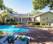
Westville Bed & Breakfast Guest House
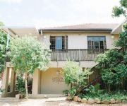
Mackaya Bella Guest House
Roseland House
Sparkling Star Bed & Breakfast
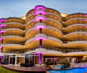
COASTLANDS MUSGRAVE HOTEL
Musgrave Avenue Guest Lodge
A Family and Friends Guest House
Villa Valencia
Hamelin Guest House
Andaluz Boutique Hotel
Videos from this area
These are videos related to the place based on their proximity to this place.
LED Blue Twinkle Lights by Magic Lighting
For more information contact us on: Durban 238 Anleno Road, Montclair Kwa-Zulu Natal Tel: +27 31 462 9473 Fax: +27 31 462 9630 GPS Location: -29.911924,30.970597 Gauteng: 233 Alexandra ...
2014-02-26: Kia ND 747 692, driving on wrong side of Kingfisher Rd, blocking Kenyon Howden Rd
2014-02-26: Kia ND 747 692, driving on wrong side of Kingfisher Rd, blocking oncoming traffic from Kenyon Howden Rd, Yellowwood Park.
Firework Lights By Magic Lighting
For more information contact us on: Durban 238 Anleno Road, Montclair Kwa-Zulu Natal Tel: +27 31 462 9473 Fax: +27 31 462 9630 GPS Location: -29.911924,30.970597 Gauteng: 233 Alexandra ...
Cascoland 2008 Durban Parade Film
During the Cascoland 2008 project in Durban, Movinghands created a mobile production unit made from a camera and tv monitor mounted in a wheely bin. We recorded the reactions of passers over...
Banghra Dance in Durban MRT3859838
This was happening in 2007 in Pavillion shopping mall in Westville MRT3859838.
Using Google Earth Images in PhotoModeler Scanner
This tutorial example shows how a 3D model can be created in PhotoModeler Scanner using Google Earth images. N.B. That the 3D model created is reliant on the Google Earth elevation mode...
MTB South Africa Vol2
Here we are again on a bumpy ride, now in great African style. Go along with the shaky camera through Stainbank Reserve and see what's all about cycling in A...
2014-08-01 - Silver Toyota Avanza skips red traffic light on Sarnia Rd.
2014-08-01 - Silver Toyota Avanza skips red traffic light on Sarnia Rd because he/she is too impatient to wait 20 seconds.
Videos provided by Youtube are under the copyright of their owners.
Attractions and noteworthy things
Distances are based on the centre of the city/town and sightseeing location. This list contains brief abstracts about monuments, holiday activities, national parcs, museums, organisations and more from the area as well as interesting facts about the region itself. Where available, you'll find the corresponding homepage. Otherwise the related wikipedia article.
University of KwaZulu-Natal
The University of KwaZulu-Natal or UKZN is a university with five campuses all located in the province of KwaZulu-Natal in South Africa. It was formed on 1 January 2004 after the merger between the University of Natal and the University of Durban-Westville.
Westville Boys' High School
Westville Boys' High School, often referred to as WBHS, is a public high school for boys located in Westville, KwaZulu-Natal, South Africa.
Durban University of Technology
The Durban University of Technology (DUT) is a University of Technology in KwaZulu-Natal, South Africa. It was formed in 2002 by the merger of Technikon Natal and ML Sultan Technikon and was previously known as the Durban Institute of Technology. It has four campuses in Durban, and two in Pietermaritzburg. In 2005, around 20 000 students were enrolled.
Bluff, KwaZulu-Natal
Bluff or The Bluff is a geographical area, containing seven suburbs, in Durban, eThekwini metropolitan municipality, KwaZulu-Natal Province, South Africa. Within the area referred to as "The Bluff" lie the suburbs of Brighton Beach, Grosvenor, King's Rest, Ocean View, Fynnland, Treasure Beach and Wentworth. The name of the area is derived from the long bluff - two ancient sand dunes on which most of the suburbs lie.
Berea, Durban
The Berea is a ridge above the city of Durban, KwaZulu-Natal, South Africa on the northern side which overlooks the city centre and the Indian Ocean. Berea is also used as a collective designation for the suburbs in the area. It has been described as the area between the Howard College Campus of the University of KwaZulu-Natal, and the Burman Bush Nature Reserve. Some of the oldest mansions in Durban were built in this once forested area.
Clifton School
Clifton School is an independent school for boys located in Durban, Kwazulu-Natal, in the Republic of South Africa.
Kennedy Road, Durban
Kennedy Road is a shack settlement, in the suburb of Clare Estate in Durban, in the province of KwaZulu-Natal in South Africa. It was founded by a Mr. Mzobe in the late 1970s. The land on which the settlement was founded is steep and runs down between the Municipal Dump and the 6 lane Umgeni Road. At the time of the occupation, the suburb of Clare Estate was reserved, under apartheid legislation, for the exclusive use of people of Indian descent.
Al Falaah College
Al Falaah College is an alternative, independent school situated in the coastal city of Durban, in KwaZulu-Natal, South Africa.
Airlink Flight 8911
Airlink Flight 8911 was a positioning flight from Durban International Airport to Pietermaritzburg Airport that crashed into the grounds of Merebank Secondary School shortly after takeoff at around 8:00 a.m. local time on September 24, 2009, injuring the three occupants of the aircraft and one on the ground. The captain of the flight subsequently died of his injuries on October 7, 2009.
Jameson Park and Rose Garden
Jameson Park and Rose Garden {{#invoke:Coordinates|coord}}{{#coordinates:29|49|37|S|31|00|31|E| |primary |name= }} is a rose garden located in Durban, South Africa. Once being a pineapple plantation, it currently possesses about 200 species of roses which are prominent in the South African Spring months of September to November.
Burman Bush
Burman Bush is a nature reserve in Morningside, Durban, situated some 8 km north of the CBD. At about 50 hectares it constitutes a small coastal forest, that forms part of the Durban Municipal Open Space System (D'MOSS). Among the forest trees that populate the reserve are flat-crowns, the forest fever-berry and red beech.
Natal Observatory
The Natal Observatory was an astronomical observatory in the Colony of Natal (now the KwaZulu-Natal province of the Republic of South Africa) from 1882 to 1911. The most important work carried out there was a study of the motion of the moon.
Chatsworth Stadium
Chatsworth Stadium is a multi-purpose stadium in Durban, South Africa. It is currently used mostly for football matches and serves as the home stadium of Golden Arrows.
Umbilo River
The Umbilo River is a river in KwaZulu-Natal, South Africa. The mouth of the river is situated in Durban harbour. The Umbilo River forms part of the Durban Metro's d'Moss trail and conservation efforts.
Educor
Educor is a premier supplier of tertiary education in South Africa. Educor is an abbreviation for the Education Investment Corporation Limited. They are the largest provider of private education in Southern Africa. They provide Higher, Further and Vocational education via face-to-face classes, distance learning and online learning. They also offer full-time and part-time studies, providing people from all walks of life with access to education.
Pigeon Valley
Pigeon Valley is a Natural Heritage Park in Durban, South Africa. It was established to provide protection for the Natal White Stinkwood and other forest giants of the coastal climax forest. Another rare tree that occurs here is Oxyanthus pyriformis which is endemic to the Durban area and to Ongoye Forest. Pigeon Valley was developed as a Nature Reserve in 1989 and is about 10ha in extent.
Durban Botanic Gardens
The Durban Botanic Gardens is situated in the City of Durban, KwaZulu-Natal, South Africa. It is Durban’s oldest public institution and Africa's oldest surviving botanic gardens. The gardens cover an area of 15 hectares in a subtropical climate.
Mitchell Park Zoo
Mitchell Park Zoo is also known as Mitchell Park or Mitchell's Park. Situated in the Morningside suburb of Durban, South Africa, it is the only zoo in Durban. The zoo was established as an Ostrich farm in 1910, but was unprofitable and started adding other animals. At one time it was home to many large animals, the most notable of which was an Indian Elephant named Nellie.
Durban railway station
Durban railway station is the central railway station in the city of Durban, South Africa, located between Umgeni Road and Masabalala Yengwa Avenue just to the north of the central business district. It is the terminus of Shosholoza Meyl long-distance services from Johannesburg and Cape Town, and the hub of a network of Metrorail commuter rail services that stretch as far as KwaDukuza (Stanger) to the north, Kelso to the south, and Cato Ridge inland.
Umgeni River Bird Park
The Umgeni River Bird Park is a bird zoo located in Durban, in the province of KwaZulu-Natal, South Africa.
SJ Smith Stadium
SJ Smith Stadium is a multi-use stadium at the Lamontville district, in the Chatsworth suburb of Durban, situated in the KwaZulu-Natal province of South Africa. It is currently used mostly for football matches, and was the home venue of Durban Stars and African Wanderers during the 2010-11 season of Vodacom League.
Lambert Road Baptist Church
Lambert Road Baptist Church is an evangelical church located in the suburb of Morningside, in Durban, South Africa. This church is a member of the Baptist Union of Southern Africa.
KwaZulu-Natal High Court, Durban
The KwaZulu-Natal High Court, Durban (formerly the Durban & Coast Local Division and commonly known as the Durban High Court) is one of the High Courts of South Africa. It sits at Durban and has general jurisdiction over the coastal districts of KwaZulu-Natal. It is a local division subordinate to the KwaZulu-Natal High Court, Pietermaritzburg, and as such it does not have its own Judge President but is under the leadership of the Judge President of the Pietermaritzburg court.
Trams in Durban
The Durban tramway network formed part of the public transport system in Durban, South Africa, for nearly 70 years until the end of the 1940s.
Overport
Overport is a hilly residential area in Durban, South Africa. The name Overport is commonly used to refer to the suburbs of Overport, Sydenham, Sparks and parts of Essenwood, with the part of Sydenham west of Brickfield Road usually called Asherville rather than Overport. The name Overport was coined by William Hartley, the eighth Mayor of Durban for an estate he developed in what had up to then been called West Hill.


