Saint Kitts and Nevis
in Caribbean
North America
- Currency and Currency Code:
- Dollar - XCD
- Spoken languages:
- English
- Local electricity:
- 230 V - 60 Hz (plugs: D, G)
- Mobile phone / cellular frequencies (MHz):
- 850 MHz, 900 MHz, 1800 MHz, 1900 MHz, 3G, 4G
- ISO 2-Letter code:
- KN
- Internet top level domain:
- .kn
- Country phone prefix:
- +1-869
- Local Time (capital):
- Timezone:
- UTC/GMT offset: hours
Safety Score: 2,5 of 5.0 based on data from 9 authorites. Meaning we advice caution when travelling to Saint Kitts and Nevis.
Travel warnings are updated daily. Source: Travel Warning Saint Kitts and Nevis. Last Update: 2024-08-13 08:21:03
Explore Saint Kitts and Nevis
Saint Kitts and Nevis with its capital Basseterre is located in North America (Caribbean, islands in the Caribbean Sea). It covers some 262 square kilometers (1.5 times the size of Washington, DC) with 52,715 citizens. English is the language commonly spoken used by the people in Saint Kitts and Nevis. This country shares no land borders with another country.


Saint Kitts and Nevis are a pair of tropical islands in the Caribbean, about one-third of the way from Puerto Rico to Trinidad and Tobago. What is really remarkable on St-Kitts and Nevis is the natural aspect. Many tropical birds which one rarely finds elsewhere are present in great concentration in the nature and there are also the famous monkeys which, it is said, were introduced by the pirates. An all-new road permits going to the southeast end of St-Kitts (Turtle Beach) where one feels that a certain febrility in the air will make of this part of the island an appreciated place.
Popular Destinations in Saint Kitts and Nevis
Administrative regions of Saint Kitts and Nevis
- Christ Church Nichola Town
- Saint Anne Sandy Point
- Saint George Basseterre
- Saint George Gingerland
- Saint James Windward
- Saint John Capesterre
- Saint John Figtree
- Saint Mary Cayon
- Saint Paul Capesterre
- Saint Paul Charlestown
- Saint Peter Basseterre
- Saint Thomas Lowland
- Saint Thomas Middle Island
- Trinity Palmetto Point
About the country
The landscape is volcanic with mountainous interiors. The average density of population is about 202 per km². The climate in Saint Kitts and Nevis can be described as tropical, tempered by constant sea breezeslittle seasonal temperature variation, rainy season (May to November). Potential threats by nature are hurricanes (July to October) Mount Liamuiga (1,156 m) on Saint Kitts, and Nevis Peak (985 m) on Nevis, are both volcanoes that are part of the volcanic island arc of the Lesser Antilles, which extends from Saba in the north to Grenada in the south
To reach someone Saint Kitts and Nevis dial +1-869 prior to a number. The local cellular networks are operated on 850 MHz, 900 MHz, 1800 MHz, 1900 MHz, 3G, 4G. Websites typically end with the top level domain ".kn". If you want to bring electric appliances (e.g. battery chaarger), keep in min the local 230 V - 60 Hz (plugs: D, G). The sign for the locally used currency Dollar is XCD.
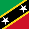
Divided diagonally from the lower hoist side by a broad black band bearing two white, five-pointed stars; the black band is edged in yellow; the upper triangle is green, the lower triangle is red; green signifies the island's fertility, red symbolizes the struggles of the people from slavery, yellow denotes year-round sunshine, and black represents the African heritage of the people; the white stars stand for the islands of Saint Kitts and Nevis, but can also express hope and liberty, or independence and optimism.

Carib Indians occupied the islands of the West Indies for hundreds of years before the British began settlement in 1623. In 1967, the island territory of Saint Christopher-Nevis-Anguilla became an associated state of the UK with full internal autonomy. The island of Anguilla rebelled and was allowed to secede in 1971. The remaining islands achieved independence in 1983 as Saint Kitts and Nevis. In 1998, a referendum on Nevis to separate from Saint Kitts fell short of the two-thirds majority vote needed. Nevis continues in its efforts to separate from Saint Kitts.
Geography
| Area | ||
|---|---|---|
| Total (World Rank: 209) | 261 | sq km |
| Land (World Rank: 206) | 261 | sq km |
| Forest (World Rank: 173) | 3.50 | % |
| Comparative | 1.5 times the size of Washington, DC | |
| Coastline | ||
| 135 | ||
| Elevation | ||
| Highest point (World Rank: 157) | 1,156 | m |
| Agricultural land | ||
| Total (World Rank: 154) | 23.10 | % |
| Arable (World Rank: 59) | 19.20 | % |
| Permanent crops (World Rank: 153) | 0.40 | % |
| Permanent pastures (World Rank: 173) | 3.50 | % |
| Irrigated land (World Rank: 174) | 8 | sq km |
| Map reference | ||
| Central America and the Caribbean | ||
| Environment | ||
| Issues |
| |
| Agreement party |
| |
| Hazzards |
| |
| Location | ||
| Caribbean, islands in the Caribbean Sea, about one-third of the way from Puerto Rico to Trinidad and Tobago | ||
| Climate | ||
| tropical, tempered by constant sea breezes; little seasonal temperature variation; rainy season (May to November) | ||
| Terrain | ||
| volcanic with mountainous interiors | ||
People
| Population | ||
|---|---|---|
| Total (World Rank: 205) | 52,715 | |
| Deathrate (World Rank: 126) | 0.71 | % |
| Birthrate (World Rank: 146) | 1.32 | % |
| Growthrate (World Rank: 139) | 0.73 | % |
| Migration rate (World Rank: 54) | 0.12 | % |
| Fertility rate (World Rank: 154) | 1.77 | % |
| Median age | ||
| Male (World Rank: 72) | 35.20 | |
| Female (World Rank: 83) | 34.80 | |
| Age structure | ||
| 0 14 male (World Rank: 206) | 5,378 | |
| 0 14 female (World Rank: 206) | 5,332 | |
| 15 24 male (World Rank: 207) | 3,689 | |
| 15 24 female (World Rank: 203) | 3,978 | |
| 25 54 male (World Rank: 206) | 12,070 | |
| 25 54 female (World Rank: 205) | 11,441 | |
| 55 64 male (World Rank: 203) | 3,130 | |
| 55 64 female (World Rank: 203) | 3,142 | |
| 65 x male (World Rank: 207) | 2,107 | |
| 65 x female (World Rank: 207) | 2,448 | |
| Health | ||
| Infant mortality rate (World Rank: 148) | 0.84 | % |
| Life expectancy total (World Rank: 93) | 76 | years |
| Life expectancy female (World Rank: 101) | 78 | years |
| Life expectancy male (World Rank: 92) | 74 | years |
| Hospital bed per 1000 (World Rank: 92) | 2.30 | |
| Sanitation access total (World Rank: 106) | 87.30 | % |
| Obesity adult (World Rank: 71) | 22.90 | % |
| Drinking water access (World Rank: 74) | 98.30 | % |
Energy
| Electricity | ||
|---|---|---|
| Production (World Rank: 183) | 208,000,000 | kWh |
| Consumption (World Rank: 190) | 193,400,000 | kWh |
| Source fossil (World Rank: 58) | 94.90 | % |
| Source renew (World Rank: 84) | 6.60 | % |
| Refined products | ||
| Consumption (World Rank: 193) | 1,900 | bbl / day |
| Import (World Rank: 187) | 1,907 | bbl / day |
| Carbon footprint | ||
| 300000 | ||
Nation
| Budget | ||
|---|---|---|
| Education (World Rank: 99) | 4 | % of GDP |
| Health (World Rank: 138) | 5 | % of GDP |
| Surplus (World Rank: 9) | 4 | % of GDP |
| National symbol | ||
| Royal Poinciana tree | ||
| National colours | ||
| yellow | ||
| Adjective | ||
| Kittitian, Nevisian | ||
| Noun | ||
| Kittitian(s), Nevisian(s) | ||
| Background | ||
| Carib Indians occupied the islands of the West Indies for hundreds of years before the British began settlement in 1623. In 1967, the island territory of Saint Christopher-Nevis-Anguilla became an associated state of the UK with full internal autonomy. The island of Anguilla rebelled and was allowed to secede in 1971. The remaining islands achieved independence in 1983 as Saint Kitts and Nevis. In 1998, a referendum on Nevis to separate from Saint Kitts fell short of the two-thirds majority vote needed. Nevis continues in its efforts to separate from Saint Kitts. | ||
| Flag description | ||
| divided diagonally from the lower hoist side by a broad black band bearing two white, five-pointed stars; the black band is edged in yellow; the upper triangle is green, the lower triangle is red; green signifies the island's fertility, red symbolizes the struggles of the people from slavery, yellow denotes year-round sunshine, and black represents the African heritage of the people; the white stars stand for the islands of Saint Kitts and Nevis, but can also express hope and liberty, or independence and optimism | ||
Economy
| Gdp | ||
|---|---|---|
| Purchasing power parity (World Rank: 198) | 1,463,000,000 | USD |
| Real growth rate (World Rank: 92) | 3.10 | % |
| Per capita purchasing power parity (World Rank: 71) | 26,100 | USD |
| Source agriculture (World Rank: 194) | 1.10 | % |
| Source industry (World Rank: 83) | 29.00 | % |
| Source service (World Rank: 67) | 69.90 | % |
| Labourforce | ||
| Total (World Rank: 209) | 18,170 | |
| Products | ||
| Industries |
| |
| Agriculture |
| |
| Exports |
| |
| Imports |
| |
Communication
| Phone | ||
|---|---|---|
| Landline total (World Rank: 178) | 17,433 | |
| Landline per 100 (World Rank: 60) | 33.00 | |
| Mobile per 100 (World Rank: 32) | 146.00 | |
| Assessment | 0 | |
| Internet | ||
| Users (World Rank: 197) | 39,000 | |
| Population (World Rank: 62) | 75.70 | % |
Transport
| Air | ||
|---|---|---|
| Airports paved (World Rank: 187) | 2.00 | |
| Rail | ||
| Total length (World Rank: 132) | 50.00 | |
| Road | ||
| Total length (World Rank: 201) | 383 | |
| Paved length (World Rank: 173) | 163.00 | |
| Unpaved length (World Rank: 141) | 220.00 | |
This is a list of famous places in this country in alphabetical order.
 Bachelors Hall
- Barnabys Village
- Barnes Ghaut
- Basseterre
- Bath
- Bayford's
- Bourryau
- Boyd's
- Brambles
- Brick Kiln
- Brown Hill
- Brown Pasture
- Brownes
- Brumaire
- Buck's Hill
- Burnaby
- Burts
- Butlers
- Canada
- Cayon
- Challengers
- Charlestown
- Cliftons
- Cliftons
- Cotton Ground
- Cox
- Craddocks
- Dalzells
- Dieppe Bay Town
- Douglas
- Fig Tree
- Fig Tree
- Fothergill
- Fountain
- Geagans
- Gingerland
- Golden Rock
- Greatheeds
- Half Way Tree
- Hardtimes
- Harris
- Heldens
- Hermitage
- Hichmans
- Hick's
- Houstons
- Jack in the Box
- Jessup
- John England Village
- Key
- Kit Stoddart
- Kittitian Village
- La Guerite
- Limekiln
- Lodge
- Lucas
- Maddens
- Mansion
- Mardenbrough
- Market Shop
- Middle Island
- Molineaux
- Monkey Hill
- Montpelier
- Mount Lily
- New River
- Newcastle
- Newton Ground
- Nicola Town
- Ogee's
- Old Road Town
- Ortons
- Ottley's
- Ottley's
- Parry's
- Parson's Ground
- Phillips
- Romneys
- Sadlers
- Saint Paul's
- Saint Peter's
- Sandy Point Town
- Scarborough
- Sherriffs
- Stapleton
- Tabernacle
- Trants
- Trinity
- Upper Conaree
- Webb's Ground
- Westbury
- Whitegate
- Wingfield Manor
- Zetlands
- Zion