Safety Score: 3,0 of 5.0 based on data from 9 authorites. Meaning we advice caution when travelling to Panama.
Travel warnings are updated daily. Source: Travel Warning Panama. Last Update: 2024-05-04 08:22:41
Touring Nuevo Cristóbal
The district Nuevo Cristóbal of Colón in Provincia de Colón is a subburb located in Panama about 36 mi north-west of Panama, the country's capital place.
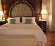
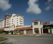
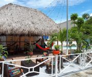
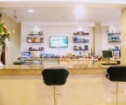
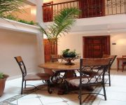
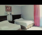
Need some hints on where to stay? We compiled a list of available hotels close to the map centre further down the page.
Being here already, you might want to pay a visit to some of the following locations: Arco Iris, Las Margaritas, Cativa, Sabanitas and Puerto Pilon. To further explore this place, just scroll down and browse the available info.
Local weather forecast
Todays Local Weather Conditions & Forecast: 31°C / 89 °F
| Morning Temperature | 24°C / 76 °F |
| Evening Temperature | 28°C / 82 °F |
| Night Temperature | 26°C / 78 °F |
| Chance of rainfall | 0% |
| Air Humidity | 55% |
| Air Pressure | 1010 hPa |
| Wind Speed | Gentle Breeze with 6 km/h (4 mph) from South-East |
| Cloud Conditions | Overcast clouds, covering 94% of sky |
| General Conditions | Overcast clouds |
Monday, 6th of May 2024
31°C (87 °F)
26°C (79 °F)
Overcast clouds, gentle breeze.
Tuesday, 7th of May 2024
31°C (88 °F)
26°C (79 °F)
Overcast clouds, gentle breeze.
Wednesday, 8th of May 2024
32°C (89 °F)
26°C (79 °F)
Light rain, gentle breeze, scattered clouds.
Hotels and Places to Stay
HOTEL CLUB FRANCES LVX
Meliá Panamá Canal
Radisson Colon 2000 Hotel and Casino
Sand Diamond Hotel
Hotel Evenia Coronado
Hotel Meryland
Hotel Andros
MERYLAND HOTEL
Videos from this area
These are videos related to the place based on their proximity to this place.
El primer campamento musical de Colón
El pasado 28 de febrero realizamos con éxito el primer Campamento creativo juvenil musical de Colón junto a Joshue Ashby & C3 Project. Este campamento fue diseñado para trabajar y potenciar...
Desfile 5 de noviembre 2010 - Ciudad de Colón ::Fronterizos::
Presentación del el día 5 de Noviembre de 2010 (Día de Colón) de El Servicio Nacional de Fronteras de Panamá en el marco de las fiestas patrias de la República de Panamá.
Policia golpeando a niños en manifestaciones de Colón
Sin orden judicial ninguna, la policia vestida de civil entraba a los multifamiliares como este de calle 1, ciudad de Colón, para requizar las casas y arrestar a cualquier persona, entre ellos...
Reel 2013 | Aronátegui Producciones | Colón Panamá |
Muestra de algunos trabajos realizados en el 2013. Contacto: Abel Aronátegui Email: abel0806@hotmail.com Celular: (507) 69816036 / 66869233.
desfile 1 noviembre 2010 - Colón
Con el desfile de las escuelas oficiales, inician las festividades patrias.
Gatun Lock Panama Canal Dwyerkev's photos around Colón, Panama (gatun locks panama canal)
Preview of Dwyerkev's blog at TravelPod. Read the full blog here: http://www.travelpod.com/travel-blog-entries/dwyerkev/1/1264416068/tpod.html This blog preview was made by TravelPod using...
Familias Legalmente Unidas Colón
Sí acepto! Eso fue lo que dijeron 651 parejas colonenses que decidieron formalizar su unión y formar un hogar. La ceremonia del matrimonio civil múltiple empezó a las 9:00 a.m. y terminó...
desfile 5 noviembre 2010 - Colón
Los colonenses salieron a celebrar su día, pese a las inclemencias del tiempo.
Panama Canal, Panama - Transit - Port of Colon HD (2014)
Colón is a sea port on the Caribbean Sea (Atlantic) coast of Panama. The city lies near the Caribbean Sea entrance to the Panama Canal. It is the capital of Panama's Colón Province and has...
Videos provided by Youtube are under the copyright of their owners.
Attractions and noteworthy things
Distances are based on the centre of the city/town and sightseeing location. This list contains brief abstracts about monuments, holiday activities, national parcs, museums, organisations and more from the area as well as interesting facts about the region itself. Where available, you'll find the corresponding homepage. Otherwise the related wikipedia article.
Colón, Panama
Colón is a sea port on the Caribbean Sea coast of Panama. The city lies near the Caribbean Sea entrance to the Panama Canal. It is the capital of Panama's Colón Province and has traditionally been known as Panama's second city. Colón was originally located entirely on Manzanillo Island, surrounded by Limon Bay, Manzanillo Bay, and the Folks River.
Gatun Dam
The Gatun Dam is a large earthen dam across the Chagres River in Panama, near the town of Gatun. The dam, constructed between 1907 and 1913, is a crucial element of the Panama Canal; it impounds the artificial Gatun Lake, which in turn carries ships for 33 kilometres of their transit across the Isthmus of Panama. In addition, a hydro-electric generating station at the dam generates electricity which is used to operate the locks and other equipment in the canal.
Coco Solo
Coco Solo was a United States Navy submarine base established in 1918 on the Atlantic Ocean (northwest) side of the Panama Canal Zone, near Colón, Panama. United States Senator John McCain was born in 1936 at a small Navy hospital at Coco Solo Naval Air Station. The larger Coco Solo Hospital was constructed in the summer of 1941.
Galeta Island (Panama)
Galeta Island, Panama is an island located on the Atlantic side of the Republic of Panama just east of the city of Colón, Panama. Galeta Island was the site of a U.S. military communications facility from the 1930s through 2002 at which time it was turned over to the government of the Republic of Panama. The communications facility located on the island included an operations building located in the center of a U.S.
Fort Sherman
Fort Sherman is a former United States Army base in Panama, located on Toro Point at the Atlantic (northern) end of the Panama Canal, on the western bank of the Canal directly opposite Colón (which is on the eastern bank). It was the primary defensive base for the Atlantic sector of the Canal, and was also the center for US jungle warfare training for some time. Its Pacific-side partner was Fort Amador. Both bases were turned over to Panama in 1999.
Estadio Armando Dely Valdés
Estadio Armando Dely Valdés is a multi-purpose stadium in Colón, Panama. It is currently used mostly for football matches and is the home stadium of CD Árabe Unido. The stadium holds 4,000 people, and is named after former Panamanian footballer, Armando Dely Valdés.
Fort Gulick
Fort Gulick was a U.S. Army base in the former Panama Canal Zone located on the Atlantic side of the Panama Canal near Fort Davis, on Gatun Lake.
Limon Bay
Limon Bay (Bahía Limón in the original Spanish) is a natural harbor located at the north end of the Panama Canal, west of the cities of Cristóbal and Colón. Ships waiting to enter the canal stay here, protected from storms by breakwaters.
Cristóbal, Colón
Cristóbal is a port in the Atlantic side of the Panama Canal. It is located on the western edge of Manzanillo Island and is part of the Panamanian city and province of Colón. Cristóbal Colón is the Spanish translation for Christopher Columbus, an explorer from Italy for whom these places were named.
Gatún
Gatun is a small town on the Atlantic Side of the Panama Canal, located south of the city of Colón at the point in which Gatun Lake meets the channel to the Caribbean Sea. The town is best known as the site of the Panama Canal's Gatun Locks and Gatun Dam, built by the United States between 1906-1914.
Manzanillo International Terminal
Manzanillo International Terminal is located located east of the Atlantic opening of the Panama Canal on the Manzanillo Bay, Colón Province, Republic of Panama. MIT is a distribution center for cargoes destined for cities within the Republic of Panama and neighboring countries in Central America and the Caribbean. It is one of the biggest container transhipment terminals of the region and has direct access into the Colon Free Trade Zone (CFZ).
Fort Randolph (Panama)
Fort Randolph (Panama) was a Coast Artillery Corps fort built to defend the northern end of the Panama canal in conjunction with Fort Sherman.
Third Bridge over Panama Canal
The Third Bridge over Panama Canal is a projected road bridge in Colón, Panama, which will span the Atlantic entrance to the Panama Canal. When completed it will be a third bridge over the Panama Canal after the Bridge of the Americas and the Centennial Bridge both on the Pacific side of the canal. The bridge is proposed to be a double-pylon, double-plane, concrete girder, cable-stayed bridge with a main span of 530 m, and two side spans of 230 m.


