
Address & Contact
Contact Information:
GPS Coordinates:
Longitude: 85,583°
Latitude: 28,200°
Summary
Langtang Airport is a small airport in Nepal, serving the region of Langtang.
Facts:
Airport size: small airport Serving area: Langtang Longest runway: 0 (ft)
Codes:
IATA: LTG,
ICAO: VNLT
Flight information:
Departure times (FlightStats)
Flight times (FlightRadar24)
Location on map
Show bigger map on Openstreetmap
About the airport
Langtang Airport (IATA: LTG, ICAO: VNLT) is a small domestic airport located in the Langtang region of Nepal. Situated at an elevation of 1,860 meters (6,102 feet), it serves as a gateway to the stunning Langtang Valley, a popular trekking destination.
The airport is well-connected to Kathmandu, the capital city of Nepal, with regular flights operated by domestic airlines. The flight duration from Kathmandu to Langtang Airport is approximately 30 minutes, offering travelers a convenient and time-saving option to reach this picturesque region.
Langtang Airport is surrounded by breathtaking mountain views, including the Langtang Lirung peak, which stands at an impressive 7,227 meters (23,711 feet). The airport's location makes it an ideal starting point for treks to Langtang National Park, known for its diverse flora and fauna, alpine meadows, and glacial lakes.
While the airport is small and lacks extensive facilities, it provides essential services such as baggage handling and a waiting area. Travelers planning a trip to the Langtang region can rely on Langtang Airport for a convenient and scenic entry point to this beautiful part of Nepal.
Videos from the area of the airport


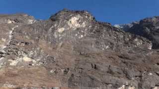
Langtang Trekking-excellent Video From Access Nepal Tour & Trekking
View Details:http://goo.gl/tyidse Langtang trekking combines the remote and spectacular valley of Langtang. Despite being very close to City, the Langtang Region is as wild as any Tibetan highlands...
Wild pigeons flocking on our Lantang trek (Nepal)
Spotted flocks and flocks of wild pigeons on our way towards Kyanjin Gompa from Lantang Village (Nepal). We could just sprint and probably will be able to grab a few if we have tried. Btw,...

Langtang trekking in Nepal
With Kandoo, http://www.kandoohimalaya.com why don't you trek the spectacular Langtang Valley if time is short and you want to enjoy the Himlayan mountains a...
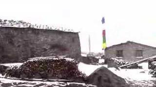
LANGTANG & GOSAINKUND trekking March 2006 - 4.Day - Old Lang
http://www.Buddhafiguren.de Walk through Old Langtang while snowing.

Climbing Naya kanga - Langtang - Nepal
Climbing to the summit of Naya kanga 5844 metres.
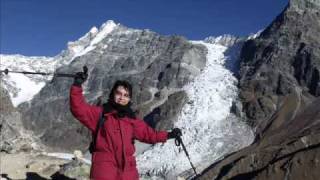
Langtang Trekking, Nepal
初めてのネパールトレッキング ランタン谷を2010年冬に楽しみました。 Trekking around Langtang area in Nepal.
Videos provided by Youtube are under the copyright of their owners. 
 Mountain Airport
Small airport - 21 mi (34 km)
Tribhuvan International AirportMedium airport - 37 mi (61 km)
Jiri AirportSmall airport - 56 mi (90 km)
Ramechhap AirportSmall airport - 63 mi (102 km)
Gorkha AirportSmall airport - 68 mi (110 km)
Phaplu AirportSmall airport - 77 mi (125 km)
Simara AirportSmall airport - 81 mi (131 km)
Bigger and popular cities in the wider vicinity are these:
- Bhaktapur
- Bhojpur
 Camgyai
- Chame
- Chongdui
- Kathmandu
- Khudi
- Lamjung
- Nagarkot
- Nawal
- Ngamring
- Pisang
- Pokhara
- Ramechhap
- Xegar
- Zhadong
- Zham
- Zongga
- Zuobude
These are some smaller cities that might be interesting. They are all rather close.