Safety Score: 4,0 of 5.0 based on data from 9 authorites. Meaning please reconsider your need to travel to Martinique.
Travel warnings are updated daily. Source: Travel Warning Martinique. Last Update: 2024-05-03 08:06:06
Touring Faubourg Schœlcher
The district Faubourg Schœlcher of Rivière-Pilote in Martinique (Martinique) is a subburb located in Martinique about 14 mi south-east of Fort-de-France, the country's capital place.
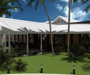
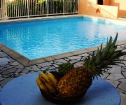
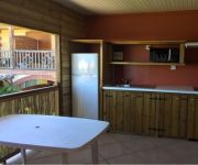
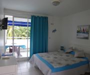
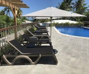
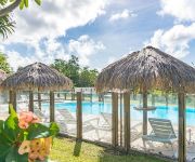
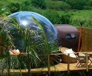
Need some hints on where to stay? We compiled a list of available hotels close to the map centre further down the page.
Being here already, you might want to pay a visit to some of the following locations: Fort-de-France, Schoelcher, Gros Islet, Castries and Anse La Raye. To further explore this place, just scroll down and browse the available info.
Local weather forecast
Todays Local Weather Conditions & Forecast: 30°C / 86 °F
| Morning Temperature | 27°C / 80 °F |
| Evening Temperature | 28°C / 82 °F |
| Night Temperature | 27°C / 81 °F |
| Chance of rainfall | 0% |
| Air Humidity | 64% |
| Air Pressure | 1011 hPa |
| Wind Speed | Moderate breeze with 10 km/h (6 mph) from North-West |
| Cloud Conditions | Broken clouds, covering 56% of sky |
| General Conditions | Light rain |
Saturday, 4th of May 2024
30°C (86 °F)
27°C (81 °F)
Light rain, moderate breeze, broken clouds.
Sunday, 5th of May 2024
30°C (86 °F)
27°C (81 °F)
Overcast clouds, moderate breeze.
Monday, 6th of May 2024
30°C (86 °F)
27°C (80 °F)
Broken clouds, gentle breeze.
Hotels and Places to Stay
AMANDIERS-KARIBEA HOTELS
Residence La Shana
Hotel Cap Macabou
Ti ' Paradis
Les Créolines
Le Grand Large Plage
Diamant les Bains Résidence Hôtelière
Corail Residence
Residence Les Cayalines
Sphair un Spa - Adults Only
Videos from this area
These are videos related to the place based on their proximity to this place.
AQUAFORM - Meeting Aquafitness, 07 Avril 2013, Anse Figuier, Reportage 2
Reportage d'ATV sur le Meeting AquaFitness organisé par Aquaform, le 07 Avril 2013, sur la Plage de l'Anse Figuier (Rivière Pilote) de 09h à 12h. 150 participants.
CARIBSAT - ATV reportage - ESPACE-Sud - 3 février 2010
Présentation du projet CARIBSAT à Sainte-Luce (Espace-Sud, Martinique) par Marc Morell et Régine Aglaé (reportage ATV - 3 février 2010).
Carnaval Martinique 2013: Dimanche gras Parade de Sainte-Luce
Article et photos sur: http://www.mcvlemag.com/2013/02/11/sainte-luce-carnaval-2013-et-dimanche-gras/ Le Dimanche gras de la commune de Sainte-Luce en Martinique, comme si vous y étiez!
Martinique : Sainte Luce
La ville de Sainte-Luce est l'une des villes les plus touristiques de Martinique. Découvrez ici le Bourg.
Ponte de tortue - SAINTE-LUCE MARTINIQUE - 1er Avril 2014 - Pierre & Vacances
Poisson d'Avril 2014 L'équipe d'Animation Pierre & Vacances Sainte-Luce, a proposé d'assister à une ponte de de Tortue en direct.
Croisières Martinique Bande Annonce.mov
Bande annonce présentant les croisières, aux alentours de la Martinique, avec Saï-Saï. Les croisières sont un mélange d'apprentissage à la navigation en monocoque ou en catamaran, avec...
Videos provided by Youtube are under the copyright of their owners.
Attractions and noteworthy things
Distances are based on the centre of the city/town and sightseeing location. This list contains brief abstracts about monuments, holiday activities, national parcs, museums, organisations and more from the area as well as interesting facts about the region itself. Where available, you'll find the corresponding homepage. Otherwise the related wikipedia article.
Diamond Rock
Diamond Rock (Rocher du Diamant) is a 175 m (574 feet) high basalt island located south of Fort-de-France, the main port of the Caribbean island of Martinique. The uninhabited island is about three kilometers from Pointe Diamant. The island gets its name from the reflections that its sides cast at certain hours of the day, which evoke images of a precious stone. Its claim to fame is the role that it played in the Napoleonic Wars.
Stade d'Honneur de Dillon
Stade d'Honneur de Dillon, is a multi-purpose stadium in Fort-de-France, Martinique. It is currently used mostly for football matches. The stadium can hold 16,300 people.
Roman Catholic Archdiocese of Fort-de-France
The Roman Catholic Archdiocese of Fort-de-France (Latin: Archidioecesis Arcis Gallicae et S. Petri o Martinicensis) is an Archdiocese of the Latin Rite of the Roman Catholic Church in the Caribbean. The Archdiocese comprises the entirety of the former French dependency of Martinique. The Archdiocese is the Metropolitan for the suffragan dioceses of Cayenne and Basse-Terre, and is a member of the Antilles Episcopal Conference.
St. Louis Cathedral, Fort-de-France
Fort-de-France Cathedral (Cathédrale Saint-Louis de Fort-de-France) is a Roman Catholic cathedral, and a national monument of France, located in the town of Fort-de-France, capital of Martinique. The architect was the Parisian Pierre-Henri Picq. This is the seventh church to have stood on the site, and although Picq had been commissioned to build a structure that could survive Martinique's plagues of fire, hurricanes and earthquakes, he built it entirely out of wood.
Stade Omnisports (Lamentin)
Stade Omnisports is a multi-use stadium in Lamentin, Martinique. It is currently used mostly for football matches and hosts the home games of Aiglon. The stadium holds 8,500 people.
Fort-de-France Bay
Fort-de-France Bay is a large inlet of the Caribbean Sea, off the coast of Martinique. It is named after Martinique's capital, Fort-de-France, the chief town on the bay.
Canton of Rivière-Pilote
The Canton of Rivière-Pilote is a canton in the Arrondissement of Le Marin on Martinique.
A1 autoroute (Martinique)
The A1 autoroute in Martinique (officially designated as A1) is the only autoroute on the French autoroute system built outside of Metropolitan France. This short autoroute, only 7 km in length, connects Aimé Césaire International Airport to Le Lamentin and Fort-de-France.
Fort Saint Louis (Martinique)
Fort Saint Louis (often hyphenated as Fort Saint-Louis) is a seaside fortress in Fort-de-France, Martinique. The present-day fort has evolved from earlier strongholds that were erected on the site as early as 1638, and has been known in previous incarnations as Fort Royal and Fort de la Republique. The modern-day Fort Saint Louis is both an active naval base and a listed historic site of France. There are daily tours of the fort, though the portion that is still a naval base is off-limits.
Fort Desaix
Fort Desaix is a Vauban fort and one of four forts that protect Fort-de-France, the capital of Martinique. The fort was built from 1768 to 1772 and sits on a hill, Morne Garnier, overlooking what was then Fort Royal. Fort Desaix was built in response to the successful British attack on Fort Royal in 1762 and was intended to prevent any future attacker from using Morne Garnier to site cannon that could then bombard Fort Royal from above.
Rivière de François
The Rivière de François is a river of Martinique.
Battle of Diamond Rock
The Battle of Diamond Rock took place between 31 May and 2 June 1805 during the Napoleonic Wars. It was an attempt by Franco-Spanish force despatched under Captain Julien Cosmao to retake Diamond Rock, at the entrance to the bay leading to Fort-de-France, from the British forces that had occupied it over a year before.
Fond-Zombi
Fond-Zombi (or Quartier Fond Zombi) is a populated place in the arrondissement of Fort-de-France on Martinique.
Stade En Camée
The Stade Alfred Marie-Jeanne, until August 2011 Stade En Camée, is a multi-purpose stadium located in Rivière-Pilote, Martinique, an overseas department of France. It is currently used mostly for football matches and is set to be utilized as a venue for the 2010 Caribbean Championship.
Trois-Rivières, Martinique
Trois-Rivières is a village on the southwest coast of Martinique, located within the commune of Sainte-Luce. It is known for its distillery/plantation Rhum Trois Rivières, located in the north of the village.


