Safety Score: 4,0 of 5.0 based on data from 9 authorites. Meaning please reconsider your need to travel to Martinique.
Travel warnings are updated daily. Source: Travel Warning Martinique. Last Update: 2024-05-01 08:01:32
Explore La Médaille
La Médaille in Martinique (Martinique) is located in Martinique a little north of Fort-de-France, the country's capital.
Local time in La Médaille is now 10:26 AM (Wednesday). The local timezone is named America / Martinique with an UTC offset of -4 hours. We know of 8 airports in the wider vicinity of La Médaille. The closest airport in Martinique is Martinique Aimé Césaire International Airport in a distance of 10 mi (or 15 km), South-East. Besides the airports, there are other travel options available (check left side).
There are two Unesco world heritage sites nearby. The closest heritage site is Morne Trois Pitons National Park in Dominica at a distance of 46 mi (or 74 km). Also, if you like golfing, there is an option about 12 mi (or 20 km). away. We found 1 points of interest in the vicinity of this place. If you need a place to sleep, we compiled a list of available hotels close to the map centre further down the page.
Depending on your travel schedule, you might want to pay a visit to some of the following locations: Schoelcher, Fort-de-France, Berekua, Soufriere and Pointe Michel. To further explore this place, just scroll down and browse the available info.
Local weather forecast
Todays Local Weather Conditions & Forecast: 29°C / 84 °F
| Morning Temperature | 24°C / 75 °F |
| Evening Temperature | 26°C / 79 °F |
| Night Temperature | 25°C / 78 °F |
| Chance of rainfall | 0% |
| Air Humidity | 59% |
| Air Pressure | 1013 hPa |
| Wind Speed | Moderate breeze with 9 km/h (6 mph) from West |
| Cloud Conditions | Few clouds, covering 12% of sky |
| General Conditions | Light rain |
Wednesday, 1st of May 2024
29°C (83 °F)
25°C (77 °F)
Light rain, moderate breeze, overcast clouds.
Thursday, 2nd of May 2024
28°C (83 °F)
26°C (78 °F)
Light rain, moderate breeze, overcast clouds.
Friday, 3rd of May 2024
27°C (81 °F)
25°C (77 °F)
Light rain, gentle breeze, overcast clouds.
Hotels and Places to Stay
VALMENIERE-KARIBEA HOTELS
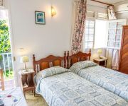
Les chambres d'hotes de la Villa Cayol
Videos from this area
These are videos related to the place based on their proximity to this place.
Martinique Maison de Balata Location Fort de France.wmv
http://www.locations-vue-turquoise.com/index.php?p=maison_de_balata Location Martinique Maison de Balata Fort de France, 3 chambres, Piscine voir aussi http://www.vue-turquoise.com.
Doigts Arrachés Jeune Fille Tour des Yoles 2009 Martinique
Doigts d'une gamine sectionnés par l'un des bateaux pendant le tour des yoles 2009 de Martinique.
la rivière de Fonds Saint Denis
c'est l'heure d'explorer la rivière du fond de la vallée de Fonds Saint Denis (Martinique) par mister Dust.
la Martinique et la pluie
au morne des Cadets (Martinique) même quand il fait mauvais, on reste en short... par mister Dust.
Descente sur Fond st denis martinique 972 / La trace
petite video "on board" d une descente sur fond st denis en martinique sur la fameuse route nomee: LA TRACE.
la Prise
baignade à la prise (captage de l'eau pour alimenter le canal aux esclaves) par mister dust.
mod fly minecraft 1.7.3
plus besoin des codes et de Mctmp (précision) explications : 1)telecharger modpack ( http://www.minecraftforum.net/topic/91055-v166-zombes-modpack-26-mods-v426-upd-7jun/ ) [faite copier...
Videos provided by Youtube are under the copyright of their owners.
Attractions and noteworthy things
Distances are based on the centre of the city/town and sightseeing location. This list contains brief abstracts about monuments, holiday activities, national parcs, museums, organisations and more from the area as well as interesting facts about the region itself. Where available, you'll find the corresponding homepage. Otherwise the related wikipedia article.
Carbet Mountains
The Carbet Mountains (French: Pitons Du Carbet, or Carbet Nails) are a massif of volcanic origin on the Caribbean island of Martinique. The Carbet Mountains occupy an 80 km long path through the centre of the island, and include some of its highest peaks, though Martinique's highest point Mount Pelée is not part of the range. The mountains are a popular tourist site and hiking and climbing destination.


