Safety Score: 2,5 of 5.0 based on data from 9 authorites. Meaning we advice caution when travelling to Ireland.
Travel warnings are updated daily. Source: Travel Warning Ireland. Last Update: 2024-05-02 08:23:34
Delve into Ballin Prior
Ballin Prior in County Kerry (Munster) is located in Ireland about 2,849 mi (or 4,585 km) west of Qeshlaq, the country's capital town.
Current time in Ballin Prior is now 04:59 PM (Thursday). The local timezone is named Europe / Dublin with an UTC offset of one hour. We know of 9 airports close to Ballin Prior, of which two are larger airports. The closest airport in Ireland is Kerry Airport in a distance of 17 mi (or 27 km), South-East. Besides the airports, there are other travel options available (check left side).
There is one Unesco world heritage site nearby. It's Sceilg Mhichíl in a distance of 43 mi (or 69 km), South. If you need a hotel, we compiled a list of available hotels close to the map centre further down the page.
While being here, you might want to pay a visit to some of the following locations: Tralee, Ennis, Galway, Courtbrack and Limerick. To further explore this place, just scroll down and browse the available info.
Local weather forecast
Todays Local Weather Conditions & Forecast: 8°C / 46 °F
| Morning Temperature | 7°C / 44 °F |
| Evening Temperature | 8°C / 47 °F |
| Night Temperature | 8°C / 47 °F |
| Chance of rainfall | 18% |
| Air Humidity | 94% |
| Air Pressure | 1009 hPa |
| Wind Speed | Gentle Breeze with 6 km/h (4 mph) from East |
| Cloud Conditions | Overcast clouds, covering 100% of sky |
| General Conditions | Heavy intensity rain |
Friday, 3rd of May 2024
10°C (50 °F)
9°C (48 °F)
Light rain, light breeze, overcast clouds.
Saturday, 4th of May 2024
10°C (50 °F)
9°C (49 °F)
Light rain, light breeze, overcast clouds.
Sunday, 5th of May 2024
16°C (60 °F)
10°C (51 °F)
Few clouds, light breeze.
Hotels and Places to Stay
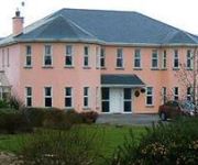
Brook Manor Lodge
Ballyroe Heights Hotel
Killarney House
Videos from this area
These are videos related to the place based on their proximity to this place.
M/V Combi Dock I arriving in Fenit Harbour
M/V Combi Dock I coming to the small harbour of Fenit in southwest Ireland to pick up a Liebherr port crane destined for the Port of Alexandria, Egypt. Filmed 03 Feb 2014.
M.V. Beluga Function leaving Fenit Harbour near Tralee, Co. Kerry, Ireland
The multipurpose heavy lift carrier M.V. "Beluga Function" is leaving Fenit Harbour near Tralee, Co. Kerry, Ireland, bound for Jeddah (U.A.Emirates) with a cargo of crane parts from the Liebherr...
Presentation to Fenit Station
Brian Meharg speaks on behalf of the Bangor Crew and presents Ger O'Donnel with a watercolour painting of Bangor Harbour from the turn of the last century.
Tralee Golf Club - The 3rd Hole The Castle
This hole is the show-piece of the course. Its hard not to be distracted by the backdrop of Fenit Island and the sweeping panorama of mountains and Tralee Bay. Known as "The Castle"-- this...
DIT 'The Cowboy' Mark Trap
Team racing, Varsities, Fenit, 2010, Dublin Institute of Technology, DIT, Sailing, Ireland, Irish Sailing.
Sacculina carcini in a crab from southwest Ireland
Pulsating sacculina carcini parasite in an unidentified crab specimen (possibly Xantho pilipes), caught near Fenit in Kerry, SW Ireland.
Videos provided by Youtube are under the copyright of their owners.
Attractions and noteworthy things
Distances are based on the centre of the city/town and sightseeing location. This list contains brief abstracts about monuments, holiday activities, national parcs, museums, organisations and more from the area as well as interesting facts about the region itself. Where available, you'll find the corresponding homepage. Otherwise the related wikipedia article.
Banna Strand
Banna Strand, also known as Banna Beach, is situated in Tralee Bay. It is an Atlantic Ocean beach extending from Ballyheigue Beach at the Blackrock in the North to Barrow Beach at its southern edge, located in County Kerry. It is located approx 12 km (7 mi) north west of Tralee. It features sand dunes along its entire length which rise up to 12 metres (40 ft). The mountains of the Dingle Peninsula can be seen on the south west horizon.
St. Brendan's Ardfert GAA
St. Brendan's is a Gaelic Athletic Association hurling club in the Ardfert area of north County Kerry, Ireland. St. Brendans play in the Kerry Senior Hurling Championship. The club is primarily concerned with the game of hurling.
Ballyheigue GAA
Ballyheigue GAA is a hurling and gaelic football club in north County Kerry, Ireland. The club competes at all levels of hurling at county and North Kerry and also plays some underage football as well as competing in the county junior football league and the county novice football shield.
Ardfert GAA
Ardfert are a Gaelic football team in north County Kerry, Ireland. They are one of two clubs in Ardfert, St. Brendan's, Ardfert being the local hurling club. They play in the County Senior Football Championship and Div 1 County League.


