Safety Score: 2,5 of 5.0 based on data from 9 authorites. Meaning we advice caution when travelling to Ireland.
Travel warnings are updated daily. Source: Travel Warning Ireland. Last Update: 2024-05-02 08:23:34
Discover Ballysheen
Ballysheen in County Kerry (Munster) is a town in Ireland about 2,844 mi (or 4,577 km) west of Qeshlaq, the country's capital city.
Current time in Ballysheen is now 07:20 PM (Thursday). The local timezone is named Europe / Dublin with an UTC offset of one hour. We know of 9 airports near Ballysheen, of which two are larger airports. The closest airport in Ireland is Kerry Airport in a distance of 15 mi (or 23 km), South-East. Besides the airports, there are other travel options available (check left side).
There is one Unesco world heritage site nearby. It's Sceilg Mhichíl in a distance of 42 mi (or 67 km), South. Looking for a place to stay? we compiled a list of available hotels close to the map centre further down the page.
When in this area, you might want to pay a visit to some of the following locations: Tralee, Ennis, Galway, Limerick and Courtbrack. To further explore this place, just scroll down and browse the available info.
Local weather forecast
Todays Local Weather Conditions & Forecast: 8°C / 46 °F
| Morning Temperature | 7°C / 44 °F |
| Evening Temperature | 8°C / 47 °F |
| Night Temperature | 8°C / 47 °F |
| Chance of rainfall | 18% |
| Air Humidity | 94% |
| Air Pressure | 1009 hPa |
| Wind Speed | Gentle Breeze with 6 km/h (4 mph) from East |
| Cloud Conditions | Overcast clouds, covering 100% of sky |
| General Conditions | Heavy intensity rain |
Friday, 3rd of May 2024
10°C (50 °F)
9°C (48 °F)
Light rain, light breeze, overcast clouds.
Saturday, 4th of May 2024
10°C (50 °F)
9°C (49 °F)
Light rain, light breeze, overcast clouds.
Sunday, 5th of May 2024
16°C (60 °F)
10°C (51 °F)
Few clouds, light breeze.
Hotels and Places to Stay
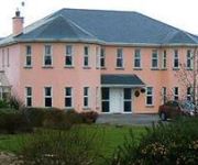
Brook Manor Lodge
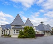
Meadowlands Tralee
Ballyroe Heights Hotel
Killarney House
Videos from this area
These are videos related to the place based on their proximity to this place.
Tralee-Paintball 2013
a small compilation of the epic match we had on 28th of september 2013!! Hope u guys enjoy it ;) Musik: Grand Theft Ecstasy (Original Mix) von Feed Me.
Tralee Active Travel
Introduction to Tralee Active Travel for more details check out our website http://traleeactivetravel.ie/
Tralee Bay (Tralee & Fenit) Wild Atlantic Way
Spinning Yarns Productions http://www.spinningyarns.ie info@spinningyarns.ie 00353 (0) 86 895 2860 Facebook Page: http://on.fb.me/10V7aHp LinkedIn: http://linkd.in/18fx91h Twitter: https://twi...
Irish Air Corps AW139 taking off from Tralee
Irish Air Corps AW139 #274 taking off from John Mitchels GAA Pitch in Tralee after delivering President Michael D. Higgins to a local event, 30/05/2012.
Carlton Hotel Tralee Lending a Paw to Woof Woofs Dog Show
http://youtu.be/vpFIwWA4KLI Carlton Hotel Tralee are lending a Paw to Liams Lodge at Woof Woofs Dog Show. Carlton has Dog Friendly rooms and they are offering great room rates for the event....
Ireland's Dingle Way walking into Camp, near Tralee
Dingle Way walking into Camp, near Tralee. This is my good Scottish slightly squiffy-at-the-time mate Paul Wilson doing his best "camp" impression.,
Videos provided by Youtube are under the copyright of their owners.
Attractions and noteworthy things
Distances are based on the centre of the city/town and sightseeing location. This list contains brief abstracts about monuments, holiday activities, national parcs, museums, organisations and more from the area as well as interesting facts about the region itself. Where available, you'll find the corresponding homepage. Otherwise the related wikipedia article.
Ardfert Cathedral
Ardfert Cathedral (Irish: Ardeaglais Ard Fhearta) is built on the site of a monastery founded in the 6th century by St. Brendan the Navigator. The cathedral is located in the village of Ardfert, County Kerry, Ireland. The site is now managed by the Office of Public Works. Part of the transept has been restored, and houses the entrance and a gift shop.
Abbeydorney Abbey
Abbeydorney Abbey, also known as Kyrie Eleison Abbey or Odorney was founded by the O Torna, chieftain of the region, in 1154 for the Cistercians from Monasteranenagh. The abbey was the daughter-house of Nenay Abbey in County Limerick, and was the only medieval Cistercian house in County Kerry. The name given by the Cistercians, Kyrie Eleison was in accordance with the order's tradition of giving names which reflected the locality - in this instance the word Kyrie being similar to Ciarrai.
Abbeydorney railway station
Abbeydorney railway station served the village of Abbeydorney in County Kerry, Ireland. The station opened on 20 December 1880. Passenger services were withdrawn on 4 February 1963, although the route through Abbeydorney continued to be used by freight trains for a while before the line to Listowel was finally closed altogether in 1977 and then to Tralee 1978. The station closed on 6 February 1978.
Ardfert railway station
Ardfert railway station served the village of Ardfert in County Kerry, Ireland. The station opened on 20 December 1880. Passenger services were withdrawn on 4 February 1963, although the route through Ardfert continued to be used by freight trains for a while before the line to Listowel was finally closed altogether in 1977 and then to Tralee 1978. The station closed on 6 February 1978. Preceding station Disused railways Following station Abbeydorney Great Southern and Western Railway Tralee
Abbeydorney GAA
Abbeydorney GAA Club is a Gaelic Athletic Association is a hurling club from North County Kerry near Tralee
Brick Rangers GAA
Brick Rangers GAA are a former Gaelic football team from the Abbeydorney area of North Kerry, Ireland.


