Safety Score: 3,4 of 5.0 based on data from 9 authorites. Meaning please reconsider your need to travel to Ghana.
Travel warnings are updated daily. Source: Travel Warning Ghana. Last Update: 2024-04-27 08:23:39
Delve into Koleman
Koleman in Greater Accra Region is located in Ghana about 17 mi (or 27 km) north-west of Accra, the country's capital town.
Current time in Koleman is now 12:25 PM (Saturday). The local timezone is named Africa / Accra with an UTC offset of zero hours. We know of 7 airports close to Koleman, of which one is a larger airport. The closest airport in Ghana is Kotoka International Airport in a distance of 15 mi (or 24 km), South-East. Besides the airports, there are other travel options available (check left side).
There are two Unesco world heritage sites nearby. The closest heritage site in Ghana is Asante Traditional Buildings in a distance of 44 mi (or 71 km), North. If you need a hotel, we compiled a list of available hotels close to the map centre further down the page.
While being here, you might want to pay a visit to some of the following locations: Accra, Koforidua, Odumase Krobo, Ho and Cape Coast. To further explore this place, just scroll down and browse the available info.
Local weather forecast
Todays Local Weather Conditions & Forecast: 31°C / 89 °F
| Morning Temperature | 28°C / 82 °F |
| Evening Temperature | 30°C / 87 °F |
| Night Temperature | 29°C / 84 °F |
| Chance of rainfall | 0% |
| Air Humidity | 67% |
| Air Pressure | 1008 hPa |
| Wind Speed | Moderate breeze with 10 km/h (6 mph) from North |
| Cloud Conditions | Scattered clouds, covering 46% of sky |
| General Conditions | Scattered clouds |
Sunday, 28th of April 2024
32°C (89 °F)
29°C (84 °F)
Overcast clouds, moderate breeze.
Monday, 29th of April 2024
31°C (88 °F)
29°C (84 °F)
Light rain, moderate breeze, overcast clouds.
Tuesday, 30th of April 2024
32°C (89 °F)
29°C (84 °F)
Light rain, fresh breeze, broken clouds.
Hotels and Places to Stay
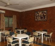
Joy Family Lodge
Videos from this area
These are videos related to the place based on their proximity to this place.
Dr Naalamle Amissah, an Agricultural Scientist
Dr. Naalamle Amissah, an agricultural scientist explains her work on using grafting technologies to reduce the effect of nematode infestation on tomato yield. The research looks at grafting...
Farming with compost in Africa
Creating a precious soil improver from farm waste is a pillar of production of top quality crops. Dorothy Duodu, from fruit-exporting company Blue Skies, is your guide to Ghana's way to make...
Integrated Farm Management in Africa
LEAF's Integrated Farm Management (IFM) makes sense of complex farm decision-making. This film outlines the key elements of IFM by showing what they are and how they interconnect on the farm....
Making Maps for better African farm management
Emmanuel Graham makes maps for the LEAF Marque farmers he works with in Ghana. Whether made with a GPS device or pen and paper, the maps make a positive difference to farm management.
USAID: Tech for Development
The is the story of USAID, which is embracing a new approach in West Africa that is connecting the full spectrum of development practitioners, farmers, and traders to information, tools, and...
89.7 WMHK Compassion Child Home Visit in Ghana Africa
A team of broadcasters (including 89.7 WMHK's Operations Manager, John Owens) traveled to Ghana, Africa, with Compassion International. We visited many Compassion projects, including the homes ...
Driving like VIPs through Ghana pt. 4
Think you're a good driver, you have nothing on Richard from Accra,Ghana. Creating his own lanes, running red lights, driving on shoulders, hitting cars, he does it all in a 30 passenger van.
Videos provided by Youtube are under the copyright of their owners.
Attractions and noteworthy things
Distances are based on the centre of the city/town and sightseeing location. This list contains brief abstracts about monuments, holiday activities, national parcs, museums, organisations and more from the area as well as interesting facts about the region itself. Where available, you'll find the corresponding homepage. Otherwise the related wikipedia article.
Nsawam
Nsawam is a town in the Eastern Region of Ghana approximately 40 km northwest from the capital, Accra. It is controlled by the Akwapim South Municipal Assembly. It is also known as the 'Bread Capital of the World' because the main occupation of the women is to bake bread and sell the bread the whole day to travellers who travel through Nsawam on the main road from Accra to Kumasi, and to other destinations. BOPA College of Arts and Sciences is also situated in Nsawam.


