Safety Score: 2,8 of 5.0 based on data from 9 authorites. Meaning we advice caution when travelling to Canada.
Travel warnings are updated daily. Source: Travel Warning Canada. Last Update: 2024-05-02 08:23:34
Delve into Stephen
Stephen in British Columbia is located in Canada about 1,881 mi (or 3,027 km) west of Ottawa, the country's capital town.
Current time in Stephen is now 04:03 AM (Thursday). The local timezone is named America / Edmonton with an UTC offset of -6 hours. We know of 8 airports close to Stephen, of which one is a larger airport. The closest airport in Canada is Fairmont Hot Springs Airport in a distance of 79 mi (or 128 km), South. Besides the airports, there are other travel options available (check left side).
There is one Unesco world heritage site nearby. It's Canadian Rocky Mountain Parks in a distance of 33 mi (or 53 km), East. If you need a hotel, we compiled a list of available hotels close to the map centre further down the page.
While being here, you might want to pay a visit to some of the following locations: Bonners Ferry, Libby, Sandpoint, Colville and Newport. To further explore this place, just scroll down and browse the available info.
Local weather forecast
Todays Local Weather Conditions & Forecast: 12°C / 53 °F
| Morning Temperature | 3°C / 37 °F |
| Evening Temperature | 13°C / 55 °F |
| Night Temperature | 5°C / 42 °F |
| Chance of rainfall | 0% |
| Air Humidity | 44% |
| Air Pressure | 1015 hPa |
| Wind Speed | Light breeze with 5 km/h (3 mph) from South-East |
| Cloud Conditions | Overcast clouds, covering 100% of sky |
| General Conditions | Overcast clouds |
Thursday, 2nd of May 2024
13°C (56 °F)
7°C (45 °F)
Light rain, gentle breeze, few clouds.
Friday, 3rd of May 2024
13°C (55 °F)
11°C (52 °F)
Overcast clouds, light breeze.
Saturday, 4th of May 2024
14°C (57 °F)
11°C (51 °F)
Light rain, light breeze, overcast clouds.
Hotels and Places to Stay
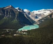
Fairmont Chateau Lake Louise
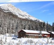
Great Divide Lodge
Deer Lodge
Videos from this area
These are videos related to the place based on their proximity to this place.
Lake Louise Update - Snow making begins!
Fresh snow and cold temperatures have helped Lake Louise Ski Area Snow makers prepare for our November 5 opening date.
Lake Louise Classics - Yamnuska Mountain Adventures
http://yamnuska.com/courses/lake-louise-guides The mountains near Lake Louise are the birthplace of Canadian mountaineering. To this day, the peaks that dominate the sky around Lake Louise...
Heavy Metal Rail Jam 2010 at the Lake Louise Ski Area
Watch some of the thrills & spills from the 2010 Heavy Metal Rail Jam that took place on December 18, 2010 at Lake Louise.
Opening Day at Lake Louise - November 5, 2010
Lake Louise is the first ski resort in Canada to open on November 5, 2010.
Plain of Six Glaciers - Lake Louise, Alberta, Canada
The hike from Lake Louise to the Lookout at Plain of Six Glaciers via the Lake Agnes and Plain of Six Glaciers Teahouses is a fascinating day of mountain diversity in one of the most beautiful...
Lake Louise Climbing, Equisite Corpse, 5.9
I had a friend shoot this just for a personal training video I could critique afterwards. I decided to edit a bit and make a short film. This is my first attempt at video editing. The climb...
Avalanche from Victoria glacier @ Lake Louise
Heard thunder but it turned out to be an avalanche. This went on for quite a while. Awesome to see and hear.
Banff National Park - High Tea
High above picturesque Lake Louise is a small teahouse tucked into the trees in the shadow of Mount Victoria. Joy Kimball has been the managing operator of the Plain of Six Glaciers Teahouse...
Avalanche, Plain of Six Glaciers, Banff National Park, Alberta, Canada, August 10, 2012
This video was captured just after 1pm, Friday, August 10, 2012, in Banff National Park, Canada, from near the Plain of Six Glaciers Tea House, above Lake Louise. There was a small avalanche...
Videos provided by Youtube are under the copyright of their owners.
Attractions and noteworthy things
Distances are based on the centre of the city/town and sightseeing location. This list contains brief abstracts about monuments, holiday activities, national parcs, museums, organisations and more from the area as well as interesting facts about the region itself. Where available, you'll find the corresponding homepage. Otherwise the related wikipedia article.
Mount Whyte
Mount Whyte is a mountain in Alberta, Canada located in Banff National Park, near Lake Louise. The mountain can be seen from the Trans-Canada Highway, and offers views of the Valley of the Ten Peaks, including the Chateau Lake Louise. The mountain was named in 1898 by Sir William Methuen after William Whyte, a representative of the Canadian Pacific Railway.
Kicking Horse Pass
Kicking Horse Pass (el. 1627 m, 5339 ft) is a high mountain pass across the Continental Divide of the Americas of the Canadian Rockies on the Alberta/British Columbia border, and lying within Yoho and Banff National Parks.
Alberta Highway 1A
Alberta Provincial Highway No. 1A is the designation of three alternate routes off the Alberta portion of the Trans-Canada Highway. However, it is not the only name used for spurs off Highway 1 - Highway 1X is another such designation. These highways, however, are not part of the Trans-Canada Highway network, and only have Alberta's provincial primary highway shields instead of the ones used for the Trans-Canada Highway.
Lake Agnes (Alberta)
Lake Agnes is a small mountain lake in the Banff National Park of Alberta, Canada. It has a surface of 0.52 km² and is located approximately 3.5 km (one-way) hiking distance from Lake Louise. A teahouse is situated along the eastern shore at an elevation of 2134 metres (7002 ft). A hiking trail continues down the northern shore, making a 180° turn before ascending to the Big Beehive. Just before the trail starts the arc, a scrambling route up Mount Niblock can be found.
Stephen Formation
The Stephen Formation is a middle Cambrian unit exposed in the Canadian Rockies of British Columbia. It is famous for the exceptional preservation of soft-bodied fossils: the Burgess Shale biota. The formation overlies the cathedral escarpment, a submarine cliff; consequently it is divided into two quite separate parts, the 'thin' sequence deposited in the shallower waters atop the escarpment, and the 'thick' sequence deposited in the deeper waters beyond the cliff.


