Safety Score: 3,2 of 5.0 based on data from 9 authorites. Meaning please reconsider your need to travel to Bolivia.
Travel warnings are updated daily. Source: Travel Warning Bolivia. Last Update: 2024-05-05 08:24:42
Discover La Maica
The district La Maica of Pucara Chico in Departamento de Cochabamba is a district in Bolivia about 126 mi north-west of Sucre, the country's capital city.
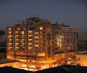
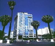
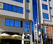
Looking for a place to stay? we compiled a list of available hotels close to the map centre further down the page.
When in this area, you might want to pay a visit to some of the following locations: Cochabamba, Independencia, Oruro, Piocera and Pocpo. To further explore this place, just scroll down and browse the available info.
Local weather forecast
Todays Local Weather Conditions & Forecast: 24°C / 75 °F
| Morning Temperature | 15°C / 58 °F |
| Evening Temperature | 20°C / 68 °F |
| Night Temperature | 17°C / 62 °F |
| Chance of rainfall | 0% |
| Air Humidity | 33% |
| Air Pressure | 1011 hPa |
| Wind Speed | Light breeze with 4 km/h (3 mph) from South-West |
| Cloud Conditions | Broken clouds, covering 73% of sky |
| General Conditions | Broken clouds |
Monday, 6th of May 2024
24°C (76 °F)
17°C (62 °F)
Light rain, light breeze, clear sky.
Tuesday, 7th of May 2024
23°C (73 °F)
17°C (63 °F)
Light rain, gentle breeze, clear sky.
Wednesday, 8th of May 2024
23°C (74 °F)
16°C (61 °F)
Light rain, light breeze, clear sky.
Hotels and Places to Stay
Camino Plaza
Cesar's Plaza Hotel
Gran Hotel Cochabamba
HOTEL DIPLOMAT
Gran Hotel Toloma
Aranjuez Cochabamba
Americana Hotel
Apart Hotel Violettas
Hotel Oblitas
La Tua Casa Hotel Boutique
Videos from this area
These are videos related to the place based on their proximity to this place.
Landing RWY 14, Cochabamba, Bolivia | BAE-146
BAE 146-200 of Transporte Aereo Militar landing at Cochabamba (SLCB), Bolivia. Aeropuerto Internacional Jorge Wilstermann.
Landing at Cochabamba, Bolivia (CBB)
Coming in for a landing at Aeropuerto Internacional Jorge Wilstermann in Cochabamba, Bolivia. It's clearly the rainy season because everything is very green. Note the AeroSur and Lloyds Aero...
TAM Bolivia 727-224/Adv - Flight from Cochabamba J Wilsterman (CBB) to La Paz El Alto Int'l (LPB)
Boeing 727-224/Adv / FAB-111 TAM - Transporte Aéreo Militar Bolivia / TAM942 Departure: Cochabamba J Wilsterman (CBB), Bolivia (Rwy 22) Arrival: La Paz El Alto Internacional (LPB), Bolivia...
TAM Bolivia 727-224/Adv & F-27-400M - Movements at Cochabamba (CBB) and Trinidad (TDD) Airports
Type: / Registration: Airline: / Flight: Departure: Arrival: Date: 6th April 2013 / Seat: ----------------------------------------------------------------------------------------- Some outside...
TAM Bolivia 727-224/Adv - Cochabamba J Wilsterman (CBB) to Santa Cruz El Trompillo (SRZ), Bolivia
Boeing 727-224/Adv / FAB-111 TAM - Transporte Aéreo Militar Bolivia / TAM850 Departure: Cochabamba Jorge Wilsterman (CBB), Bolivia (Rwy 14) Arrival: Santa Cruz El Trompillo (SRZ), Bolivia...
Despegue en el Aeropuerto de Cochabamba (SLCB)
Despegando con un Boeing B737-300 de AeroSur en el Aeropuerto Internacional Jorge Wilstermann (SLCB).
Sangre Kochala
cancion a Cochabamba -Bolivia, en ritmo de cueca composicion de JULIO CESAR HUANCA letra y musica.
SEXY AND THE CITY de SHOPPING con HANA
De Shopping con Hana - programa de televisión - Video realizado por CODIGO AGENCIA - 714-10107 * 7 888-22-60 - 2015.
Flight Simulator B727 (LAB S.A. - part 1)
Primer vuelo en el Simulador B727 del Lloyd Aereo Boliviano S.A. (1era Parte)
Videos provided by Youtube are under the copyright of their owners.
Attractions and noteworthy things
Distances are based on the centre of the city/town and sightseeing location. This list contains brief abstracts about monuments, holiday activities, national parcs, museums, organisations and more from the area as well as interesting facts about the region itself. Where available, you'll find the corresponding homepage. Otherwise the related wikipedia article.
Cochabamba
Cochabamba is a city in central Bolivia, located in a valley bearing the same name in the Andes mountain range. It is the capital of the Cochabamba Department and is the fourth largest city in Bolivia with an urban approximate population of 700,000 (2010) and a metropolitan population of more than 1,000,000 people. The name derives from a compound of the Quechua words qucha, meaning "lake", and pampa, "open plain".
Punata Province
Punata is a province almost in the middle of the Cochabamba Department, Bolivia, located about 45 km south of the city of Cochabamba. Its capital is Punata. The province is limited to the north by the Chapare Province, to the north-east by the Tiraque Province, to the east by the Arani Province, to the south-east by the Mizque Province, to the south by the Esteban Arze Province and to the west by the Germán Jordán Province.
Quillacollo Province
Quillacollo is a province in the Cochabamba Department, Bolivia. It is known for its festival in August where people from all over Bolivia come and pay homage to the Virgin of Urqupiña (Virgen de Urqupiña). Quillacollo is said to be one of the fastest growing cities in Bolivia.
Cercado Province (Cochabamba)
Cercado is a province in the Cochabamba Department, Bolivia. Its capital is Cochabamba which is also the capital of the department.
Quillacollo
Quillacollo is the capital of Quillacollo Province in Cochabamba Department, Bolivia. The municipality was established on 14 September 1905 under the Presidency of Ismail Montes.
Jorge Wilstermann International Airport
Jorge Wilstermann International Airport, known in Spanish as Aeropuerto Internacional Jorge Wilstermann is an airport serving Cochabamba, a city in the Cochabamba department of Bolivia. The facility is named in honor of Jorge Wilstermann, a respected Bolivian commercial aviator. It was a focus city for Lloyd Aéreo Boliviano (LAB), the country's national airline, until service from LAB was suspended. The facility is one of the most clean and modern within Bolivia.
Sacaba
Sacaba is the capital of the Bolivian province of Chapare. The city, located 13 kilometers eastward from Cochabamba, is the second largest city in the Cochabamba Department after Cochabamba city. Post-colonial architecture may be seen in the inner part of Sacaba; however, some has been destroyed due to lack of municipal care.
Estadio Félix Capriles
The Estadio Félix Capriles is a multi-purpose stadium in Cochabamba, Bolivia. It is currently used mostly for football matches. The stadium has a maximum capacity of 32,000 people. , although its normal capacity is 27,588. It is the home stadium of Club Jorge Wilstermann and Club Aurora. It is also used for bigger concerts held in the city of Cochabamba.
Cordillera Oriental (Bolivia)
The Cordillera Oriental are parallel mountain ranges of the Bolivian Andes emplaced on the eastern and north eastern margin of the Andes. Large parts of Cordillera Oriental are forested and humid areas rich in agricultural and livestock products. Geologically Cordillera Oriental is formed by the Central Andean fold and thrust belt.
Battle of Sipe-Sipe
The Battle of Sipe-Sipe (also known as Battle of Viluma among Spanish historians) was a major battle in the South American wars of independence in which the United Provinces of Río de la Plata (formerly the Spanish Viceroyalty of the Río de la Plata) were decisively defeated by Spanish royalist forces in Upper Peru. The battle took place on November 29, 1815, and resulted in the loss of Upper Peru for Buenos Aires. The area was reannexed by the Spanish Viceroyalty of Peru.
Cristo de la Concordia
Cristo de la Concordia (Christ of Peace) is a statue of Jesus Christ located atop San Pedro Hill, to the east of Cochabamba, Bolivia. It is accessible by cable car, or by climbing 2,000 steps. The statue is 34.20 metres tall, on a pedestal of 6.24 metres, for a total height of 40.44 metres .
La Angostura Lake
Laguna La Angostura is a lake in the Cochabamba Department, Bolivia. At an elevation of 2700 m, its surface area is 10.5 km².
Larati Lake
Lago Larati is a lake in the Cochabamba Department, Bolivia. At an elevation of 3585 m, its surface area is 1.36 km².
Colcapirhua Municipality
Colcapirhua Municipality is the fifth municipal section of the Quillacollo Province in the Cochabamba Department, Bolivia. Its seat is Colcapirhua.
Santiváñez Municipality
Santiváñez Municipality is the second municipal section of the Capinota Province in the Cochabamba Department, Bolivia. Its seat is Santiváñez.
Waña Quta (Cochabamba)
Waña Quta (Aymara waña dry, quta lake, "dry lake", hispanicized spellings Huanacota, Guañacoba, Guañacota, Huañacota, Huna Khota) is a lake in Bolivia located in the Cochabamba Department, Capinota Province, Santiváñez Municipality, Waña Quta Canton and Santiváñez Canton. It is situated south east of the village Waña Quta and east of the town Santiváñez at a height of about 2,752 metres (9,029 ft).
Metropolitan Cathedral of Saint Sebastian
The Metropolitan Cathedral of Saint Sebastian (Spanish: Catedral Metropolitana San Sebastián) is the cathedral of the Roman Catholic Church in the Archdiocese of Cochabamba. It is located in the Plaza 14 de Septiembre in Cochabamba, Bolivia.
Warawara Lake (Cochabamba)
Warawara (Aymara warawara star, hispanicized spellings Huara Huara, Huarahuara), often spelled Wara Wara, is a lake in the Tunari National Park in Bolivia. It is located in the Cochabamba Department, Chapare Province, Sacaba Municipality. Warawara lies north east of the city Cochabamba and north of Alalay Lake. The lake is situated 4,105 metres (13,468 ft) high. It is 0.8 km long and 0.5 km at its widest point.


