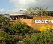
Touring Fitzgerald River National Park
Fitzgerald River National Park in Jerramungup (Western Australia) is a town located in Australia about 1,681 mi (or 2,706 km) west of Canberra, the country's capital place.
Time in Fitzgerald River National Park is now 09:49 AM (Saturday). The local timezone is named Australia / Perth with an UTC offset of 8 hours. We know of 5 airports nearby Fitzgerald River National Park. The closest airport in Australia is Ravensthorpe Airport in a distance of 62 mi (or 100 km), North-East. Besides the airports, there are other travel options available (check left side).
Need some hints on where to stay? We compiled a list of available hotels close to the map centre further down the page.
Being here already, you might want to pay a visit to some of the following locations: City of Cockburn, Rockingham, Perth, and . To further explore this place, just scroll down and browse the available info.
Local weather forecast
Todays Local Weather Conditions & Forecast: 16°C / 61 °F
| Morning Temperature | 15°C / 60 °F |
| Evening Temperature | 16°C / 60 °F |
| Night Temperature | 15°C / 59 °F |
| Chance of rainfall | 4% |
| Air Humidity | 76% |
| Air Pressure | 1019 hPa |
| Wind Speed | Fresh Breeze with 13 km/h (8 mph) from North-East |
| Cloud Conditions | Broken clouds, covering 73% of sky |
| General Conditions | Light rain |
Sunday, 5th of May 2024
18°C (64 °F)
12°C (54 °F)
Moderate rain, moderate breeze, broken clouds.
Monday, 6th of May 2024
19°C (66 °F)
14°C (57 °F)
Light rain, light breeze, clear sky.
Tuesday, 7th of May 2024
19°C (67 °F)
15°C (60 °F)
Light rain, gentle breeze, few clouds.
Hotels and Places to Stay
Bremer Bay Resort
Bremer Bay Bed and Breakfast
Videos from this area
These are videos related to the place based on their proximity to this place.
Fitzgerald River NP and Bremer Bay - Easter 2012
I wasn't able to do the trip, so I sent the camera out with my son, who recorded this video of the weekends shenanigans ............... www.4wdozdvd.com.
Videos provided by Youtube are under the copyright of their owners.
Attractions and noteworthy things
Distances are based on the centre of the city/town and sightseeing location. This list contains brief abstracts about monuments, holiday activities, national parcs, museums, organisations and more from the area as well as interesting facts about the region itself. Where available, you'll find the corresponding homepage. Otherwise the related wikipedia article.
Bremer Bay, Western Australia
Bremer Bay is a coastal town situated on the south coast of Western Australia in the Great Southern region between Albany and Esperance, at the mouth of the Bremer River. Bremer Bay is 515 kilometres southeast of the state capital, Perth, and 180 kilometres east of Albany. The town has a population of about 240. Electricity is generated by a wind-diesel hybrid system. Bremer Bay is known for its beautiful beaches; the main beach is only 10 minutes walk from town.
Bremer River (Western Australia)
Bremer River is a river in Western Australia that rises near Jerramungup at the border of the Yilgarn plateau. The river flows in a generally south-easterly direction and the river valley becomes steadily deeper as the river approaches the coast where it has eroded the Pallinup siltstone deposits that deposited over the underlying granite.
Wellstead Estuary
Wellstead Estuary is an estuarine inlet in the Great Southern region of Western Australia. The estuary has length of 13 kilometres and holds a volume of 2,400,000 cubic metres . The inlet covers a total surface area of 4.7 square kilometres with the central basin and barriers covering 2.7 square kilometres and salt marshes and tidal flats covering the remainder of the area.


