Discover Rivervale
The district Rivervale of in Belmont (Western Australia) with it's 7,070 citizens Rivervale is a subburb in Australia about 1,916 mi west of Canberra, the country's capital city.
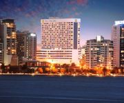
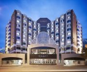
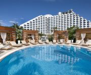
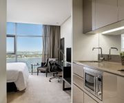
If you need a hotel, we compiled a list of available hotels close to the map centre further down the page.
While being here, you might want to pay a visit to some of the following locations: Perth, City of Cockburn, Rockingham, and . To further explore this place, just scroll down and browse the available info.
Local weather forecast
Todays Local Weather Conditions & Forecast: 23°C / 74 °F
| Morning Temperature | 20°C / 68 °F |
| Evening Temperature | 23°C / 74 °F |
| Night Temperature | 20°C / 68 °F |
| Chance of rainfall | 4% |
| Air Humidity | 59% |
| Air Pressure | 1021 hPa |
| Wind Speed | Gentle Breeze with 8 km/h (5 mph) from South-West |
| Cloud Conditions | Overcast clouds, covering 100% of sky |
| General Conditions | Light rain |
Friday, 3rd of May 2024
20°C (68 °F)
16°C (62 °F)
Light rain, gentle breeze, overcast clouds.
Saturday, 4th of May 2024
21°C (69 °F)
15°C (60 °F)
Sky is clear, moderate breeze, clear sky.
Sunday, 5th of May 2024
20°C (68 °F)
17°C (62 °F)
Sky is clear, moderate breeze, clear sky.
Hotels and Places to Stay
Pan Pacific Perth
Hyatt Regency Perth
Crown Metropol Perth
Crown Towers Perth
Fraser Suites Perth
International on the Water Hotel
The Sebel East Perth
Aloft Perth
ASSURED ASCOT QUAYS APARTMENT HOTEL
COUNTRY COMFORT INTERCITY HOTEL PERTH
Videos from this area
These are videos related to the place based on their proximity to this place.
Travelling Oz - 1
We've just spent the last 12 months travelling around Australia filming our documentary. In that time, we covered over 56000 kms and filmed some of the most spectacular country that you will...
SOLD - Ashton Crooks 2/36 Joseph Street, Maylands - LJ Hooker City Residential Maylands
http://cityresperth.ljhooker.com.au/17JJFGJ - 2/36 Joseph Street, Maylands This fantastic 2 bedroom, 1 bathroom villa comprising of 161m2 including 78m2 of courtyard is an absolute must see....
1.1kW AirDuck Nozzle with a 1kW Pump installed over irrigation pump
Drainlake Ascot, City of Belmont, Perth. Stormwater catchment, irrigation Lake 1.5m full length video.
MMO City Tour #6 The Grove from Guild Wars 2
The Grove is underneath the Pale Tree which created the Sylvari race in Guild Wars 2. Plant people! They are not huge hippies or peace lovers and they dont live in a tree, they live under a...
MMO City Tour #5 Sanctum from Aion Online
Sactum is a city in the MMORPG Aion Online. It is home to the Elyos people and floats above the continent called Elysea. Originally a fortress meant for war it has since been turned into a...
Pig City #3 Thorins Hall from Lord of the Rings
Thorins Hall is a city in the Ered Luin region of Middle Earth where Lord of the Rings is based. Here I explore it and give a tour of the city while explaining the mechanics and features of...
Travel Australia: Wonderful holiday at Perth Intercontinental Burswood resort 旅游 澳洲 柏斯
This amazing place attract me to go for holidays time by time, share my experience with you.
Guild Wars 2, Black Citadel MMO City Tour #9
Maybe the last City Tour. Black Citadel is the home of the Chaee, an intelligent race of beasts. The Black Citadel is built over the ruins of Rin a former kingdom of the Humans, Game made...
Videos provided by Youtube are under the copyright of their owners.
Attractions and noteworthy things
Distances are based on the centre of the city/town and sightseeing location. This list contains brief abstracts about monuments, holiday activities, national parcs, museums, organisations and more from the area as well as interesting facts about the region itself. Where available, you'll find the corresponding homepage. Otherwise the related wikipedia article.
Swan River (Western Australia)
The Swan River estuary flows through the city of Perth, in the south west of Western Australia. Its lower reaches are relatively wide and deep, with few constrictions, while the upper reaches are usually quite narrow and shallow. The Swan River drains the Avon and coastal plain catchments, which have a total area of about 121,000 km. It has three major tributaries, the Avon River, Canning River and Helena River.
City of Belmont
The City of Belmont is a local government area in the inner eastern suburbs of the Western Australian capital city of Perth, located about 5 kilometres east of Perth's central business district on the south bank of the Swan River. The City covers an area of 39.8 square kilometres, maintains 225 km of roads and has a population of 35,209 (2011). Belmont contains Perth's domestic and international airports which account for 33.7% of the City of Belmont's land area.
Town of Victoria Park
The Town of Victoria Park is a local government area of Western Australia. It covers an area of 17.62 km² in metropolitan Perth, the capital of Western Australia. The Town of Victoria Park maintains 154.55 km of roads, a little over 1 km² of parks and gardens and has a population of 27,160 as of the 2001 census.
Rivervale, Western Australia
Rivervale, near the Swan River in Australia, is a suburb of Perth, Western Australia and 5 km from Perth's central business district. Rivervale was known as Barndon Hill until 1884.
Ascot Racecourse (Western Australia)
Ascot Racecourse is the major racecourse in Perth, Western Australia, situated approximately 8 kilometres east of the Perth central business district, with the headquarters of the Western Australian Turf Club(WATC) positioned directly opposite. It is regarded as the 'grand old lady' of Australian racecourses. Featuring a 2,000 metre track with modern, well drained turf, and a 300 metre inclining straight regarded by experts as the most severe test of stayers in Australia.
Lathlain railway station
Lathlain is a former Transperth railway station 6.5 km from Perth railway station, on the Armadale Line, in Western Australia.
Victoria Park railway station, Perth
Victoria Park Station is a Transperth railway station 6.2 km southeast of Perth railway station on the Armadale / Thornlie Line, located between the suburbs of Lathlain and Victoria Park in inner suburban Perth, Western Australia. The new Victoria Park station located 230 metres south of the existing station and commenced operations on 20 July 2008. The old station platforms, footbridge and pedestrian level crossing have been demolished as of 27 July 2008.
Burswood railway station
Burswood (known as Rivervale between 1921 and 1993), is a Transperth railway station 4.8 kilometres east of Perth railway station on the Armadale/Thornlie Line. It is adjacent to Crown Perth.
Belmont Park railway station
Belmont Park Station (known as Goodwood from 1906 until 1979), is a Transperth railway station 3.2 km from Perth railway station, Western Australia, on the Armadale / Thornlie Line. It is near the Belmont Park Racecourse, and is used only when there is an event at that racecourse.
Crown Perth
Crown Perth (formerly known as Burswood Entertainment Complex) is located on the Swan River near the city of Perth, Western Australia, and is owned by Crown Limited. The complex includes a 24-hour casino, a wide range of restaurants and bars, two hotels (the luxury 5-star Crown Metropol and 4-star Crown Promenade), a Convention Centre, nightclub, 2,300-seat theatre and 20,000-seat indoor arena. Burswood railway station, near The Dome, provides a public transport link to the Perth CBD.
Carlisle, Western Australia
Carlisle is a suburb of Perth, Western Australia. Its Local Government Area is the Town of Victoria Park.
Burswood, Western Australia
Burswood is an inner southeastern suburb of Perth, Western Australia, located immediately across the Swan River from Perth's central business district (CBD) via both The Causeway and Graham Farmer Freeway. Its Local Government Area is the Town of Victoria Park. Burswood contains the Burswood Entertainment Complex and the Belmont Park racecourse.
Ascot, Western Australia
Ascot is a suburb of Perth, the capital city of Western Australia, covering a narrow strip of land along the southern bank of the Swan River approximately 10 kilometres east of Perth's central business district (CBD). Its Local Government Area is the City of Belmont. The suburb, which was previously part of Belmont and Redcliffe, was officially established on 7 March 1991, with the boundaries being approved on 22 March 1991.
Lathlain, Western Australia
Lathlain is an inner south eastern suburb of Perth, Western Australia. Its Local Government Area is the Town of Victoria Park.
Belmont City College
Belmont City College (known as Belmont Senior High School until 2000) is a comprehensive public high school located in Belmont, 6 kilometres east of Perth, Western Australia. Opening in 1957, the school's catchment area covers most of the City of Belmont and the eastern part of the Town of Victoria Park and, as at Semester 1, 2011, the school has an enrolment of 512 students between Year 8 and Year 12, 69 (13.5%) of whom are Aboriginal.
Riverview Church
Riverview Church is a Pentecostal evangelical Christian church headquartered in Burswood, an inner suburb of Perth, Western Australia. Riverview has expanded in recent times to include a north and south campus, and in 2007 launched a campus in Orange County, California, which is now no longer considered a campus of Riverview Church.
Belmont, Western Australia
Belmont is a suburb of Perth, the capital city of Western Australia, and is located 7 kilometres east of Perth's central business district (CBD) on the southern bank of the Swan River. Its Local Government Area is the City of Belmont. The suburb, part of a land grant assigned to Captain Francis Henry Byrne in 1831, was believed to have been named Belmont after Byrne's estate in England. The land was purchased by Shepherd Smith of Sydney in 1882, who subdivided it in 1897–1898.
Victoria Park, Western Australia
Victoria Park is an inner south eastern suburb of Perth, Western Australia. Its local government area is the Town of Victoria Park. Victoria Park is the eastern gateway to Perth's central business district, being the intersection of the three original eastern arterial roads: Albany Highway, Canning Highway, Great Eastern Highway, and the Causeway Bridge. The Causeway connects Victoria Park to the city, located 3 km to the northwest.
Parry Field
Parry Field in Belmont, Perth, Western Australia was the site of Baseball WA's first purpose-built baseball stadium, named for Kevin Parry, a local businessman and enthusiast whose fortunes failed soon after the opening. The stadium featured television-standard lighting, seating for about 2,200 people and standing room for 3,000 more. The stadium was sold off by Belmont City Council as part of the WA Building Better Cities Program.
Lathlain Park
Lathlain Park (currently known as Brownes Stadium under a ground sponsorship arrangement) is an Australian rules football ground, located in Lathlain, an inner-eastern suburb of Perth, Western Australia. Since its opening in 1959, it has been the home ground for the Perth Football Club, who play in the West Australian Football League (WAFL). It was known only as Lathlain Park, until 2003 when the Demons sold the naming rights to Eftel, an internet company, for a period of five years.
Tranby House
Tranby (Peninsula Farm) is an historic farmers cottage located on Johnson Road, in Maylands, Western Australia overlooking the Swan River, and is one of the oldest surviving buildings from the early settlement of the Swan River Colony.
Perth Montessori School
The Perth Montessori School is an Montessori education centre for children in Perth, Western Australia. The School maintains several properties on a block in suburban Burswood.
Belmont Park Racecourse
Belmont Park Racecourse is one of the two major horse racing venues within the Perth, Western Australia metropolitan area, the other being Ascot Racecourse. The track has a circumference of 1,699 metres with a 333 metre straight. Belmont is Perth's winter racecourse, with fully enclosed facilities for spectators.
Ursula Frayne Catholic College
Ursula Frayne Catholic College is a private, co-educational school located southwest of Perth, Western Australia, operating on two campuses. Years 7 to 12 currently attend Frayne at the Duncan street campus in Victoria Park, while students from Kindergarten to Year 6 are educated at the Balmoral street campus in East Victoria Park. The College was established in its present form in 1990, but was originally founded by the Sisters of Mercy, led by Mother Clare Buggy.
Maylands Airport
Maylands Airport (also known as Maylands Aerodrome, Maylands Airfield) on the Maylands peninsula, in Maylands, Western Australia was the main landing place of a significant number of record breaking flights in the early stages of flight in Australia. It was Perth's first official airport and was the birthplace of commercial aviation in Western Australia.


