Explore Greenbank
The district Greenbank of in Logan (Queensland) is located in Australia about 570 mi north-east of Canberra, the country's capital.
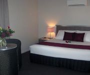
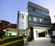
If you need a place to sleep, we compiled a list of available hotels close to the map centre further down the page.
Depending on your travel schedule, you might want to pay a visit to some of the following locations: Brisbane, Sunshine Coast, Carrolls Creek, and . To further explore this place, just scroll down and browse the available info.
Local weather forecast
Todays Local Weather Conditions & Forecast: 21°C / 70 °F
| Morning Temperature | 15°C / 59 °F |
| Evening Temperature | 19°C / 67 °F |
| Night Temperature | 16°C / 61 °F |
| Chance of rainfall | 0% |
| Air Humidity | 66% |
| Air Pressure | 1025 hPa |
| Wind Speed | Moderate breeze with 10 km/h (6 mph) from North-West |
| Cloud Conditions | Overcast clouds, covering 89% of sky |
| General Conditions | Light rain |
Friday, 3rd of May 2024
19°C (66 °F)
16°C (61 °F)
Light rain, gentle breeze, overcast clouds.
Saturday, 4th of May 2024
20°C (69 °F)
15°C (60 °F)
Light rain, gentle breeze, overcast clouds.
Sunday, 5th of May 2024
21°C (70 °F)
15°C (59 °F)
Light rain, gentle breeze, broken clouds.
Hotels and Places to Stay
Johnson Road Motel
SPRINGFIELD LAKES HOTEL
Videos from this area
These are videos related to the place based on their proximity to this place.
Swimming Pool Interiors
Rouko Swimming Pool Interiors 1516 Chambers Flat Rd Chambers Flat QLD 4133 07 3802 1094 http://www.roukopoolinteriors.com.au/ johnduyn@msn.com Rouko Swimming Pool Interiors offers...
Freak 2.7m Fishing Kayak Review.wmv
This is a Freak Kayak Package customer's review received and published.
Park Ridge Animal Hospital Brisbane Queensland | Call 07 3800 1378 | Vet In Brisbane Queensland
Park Ridge Animal Hospital Brisbane Queensland | Call 07 3800 1378 | Vet In Brisbane Queensland http://www.parkridgevet.com.au - When you need a vet in Brisbane Queensland, Park Ridge Animal.
8 Wattlebrush Court Regents Park 4118 QLD by chris gilmour
Property Video shoot of 8 Wattlebrush Court Park Ridge 4125 QLD by platinumhd http://www.platinumhd.tv for All Properties Group.
1 Whistler Place - Heritage Park (4118) Queensland by chris gilmour
Property Video shoot of 1 Whistler Place - Heritage Park (4118) Queensland by PlatinumHD http://www.platinumhd.tv for.
How many kids do you have? We have rooms for all! (Video)
If you are looking for a fantastically large and modern family home, and in need of more than just a family and lounge room - have a look at this one. No fancy words or representations - this...
35 Birdsville Street - Greenbank (4124) Queensland by David Neate
Property Video shoot of 35 Birdsville Street - Greenbank (4124) Queensland by PlatinumHD http://www.platinumhd.tv for.
198 Begley Road - Greenbank (4124) Queensland by Larry Cliff...
Property Video shoot of 198 Begley Road - Greenbank (4124) Queensland by PlatinumHD http://www.platinumhd.tv for Coronis Springfield Lakes.
Brisbane Floods Water Crossing Prado - New Beith Road Greenbank
Chickening out on the way back through this water crossing and followed another vehicle through.
Videos provided by Youtube are under the copyright of their owners.
Attractions and noteworthy things
Distances are based on the centre of the city/town and sightseeing location. This list contains brief abstracts about monuments, holiday activities, national parcs, museums, organisations and more from the area as well as interesting facts about the region itself. Where available, you'll find the corresponding homepage. Otherwise the related wikipedia article.
Browns Plains Grand Plaza bus station
The Browns Plains Grand Plaza Bus Station, at Browns Plains, is serviced by TransLink bus routes. It is part of the Grand Plaza Shopping Centre and is a major interchange for TransLink's Southern Region. It is in a transition precinct between Zone 5 and Zone 6 of the TransLink integrated public transport system.
Centenary Motorway
The M5 (Centenary Motorway) is a 43-kilometre motorway in the western suburbs of Brisbane, Australia. It starts as a two-lane arterial road at Yamanto, travelling to Springfield, where it becomes a two-lane highway and travels across the M2 Logan Motorway at Ellen Grove (formerly Metroad 4 / M4) and ends at Kenmore where it changes its name to the M5 Western Freeway.
Browns Plains, Queensland
Browns Plains is a suburb of Logan City, Queensland, Australia.
South East Queensland Regional Plan
The South East Queensland Regional Plan 2009-2031 (SEQ-RP) is a document designed to guide regional growth and development in South East Queensland, Australia. It was established under the Integrated Planning Act 1997 (Qld), which has now been replaced by The Sustainable Planning Act 2009 and includes South East Queensland State Planning Regulatory Provisions. SEQ’s population is expected to grow from 2.8 million in 2006 to 4.4 million people by 2031.
Larapinta, Queensland
Larapinta is a suburb located in the southern regions of Brisbane, on the boundary with Logan City. The suburb is sparsely populated, being mostly bushland, save for the recent industrial development. The industrial area has become a new addition to the expansion of Brisbane's industry, including the purpose built South Brisbane Industrial Park in nearby Heathwood. Larapinta means "flowing water" and was so named because the north and west of the suburb is bounded by Oxley Creek.
The Springfield College
The Springfield Anglican College (TSAC) is an independent, co-educational day school, located at Springfield, a suburb in South East Queensland, Australia. It is not to be confused with Springfield College, the institution in Springfield, Massachusetts, USA, where the sport of basketball was invented. The campus on Springfield College Drive, Springfield now houses the Junior School (Prep to Year Six).
Greenbank, Queensland
Greenbank is a rural-residential suburb within Logan City in Queensland, Australia. Once divided between Beaudesert and Logan City the Queensland Governments Council Amalgamation now have Greenbank wholly within Logan City, since 15 March 2008. The suburb is surrounded by farmland and includes the forested Greenbank Military Range, which is a registered Australian Heritage Site.
Heritage Park, Queensland
Heritage Park is a suburb of Logan City, Queensland, Australia.
Hillcrest, Queensland
Hillcrest is a suburb of Logan City,part of the Brisbane metropolitan region, Queensland, Australia. Hillcrest lies to the west of Browns Plains and was originally part of that suburb. It is bounded by Johnson Road, Mount Lindesay Highway, the interstate railway and Coronation Road to the south. It was gazetted as a place name in June 1987. Hillcrest is home to the Logan West Community Centre, which began with the relocation of a house from Jacaranda Avenue Woodridge in October 1982.
Park Ridge, Queensland
Park Ridge is a suburb of Logan City,part of the Brisbane metropolitan region, Queensland, Australia. Park Ridge lies to Logan's west and enjoys a rural setting. There are manicured acreage properties buffered by pretty bushland and the suburb holds great appeal for horse lovers.
Regents Park, Queensland
Regents Park is a suburb of Logan City,part of the Brisbane metropolitan region, Queensland, Australia. The size of Regents Park is approximately 5 km²(476 hectares). It has 5 parks covering nearly 12% of the total area.
EDUCANG
EDUCANG Limited was originally an initiative of the Anglican Church of Australia and the Uniting Church in Australia. The name of the company reflected a partnership in independent schooling. The word EDUCANG is composed of:- ED from education, UC from the Uniting Church in Australia, and ANG from the Anglican Church of Australia. Directors of the Board were volunteers who were drawn exclusively from the two auspicing churches.
Heathwood, Queensland
Heathwood is an outer suburb of Brisbane, Australia. It is 21 km south of the Brisbane central business district. The suburb was declared a suburb in 1975. Heathwood was named after an early settler in the district. The western boundary of Heathwood is marked by Oxley Creek.
Drewvale, Queensland
Drewvale is an outer suburb of Brisbane, Australia. It is 28 kilometres south of the CBD and borders with Logan City. Drewvale is located at the interchange of the Gateway and Logan Motorways. It is the most southern suburb of Brisbane.
Doolandella, Queensland
Doolandella is an outer suburb of Brisbane, Australia. It is 17 kilometres south-west of the Brisbane central business district. It was declared as an official suburb in 1976. The name Doolandella, or Dulandella as expressed by Aborigines, refers to the Geebung tree, a broad leaved shrub with yellow fruit which grows in the area. In 2004, a total of 70 houses with a population of 255 was recorded in the suburb.
Parkinson, Queensland
Parkinson is an outer southern suburb of Brisbane, Australia. It is 19 km south of the CBD and borders Logan City. Parkinson is sparsely populated with mainly rural land use. It is in the Electoral district of Algester.
Mary McConnel School
Mary McConnel School (MMS) is a joint initiative of the Anglican Church of Australia and the Uniting Church in Australia. It is operated by EDUCANG Limited, along with Forest Lake College, The FLC International Centre, The Lakes College and The Springfield College. The Mary McConnel School provides an alternative educational program for students who, due to a high-support learning need, have difficulties accessing conventional education programs.
Forest Lake State High School
Forest Lake State High School (FLSHS) is a secondary state school located in Forest Lake, Queensland, Australia.
Springfield Lakes, Queensland
Springfield Lakes is a suburb approximately 29km south-west of Brisbane CBD, the capital city of the Australian state of Queensland in the local government area of the City of Ipswich. Springfield Lakes forms part of a 2850 hectare site being Australia’s largest master planned community. For comparison purposes this is more than half the size of Cairns.
Brookwater, Queensland
Brookwater is a suburb of Ipswich, Queensland, Australia. It was developed by the Springfield Land Corporation (who also developed the adjoining suburb of Springfield) and is a premier golf community with many luxury modern homes overlooking the Brookwater Golf Club.
Forest Lake Shopping Centre
Forest Lake Shopping Centre (formerly Forest Lake Village) is a shopping mall located in Forest Lake, Queensland, Australia. The centre first opened in 1997 and underwent significant changes in 2011 with the closure of Sam's Warehouse and addition of Coles. A Target store was also constructed on the southern end of the centre.
Greenbank Military Range
The Greenbank Military Range is a 4,500ha live training facility for the Australian Defence Force located approximately 25 kilometres south-west of Brisbane, Queensland. The location is heritage listed and also serves as a flaura and fauna reserve. The site has been the location of several controversial brumby cullings.
Park Ridge South, Queensland
Park Ridge South is a suburb of the Logan City local government area,within the Greater Brisbane Metropolitan Region, Queensland, Australia. Once a rural community, it is presently forming a low density residential suburb. Park Ridge South was officially gazetted as a suburb in 1991. It was previously part of the Beaudesert Shire local government area.
Munruben, Queensland
Munruben is a suburb of the Logan City, Queensland, Australia. Once a rural community, it is presently forming a low density residential community.
Stockleigh, Queensland
Stockleigh is a suburb of Logan City, Queensland, Australia. Once part of the Shire of Beaudesert, Stockleigh has now been included in Logan City and is a low density semi-rural locality with larger acreage blocks. When pioneer Will Elworthy settled in the district in 1863 the area to be known as Stockleigh was named after his birthplace in Devon, England.


