Safety Score: 2,7 of 5.0 based on data from 9 authorites. Meaning we advice caution when travelling to United States.
Travel warnings are updated daily. Source: Travel Warning United States. Last Update: 2024-05-18 08:26:29
Delve into Thompson Gardens
The district Thompson Gardens of Roy in Weber County (Utah) is a subburb in United States about 1,845 mi west of Washington DC, the country's capital town.
If you need a hotel, we compiled a list of available hotels close to the map centre further down the page.
While being here, you might want to pay a visit to some of the following locations: Ogden, Farmington, Brigham City, Morgan and Salt Lake City. To further explore this place, just scroll down and browse the available info.
Local weather forecast
Todays Local Weather Conditions & Forecast: 18°C / 64 °F
| Morning Temperature | 9°C / 49 °F |
| Evening Temperature | 20°C / 68 °F |
| Night Temperature | 14°C / 57 °F |
| Chance of rainfall | 0% |
| Air Humidity | 34% |
| Air Pressure | 1012 hPa |
| Wind Speed | Gentle Breeze with 8 km/h (5 mph) from North-West |
| Cloud Conditions | Clear sky, covering 0% of sky |
| General Conditions | Light rain |
Sunday, 19th of May 2024
16°C (62 °F)
10°C (50 °F)
Light rain, fresh breeze, clear sky.
Monday, 20th of May 2024
14°C (57 °F)
11°C (51 °F)
Light rain, gentle breeze, few clouds.
Tuesday, 21st of May 2024
11°C (52 °F)
10°C (51 °F)
Light rain, gentle breeze, broken clouds.
Hotels and Places to Stay
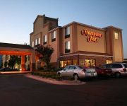
Hampton Inn Salt Lake City-Layton
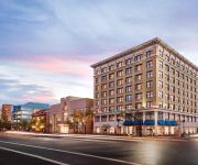
Hampton Inn and Suites Ogden
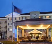
Holiday Inn Express LAYTON-I-15
TownePlace Suites Salt Lake City Layton
Courtyard Salt Lake City Layton
Fairfield Inn Salt Lake City Layton
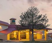
La Quinta Inn and Suites Salt Lake City - Layton
Ogden UT Hilton Garden Inn
BW PLUS HIGH COUNTRY INN
Courtyard Ogden
Videos from this area
These are videos related to the place based on their proximity to this place.
1990 Toyota 4Runner Used Cars Roy UT
http://www.joescarconnection.com This 1990 Toyota 4Runner is available from Joe's Car Connection. For details, call us at 801-776-8075.
Foot Doctor Roy UT | Podiatrist Michael Kotter
http://www.KotterFootDoctor.com. Looking for the top foot doctor and ankle surgeon in Roy and Ogden, Utah? Watch this video about Dr. Mike Kotter. Kotter Foot and Ankle in Roy, UT provides...
2nd Annual Roy High School Faculty Talent Show | April 9, 2013 | Part 2 of 2
Video footage from the 2nd Annual Roy High School Faculty Talent Show on April 9th @ 7 p.m. at the RHS Auditorium. Tickets were sold at the door for $5. All proceeds benefitted The Sheryl Eggett...
Night Climbing the Roy Tower
Replacing an access point on a 200' tower in Roy, UT. If the web goes down, we go up!
2009 Ford E-Series Van Used Cars Roy UT
http://www.joescarconnection.com This 2009 Ford E-Series Van is available from Joe's Car Connection. For details, call us at 801-776-8075.
2004 Lexus IS 300 Used Cars Roy UT
http://www.kappautosalesroy.com This 2004 Lexus IS 300 is available from Kapp Auto Sales. For details, call us at 801-825-0800.
Evening Drive in the 67 C20, flowmaster super 44
I took a short trip from the local fuel station back to my house. This shows the rich tone of the exhaust in the cab with the windows down, and relatively good ride. This vehicle was built...
Ogden UT to Bozeman MT TImelapse 1967 Chevy
The first part of my journey took me from Ogden UT to Bozeman MT. 380 Miles in my 1967 C20 Chevy. This was taken using a Logitech C920 webcam set to take a picture once every second.
Kincaid's Lyrical Dance Solo (Rocky Mountain Classic 2014)
Kincaid conducts her Lyrical Dance Solo to "Paint my Life" by SHEL at the Rocky Mountain Classic on April 25, 2014 in Roy, Utah. This routine earned her Queen (1st Place) in the 12 yr old...
Saying Goodbye | Connie Jo Bridges Higgs
http://www.classreport.org/usa/ut/roy/rhs/1983/ http://www.facebook.com/royhighclassof1983/ Our good friend and classmate Connie Jo Bridges Higgs would like to say thank you, I love you, and...
Videos provided by Youtube are under the copyright of their owners.
Attractions and noteworthy things
Distances are based on the centre of the city/town and sightseeing location. This list contains brief abstracts about monuments, holiday activities, national parcs, museums, organisations and more from the area as well as interesting facts about the region itself. Where available, you'll find the corresponding homepage. Otherwise the related wikipedia article.
Ogden, Utah
Ogden /ˈɒɡdɛn/ is a city in and the county seat of Weber County,, Utah, United States. The population was 82,825 according to the 2010 Census. The city served as a major railway hub through much of its history, and still handles a great deal of freight rail traffic which makes it a convenient location for manufacturing and commerce. Ogden is also known for its many historic buildings, proximity to the Wasatch Mountains, and as the location of Weber State University.
Roy, Utah
Roy is a city in Weber County, Utah, United States, along Interstate 15. The population was 36,884 at the 2010 census. It is part of the Ogden–Clearfield, Utah Metropolitan Statistical Area. Roy is the least expensive city in Utah to buy a home in. The median price for homes currently on the market in Roy is $163,252.
Hill Air Force Base
Hill Air Force Base is a major U.S. Air Force base located in northern Utah, just south of the city of Ogden, and near the towns of Clearfield, Riverdale, Roy, Sunset, and Layton. It is about 30 miles north of Salt Lake City. The base was named in honor of Major Ployer Peter Hill of the U.S. Army Air Corps, who died test-flying a prototype of the B-17 Flying Fortress bomber.
Lindquist Field
Lindquist Field is a stadium in Ogden, Utah. It is primarily used for baseball and soccer, and is the home field of the Ogden Raptors minor league baseball team. It was built in 1997. In 2008, the Raptors added a new spectator deck large enough for 1,200 spectators, two more concession stands, a Hardball Café, and an additional 2,000 fixed seats to the stadium. A new masonry wall was added, and the chain-link fencing was also replaced.
Ogden-Hinckley Airport
Ogden-Hinckley Airport, formerly Ogden Municipal Airport, is a public airport located three miles (5 km) southwest of the city of Ogden in Weber County, Utah, U.S. It is billed as "Utah's Busiest Municipal Airport" and was a filming location for the 1997 film Con Air. The 2013 Federal sequester will result in the closure of the airport's control tower and will require pilots to rely on air traffic controllers from other area airports.
Stevens–Henager College
Stevens–Henager College, headquartered in Ogden, Utah, United States, is a private, formerly for-profit, coeducational college. Established in 1891, the college has five campuses in Idaho and Utah. It offers online and on-campus programs in for Associate's degrees, Bachelor's degrees, and Master's degrees. Post-secondary education offered by Stevens-Henager is regulated by the Accrediting Commission of Career Schools and Colleges, but the institution is not regionally accredited.
Peery's Egyptian Theater
Peery's Egyptian Theater is a movie palace located at 2439 Washington Blvd. , in Ogden, Utah in the United States of America. It was added to the National Register of Historic Places in 1978.
Independence University
Independence University, formerly known as California College for Health Sciences, is a distance learning university headquartered in Ogden, Utah. Independence University is a branch of Stevens–Henager College’s Ogden/West Haven main campus.
Roy High School (Utah)
Roy High School is a 4A secondary school founded in 1965 that serves the residents of Roy, UT.
Bonneville High School (Washington Terrace, Utah)
Bonneville High School is a secondary high school in Washington Terrace, Utah, United States.
Ogden River
The Ogden River is a 35-mile long river in Utah. The Ogden River's three forks (North, Central and South) begin in the Wasatch Range in Weber County and converge at Pineview Reservoir, near Huntsville. The river then flows southwest through Ogden Canyon, Ogden City, and the border of West Haven and Marriott-Slaterville where it joins the Weber River.
Fort Buenaventura
Fort Buenaventura was the first permanent Anglo settlement in the Great Basin. It was founded in 1846 just east of the Weber River, west of current downtown Ogden, Utah. The fort and the surrounding land were bought by the Mormon settlers in 1847 and renamed Brownsville (then later Ogden). The land on which the actual fort stood is now a Weber County park.
Hill Aerospace Museum
Hill Aerospace Museum, located near Ogden, Utah, is a U.S. Air Force museum that is part of the United States Air Force Heritage Program. The museum, founded in 1981 and moved to its current location in 1991, displays over 90 aircraft from around the world, in addition to a variety of munitions, equipment, auxiliary vehicles, and other items of historical interest. In 1996, the Museum became the home of the Utah Aviation Hall of Fame.
Morrisite War
The Morrisite War was a skirmish between a Latter Day Saint sect known as the "Morrisites" and the Utah territorial government.
McKay-Dee Hospital Center
McKay-Dee Hospital Center is a not-for-profit community focused health system operated by Intermountain Healthcare. With 352 licensed beds (425 total beds), it is the 3rd largest hospital in the Intermountain system, and the 4th largest Hospital in Utah. McKay-Dee Hospital offers nationally ranked programs including the Heart and Vascular Institute and Newborn ICU.
Ogden Regional Medical Center
The Ogden Regional Medical Center is a hospital in Ogden, Utah.
KSVN (AM)
KSVN is a radio station broadcasting a Regional Mexican format. Licensed to Ogden, Utah, USA, it serves the Ogden and Salt Lake City area. The station is currently owned by Azteca Broadcasting Corporation.
Lifetime Products
Lifetime Products Inc. is the world's leading manufacturer of blow-molded polyethylene folding chairs and tables, picnic tables, and home basketball equipment. They also manufacture other consumer products, including sheds, trailers, kayaks and paddleboards, and lawn and garden items, along with OEM steel and plastic items for other companies.
Clearfield (UTA station)
Clearfield is a commuter rail station in Clearfield, Utah, United States served by FrontRunner, Utah Transit Authority's (UTA) commuter rail that operates along the Wasatch Front from Pleasant View in northern Weber County through Ogden, Davis County, Salt Lake City, and Salt Lake County to Provo in central Utah County.
Roy (UTA station)
Roy is a commuter rail station in Roy, Utah, United States served by FrontRunner, Utah Transit Authority's (UTA) commuter rail that operates along the Wasatch Front from Pleasant View in northern Weber County through Ogden, Davis County, Salt Lake City, and Salt Lake County to Provo in central Utah County.
National Register of Historic Places listings in Weber County, Utah
This is a list of the National Register of Historic Places listings in Weber County, Utah. This is intended to be a complete list of the properties and districts on the National Register of Historic Places in Weber County, Utah, United States. Latitude and longitude coordinates are provided for many National Register properties and districts; these locations may be seen together in a Google map. There are 63 properties and districts listed on the National Register in the county.
Freeport Center
The Freeport Center is a manufacturing, warehousing, and distribution center located in Clearfield, Utah, United States. It was originally built in 1942 as the Clearfield Naval Supply Depot, which was decommissioned in 1962. The 680-acre Freeport Center consists of 78 buildings, totaling more than 7,000,000 square feet . Buildings range in size from 4,000 square feet to 400,000 square feet . Most buildings have a railroad loading dock on one side, and a truck loading dock on the other.
Utah State Industrial School
Utah State Industrial School was a juvenile reform school that operated in Ogden, Utah from October 31, 1889 to 1983.
Tanner (subdivision)
Tanner is a place in Weber County, Utah, United States.
Ogden Intermodal Transit Center
The Ogden Intermodal Transit Center is a commuter rail train station in Ogden, Utah, United States served by FrontRunner, Utah Transit Authority's (UTA) commuter rail that operates along the Wasatch Front from Pleasant View in northern Weber County through Ogden, Davis County, Salt Lake City, and Salt Lake County to Provo in central Utah County. It provides an interchange between FrontRunner trains and both UTA local inter-city and Greyhound Lines inter-state bus service.


