Safety Score: 2,7 of 5.0 based on data from 9 authorites. Meaning we advice caution when travelling to United States.
Travel warnings are updated daily. Source: Travel Warning United States. Last Update: 2024-04-19 08:03:45
Delve into Moab
Moab in Grand County (Utah) with it's 5,235 habitants is a city located in United States about 1,743 mi (or 2,805 km) west of Washington DC, the country's capital town.
Current time in Moab is now 02:23 AM (Friday). The local timezone is named America / Denver with an UTC offset of -6 hours. We know of 3 airports closer to Moab, of which one is a larger airport. The closest airport in United States is Grand Junction Regional Airport in a distance of 67 mi (or 108 km), North-East. Besides the airports, there are other travel options available (check left side).
Also, if you like playing golf, there is an option about 0 mi (or 0 km). away. We saw 1 points of interest near this location. In need of a room? We compiled a list of available hotels close to the map centre further down the page.
Since you are here already, you might want to pay a visit to some of the following locations: Monticello, Dove Creek, Grand Junction, Delta and Cortez. To further explore this place, just scroll down and browse the available info.
Local weather forecast
Todays Local Weather Conditions & Forecast: 24°C / 75 °F
| Morning Temperature | 16°C / 60 °F |
| Evening Temperature | 25°C / 76 °F |
| Night Temperature | 19°C / 67 °F |
| Chance of rainfall | 0% |
| Air Humidity | 17% |
| Air Pressure | 1008 hPa |
| Wind Speed | Moderate breeze with 11 km/h (7 mph) from South-West |
| Cloud Conditions | Overcast clouds, covering 93% of sky |
| General Conditions | Overcast clouds |
Friday, 19th of April 2024
23°C (73 °F)
17°C (63 °F)
Broken clouds, moderate breeze.
Saturday, 20th of April 2024
23°C (74 °F)
23°C (74 °F)
Few clouds, moderate breeze.
Sunday, 21st of April 2024
27°C (80 °F)
25°C (76 °F)
Broken clouds, fresh breeze.
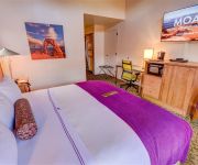
Hotels and Places to Stay
57 Robber's Roost
Cali Cochitta Bed & Breakfast
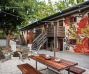
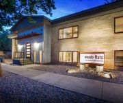
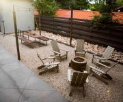
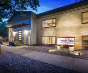
Moab Flats #4 by RedAwning
Moab Flats #6 by RedAwning
Moab Flats #5 by RedAwning
Moab Flats #2 by RedAwning
Moab Flats #1 by RedAwning
Moab Flats #7 by RedAwning
Moab Flats #3 by RedAwning
GONZO INN
Videos from this area
These are videos related to the place based on their proximity to this place.
Moab, UT Easter Jeep Safari 2014
3000 mile road trip from WI to UT and back for the 2014 Easter Jeep Safari!
Easter Jeep Safari 2013 Day 1 - Moab, UT // Rebel Off Road @ Golden Spike
If you are going to take your Jeep out of the garage once this year, Easter Jeep Safari better be your destination! The Safari is a bit earlier and colder this year - making for more jacket...
Unofficial Moab Mountain Unicycle Weekend 2015
It wasn't an event, we just all showed up! Moab, Utah. March 20-22, 2015.
Moab Dual Sport 2014
Six guys from the SDSC headed down to Moab for a week of awesome riding. Some of the trails in the video: Slick Rock Kane Creek Sovereign Hell's Revenge Chicken Corners Hurrah Pass Lockhart...
Project Rattle Trap Meets Moab - 2012
MBRP's Project Rattle Trap gets its first taste of what it was made for on Moab's hard hitting terrain. Produced by JakeMedia http://jakemedia.ca.
2014 Moab Jeep Jamboree - Cliff Hanger Trail
Clips of Jeep Wranglers tackling a few of the obstacles along the "Cliff Hanger" trail during the 2014 Moab Jeep Jamboree.
Easter Jeep Safari, Moab Utah | Aerial Imagery Works
The 2013 Easter Jeep Safari in Moab Utah. Big thanks to the great people of the Border City JKs for hauling my equipment and myself out to there all the way from Michigan. I had an awesome...
Moab - Chicken Corners
The final Moba video! Yes I'm sad too. Today Mrs.Stacey and I take a ride out to chicken corners justly named by the 4x4 tour guides in the area for when they allow people to walk around the...
My Ascent up Hell's Gate in Moab @ Hell's Revenge in an H1 Hummer (View from the top)
First day, first trail, first time in Moab and what a helluva obstacle to tackle on day one! You'll notice my spotters all thought my passenger side of the vehicle was obliterated from falling...
Videos provided by Youtube are under the copyright of their owners.
Attractions and noteworthy things
Distances are based on the centre of the city/town and sightseeing location. This list contains brief abstracts about monuments, holiday activities, national parcs, museums, organisations and more from the area as well as interesting facts about the region itself. Where available, you'll find the corresponding homepage. Otherwise the related wikipedia article.
Negro Bill Canyon
Negro Bill Canyon is a canyon in southeast Utah. It is part of the Colorado River watershed. Its stream flows directly into the main channel of the Colorado River within Moab Canyon. A trailhead which gives hiking access into the canyon is located directly adjacent to Utah State Route 128. The trailhead is located about 3 miles (5 km) east of the junction of Route 128 and US Route 191.
Slickrock Trail
The Slickrock Trail, located near Moab, Utah, is a popular mountain biking destination with worldwide fame. This 13-mile loop takes intrepid riders over a landscape of "petrified" sand dunes and the eroded remnants of ancient sea beds. The Slickrock Trail is one of the more difficult rides in the Moab area, both technically and cardiovascularly, and is not suitable for novice riders.
The Lion's Back
The Lion's Back is a sandstone ridge in Moab, Utah that is very popular among 4x4'ers. The attraction and campground is now private property and no longer accessible by 4x4'ers.
Porcupine Rim Trail
The Porcupine Rim Trail, located near Moab, Utah, is a popular mountain biking trail almost as famous as the Slickrock Trail. This 14.4-mile trail is ridden one way with shuttle service or as a 30.8-mile loop. The trailhead is located in the Sand Flats Recreation Area about 8 miles past the Slickrock trailhead. Like the Slickrock Trail, Porcupine Trail was originally created for motorcycles, and they are allowed on the trail.
Grand County High School
Grand County High School is the only high school in Grand County School District in Moab, Utah, USA. It enrolls over 400 students in grades 9-12 from Moab, Castle Valley, and Thompson Springs in Grand County and Spanish Valley in San Juan County. The average graduating class is around 100 students each.
Moab Regional Hospital
Moab Regional Hospital (formerly known as Allen Memorial Hospital) opened on February 14, 2011. The hospital is a critical access hospital and a Level IV Trauma Center. It is a non-profit, community-owned hospital located in Moab, Utah.


