Safety Score: 2,7 of 5.0 based on data from 9 authorites. Meaning we advice caution when travelling to United States.
Travel warnings are updated daily. Source: Travel Warning United States. Last Update: 2024-05-06 08:04:52
Explore River Park Addition
The district River Park Addition of Ogden in Weber County (Utah) is located in United States about 1,843 mi west of Washington DC, the country's capital.
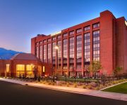
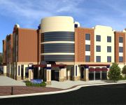
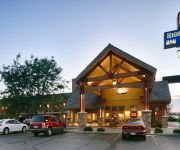
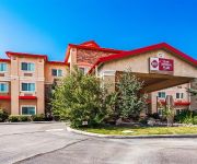
If you need a place to sleep, we compiled a list of available hotels close to the map centre further down the page.
Depending on your travel schedule, you might want to pay a visit to some of the following locations: Farmington, Brigham City, Morgan, Salt Lake City and Logan. To further explore this place, just scroll down and browse the available info.
Local weather forecast
Todays Local Weather Conditions & Forecast: 6°C / 43 °F
| Morning Temperature | 2°C / 36 °F |
| Evening Temperature | 9°C / 48 °F |
| Night Temperature | 2°C / 36 °F |
| Chance of rainfall | 2% |
| Air Humidity | 76% |
| Air Pressure | 1011 hPa |
| Wind Speed | Fresh Breeze with 16 km/h (10 mph) from East |
| Cloud Conditions | Overcast clouds, covering 99% of sky |
| General Conditions | Rain and snow |
Tuesday, 7th of May 2024
6°C (42 °F)
1°C (34 °F)
Rain and snow, strong breeze, overcast clouds.
Wednesday, 8th of May 2024
7°C (44 °F)
3°C (38 °F)
Rain and snow, gentle breeze, overcast clouds.
Thursday, 9th of May 2024
12°C (53 °F)
8°C (46 °F)
Overcast clouds, gentle breeze.
Hotels and Places to Stay
Comfort Suites Ogden
Holiday Inn Express & Suites OGDEN
Courtyard Ogden
Hampton Inn and Suites Ogden
Ogden UT Hilton Garden Inn
BW PLUS HIGH COUNTRY INN
DAYS INN OGDEN
BW PLUS CANYON PINES
WOODSPRING SUITES OGDEN
MOTEL 6 OGDEN 21ST STREET
Videos from this area
These are videos related to the place based on their proximity to this place.
Ogden River Survey
In 2009 DWR Northern Region biologists used a raft for the first time to survey fish populations in the Ogden River through the City of Ogden and found up to 2000 brown trout per mile.
Plane watching at Ogden-Hinckley Airport
A Pilatus PC-12, taking off from KOGD runway 3 and Utah ANG KC-135 flying overhead after a touch and go from Hill AFB.
LegalHeat 50 States Guide to Firearm Laws
LegalHeat is the only gun laws reference you need for both Concealed Carry, and Open Carry laws for all 50 states, includes transport laws, custom maps that illustrate reciprocation of Concealed...
TimberKing Portable Sawmill Model 1220 Owner Saws Huge Beams
TimberKing Portable Sawmill Model 1220 owner saws huge beams on a Utah Mountain Top. Founded in 1929 under the name Belsaw, TimberKing is America's oldest manufacturer of Portable ...
Ogden Utah Winterfest,Winterfest 2010 Ogden Utah
Ogden Utah Winterfest,Winterfest in Ogden Utah,Snow Drags - from 26th to 25th st Ogden Utah.
SPIN SPARE
SPIN SPARE is a novelty item. Have fun with that boring spare tire whether mounted on a trailer or on your vehicle. Your Spare tire will spin at free will. People will drive by concerned...
Union Station Ogden Utah
Union Station in Ogden Utah Union Station in Ogden, Utah, also known as Ogden Union Station, is located at the west end of Historic 25th Street, just south of the Ogden Intermodal Transit...
Utah State Train Museum Ogden Utah
Utah State Railroad Museum The Utah State Railroad Museum, in Union Station Ogden, Utah does a great job of documenting the history of train development in the State of Utah. Visitors to the...
United States Supreme Court Letter-Obama's and McCain's Eligibility
United States Supreme Court Letter on Obama's and McCain's eligibility- Cody Judy reads a letter sent to the United States Supreme Court Justices in 2008, an Order in the case of Judy v. McCain,...
The Stepmom
This video takes a look at my inner thoughts about my stepchildren and my responsibility towards them. www.emilyfoxart.com.
Videos provided by Youtube are under the copyright of their owners.
Attractions and noteworthy things
Distances are based on the centre of the city/town and sightseeing location. This list contains brief abstracts about monuments, holiday activities, national parcs, museums, organisations and more from the area as well as interesting facts about the region itself. Where available, you'll find the corresponding homepage. Otherwise the related wikipedia article.
Ogden, Utah
Ogden /ˈɒɡdɛn/ is a city in and the county seat of Weber County,, Utah, United States. The population was 82,825 according to the 2010 Census. The city served as a major railway hub through much of its history, and still handles a great deal of freight rail traffic which makes it a convenient location for manufacturing and commerce. Ogden is also known for its many historic buildings, proximity to the Wasatch Mountains, and as the location of Weber State University.
Lindquist Field
Lindquist Field is a stadium in Ogden, Utah. It is primarily used for baseball and soccer, and is the home field of the Ogden Raptors minor league baseball team. It was built in 1997. In 2008, the Raptors added a new spectator deck large enough for 1,200 spectators, two more concession stands, a Hardball Café, and an additional 2,000 fixed seats to the stadium. A new masonry wall was added, and the chain-link fencing was also replaced.
Ogden-Hinckley Airport
Ogden-Hinckley Airport, formerly Ogden Municipal Airport, is a public airport located three miles (5 km) southwest of the city of Ogden in Weber County, Utah, U.S. It is billed as "Utah's Busiest Municipal Airport" and was a filming location for the 1997 film Con Air. The 2013 Federal sequester will result in the closure of the airport's control tower and will require pilots to rely on air traffic controllers from other area airports.
Hi-Fi murders
The Hi-Fi murders were the brutal killings of three people during an armed robbery at a home audio store called the Hi-Fi Shop in Ogden, Utah, on April 22, 1974. Five people had been held hostage and tortured, but two survived with severe injuries. All were bound and forced to drink Drano (a corrosive drain cleaner). One victim had a pen stomped into his ear, and a teenage girl was repeatedly raped before being flung face-down on the floor and shot in the head.
Stevens–Henager College
Stevens–Henager College, headquartered in Ogden, Utah, United States, is a private, formerly for-profit, coeducational college. Established in 1891, the college has five campuses in Idaho and Utah. It offers online and on-campus programs in for Associate's degrees, Bachelor's degrees, and Master's degrees. Post-secondary education offered by Stevens-Henager is regulated by the Accrediting Commission of Career Schools and Colleges, but the institution is not regionally accredited.
Peery's Egyptian Theater
Peery's Egyptian Theater is a movie palace located at 2439 Washington Blvd. , in Ogden, Utah in the United States of America. It was added to the National Register of Historic Places in 1978.
Defense Depot Ogden
Defense Depot Ogden was a U.S. military installation located in Ogden, Utah. It encompassed 1,128 acres with its southeast corner located on 12th Street and Tomlinson Avenue. Its eastern border is the old Utah Northern Railroad, now owned by the Union Pacific Railroad.
Independence University
Independence University, formerly known as California College for Health Sciences, is a distance learning university headquartered in Ogden, Utah. Independence University is a branch of Stevens–Henager College’s Ogden/West Haven main campus.
Roy High School (Utah)
Roy High School is a 4A secondary school founded in 1965 that serves the residents of Roy, UT.
Bonneville High School (Washington Terrace, Utah)
Bonneville High School is a secondary high school in Washington Terrace, Utah, United States.
Ogden River
The Ogden River is a 35-mile long river in Utah. The Ogden River's three forks (North, Central and South) begin in the Wasatch Range in Weber County and converge at Pineview Reservoir, near Huntsville. The river then flows southwest through Ogden Canyon, Ogden City, and the border of West Haven and Marriott-Slaterville where it joins the Weber River.
Fort Buenaventura
Fort Buenaventura was the first permanent Anglo settlement in the Great Basin. It was founded in 1846 just east of the Weber River, west of current downtown Ogden, Utah. The fort and the surrounding land were bought by the Mormon settlers in 1847 and renamed Brownsville (then later Ogden). The land on which the actual fort stood is now a Weber County park.
DaVinci Academy of Science and the Arts
DaVinci Academy of Science and The Arts is a charter school located in Ogden, Utah.
Ogden Stadium
Ogden Stadium is a multi-purpose stadium in Ogden, Utah. The main event held here is "Hot Rocking 4th", an annual event that includes demolition derbies, a monster truck exhibition which often includes monster trucks from Kreg Christensen Motorsports (Dragon Slayer, Kaptain Insano, or Spiderman) and rock crawlers. There are also country music performances and the park next door to the stadium holds a small funfair and a classic car show. It also hosts rodeo events.
Richard Ballantyne
Richard Ballantyne (August 26, 1817 – November 8, 1898) was the founder of the Sunday School of The Church of Jesus Christ of Latter-day Saints, having begun the program in December 1849. He was also a Mormon pioneer and missionary. Ballantyne was born in Whitridgebog, Roxburghshire, Scotland, where he was a Sunday school teacher in the Relief Presbyterian Church.
Ralph Bristol House
The Ralph Bristol House is a home in Ogden, Utah built c. 1912 by businessman Ralph Bristol. It is located at 2480 Van Buren Avenue. The wrought iron porch roof is said to have been a gift from a French political figure. It is also rumored that Leroy Eccles build his larger and more stately house at 1029 25th Street in response to Mr. Bristol's house. (Mr. Eccles previously resided at 2555 Eccles Avenue.)
KOGN
KOGN is a radio station broadcasting a Regional Mexican format. Licensed to Ogden, Utah, USA, the station serves the Ogden area. The station is owned by AM Radio 1490, Inc. The station was an affiliate of Dial Global's adult standard format. KOGN's signal was also simulcasted on nearby KNFL 1470 kHz in Tremonton, Utah. The station was silent for quite some time beginning in 2009. In 2010, the station returned to air with a regional Mexican format. KNFL is no longer simulcasting KOGN.
Ogden Nature Center
The Ogden Nature Center is a 152-acre nature preserve and education center located in Ogden, Utah. Created in 1975, it was Utah's first nature center. The center includes live animal exhibits, walking trails, ponds, bird blinds, observation towers, treehouses, gardens featuring drought resistant plants, and protected areas for wildlife. It offers nature-based classes and activities for children and adults, as well as classes on environmental issues.
Roy (UTA station)
Roy is a commuter rail station in Roy, Utah, United States served by FrontRunner, Utah Transit Authority's (UTA) commuter rail that operates along the Wasatch Front from Pleasant View in northern Weber County through Ogden, Davis County, Salt Lake City, and Salt Lake County to Provo in central Utah County.
Hayden Geological Survey of 1871
The Hayden Geological Survey of 1871 explored the region of northwestern Wyoming that later became Yellowstone National Park in 1872. It was led by geologist Ferdinand Vandeveer Hayden. The 1871 survey was not Hayden's first, but it was the first federally funded, geological survey to explore and further document features in the region soon to become Yellowstone National Park and played a prominent role in convincing the U.S. Congress to pass the legislation creating the park.
National Register of Historic Places listings in Weber County, Utah
This is a list of the National Register of Historic Places listings in Weber County, Utah. This is intended to be a complete list of the properties and districts on the National Register of Historic Places in Weber County, Utah, United States. Latitude and longitude coordinates are provided for many National Register properties and districts; these locations may be seen together in a Google map. There are 63 properties and districts listed on the National Register in the county.
Utah State Industrial School
Utah State Industrial School was a juvenile reform school that operated in Ogden, Utah from October 31, 1889 to 1983.
Jane S. Richards
Jane Snyder Richards (January 31, 1823–November 17, 1912) was a counselor to Zina D. H. Young in the general presidency of the Relief Society of The Church of Jesus Christ of Latter-day Saints (LDS Church) from 1888 to 1901. Jane Snyder was born to Isaac Richards Snyder and his wife Louise Comstock in Parmelia, Jefferson County, New York. Her parents and siblings joined the LDS Church while in Upper Canada, but Jane did not join until January 1840.
Josephine Richards West
Josephine Richards West (May 25, 1853 – April 23, 1933) was a leader in The Church of Jesus Christ of Latter-day Saints (LDS Church) and was a suffragist from Utah Territory. Josephine Richards was born in Salt Lake City, Utah Territory, to Franklin D. Richards and Jane Snyder. In 1873 she married Joseph A. West; they resided in Ogden, Utah. Richards was a member of the general board of the Primary Association of the LDS Church from 1893 until her death. In 1896, she succeeded Clara C. M.
Ogden Intermodal Transit Center
The Ogden Intermodal Transit Center is a commuter rail train station in Ogden, Utah, United States served by FrontRunner, Utah Transit Authority's (UTA) commuter rail that operates along the Wasatch Front from Pleasant View in northern Weber County through Ogden, Davis County, Salt Lake City, and Salt Lake County to Provo in central Utah County. It provides an interchange between FrontRunner trains and both UTA local inter-city and Greyhound Lines inter-state bus service.


