Safety Score: 2,7 of 5.0 based on data from 9 authorites. Meaning we advice caution when travelling to United States.
Travel warnings are updated daily. Source: Travel Warning United States. Last Update: 2024-05-18 08:26:29
Delve into Mount Olympus Park
The district Mount Olympus Park of Mount Olympus in Salt Lake County (Utah) is a subburb in United States about 1,837 mi west of Washington DC, the country's capital town.
If you need a hotel, we compiled a list of available hotels close to the map centre further down the page.
While being here, you might want to pay a visit to some of the following locations: Salt Lake City, Farmington, Morgan, Coalville and Provo. To further explore this place, just scroll down and browse the available info.
Local weather forecast
Todays Local Weather Conditions & Forecast: 21°C / 69 °F
| Morning Temperature | 13°C / 56 °F |
| Evening Temperature | 22°C / 71 °F |
| Night Temperature | 15°C / 60 °F |
| Chance of rainfall | 0% |
| Air Humidity | 25% |
| Air Pressure | 1012 hPa |
| Wind Speed | Gentle Breeze with 7 km/h (4 mph) from North |
| Cloud Conditions | Few clouds, covering 19% of sky |
| General Conditions | Few clouds |
Sunday, 19th of May 2024
18°C (64 °F)
11°C (52 °F)
Light rain, gentle breeze, clear sky.
Monday, 20th of May 2024
15°C (58 °F)
6°C (43 °F)
Moderate rain, gentle breeze, overcast clouds.
Tuesday, 21st of May 2024
6°C (43 °F)
9°C (47 °F)
Rain and snow, gentle breeze, overcast clouds.
Hotels and Places to Stay
Salt Lake City Marriott University Park
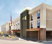
Home2 Suites by Hilton Salt Lake City-East
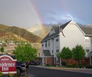
Residence Inn Salt Lake City Cottonwood
Hampton Inn by Hilton SLC-Cottonwood UT
Hampton Inn - Suites Salt Lake City-Univ-Foothill Dr UT
Oakwood Sugr House by Urbana
HAWTHORN SUITES BY WYNDHAM SAL
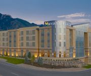
Hyatt Place Salt Lake City/Cottonwood
ENGEN HUS B AND B
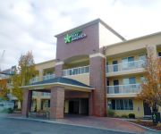
Extended Stay America Salt Lake City Sugar House
Videos from this area
These are videos related to the place based on their proximity to this place.
Tarantula in Utah
Tarantula found on Mount Olympus hiking trail in Salt Lake City, Utah. Track Name: Nevada City (found in Youtube's Audio Library) Contributing Artist: Huma-Huma Channel Name: Spyhike.
Prosperity Contracting Inc General Contractors Salt Lake City UT
Is there a dream project around your home that you've always wanted to complete? Prosperity Contracting Inc offers the region's premier general contractors y...
SOLD - Salt Lake City - 4291 S Lares Circle - Luxury Real Estate
SOLD! - Fabulous Mansion with European Architecture BEDROOMS: 5 BATHS: 5 SQUARE FOOTAGE: 6879 LOT: .33 ACRES Two incredible master suites up and down. Soaring vaults, tongue and ...
Luxury Real Estate - 4523 Gilead Way - Salt Lake City, UT
Olympus Cove Estate on Over 50 Acres 4523 S Gilead Way Salt Lake City, UT 84124 Bedrooms: 5 Baths: 7 Lot: 51.23 Acres Square Feet: 13717 Year: 2004 Gated Multi Million Dollar Estates in...
Luxury Real Estate - 3826 E Thousand Oaks Circle Salt Lake City, UT
Modern Luxury with Panoramic Views 3826 E Thousand Oaks Circle Salt Lake City, UT 84124 Bedrooms: 4 Baths: 7 Lot: 3.56 Acres Square Feet: 10765 Year: 1992 Salt Lake Luxury Real Estate -...
Driving on I-80 W to Salt Lake City
Driving in our Kia Rio rental car going west on I-80 toward Salt Lake City, August, 2011. Shortly before, we had gone to Yellowstone.
Co-Working, Virtual Offices, & Meeting Rooms | Salt Lake City, Utah
http://mybusinessbar.com/services/meeting-rooms/ Co-Working, Virtual Offices, & Meeting Rooms available in Salt Lake City, Utah are discussed by Internet Marketing professional Sean Burrows....
Young Life Salt Lake City Presents: The Ball Skit
Recorded on March 14, 2011 using a Flip Video camcorder.
Salt Lake City Snazzy Condo!
Beautifully remodeled 2 bedroom condo with lush new carpet,2 tone paint, appliances, maple cabinets, new light fixtures and much more! Condo is located near freeway access, shopping,schools...
Family Dentist Salt Lake City, UT | Call Today: 801-278-5000
Call Today: 801-278-5000 Dr. W. Kris Rosander DDS is a Salt Lake City Dentist providing root canals, dentures, crowns and teeth whitening. Specialties includ...
Videos provided by Youtube are under the copyright of their owners.
Attractions and noteworthy things
Distances are based on the centre of the city/town and sightseeing location. This list contains brief abstracts about monuments, holiday activities, national parcs, museums, organisations and more from the area as well as interesting facts about the region itself. Where available, you'll find the corresponding homepage. Otherwise the related wikipedia article.
Cottonwood West, Utah
Cottonwood West was a census-designated place (CDP) in Salt Lake County, Utah, United States. The CDP was situated between the cities of Holladay and Murray, which by the mid-2000s had annexed virtually all of the area between them. The population was 18,727 at the 2000 census, a slight increase over the 1990 census figure of 17,476. The area was known as South Cottonwood during the 1980 census, at which time the population was 11,117.
Mount Olympus (Utah)
Mount Olympus in the U.S. state of Utah, is one of the most prominent and recognizable mountains viewable from practically every location in the Salt Lake Valley. Mount Olympus is not the tallest peak along the Wasatch Front, but its unusual form and location make it a popular hiking destination for locals. The mountain is situated immediately east of the center of the Salt Lake Valley.
Olympus High School
Olympus High School is a public high school in the Granite School District in Holladay, Utah, a suburb of Salt Lake City. It opened on September 1, 1953 with an original enrollment of 1028 students.
Cottonwood High School (Murray, Utah)
Cottonwood High School is a public high school located in Murray, Utah. Founded in 1970, by Tyson Burton after the Granite School District condemned the property and obtained the land from farmers, who bought the land from Native Americans. The current enrollment is just above 1,500 with many ethnic groups represented. It hosts traditional schooling, grades 10-12, as well as a public charter school, the Academy for Math, Engineering, and Science(AMES) which utilizes unused school space.
Skyline High School (Utah)
Skyline High School is a public high school in Millcreek in Salt Lake County, Utah, USA. Skyline High School serves tenth, eleventh, and twelfth graders. The school opened in 1962 and is administered by the Granite School District. Admission to Skyline High School is open enrollment. Students are neither required to take an admission exam nor need to live within the boundaries set by the administering district.
Academy for Math, Engineering, and Science
The Academy for Math, Engineering, & Science (AMES), is a charter high school serving grades 9-12 in Murray Utah, a suburb of Salt Lake City.
Ivy Baker Priest
Ivy Baker Priest (September 7, 1905 – June 23, 1975) was an American political figure. Born in Kimberly, Utah, she was a member of The Church of Jesus Christ of Latter-day Saints. Priest ran for Congress in Utah on the Republican ticket in 1934 and 1950, losing both times. However, she became nationally known by serving as Treasurer of the United States under President Dwight D. Eisenhower from January 28, 1953 to January 29, 1961, at which time her signature appeared on all U.S. currency.
This is the Place Monument
"This Is The Place" redirects here. For the song by Red Hot Chili Peppers, see By the Way The This Is The Place Monument is a historical monument at the This Is The Place Heritage Park, located on the east side of Salt Lake City, Utah, at the mouth of Emigration Canyon. It is named in honour of Brigham Young's famous statement in 1847 that the Latter-day Saint pioneers should settle in the Salt Lake Valley. Sculpted between 1939 and 1947 by Mahonri M.
Hogle Zoo
Utah's Hogle Zoo is a 42-acre zoo located in Salt Lake City, Utah. It is the state's largest zoo, housing animals from diverse ecosystems. It is located at the mouth of Emigration Canyon. Utah's Hogle Zoo is an accredited member of the Association of Zoos and Aquariums (AZA) and the World Association of Zoos and Aquariums (WAZA).
KUCL-LD
KUCL-LD is a low-power television station in Salt Lake City, Utah, broadcasting locally in digital on UHF channel 26 as an affiliate of 3ABN. Founded April 7, 1992, the station is owned by Christian Life Broadcasting. On its subchannel 26.2, the Latina feed of 3ABN is broadcast. The signal covers a majority of the Salt Lake portion of the Wasatch Front. Currently, its transmitter is located next to Wasatch Hills church at 2139 Foothill Boulevard in Salt Lake City.
Wasatch Junior High
Wasatch Junior High is a school in the Granite School District in Salt Lake County, Utah, United States.
Intermountain Christian School
Intermountain Christian School is a school that was founded in 1983. In recent years, ICS has been named the #1 High School (Middle School #7, Elementary #4) in the state of Utah. The school’s ranking has been done by the Sutherland Institute since 2004.
Amy B. Lyman
Amy Brown Lyman (February 7, 1872 – December 5, 1959) was the eighth general president of the Relief Society of The Church of Jesus Christ of Latter-day Saints (LDS Church) from 1940 to 1945. Born in Pleasant Grove, Utah Territory, Amy Cassandra Brown was the 23rd of 25 children born to her polygamist father, John Brown.
May Green Hinckley
May Green Hinckley (May 1, 1881 – May 2, 1943) was the third general president of the Primary of The Church of Jesus Christ of Latter-day Saints (LDS Church) from 1940 until her death. She was the stepmother of Gordon B. Hinckley, fifteenth president of the LDS Church.
Ruth H. Funk
Ruth Hardy Funk (February 11, 1917 – February 5, 2011) was the seventh general president of the Young Women organization of The Church of Jesus Christ of Latter-day Saints (LDS Church) from 1972 to 1978.
Charles Zitting
Charles Frederick Zitting (March 30, 1884–July 14, 1954) was a Mormon fundamentalist leader of the community in Short Creek, Arizona. Zitting began his rise in the leadership of the Mormon fundamentalist Short Creek Community when he was arrested on April 1, 1931 on charges of polygamy and bailed out by Lorin C. Woolley, J. Leslie Broadbent, and Joseph W. Musser the next day.
Marvin O. Ashton
Marvin Owen Ashton (April 8, 1883 – October 7, 1946) was a general authority of The Church of Jesus Christ of Latter-day Saints (LDS Church) from 1938 until his death. Prior to becoming a general authority, Ashton was a prominent local leader of the LDS Church in Salt Lake City, Utah. Ashton was born in Salt Lake City, Utah Territory to Mormon parents. He married Rachel Grace Jeremy in 1906 and in 1907 went to England as a missionary for the LDS Church.
Avard Fairbanks
Avard Tennyson Fairbanks (March 2, 1897 – January 1, 1987) was a prolific 20th century American sculptor. Three of his sculptures are in the United States Capitol, and the state capitols in both Utah and Wyoming, as well as numerous other locations, also have his works. Possibly his most well-known artistic contribution was designing the ram symbol for Dodge.
Utah State Route 190
State Route 190 or the Big Cottonwood Canyon Scenic Byway is primarily an east and west scenic highway located in Salt Lake County, Utah that begins at I-215 and runs through Big Cottonwood Canyon including the Brighton Loop and ends at the Salt Lake and Wasatch County line.
Millcreek Canyon
Millcreek Canyon is a canyon in the Wasatch Mountains and part of Millcreek Township on the east side of the Salt Lake Valley, USA. It is a popular recreation area both in the summer and in the winter. It was named after all the mills that were once located in the densely forested canyon. It is home to two restaurants and six Boy Scout Day Camps. Millcreek Canyon is next to Parley's Canyon on the north and Big Cottonwood Canyon on the south.
J. E. Cosgriff Memorial Catholic School
J. E. Cosgriff Memorial Catholic School is a Catholic PK-8th Grade school in Salt Lake City, Utah and is associated with St Ambrose's Church. The school was founded in 1957. The principal of the school is Betsy Hunt. Father Andrew, a priest from Poland, and Jim Larson, middle school science/math teacher and seventh grade home room teacher, also help run the school. J. E. Cosgriff Memorial Catholic School was founded in 1957 by the Daughters of Charity.
Villa Theatre
The Villa Theatre is a now-closed movie theater in Salt Lake City, Utah, located at 3092 S. Highland Drive. The theatre was open from December 23, 1949 to February 18, 2003.
Cottonwood Mall (Utah)
Cottonwood Mall was an enclosed shopping mall in Holladay, Utah, a suburb of Salt Lake City, Utah. It was the first indoor shopping mall in the state.
Highland High School (Utah)
Highland High School is a high school in Salt Lake City, in the U.S. state of Utah, that opened in 1956 and has a student body of 1,546. It is located at 2166 South 1700 East, next to Sugar House Park, and is part of the Salt Lake City School District. The current principal is Paul Schulte. Newsweek currently ranks it as the #575 high school in the country.
Foothill, Salt Lake City
Foothill in Salt Lake City, Utah is a relatively affluent and primarily residential neighborhood of Salt Lake City that lies at the base of the Wasatch Range and extends west to approximately 1500 East. Also sometimes referred to as "The East Bench", it is bordered on the north by the Federal Heights neighborhood and on the south by Interstate 80. This neighborhood becomes increasingly affluent moving from west to east.


