Safety Score: 2,7 of 5.0 based on data from 9 authorites. Meaning we advice caution when travelling to United States.
Travel warnings are updated daily. Source: Travel Warning United States. Last Update: 2024-05-18 08:26:29
Delve into Cherry Farm Estates
The district Cherry Farm Estates of South Weber in Davis County (Utah) is a subburb in United States about 1,840 mi west of Washington DC, the country's capital town.
If you need a hotel, we compiled a list of available hotels close to the map centre further down the page.
While being here, you might want to pay a visit to some of the following locations: Ogden, Farmington, Morgan, Salt Lake City and Brigham City. To further explore this place, just scroll down and browse the available info.
Local weather forecast
Todays Local Weather Conditions & Forecast: 18°C / 65 °F
| Morning Temperature | 9°C / 49 °F |
| Evening Temperature | 20°C / 68 °F |
| Night Temperature | 14°C / 57 °F |
| Chance of rainfall | 0% |
| Air Humidity | 35% |
| Air Pressure | 1012 hPa |
| Wind Speed | Gentle Breeze with 6 km/h (4 mph) from North-West |
| Cloud Conditions | Clear sky, covering 0% of sky |
| General Conditions | Light rain |
Sunday, 19th of May 2024
16°C (62 °F)
10°C (50 °F)
Moderate rain, moderate breeze, clear sky.
Monday, 20th of May 2024
14°C (57 °F)
10°C (49 °F)
Light rain, gentle breeze, few clouds.
Tuesday, 21st of May 2024
11°C (51 °F)
9°C (49 °F)
Light rain, gentle breeze, overcast clouds.
Hotels and Places to Stay
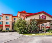
BW PLUS CANYON PINES
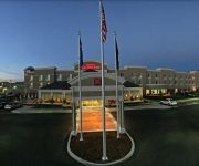
Hilton Garden Inn Salt Lake City-Layton
Home2 Suites by Hilton Layton UT
Hampton Inn Salt Lake City-Layton
Comfort Inn Layton
Courtyard Salt Lake City Layton
TownePlace Suites Salt Lake City Layton
Holiday Inn Express LAYTON-I-15
Fairfield Inn Salt Lake City Layton
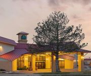
La Quinta Inn and Suites Salt Lake City - Layton
Videos from this area
These are videos related to the place based on their proximity to this place.
one9 Thermal night op connex city Hill AFB
one9 hosted night op at Hill AFB 7/27/13 attack and defend game. FLIR mounted to my KWA Kriss Vector Thermal airsoft night ops one9alliance.com The Alliance Airsoft on Facebook one9, Utah,...
DJI Phantom 2 Vision Plus Sunset Flight in 20 mph winds
DJI Phantom 2 Vision Plus Sunset Flight in 20 mph winds.
Air Duct Cleaners--garbage
http://www.4nodirt.com. Air Duct Cleaners 1189 Princes, Syracuse, UT 84075. 801-776-8303. Emptying the dirt box on the air duct cleaning truck. This is where all the debris and other junk...
Beautiful House, Beautiful Views!
For more details click here: http://www.visualtour.com/showvt.asp?t=3108636 1957 E Sunset Dr Layton, UT 84040 $259900, 4 bed, 3.5 bath, 2368 SF, MLS# 1173921 A Lease Option is a Possibility!!...
Emergency Locksmith Clearfield,24/7 Locksmith Clearfield,Locksmith Layton,24/7 Locksmith Layton
http://www.BackusLocksmithLayton.com Call 801-682-5754...24/7 Locksmith services. If you need your locks changed or spare keys made quickly, you can count on us. For the best locksmith services...
1197 N 1725 E Layton UT 84040 - Obeo Virtual Tour 922577
http://homesite.obeo.com/viewer/default.aspx?tourid=922577?refurl=youtube Contact: Marsha Beaudry MANSELL REAL ESTATE - OGDEN OFFICE 801-682-5521 marsha@mans...
Immaculate 6 Bedroom 2- Story Home!!!
For more details click here: http://www.visualtour.com/showvt.asp?t=2950194 1515 N 2240 E Layton, UT 84040 $370000, 6 bed, 4.5 bath, 5032 SF, MLS# 1131539 ...
2581 North 2700 East, Layton UT 84040
This is the home you've been looking for in the Oak Forest Neighborhood of East Layton located minutes from Hobbs Reservoir. This brick rambler has mountain ...
Videos provided by Youtube are under the copyright of their owners.
Attractions and noteworthy things
Distances are based on the centre of the city/town and sightseeing location. This list contains brief abstracts about monuments, holiday activities, national parcs, museums, organisations and more from the area as well as interesting facts about the region itself. Where available, you'll find the corresponding homepage. Otherwise the related wikipedia article.
Hill Air Force Base
Hill Air Force Base is a major U.S. Air Force base located in northern Utah, just south of the city of Ogden, and near the towns of Clearfield, Riverdale, Roy, Sunset, and Layton. It is about 30 miles north of Salt Lake City. The base was named in honor of Major Ployer Peter Hill of the U.S. Army Air Corps, who died test-flying a prototype of the B-17 Flying Fortress bomber.
Weber State University
Weber State University is a public university located in the city of Ogden in Weber County, Utah, USA. It is a coeducational, publicly supported university offering professional, liberal arts and technical certificates, as well as associate, bachelor's and master's degrees. Weber State University is accredited by the Northwest Commission on Colleges and Universities. Programs throughout the university are accredited as well.
Dee Events Center
Dee Events Center is a 11,500-seat multi-purpose arena in Ogden, Utah. The circular, domed arena, similar in design to many arenas of the time, opened in 1977 and was named for the Lawrence T. Dee family, for his extensive contributions in building the arena. The arena is the largest arena in Utah north of Salt Lake City. It is home to the Weber State University Wildcats men's and women's basketball teams. It was home to the Weber State women's volleyball team until 2006.
Christopher Layton
Christopher Layton (March 8, 1821 – August 7, 1898) was a Mormon colonizer and Patriarch who founded the cities of Kaysville, Utah, Layton, Utah, and Thatcher, Arizona. Layton, Utah is named after him. Layton was born at Thorncote Green, Northill, Bedfordshire, England. He joined The Church of Jesus Christ of Latter-day Saints in 1842 and a year later emigrated to the United States. In 1846, Layton joined the Mormon Battalion. In 1852, he moved to Kaysville, Utah Territory.
Stewart Stadium
Elizabeth Dee Shaw Stewart Stadium is a 17,312-seat outdoor multi-purpose stadium in Ogden, Utah, used primarily for football. It is the home field of the Weber State University Wildcats of the Big Sky Conference. It was expanded in 1966 with the construction of the west grandstand, nearly doubling its capacity. The stadium is located at 3402 University Circle.
KWCR-FM
KWCR-FM ("88.1 WEBER FM", formerly "88.1 The Edge") is a student-run College radio station in Ogden, Utah, Owned and operated by Weber State University and broadcasts at the frequency 88.1 MHz FM and online. All DJs and staff members are students at Weber State University, studying various courses throughout the university. The current general manager is Alex Larrabee and Nick Smith is the program director.
Swenson Gym
Swenson Gym, also known as Wildcat Gym, was the home of several indoor athletic teams of the Weber State University Wildcats. It was built in 1962 and replaced by the more modern Dee Events Center in 1977. The facility was renovated for its new role as the home of volleyball matches in Fall 2006. The arena hosted the 1976 Big Sky Conference men's basketball tournament.
Layton High School
Layton High School is a secondary school located in Layton, Utah USA. Part of the Davis School District, Layton High School educates students in grades 10 to 12. As of 2002, 1,805 students were enrolled and actively attending the school.
Northridge High School (Layton, Utah)
Northridge High School (NHS), is a high school which is located in Layton, Utah. It was opened in 1992 and is part of the Davis School District.
Northern Utah Academy for Math Engineering and Science
The Northern Utah Academy for Math Engineering and Science (NUAMES) is a grades ten through twelve public charter high school started in 2004 that specializes in preparing high school students for an early transition into a university baccalaureate program in fields related to math, engineering or science. The Principal is Alan Stokes, the Vice Principal is Dave Dau and Debbie Hefner is the director of business operations. The curriculum focuses on math, engineering, and science.
Bonneville High School (Washington Terrace, Utah)
Bonneville High School is a secondary high school in Washington Terrace, Utah, United States.
North Layton Junior High School
North Layton Junior High School is a Secondary School in Layton, Utah serving communities of North Layton, Northwest Layton and Hill Air Force Base. It is a part of Davis School District.
Ott Planetarium
The Ott Planetarium is a planetarium at Weber State University in Ogden, Utah, USA. The facility is named for Layton P. Ott and the Ott family. The planetarium is operated by university students and is a place of learning for audiences and staff alike.
Morrisite War
The Morrisite War was a skirmish between a Latter Day Saint sect known as the "Morrisites" and the Utah territorial government.
George D. Watt
George Darling Watt (May 12, 1812 – October 24, 1881) was the first convert to Mormonism baptized in the British Isles. As a member of The Church of Jesus Christ of Latter-day Saints (LDS Church), Watt was a secretary to Brigham Young, the primary editor of the Journal of Discourses and the primary inventor of the Deseret Alphabet. Watt was born in Manchester, England. While living in Preston as a young man, Watt was a member of the Reverend James Fielding's congregation.
The Ice Sheet at Ogden
The Ice Sheet at Ogden, also known as the Weber County Ice Sheet, is located 35 miles north of Salt Lake City on the campus of Weber State University in Ogden. The Ice Sheet opened in 1994 as a recreational training center for curling, ice hockey, and figure skating. During the 2002 Winter Olympics the Ice Sheet hosted the curling events.
McKay-Dee Hospital Center
McKay-Dee Hospital Center is a not-for-profit community focused health system operated by Intermountain Healthcare. With 352 licensed beds (425 total beds), it is the 3rd largest hospital in the Intermountain system, and the 4th largest Hospital in Utah. McKay-Dee Hospital offers nationally ranked programs including the Heart and Vascular Institute and Newborn ICU.
Ogden Regional Medical Center
The Ogden Regional Medical Center is a hospital in Ogden, Utah.
Ogden–Clearfield metropolitan area
The Ogden-Clearfield, UT Metropolitan Statistical Area, as defined by the United States Office of Management and Budget, is an area consisting of four counties in north central Utah, anchored by the cities of Ogden and Clearfield. As of the 2010 census, the MSA had a population of 547,184.
John B. Goddard School of Business & Economics
John B. Goddard School of Business & Economics at Weber State University prepares students for careers in business and economics. The Goddard School attracts students from across the nation and around the world.
Weber Canyon
Weber Canyon is a canyon in the Wasatch Range near Ogden, Utah, through which the Weber River flows west toward the Great Salt Lake. It is fed by 13 tributary creeks and is 40 miles long.
East Layton, Utah
East Layton is a former city in Davis County, Utah, United States. Adjacent to Layton, it was incorporated in 1936 in order to secure funding for a community water system. East Layton remained a small, steadily growing residential town for decades, becoming a city in 1972. Rapid expansion during the 1970s led to a merger in 1981 with Layton, now Davis County's most populous city and one of the largest in Utah.
Dr. Ezekiel R. Dumke College of Health Professions
The Dr. Ezekiel R. Dumke College of Heath Professions is a college of Weber State University located in the Marriott Allied Health building on the east side of campus south of the Science Lab building.
Layton Hills Mall
Layton Hills Mall is an enclosed shopping mall in Layton, Utah. Opened in 1980, the mall features Dick's Sporting Goods, J.C. Penney and Macy's as its anchor stores. The mall is owned by CBL & Associates Properties.
Nightingale College Utah
Nightingale College, is a proprietary post-secondary institution located in Ogden, Utah. Nightingale College is primarily focused on providing nursing education programs. The College offers one education program, the Associate Degree Nursing (ADN) Program.


