Safety Score: 2,7 of 5.0 based on data from 9 authorites. Meaning we advice caution when travelling to United States.
Travel warnings are updated daily. Source: Travel Warning United States. Last Update: 2024-04-29 08:03:39
Explore Planeport
Planeport in El Paso County (Texas) is a city in United States about 1,718 mi (or 2,766 km) west of Washington DC, the country's capital.
Local time in Planeport is now 08:42 AM (Monday). The local timezone is named America / Denver with an UTC offset of -6 hours. We know of 8 airports in the vicinity of Planeport. The closest airport in United States is El Paso International Airport in a distance of 4 mi (or 6 km), East. Besides the airports, there are other travel options available (check left side).
There is one Unesco world heritage site nearby. The closest heritage site is Archaeological Zone of Paquimé, Casas Grandes in Mexico at a distance of 103 mi (or 165 km). Also, if you like golfing, there are multiple options in driving distance. We found 1 points of interest in the vicinity of this place. If you need a place to sleep, we compiled a list of available hotels close to the map centre further down the page.
Depending on your travel schedule, you might want to pay a visit to some of the following locations: El Paso, Las Cruces, Alamogordo, Sierra Blanca and Deming. To further explore this place, just scroll down and browse the available info.
Local weather forecast
Todays Local Weather Conditions & Forecast: 25°C / 76 °F
| Morning Temperature | 15°C / 59 °F |
| Evening Temperature | 27°C / 80 °F |
| Night Temperature | 23°C / 74 °F |
| Chance of rainfall | 0% |
| Air Humidity | 13% |
| Air Pressure | 1010 hPa |
| Wind Speed | Gentle Breeze with 8 km/h (5 mph) from North-East |
| Cloud Conditions | Clear sky, covering 0% of sky |
| General Conditions | Sky is clear |
Monday, 29th of April 2024
28°C (83 °F)
24°C (75 °F)
Sky is clear, moderate breeze, clear sky.
Tuesday, 30th of April 2024
26°C (80 °F)
26°C (79 °F)
Sky is clear, fresh breeze, clear sky.
Wednesday, 1st of May 2024
25°C (77 °F)
24°C (75 °F)
Sky is clear, fresh breeze, clear sky.
Hotels and Places to Stay
El Paso Marriott
Embassy Suites by Hilton El Paso
Courtyard El Paso Airport
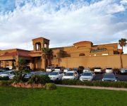
Radisson Hotel El Paso Airport
Fairfield Inn & Suites El Paso Airport
TownePlace Suites El Paso Airport
Residence Inn El Paso
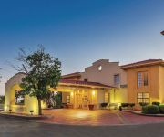
La Quinta Inn El Paso - Airport
Hyatt Place El Paso Airport
WYNDHAM EL PASO AIRPORT HOTEL
Videos from this area
These are videos related to the place based on their proximity to this place.
Fort Bliss - Corregidor
The Corregidor neighborhood (formerly known as South and West Officers) offers 3-4 bedroom single family homes with features that include: fully equipped kitchens, central air, and washer/dryer...
Fort Bliss - Rio Bravo
Rio Bravo is a neighborhood that offers 3-4 bedroom homes with features that include: fully equipped kitchens, central air, garages, and washer/dryer hookups.
Fort Bliss - Hayes
The Hayes neighborhood offers 2-4 bedroom single family homes with features that include: fully equipped kitchens, central air, fenced-in yards, and washer/dryer hookups. Hayes is located directly...
Fort Bliss - Aero Vista
The Aero Vista neighborhood offers 3-4 bedroom single family homes with features that include fully equipped kitchens, central air, and washer/dryer hookups. With spectacular views of the Franklin...
Fort Bliss - Logan Heights
Logan Heights offers 2-4 bedroom single family and duplex homes that feature: fully equipped kitchens, central air, ceiling fans, and washer/dryer hookups. With beautiful views of the Franklin...
ParaNorm at Abandoned Fort Bliss Child Development Center (CDC)
Paranormal Activity at the abandonded and Haunted CHILD DEVELOPMENT CENTER near William Beuamont Army Medical Center at Fort Bliss, Texas. We were looking for some hot spots around the ...
Ft Bliss - Lower Beaumont
The Lower Beaumont neighborhood offers 2-4 bedroom historic and non-historic single family and duplex homes with features that include: fully equipped kitchens, central air, and washer/dryer...
Fort Bliss - 108s
The 108s is a neighborhood that offers 2-4 bedroom homes with features that include: central air, fenced-in yards, and washer/dryer hookups. Located a little over one mile west of the base,...
Fort Bliss - Rio Bravo Community Center
The Balfour Beatty Communities Fort Bliss Community Centers offer a multitude of features for resident enjoyment including a play area, multipurpose room with a projection screen and kitchen,...
Videos provided by Youtube are under the copyright of their owners.
Attractions and noteworthy things
Distances are based on the centre of the city/town and sightseeing location. This list contains brief abstracts about monuments, holiday activities, national parcs, museums, organisations and more from the area as well as interesting facts about the region itself. Where available, you'll find the corresponding homepage. Otherwise the related wikipedia article.
El Paso, Texas
El Paso is the county seat of El Paso County, Texas, United States, and lies in far West Texas. As of the 2010 census the city's population was 649,121. El Paso is the 19th most populous city in the United States and the sixth most populous city in the state of Texas. Its metropolitan area covers all of El Paso County, whose population in 2010 was 800,647. El Paso stands on the Rio Grande (Río Bravo del Norte), across the border from Juárez, Chihuahua, Mexico.
Fort Bliss
Fort Bliss is a United States Army post in the U.S. states of New Mexico and Texas, with its headquarters located in El Paso, Texas. With an area of about 1,700 square miles, it is the Army's second-largest installation, behind the adjacent White Sands Missile Range. It is FORSCOM's (United States Army Forces Command) largest installation, and has the Army's largest Maneuver Area (992,000 acres) behind the National Training Center.
Roman Catholic Diocese of El Paso
The Roman Catholic Diocese of El Paso is a particular church of the Roman Catholic Church in West Texas. Covering 26,686 square miles, it encompasses the Texas counties of El Paso, Brewster, Culberson, Hudspeth, Jeff Davis, Loving, Presidio, Reeves, Ward and Winkler with approximately 668,000 professing members, being 80.8% of the total population, served by 107 priests, 54 parishes and 237 male and female religious. The see is a suffragan of the Archdiocese of San Antonio.
McKelligon Canyon
McKelligon Canyon is the location of a 1,503-seat amphitheater located in El Paso, Texas, United States, where the play Viva El Paso! is presented. The amphitheater is also used for concerts, graduation ceremonies, and other special events. Adjacent is the 300-seat McKelligon Canyon Pavilion.
Mesilla Valley
The Mesilla Valley is a geographic feature of Southern New Mexico and far West Texas. It was formed by repeated heavy spring floods of the Rio Grande. The fertile Mesilla Valley extends from Radium Springs, New Mexico, to the west side of El Paso, Texas. The valley is quite fertile, and is characterized by its few remaining bosques, as well as its native cottonwood trees, and increasingly, by invasive tamarisk, which was introduced in the late 19th century, and is known locally as salt cedar.
Loretto Academy (El Paso, Texas)
Loretto Academy is a private Roman Catholic school in El Paso, Texas. It is a part of the Roman Catholic Diocese of El Paso alongside Cathedral High School and Father Yermo. Grades K-5 are coeducational, while grades 6-12 are all girls.
History of El Paso, Texas
The history of El Paso, Texas, in the United States spans a period from the middle of the Spanish Imperial period to modern day. Founded as El Paso del Norte by Spanish franciscan friars at an important mountain pass, the area became a small agricultural producer though most settlement was south of the river where modern Mexico lies.
Austin High School (El Paso, Texas)
Stephen F. Austin High School is a secondary school in El Paso, Texas, opened in 1930. It is part of the El Paso Independent School District. The school's mascot is a Golden Panther named "Henry. " The school was designed by Texas contractor and architect Robert E. McKee. When the local school district ran out of money during the construction, McKee donated the remainder owed. Consequently, the school's football stadium is named in McKee's honor. The R.E.


