Safety Score: 2,7 of 5.0 based on data from 9 authorites. Meaning we advice caution when travelling to United States.
Travel warnings are updated daily. Source: Travel Warning United States. Last Update: 2024-04-28 08:22:10
Delve into Little Browning
Little Browning in Glacier County (Montana) with it's 206 habitants is a town located in United States about 1,866 mi (or 3,003 km) west of Washington DC, the country's capital town.
Time in Little Browning is now 11:44 PM (Sunday). The local timezone is named America / Denver with an UTC offset of -6 hours. We know of 7 airports closer to Little Browning, of which one is a larger airport. The closest is airport we know is Lethbridge County Airport in Canada in a distance of 72 mi (or 116 km). The closest airport in United States is Glacier Park International Airport in a distance of 90 mi (or 116 km), North. Besides the airports, there are other travel options available (check left side).
There are two Unesco world heritage sites nearby. The closest heritage site is Waterton Glacier International Peace Park in Canada at a distance of 28 mi (or 45 km). In need of a room? We compiled a list of available hotels close to the map centre further down the page.
Since you are here already, you might want to pay a visit to some of the following locations: Cut Bank, Shelby, Conrad, Choteau and Chester. To further explore this place, just scroll down and browse the available info.
Local weather forecast
Todays Local Weather Conditions & Forecast: 12°C / 53 °F
| Morning Temperature | 6°C / 43 °F |
| Evening Temperature | 10°C / 50 °F |
| Night Temperature | 5°C / 42 °F |
| Chance of rainfall | 0% |
| Air Humidity | 27% |
| Air Pressure | 1003 hPa |
| Wind Speed | Strong breeze with 18 km/h (11 mph) from East |
| Cloud Conditions | Few clouds, covering 20% of sky |
| General Conditions | Few clouds |
Monday, 29th of April 2024
6°C (43 °F)
2°C (35 °F)
Rain and snow, strong breeze, overcast clouds.
Tuesday, 30th of April 2024
0°C (33 °F)
0°C (33 °F)
Snow, strong breeze, overcast clouds.
Wednesday, 1st of May 2024
4°C (39 °F)
8°C (46 °F)
Light rain, gentle breeze, broken clouds.
Hotels and Places to Stay
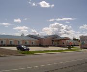
Glacier Gateway Plaza
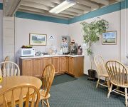
SUPER 8 CUT BANK
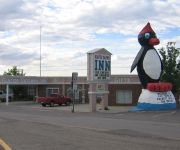
Glacier Gateway Inn
Videos from this area
These are videos related to the place based on their proximity to this place.
Amtrak Ride S2012: Amtrak 8 Cut Bank, MT Approach
July 29, 2012: From the "Rail Fan Window" on the Empire Builder East #8 crossing the trestle and approaching Cut Bank, MT Amtrak station.
Empire Builder westbound Crossing Trestle Cut Bank 2008-07
The westbound Empire Builder crossing the trestle at Cut Bank, MT from east side to west side. 2008-07-02.
Empire Builder eastbound Crossing Trestle Cut Bank, MT 2007-11
The eastbound Empire Builder crossing the trestle at Cut Bank, MT 2007-11-04. WS.
Cut Bank Cafe
Just great home style food... Located at 13 West Main in Cut Bank, Montana. Open 6 AM to 9 PM with truly great service and large portions. They also have petite portions when you are not that hungry.
Empire Builder eastbound across trestle Cut Bank MT 2009-03-17
The Empire Builder eastbound - over the trestle at Cut Bank, MT - 2009-03-17.
2001 Ford Taurus Used Cars Cut Bank MT
http://www.northernford.com This 2001 Ford Taurus is available from Northern Ford. For details, call us at 406-873-5541.
Empire Builder westbound Tr Rails comments Cut Bank MT 2009-09-04
Empire Builder westbound - "Trails & Rails" commentary in the Lounge car by Cut Bank, MT. 2009-09-04 approx 6 PM.
Empire Builder eastbound Arrival into Cut Bank MT 2007-04-02
Empire Builder eastbound - Approach/Arrival into Cut Bank, MT. 2007-04-02. WS.
2008-10-25/26 - Amtrak Empire Builder Ride Crossing Cut Bank, MT Trestle, Dual View
Riding the Amtrak Empire Builder trains 7 and 8 across the Cut Bank, MT trestle looking from both sides of the train. When I realized I had 2 shots of crossing the Cut Bank Trestle (thanks...
X-Plane 10 - From Starr-Browning Airstrip (MT) to Cut Bank (MT)
From Starr-Browning Airstrip (MT) to Cut Bank (MT), RWY 5. ICAO code: KCTB. Aircraft: Cessna 172SP. Flight simulator: X-Plane 10 3.0.
Videos provided by Youtube are under the copyright of their owners.
Attractions and noteworthy things
Distances are based on the centre of the city/town and sightseeing location. This list contains brief abstracts about monuments, holiday activities, national parcs, museums, organisations and more from the area as well as interesting facts about the region itself. Where available, you'll find the corresponding homepage. Otherwise the related wikipedia article.
Cut Bank, Montana
Cut Bank is a city in and the county seat of Glacier County, Montana, United States located just east-south-east of the "cut bank" geographical feature which formed canyon-like along the eponymously named Cut Bank Creek river. The population was 2,919 at the 2010 census.
Cut Bank (Amtrak station)
Cut Bank, Montana is a station stop for the Amtrak Empire Builder in Cut Bank, Montana and an important regional railway freight yard for the BNSF Railway—which operates no less than three grain collection elevators in the yard collecting grains from the western great plains region. The station, platform, and parking are owned by Amtrak, while the adjacent Railyard sidings, trackage, and signals are owned and operated by BNSF Railway.
Cut Bank Municipal Airport
Cut Bank Municipal Airport is a public use airport located three nautical miles (6 km) southwest of the central business district of Cut Bank, a city in Glacier County, Montana, United States. It is owned by Cut Bank and Glacier County. The airport's website refers to it as Cut Bank International Airport. Its first flight took place on 1 June 1941.


