Safety Score: 2,7 of 5.0 based on data from 9 authorites. Meaning we advice caution when travelling to United States.
Travel warnings are updated daily. Source: Travel Warning United States. Last Update: 2024-05-12 08:29:37
Delve into Southwest Garden
The district Southwest Garden of in St. Louis (Missouri) is a district located in United States about 713 mi west of Washington DC, the country's capital town.
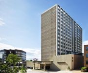
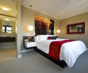
In need of a room? We compiled a list of available hotels close to the map centre further down the page.
Since you are here already, you might want to pay a visit to some of the following locations: Clayton, St Louis, Saint Charles, Waterloo and Belleville. To further explore this place, just scroll down and browse the available info.
Local weather forecast
Todays Local Weather Conditions & Forecast: 25°C / 76 °F
| Morning Temperature | 15°C / 58 °F |
| Evening Temperature | 23°C / 74 °F |
| Night Temperature | 19°C / 67 °F |
| Chance of rainfall | 0% |
| Air Humidity | 41% |
| Air Pressure | 1013 hPa |
| Wind Speed | Gentle Breeze with 9 km/h (5 mph) from North-West |
| Cloud Conditions | Broken clouds, covering 66% of sky |
| General Conditions | Light rain |
Monday, 13th of May 2024
17°C (63 °F)
17°C (63 °F)
Moderate rain, gentle breeze, overcast clouds.
Tuesday, 14th of May 2024
20°C (67 °F)
16°C (60 °F)
Moderate rain, moderate breeze, overcast clouds.
Wednesday, 15th of May 2024
22°C (72 °F)
18°C (64 °F)
Broken clouds, gentle breeze.
Hotels and Places to Stay
The Ritz-Carlton St. Louis
THE MOONRISE HOTEL
Sheraton Clayton Plaza Hotel St. Louis
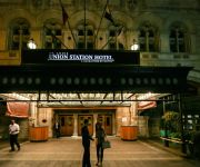
St. Louis Union Station a Curio by Hilton
Courtyard St Louis Downtown West
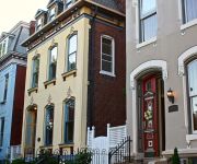
Napoleon's Retreat Bed and Breakfast
SpringHill Suites St. Louis Brentwood
Residence Inn St. Louis Downtown
Hotel Ignacio Saint Louis
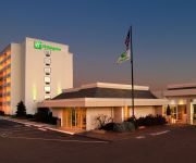
Holiday Inn ST. LOUIS - FOREST PARK
Videos from this area
These are videos related to the place based on their proximity to this place.
U-City Soldiers vs Metro Warriors Playoff Game
Undefeated U-City Solders faced the Metro Warriors @ the St. Louis Recreation center filed on Kingshighway. Another nice day for sunday football and U-City only have one thing on their mind...and...
St. Louis Nurse and Allied Jobs
Learn more about great nursing and therapy jobs in the St. Louis area.
Episode Thirty-Eight - American Discovery Trail
In Defiance, Lion King talks to Lindsay the school teacher and her family. And runs into Vicky who he met on October on the Hover Trail in Iowa! A stop at the St. Louis Gateway Arch.
Saving a Deck From the Landfill- StLouis, MO
St Louis City Building Code Officials said: "Bring the Deck to Current Building Codes or Tear It Down". We chose to save the deck and added: New Stairs, Additional Support, Simpson Strong...
T-Model Ford Big Boss Man May 26, 2011 Off broadway St. Louis
I was so close I could barely squeeze marty on the drums in a bit :)
Pinnacle Entertainment Owners Club
On April 4th 2011, Pinnacle Entertainment re-launched its mychoice program. The top guests, collectively known as The Owner's Club, were invited to private VIP parties where they received all...
Drunk Hoosier Catches Turtle in Tower Grove Park Pond
My son and I went to Tower Grove Park to feed the ducks. We saw this guy who had consumed some vodka, taking off his socks, shoes and shirt, to then get in the water and grab a turtle. He did...
Tenth Life's Fourth Annual Hissin' Hustle
It was a beautiful day for the Tenth Life Hissin' Hustle, our annual 5K/1M Catwalk in Tower Grove Park. This was the first year we added a 10K and it was so nice to be joined by hundreds of...
Qigong at Market bounce.m4v
Michael Schomaker of Bamboo Studio St. Louis, leads the Saturday morning group in a warm up "bounce". The group meets every Saturday morning at Tower Grove Farmers' Market in Tower Grove...
Videos provided by Youtube are under the copyright of their owners.
Attractions and noteworthy things
Distances are based on the centre of the city/town and sightseeing location. This list contains brief abstracts about monuments, holiday activities, national parcs, museums, organisations and more from the area as well as interesting facts about the region itself. Where available, you'll find the corresponding homepage. Otherwise the related wikipedia article.
Missouri Botanical Garden
The Missouri Botanical Garden is a botanical garden located in St. Louis, Missouri. It is also known informally as Shaw's Garden for founder Henry Shaw, a botanist and philanthropist.
The Hill, St. Louis
The Hill is a mostly Italian-American neighborhood within St. Louis, Missouri, located on high ground south of Forest Park. The official boundaries of the area are Manchester Avenue on the north, Columbia and Southwest Avenues on the south, South Kingshighway Boulevard on the east, and Hampton Avenue on the west. Its name is due to its proximity to the highest point of the city, formerly named St.
St. Louis Arena
The St. Louis Arena (formerly The Checkerdome from 1977 to 1983 and commonly as "The Barn") was an indoor arena, located in St. Louis, Missouri, that stood from 1929 to 1999. It was home to the St. Louis Blues and various other sports franchises. The Arena was located directly across I-64 from Forest Park's Aviatation Field.
St. Louis University High School
St. Louis University High School (SLUH), a Jesuit Catholic high school for boys founded in 1818, is the oldest secondary educational institution in the U.S. west of the Mississippi River, and one of the largest private high schools in Missouri. It is located in the Roman Catholic Archdiocese of St. Louis.
Gateway High School (St. Louis)
Gateway High School (also known as Gateway STEM High School and previously known as Gateway Institute of Technology and as O'Fallon Technical High School) is a public magnet high school in St. Louis, Missouri, USA.
Climatron
The Climatron is a greenhouse enclosed in a geodesic dome that is part of the Missouri Botanical Garden in St. Louis. Initiated by then Garden director Frits W. Went, the dome is the world's first completely air-conditioned greenhouse and the first geodesic dome to be enclosed in rigid Plexiglass (Perspex) panels. Completed in 1960, it was designed by T.C. Howard, of Synergetics, Inc. , Raleigh, NC.
Tower Grove Park
Tower Grove Park is a municipal park in the City of St. Louis, Missouri. Most of its land was donated to the city by Henry Shaw in 1868. It is on 289 acres (1.17 km²) adjacent to the Missouri Botanical Garden, another of Shaw’s legacies. It extends 1.6 miles from west to east, between Kingshighway Boulevard and Grand Boulevard. It is bordered on the north by Magnolia Avenue and on the south by Arsenal Street.
Saint Louis Science Center
The Saint Louis Science Center, founded as a planetarium in 1963, is a collection of buildings including a science museum and planetarium in St. Louis, Missouri, on the southeastern corner of Forest Park. With over 750 exhibits in a complex of over 300,000 square feet, it is among the largest of its type in the country, and according to the Association of Science and Technology Centers, is one of the top 5 science centers in the United States.
Seiwa-en
Seiwa-en is a Japanese strolling garden located in the Missouri Botanical Garden, St Louis, Missouri, in the Midwestern United States. At 5 ha (14 acres), it is the largest such garden in North America. It features a large lake, modest traditional buildings, bridges, islands, carp, dry gravel landscaping, and other symbolic features. Planning for the garden began in 1972, and it was dedicated in May 1977. Seiwa-en was designed by Dr.
Amighetti's Bakery
Amighetti's Bakery is an Italian American bakery and cafe located in the Hill, the large Italian neighborhood of St. Louis, Missouri; as well as Hazelwood, Missouri and Rock Hill, Missouri. They are most known for their Amighetti's Special Sandwich. The Special is made with ham, roast beef, Genoa salami, brick cheese, lettuce, tomato, pickles, onions, pepperoncini and secret recipe Amighetti's dressing on freshly baked Italian bread. They also make and serve fresh pasta.
Broadcast Center
Broadcast Center is a private vocational school located in St. Louis, Missouri, that provides training in the broadcast industry in radio and television talent, production, and marketing positions. Broadcast Center first opened in 1972 in the St. Louis suburb of Clayton, MO. In 1997 the Center relocated to its current location at 2360 Hampton Avenue, in a building that formerly housed radio station KGLD.
Southampton, St. Louis
Southampton is a neighborhood in St. Louis, Missouri. Located in the southern reaches of the city, its borders are Chippewa Street on the north, Hampton Avenue on the west, Eichelberger Street on the south and South Kingshighway Boulevard on the east. It is a quiet neighborhood that was historically populated by Germanic immigrants. Typical architecture styles include "Hansel and Gretel", Gingerbread, Neo-Tudor, Brick, Arts & Crafts homes, and "Four Square".
Cleveland Junior Naval Academy
Cleveland Junior Naval Academy (also known as Cleveland High School) is a magnet military academy high school in St. Louis, Missouri and is a part of the St. Louis Public Schools. Cleveland High School opened in 1915 as a comprehensive high school, merging with the Junior Naval Academy in 1984. The Junior Naval Academy was a magnet military academy, founded in 1981.
Missouri Crematory
The Missouri Crematory was the sixth modern crematory built in the United States and holds the distinction of being the first crematory built west of the Mississippi River. The crematory is located at 3211 Sublette Avenue in St. Louis, just across from the State Mental Hospital off of Arsenal Street. Now called "Valhalla's Hillcrest Abbey" it is owned by the Zell Family, who also own the Valhalla Chapel and Memorial Park on St. Charles Rock Road.
American College of Zoological Medicine
American College of Zoological Medicine was established in 1983 as an international specialty organization of veterinarians with special expertise in zoological medicine. The ACZM was established to encourage medical research that benefits wild animals. Also it was established to advance competency and scientific progress in zoological medicine, integrate the principles of ecology, conservation, and veterinary medicine as it applies to wild animals within natural and artificial environments.
Clifton Heights, St. Louis
Clifton Heights is a neighborhood of St. Louis, Missouri, located along the southwest border of the city and highlighted by a park—Clifton Park —with a playground and a lake. The neighborhood is mostly residential, with a history dating back to the early 19th century and houses of varying architectural styles, including some Victorians and numerous Arts and Crafts homes. The curving streets surrounding the park and the hills that slope downward toward I-44 are somewhat unusual for St.
Cheltenham, St. Louis
Cheltenham is a neighborhood of St. Louis, Missouri, within a section known as Dogtown. It is bound by Forest Park on the north, Macklind on the east, Manchester Avenue on the south, and Hampton Avenue on the west. Businesses located in Cheltenham include the St. Louis Community College at Forest Park. It is also the former home of FOX-affiliate KTVI, as well as the St. Louis Arena.
Forest Park Southeast, St. Louis
Forest Park Southeast is a neighborhood of St. Louis, Missouri. It is bordered by I-64/US-40 on the north, Vandeventer Avenue on the east, I-44 on the south, and Kingshighway and Forest Park on the West. The Grove is a recent name for the entertainment, dining and commercial district along Manchester Blvd in Forest Park Southeast that is revitalized and developing.
Kings Oak, St. Louis
Kings Oak is a neighborhood of St. Louis, Missouri. The neighborhood is named for two of its streets that make up the neighborhood's boundaries. "Kings" comes from Kingshighway Blvd. , the neighborhood's eastern border and "Oak" comes from Oakland Ave. , the neighborhood's northern border. The neighborhood has a relatively low population and population density because Saint Louis University High School and the Saint Louis Science Center are located in this very small neighborhood.
Botanical Heights, St. Louis
Botanical Heights is a neighborhood of St. Louis, Missouri. Its former name was McRee Town. The Botanical Heights neighborhood is defined by Chouteau Avenue on the North, Interstate 44 on the South, 39th Street on the East and Vandeventer Avenue on the West. This near Southside neighborhood is located just north of the Shaw neighborhood.
North Hampton, St. Louis
North Hampton is a neighborhood of St. Louis, Missouri. Located in Southwest City, Northampton is bounded by Scanlan and Connecticut to the north, South Kingshighway Boulevard to the east, Chippewa Street to the south, and Hampton Avenue to the west. Two smaller neighborhoods make up North Hampton. The Tilles Park neighborhood occupies the area from Hampton Avenue to Macklind Avenue, and the Kingshighway Hills neighborhood occupies the area from Macklind Avenue to South Kingshighway Boulevard.
Southwest Garden, St. Louis
Southwest Garden is a neighborhood of St. Louis, Missouri.
Tower Grove South, St. Louis
Tower Grove South is a neighborhood of St. Louis, Missouri. Formerly known as Oak Hill, Tower Grove South is bounded by Arsenal Street on the north, Chippewa Street on the south, Kingshighway Boulevard on the west, and Grand Boulevard on the east. The majority of the neighborhood was built following the extension of streetcar lines from downtown St. Louis.
Academy of Science, St. Louis
The Academy of Science - St. Louis is a non-profit organization in St. Louis, Missouri, dedicated to science literacy and education. It was founded in 1856 by a group of scientists and businessmen in St. Louis, including George Engelmann and James B. Eads, the Academy has been involved in many science-related activities in the city. It ran a Museum of Science and Natural History in Clayton, Missouri, and was involved in the efforts to raise funding for the Saint Louis Science Center.
Clayton/Tamm, St. Louis
Clayton-Tamm is a traditionally Irish-American neighborhood located near the western border of St. Louis, Missouri, USA, just south of Forest Park. Its borders are Hampton Avenue to the east, Manchester Road to the south, Louisville Avenue on the west and Oakland and I-64 to the north. Its name is derived from the intersecting streets of Clayton Avenue and Tamm Avenue, which is the center of the neighborhood's business district.


