Safety Score: 2,7 of 5.0 based on data from 9 authorites. Meaning we advice caution when travelling to United States.
Travel warnings are updated daily. Source: Travel Warning United States. Last Update: 2024-05-17 08:07:57
Explore Kinloch
Kinloch in Saint Louis County (Missouri) with it's 299 inhabitants is located in United States about 715 mi (or 1,150 km) west of Washington DC, the country's capital.
Local time in Kinloch is now 11:25 PM (Friday). The local timezone is named America / Chicago with an UTC offset of -5 hours. We know of 10 airports in the wider vicinity of Kinloch, of which 4 are larger airports. The closest airport in United States is Lambert St Louis International Airport in a distance of 2 mi (or 4 km), West. Besides the airports, there are other travel options available (check left side).
There is one Unesco world heritage site nearby. It's Cahokia Mounds State Historic Site in a distance of 22 mi (or 35 km), East. Also, if you like golfing, there are multiple options in driving distance. We found 1 points of interest in the vicinity of this place. If you need a place to sleep, we compiled a list of available hotels close to the map centre further down the page.
Depending on your travel schedule, you might want to pay a visit to some of the following locations: Clayton, Saint Charles, St Louis, Edwardsville and Jerseyville. To further explore this place, just scroll down and browse the available info.
Local weather forecast
Todays Local Weather Conditions & Forecast: 27°C / 80 °F
| Morning Temperature | 17°C / 62 °F |
| Evening Temperature | 28°C / 82 °F |
| Night Temperature | 22°C / 72 °F |
| Chance of rainfall | 0% |
| Air Humidity | 51% |
| Air Pressure | 1011 hPa |
| Wind Speed | Light breeze with 4 km/h (2 mph) from North |
| Cloud Conditions | Clear sky, covering 0% of sky |
| General Conditions | Sky is clear |
Saturday, 18th of May 2024
29°C (85 °F)
24°C (75 °F)
Broken clouds, gentle breeze.
Sunday, 19th of May 2024
29°C (85 °F)
26°C (78 °F)
Overcast clouds, moderate breeze.
Monday, 20th of May 2024
33°C (91 °F)
27°C (81 °F)
Sky is clear, moderate breeze, clear sky.
Hotels and Places to Stay
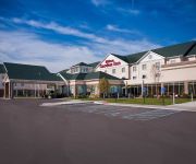
Hilton St Louis Airport
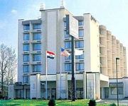
Renaissance St. Louis Airport Hotel
Marriott St. Louis Airport
Hilton Garden Inn St Louis Airport
La Quinta Inn St. Louis Hazelwood - Airport North
RAMADA ST LOUIS AIRPORT
Holiday Inn Express & Suites ST LOUIS AIRPORT
SureStay Plus Hotel by Best Western St. Louis Airport
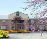
Quality Inn Airport
Holiday Inn ST. LOUIS-AIRPORT
Videos from this area
These are videos related to the place based on their proximity to this place.
Tornado destruction in Berkeley, MO
Governor Jay Nixon and St. Louis County Executive Charlie Dooley view damage done by class 4 tornado.
Ferguson MO Riots & Ferguson Syndrome! Diversity Training Expert Jason Greer's City Council Offer.
http://www.greerconsultinginc.com/ Ferguson MO Riots & Ferguson Syndrome! Diversity training expert Jason Greer's offer theCity Councils & police departments. For more info. call 314-643-6572.
Ferguson Municipal Public Library Tour
Welcome to the Ferguson Municipal Public Library, NOW with SUPER SHAKY CAM (TM). This tour will show you around the public areas of the library. A simple video introduction, and a big welcome...
Ferguson Police brutally assault minority student
A local High School from Ferguson, Missouri was hit by the Racial discrimination that the city. Subscribe and Share this with your friends and family.
RAIZED ROTTEN PRESENTS Y.T-ROGERS (U-AINT)
A ST.LOUIS MOVEMENT BROUGHT TO YOU BY THE SENSATIONAL Y.T-ROGERS AND THE RAIZED ROTTEN CLAN FROM KINLOCH AND BERKELEY MISSOURI HOME OF NELLY CHINGY ...
Nickel Plate Railroad NPR 765 through St. Louis
The steam locomotive NPR 765 visited the St. Louis area on 9/9/12. Here are some clips as it traveled to & from Berkeley to St. Charles, MO.
Window Replacement In Ferguson MO | (314) 690-9900
Window Replacement In Ferguson MO | (314) 690-9900 http://zenwindows.com/locations/replacement-windows-st-louis-mo/ With today's technological innovations that have been used in the design...
Jewelry Stores in Ferguson, Missouri, MO (314) 757-2858
Jewelry Stores in Ferguson, Missouri, MO (314) 757-2858 Have you been searching Google for Jewelry Stores in Ferguson MO, Jewelry Store in Ferguson MO, or Jewelry Shops in Ferguson Missouri?
Ferguson, MO Riots = Ferguson Syndrome - Labor Relations & Diversity Training Expert St. Louis, MO.
http://www.greerconsultinginc.com/ Ferguson, MO riots created the Ferguson Syndrome - Jason Greer who is a labor relations & diversity training expert based in St. Louis, MO offers funding...
Ferguson Police Threaten Arrest, Immediately Fire
Police in Ferguson attempt to push back crowds and force them to disperse, and in a moment just sent by News2share's Trey Yingst, immediately following telling them they'd be subject to arrest,...
Videos provided by Youtube are under the copyright of their owners.
Attractions and noteworthy things
Distances are based on the centre of the city/town and sightseeing location. This list contains brief abstracts about monuments, holiday activities, national parcs, museums, organisations and more from the area as well as interesting facts about the region itself. Where available, you'll find the corresponding homepage. Otherwise the related wikipedia article.
Bel-Ridge, Missouri
Bel-Ridge is a northern suburban village in St. Louis County, Missouri, United States. The population was 2,737 at the 2010 census. Bel-Ridge is part of the Normandy School System and borders the affluent villages of Bel-Nor and Bellerive.
Calverton Park, Missouri
Calverton Park is a village in St. Louis County, Missouri, United States. The population was 1,293 at the 2010 census.
Cool Valley, Missouri
Cool Valley is a city in St. Louis County, Missouri, United States in Greater St. Louis. The population was 1,196 at the 2010 census.
St. John, Missouri
St. John is a city in St. Louis County, Missouri, with its commercial district centered along St. Charles Rock Road. It is a few miles southeast of Lambert-St. Louis International Airport. As of the 2010 census, the city population was 6,517.
North Hanley (St. Louis MetroLink)
North Hanley is a St. Louis MetroLink Station, located by the North Hanley overpass of I-70. It is primarily a commuter station featuring 1583 Park-Ride spaces (including 657 in a garage facility). The station also serves as a major bus transfer center for Metro in North St. Louis County.
McCluer South-Berkeley High School
McCluer South-Berkeley High School is a secondary school located at 201 Brotherton Lane in the city of Ferguson, Missouri a suburb of St. Louis. Located in the Ferguson-Florissant School District McCluer South Berkeley is the newest secondary school. MSB educates students from the cities of Cool Valley, Ferguson, Kinloch and Berkeley. The school opened in January 2004, replacing Berkeley High School in Berkeley, which had closed in December 2003 due to expansion of the Lambert-St.
Ozark Air Lines Flight 809
Ozark Air Lines Flight 809 was a regularly scheduled flight from Nashville, Tennessee, to St. Louis, Missouri, with four intermediate stops. On July 23, 1973, while landing at St. Louis International Airport, it crashed, killing 38 of the 44 persons aboard. Windshear was cited as the cause.
1966 NASA T-38 crash
The 1966 NASA T-38 crash occurred when a NASA Northrop T-38 Talon crashed at Lambert Field in St. Louis, Missouri, on February 28, 1966, killing two Project Gemini astronauts, Elliot See and Charles Bassett. The aircraft, piloted by See, crashed into the McDonnell Aircraft building where their Gemini 9 spacecraft was being assembled. The weather was poor with rain, snow, fog, and low clouds. A NASA panel, headed by the Chief of the Astronaut Office, Alan Shepard, investigated the crash.


