Safety Score: 2,7 of 5.0 based on data from 9 authorites. Meaning we advice caution when travelling to United States.
Travel warnings are updated daily. Source: Travel Warning United States. Last Update: 2024-05-09 08:23:21
Delve into Elwood
Elwood in Greene County (Missouri) is a city located in United States about 898 mi (or 1,445 km) west of Washington DC, the country's capital town.
Current time in Elwood is now 04:08 PM (Thursday). The local timezone is named America / Chicago with an UTC offset of -5 hours. We know of 11 airports closer to Elwood, of which 5 are larger airports. The closest airport in United States is Springfield Branson National Airport in a distance of 3 mi (or 4 km), North-East. Besides the airports, there are other travel options available (check left side).
Also, if you like playing golf, there are some options within driving distance. In need of a room? We compiled a list of available hotels close to the map centre further down the page.
Since you are here already, you might want to pay a visit to some of the following locations: Springfield, Ozark, Bolivar, Mount Vernon and Galena. To further explore this place, just scroll down and browse the available info.
Local weather forecast
Todays Local Weather Conditions & Forecast: 20°C / 69 °F
| Morning Temperature | 12°C / 53 °F |
| Evening Temperature | 18°C / 64 °F |
| Night Temperature | 13°C / 55 °F |
| Chance of rainfall | 0% |
| Air Humidity | 54% |
| Air Pressure | 1012 hPa |
| Wind Speed | Moderate breeze with 10 km/h (6 mph) from South-East |
| Cloud Conditions | Clear sky, covering 1% of sky |
| General Conditions | Sky is clear |
Thursday, 9th of May 2024
18°C (64 °F)
11°C (51 °F)
Few clouds, gentle breeze.
Friday, 10th of May 2024
21°C (70 °F)
18°C (64 °F)
Sky is clear, gentle breeze, clear sky.
Saturday, 11th of May 2024
24°C (75 °F)
15°C (59 °F)
Light rain, gentle breeze, few clouds.
Hotels and Places to Stay
Courtyard Springfield Airport
La Quinta Inn and Suites Springfield Airport Plaza
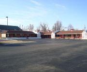
BEST BUDGET INN SPRINGFIELD
GRAND CROWNE
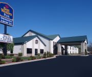
BW PLUS SPRINGFIELD AIRPORT
Videos from this area
These are videos related to the place based on their proximity to this place.
Hail in Willard, MO
Quarter to Ping Pong sized hail in Willard, Missouri near the intersection of Highway 160 & Miller Road! P.S. Sorry about it being so shaky.
Branson Landing day display fire water show (Branson, Missouri)
Branson Landing day display fire water show.
Jo Tate ride 50 mile B.C trot out
This is at the Joe Tate ride in missouri 2011. The horses name is "high noon xpress"
Republic
Visualization created for the OTO Long Range Transportation Plan, Journey 2035. Future plans for land use around this intersection include the expansion of an industrial Park and new commercial...
Sean Saunders - PGA Golf Pro - Springfield, Missouri
PGA Teaching Pro Sean Saunders talking to a group of business professionals about getting better at golf. Check him out at www.swsgolf.com or follow him on twitter (@swsgolf)
Bark at the Moon- Ozzy Osbourne
Me just messin around playing Bark at the Moon by Ozzy on my new Les Paul.
New Terminal at Springfield-Branson National Airport
Animation of new terminal at Springfield, MO airport. Scheduled to open in spring of 2009.
Joplin & Springfield Railway train ride
4th of july 2012 train ride on the Joplin & Springfield Railway. They can also do special events with advanced reservations. The railway is a 24 inch width rail. the web site is www.joplinspringfie...
Winter Weather Travel Safety
Winter weather travel safety tips. --------------------------------- National Weather Service Weather Forecast Office Springfield, MO.
Videos provided by Youtube are under the copyright of their owners.
Attractions and noteworthy things
Distances are based on the centre of the city/town and sightseeing location. This list contains brief abstracts about monuments, holiday activities, national parcs, museums, organisations and more from the area as well as interesting facts about the region itself. Where available, you'll find the corresponding homepage. Otherwise the related wikipedia article.
Springfield-Branson National Airport
Springfield-Branson National Airport, formerly Springfield-Greene County Airport, Springfield Municipal Airport and Springfield-Branson Regional Airport, is a public airport located five miles (8 km) northwest of the central business district of Springfield, a city in Greene County, Missouri, United States. The airport has non-stop service to eleven U.S. cities.


