Safety Score: 2,7 of 5.0 based on data from 9 authorites. Meaning we advice caution when travelling to United States.
Travel warnings are updated daily. Source: Travel Warning United States. Last Update: 2024-05-02 08:23:34
Delve into Glenwood Junction
The district Glenwood Junction of Minneapolis in Hennepin County (Minnesota) is a subburb in United States about 935 mi north-west of Washington DC, the country's capital town.
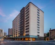
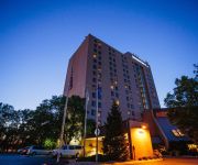
If you need a hotel, we compiled a list of available hotels close to the map centre further down the page.
While being here, you might want to pay a visit to some of the following locations: Anoka, Saint Paul, Shakopee, Chaska and Elk River. To further explore this place, just scroll down and browse the available info.
Local weather forecast
Todays Local Weather Conditions & Forecast: 10°C / 49 °F
| Morning Temperature | 11°C / 53 °F |
| Evening Temperature | 9°C / 49 °F |
| Night Temperature | 9°C / 49 °F |
| Chance of rainfall | 5% |
| Air Humidity | 93% |
| Air Pressure | 1009 hPa |
| Wind Speed | Gentle Breeze with 8 km/h (5 mph) from South-West |
| Cloud Conditions | Overcast clouds, covering 100% of sky |
| General Conditions | Moderate rain |
Friday, 3rd of May 2024
18°C (65 °F)
11°C (53 °F)
Sky is clear, gentle breeze, clear sky.
Saturday, 4th of May 2024
15°C (59 °F)
9°C (49 °F)
Moderate rain, gentle breeze, overcast clouds.
Sunday, 5th of May 2024
18°C (64 °F)
15°C (59 °F)
Sky is clear, gentle breeze, clear sky.
Hotels and Places to Stay
Le Meridien Chambers Minneapolis
AC Hotel Minneapolis West End
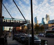
HEWING HOTEL
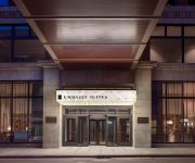
Embassy Suites By Hilton Minneapolis Downtown Hotel
Minneapolis Marriott City Center
Loews Minneapolis Hotel
DoubleTree Suites by Hilton Minneapolis
Hilton Minneapolis
DoubleTree by Hilton Minneapolis - Park Place
MOXY Minneapolis Uptown
Videos from this area
These are videos related to the place based on their proximity to this place.
Deer on the mountain bike trail.
Deer hanging out at the Glenwood section of Theo Wirth Park. They tell me it's normal.
2014 Subaru Outback Used Cars Golden Valley MN
http://www.poquetauto.com This 2014 Subaru Outback is available from Poquet Auto. For details, call us at 763-522-2000.
Akkerman GBM 4815A at a Minger Construction jobsite in Golden Valley, MN
The Akkerman 4815A Jacking Frame, part of the Guided Boring Machine (GBM) line at a Minger Construction jobsite. The video shows the augers and casings portion of the job. The casings and...
2013 Ford F-150 Used Cars Golden Valley MN
http://www.poquetauto.com This 2013 Ford F-150 is available from Poquet Auto. For details, call us at 763-522-2000.
2015 Mazda CX-5 Used Cars Golden Valley MN
http://www.poquetauto.com This 2015 Mazda CX-5 is available from Poquet Auto. For details, call us at 763-522-2000.
2015 Chevrolet Tahoe Used Cars Golden Valley MN
http://www.poquetauto.com This 2015 Chevrolet Tahoe is available from Poquet Auto. For details, call us at 763-522-2000.
2014 Mitsubishi Outlander Sport Used Cars Golden Valley MN
http://www.poquetauto.com This 2014 Mitsubishi Outlander Sport is available from Poquet Auto. For details, call us at 763-522-2000.
2015 Audi allroad Used Cars Golden Valley MN
http://www.poquetauto.com This 2015 Audi allroad is available from Poquet Auto. For details, call us at 763-522-2000.
2008 Volvo XC90 Used Cars Golden Valley MN
http://www.poquetauto.com This 2008 Volvo XC90 is available from Poquet Auto. For details, call us at 763-522-2000.
2015 BMW 3-Series Used Cars Golden Valley MN
http://www.poquetauto.com This 2015 BMW 3-Series is available from Poquet Auto. For details, call us at 763-522-2000.
Videos provided by Youtube are under the copyright of their owners.
Attractions and noteworthy things
Distances are based on the centre of the city/town and sightseeing location. This list contains brief abstracts about monuments, holiday activities, national parcs, museums, organisations and more from the area as well as interesting facts about the region itself. Where available, you'll find the corresponding homepage. Otherwise the related wikipedia article.
Golden Valley, Minnesota
Golden Valley is a city in Hennepin County, Minnesota, United States. It is a western suburb of Minneapolis and is the main corporate headquarters of General Mills and Pentair. Golden Valley is also the home of NBC affiliate KARE, the Perpich Center for Arts Education and Breck School. The population was 20,371 at the 2010 census.
WWTC
WWTC (1280 AM, "The Patriot") is a long-standing radio station serving the Twin Cities region. Despite its up-and-down history, the station spawned two of the area's major television stations and had some very innovative and unusual periods in its history. Today it is owned by Salem Communications and broadcasts a conservative talk radio format.
KDIZ
KDIZ is a radio station serving the Minneapolis-St. Paul metropolitan area. It is owned by The Walt Disney Company, and airs the Radio Disney radio network.
Lake of the Isles
Lake of the Isles is a lake in Minneapolis, Minnesota connected to Cedar Lake and Lake Calhoun. It is home to winter ice skating and hockey, as well as a New Year's Eve celebration featuring roasted marshmallows and hot chocolate. The lake has an area of 109 acres, 2.86 miles of shoreline, and a maximum depth of 31 feet . Lake of the Isles is known for its two wooded islands, its long north arm, and the stately houses of the Kenwood, Lowry Hill and East Isles neighborhoods which surround it.
Wirth Lake (Minnesota)
Wirth Lake is in Theodore Wirth Park, a large park managed by the Minneapolis Park and Recreation Board, but actually in Golden Valley, a neighboring suburb.
Theodore Wirth Park
Theodore Wirth Park is the largest park managed by the Minneapolis Park and Recreation Board. The park land is shared by Minneapolis and the neighboring suburb of Golden Valley. The 742-acre park includes two golf courses (an 18-hole course and a 9-hole par 3 course), Wirth Lake, Birch Pond, and other amenities. It forms a significant portion of the Grand Rounds Scenic Byway, linking the Chain of Lakes area with the Victory Memorial Parkway.
KYCR
KYCR (1570 AM) is a radio station serving the Minneapolis/St. Paul metropolitan area, and licensed to Golden Valley, Minnesota. The station is owned by Salem Communications and broadcasts a secular talk radio format. The call sign stands for "Your Christian Radio".
Cedar Lake (Minnesota)
Cedar Lake is a lake on the west side of Minneapolis, north of Lake Calhoun and west of Lake of the Isles. The lake is surrounded by parkland on the west side, while the east side borders the Kenwood residential area. The north side is bordered by the Cedar Lake Trail and the BNSF Railway. The lake has an area of 169 acres (0.26 sq mi) and a maximum depth of 51 feet .
Calhoun Isles, Minneapolis
Calhoun-Isles is one of the official communities (a grouping of several official neighborhoods) of Minneapolis, Minnesota. It contains the Uptown business district and the name "Uptown" is frequently (though somewhat incorrectly) used to refer to the entire community. The name of the community refers to its most prominent physical features, the large and publicly accessible lakes, Lake Calhoun and Lake of the Isles.
West Calhoun, Minneapolis
West Calhoun is a neighborhood in Minneapolis, Minnesota. It is the southwesternmost neighborhood of the Calhoun Isles community, an affluent region in the western part of the city. West Calhoun is bordered on the east by East Calhoun, or "ECCO", the north by Cedar-Isles-Dean, the south by Linden Hills and the west by the city of St. Louis Park. Its boundaries are Lake Street to the north, Lake Calhoun to the east, 36th Street to the south, and France Avenue to the west.
Benilde-St. Margaret's
Benilde-St. Margaret's School, named after Saint Bénilde Romançon and Saint Margaret of Scotland, is a Catholic, co-educational private school for grades 7–12 located in St. Louis Park, Minnesota, that draws its over one thousand students from throughout the Twin Cities Metro Area. It is located in the Roman Catholic Archdiocese of Saint Paul and Minneapolis.
Near North (neighborhood), Minneapolis
Near North is a neighborhood within the larger Near North community on the north side of Minneapolis. It is bordered by the Hawthorne and Jordan neighborhoods to the north, St. Anthony West to the east, North Loop, Sumner-Glenwood, and Harrison to the south, and Willard-Hay to the west.
Kenwood, Minneapolis
Kenwood is a neighborhood within the Calhoun-Isles community in Minneapolis. Its boundaries are Cedar Lake Parkway to the west, Kenwood Parkway to the north, West Lake of the Isles Parkway to the east, and Kenilworth Place to the south. The neighborhood is one of the most affluent in the city, with mansions along the parkways.
Bryn Mawr, Minneapolis
Bryn Mawr is a neighborhood within the Calhoun-Isles community in Minneapolis. It is located directly west of downtown Minneapolis. The oddly-shaped neighborhood is bound by parkland: Theodore Wirth Park to the north and west, Bassett Creek to the north, Bryn Mawr Meadows to the east, and Cedar Lake Park to the south. Nearby neighborhoods include Harrison to the north, Lowry Hill to the east, and Kenwood and Cedar-Isles-Dean to the south.
Cedar-Isles-Dean, Minneapolis
Cedar-Isles-Dean is a neighborhood in the Calhoun-Isles community in Minneapolis. Its boundaries are the Kenilworth Lagoon and Lake of the Isles to the north and east, West Lake Street to the south, and France Avenue South to the west. Nearby neighborhoods include Bryn Mawr and Kenwood to the north, East Isles to the east, East Calhoun to the southwest, and West Calhoun to the south. To the west is the suburb of Saint Louis Park.
Cleveland, Minneapolis
Cleveland is a neighborhood in the Camden community in Minneapolis. Its boundaries are Dowling Avenue to the north, Penn Avenue North to the east, Lowry Avenue north to the south, and Xerxes Avenue North to the west. To the west of Xerxes Avenue is the suburb of Robbinsdale.
Harrison, Minneapolis
Harrison is a neighborhood in the Near North community in Minneapolis, located to the west of downtown. Its boundaries are Olson Memorial Highway to the north, Interstate 94 to the east, Bassett Creek to the south, and Theodore Wirth Park to the west. {{#invoke:Coordinates|coord}}{{#coordinates:44.9814|-93.3031|region:US-MN_type:city(4156)_source:GoogleEarth|||||| |primary |name= }}
Jordan, Minneapolis
Jordan is a neighborhood in the Near North community in Minneapolis. Its boundaries are Lowry Avenue North to the north, Emerson Avenue North to the east, and West Broadway to the south and west. {{#invoke:Coordinates|coord}}{{#coordinates:45.0060|-93.3022|region:US-MN_type:city(9149)_source:GoogleEarth|||||| |primary |name= }}
Sumner-Glenwood, Minneapolis
Sumner-Glenwood is the name of a small neighborhood in the Near North community of Minneapolis, MN. It is roughly contained by 15 city blocks bordered to the north by 11th Avenue N. , to the south by Glenwood Avenue, to the east by I-94, and to the west by both Girard Terrace and Emerson Avenue N (2). 3,336 people lived in the neighborhood before 1998, of whom roughly 66% were Asian, Native Hawaiian or Other Pacific Islander, 29% were black, and 5% were White (1).
Willard-Hay, Minneapolis
Willard-Hay is a neighborhood within the larger Near North community on the north side of Minneapolis. The boundaries are roughly Olson Highway on the south, Penn Avenue on the east, (though a small portion of the neighborhood is northeast of Penn and Plymouth) Broadway Avenue on the northeast and Theodore Wirth Park on the west. The neighborhood is often known as Willard-Homewood by residents; the portion south of Plymouth is Homewood.
Kenwood Park Water Tower
The Kenwood Park Water Tower is an octagonal brick and stone water tower in the Kenwood neighborhood of Minneapolis, Minnesota, United States. It was built in 1910 and designed by Frederick William Cappelen, the city of Minneapolis engineer at the time. The tower is 110 feet tall, making it the tallest structure in Kenwood. The tower has not been used to store water since 1954. The tower was built to alleviate water pressure and storage problems in the Lowry Hill area.
North Community High School
North Community High School, or simply Minneapolis North, is a public, four-year high school located in Minneapolis, Minnesota. The school has existed for over 120 years in several buildings all located on the North Side of Minneapolis. North once had a predominately Jewish student body but by 1982, the school and the neighborhood it is located in had become mostly African-American.
Art Instruction Schools
Art Instruction Schools, better known to many as Art Instruction, Inc. , is a home study correspondence course providing training in cartooning and illustration. In its early years the school was named Federal School of Applied Cartooning. The company is located in Minneapolis, Minnesota, where it was founded in 1914 as a branch of the Bureau of Engraving, Inc. , to train illustrators for both the growing printing industry and the Bureau itself.
North Memorial Medical Center
North Memorial Medical Center, sometimes referred to as North Memorial, is a hospital located in Robbinsdale, Minnesota. It is one of four level one trauma facilities in Minnesota. North Memorial Medical Center owns and operates 120 ground based ambulances (serving many communities throughout Minnesota), and five emergency medical helicopter flight bases, located in Bemidji, Brainerd, Princeton, Redwood Falls and the Twin Cities.
Bassett Creek (Crystal, Minnesota)
Bassett Creek is a neighborhood within the city of Crystal, Minnesota. It borders the city of Minneapolis to the south and east, and is generally considered to be the section of Crystal that is situated east of Douglas Drive, south of 36th Ave. N. , and west of Highway 100. Bassett Creek is bordered by Crystal neighborhoods Lee Park to the east, Valley Place to the west, and Fair to the north. The neighborhood is the location for Bassett Creek Park, the largest park in Crystal.


