Safety Score: 2,7 of 5.0 based on data from 9 authorites. Meaning we advice caution when travelling to United States.
Travel warnings are updated daily. Source: Travel Warning United States. Last Update: 2024-05-16 08:19:50
Delve into Meyer
Meyer in Adams County (Illinois) is a town located in United States about 775 mi (or 1,247 km) west of Washington DC, the country's capital town.
Time in Meyer is now 02:04 AM (Friday). The local timezone is named America / Chicago with an UTC offset of -5 hours. We know of 11 airports closer to Meyer, of which 5 are larger airports. The closest airport in United States is Quincy Regional Baldwin Field in a distance of 22 mi (or 35 km), South-East. Besides the airports, there are other travel options available (check left side).
There is one Unesco world heritage site nearby. It's Cahokia Mounds State Historic Site in a distance of 133 mi (or 213 km), South-East. Also, if you like the game of golf, there are some options within driving distance. In need of a room? We compiled a list of available hotels close to the map centre further down the page.
Since you are here already, you might want to pay a visit to some of the following locations: Monticello, Quincy, Kahoka, Palmyra and Carthage. To further explore this place, just scroll down and browse the available info.
Local weather forecast
Todays Local Weather Conditions & Forecast: 23°C / 73 °F
| Morning Temperature | 15°C / 59 °F |
| Evening Temperature | 22°C / 72 °F |
| Night Temperature | 17°C / 62 °F |
| Chance of rainfall | 0% |
| Air Humidity | 61% |
| Air Pressure | 1007 hPa |
| Wind Speed | Light breeze with 4 km/h (2 mph) from West |
| Cloud Conditions | Overcast clouds, covering 93% of sky |
| General Conditions | Overcast clouds |
Friday, 17th of May 2024
25°C (77 °F)
18°C (65 °F)
Sky is clear, light breeze, clear sky.
Saturday, 18th of May 2024
26°C (78 °F)
21°C (69 °F)
Overcast clouds, gentle breeze.
Sunday, 19th of May 2024
27°C (80 °F)
22°C (72 °F)
Moderate rain, moderate breeze, overcast clouds.
Hotels and Places to Stay
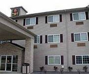
Inn Canton (Ex comfort INN)
Videos from this area
These are videos related to the place based on their proximity to this place.
Smurfwood Trails Jan. 31st 2015
a couple of friends and i went for a ride and ended up getting rained out . sorry for all the water on the gopro at the end . i was froze and that was the last thing on my mind .
Missouri Now - Gov. Nixon cuts ribbon at Canton grain elevator
Gov. Jay Nixon helps cut the ribbon at a new grain elevator on the riverfront in Canton, a facility that will help area farmers move grain and other goods to market in a way that is quicker,...
Skijoring with Big Guy
This was my second attempt at cross-country skiing while being pulled by my Giant Schnauzer. This effort could be considered crazy, as the dog has little training for it, and the skier is...
Videos provided by Youtube are under the copyright of their owners.
Attractions and noteworthy things
Distances are based on the centre of the city/town and sightseeing location. This list contains brief abstracts about monuments, holiday activities, national parcs, museums, organisations and more from the area as well as interesting facts about the region itself. Where available, you'll find the corresponding homepage. Otherwise the related wikipedia article.
Culver–Stockton College
Culver–Stockton College is a private, residential, four-year, liberal arts college located in Canton, in the U.S. state of Missouri. Culver–Stockton College offers a liberal arts education with practical learning experiences. The campus is located on 140 acres on a bluff overlooking the Mississippi River. Culver–Stockton College was founded as Christian University in 1853. As of fall 2010, the college enrolled 771 students.
Lock and Dam No. 20
Lock and Dam No. 20 is a lock and dam located on the Upper Mississippi River, about one mile upstream from Canton, Missouri. The structure is located at river mile 343.1. It includes a 2,369 feet long dam, 40 tainter gates, 3 roller gates, and a lock chamber that is 110 feet wide by 600 feet long. There is also an incomplete auxiliary lock. In 2004, the facility was listed in the National Register of Historic Places as Lock and Dam No.
KCSW-LP
KCSW-LP is a radio station licensed to Canton, Missouri, USA. The station is currently owned by Culver-Stockton College.


