Safety Score: 2,7 of 5.0 based on data from 9 authorites. Meaning we advice caution when travelling to United States.
Travel warnings are updated daily. Source: Travel Warning United States. Last Update: 2024-05-16 08:19:50
Explore Pleasant Grove
Pleasant Grove in Escambia County (Florida) is a city in United States about 830 mi (or 1,336 km) south-west of Washington DC, the country's capital.
Local time in Pleasant Grove is now 06:44 AM (Thursday). The local timezone is named America / Chicago with an UTC offset of -5 hours. We know of 8 airports in the vicinity of Pleasant Grove, of which 3 are larger airports. The closest airport in United States is Pensacola Regional Airport in a distance of 12 mi (or 20 km), North-East. Besides the airports, there are other travel options available (check left side).
Also, if you like golfing, there are multiple options in driving distance. We found 10 points of interest in the vicinity of this place. If you need a place to sleep, we compiled a list of available hotels close to the map centre further down the page.
Depending on your travel schedule, you might want to pay a visit to some of the following locations: Pensacola, Milton, Bay Minette, Mobile and Brewton. To further explore this place, just scroll down and browse the available info.
Local weather forecast
Todays Local Weather Conditions & Forecast: 30°C / 86 °F
| Morning Temperature | 20°C / 68 °F |
| Evening Temperature | 27°C / 81 °F |
| Night Temperature | 25°C / 76 °F |
| Chance of rainfall | 0% |
| Air Humidity | 44% |
| Air Pressure | 1012 hPa |
| Wind Speed | Gentle Breeze with 9 km/h (5 mph) from North |
| Cloud Conditions | Overcast clouds, covering 97% of sky |
| General Conditions | Overcast clouds |
Thursday, 16th of May 2024
28°C (83 °F)
27°C (80 °F)
Moderate rain, moderate breeze, overcast clouds.
Friday, 17th of May 2024
24°C (76 °F)
24°C (75 °F)
Heavy intensity rain, moderate breeze, overcast clouds.
Saturday, 18th of May 2024
33°C (91 °F)
26°C (78 °F)
Light rain, gentle breeze, clear sky.
Hotels and Places to Stay
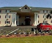
Ashton Inn and Suites
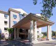
Holiday Inn Express & Suites PENSACOLA WEST-NAVY BASE
Suburban Extended Stay Hotel Pensacola
SUPER 8 PENSACOLA N.A.S. CORRY
Quality Inn N.A.S.-Corry
INDIGO BY WYNDHAM VACATION RENTALS
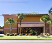
PALACIO CONDOMINIUMS BY WYNDHAM VR
ResortQuest At Palacio
Videos from this area
These are videos related to the place based on their proximity to this place.
World's Longest Golf Cart
World's Longest Golf Cart - More at http://koolkartsonline.com/velocity/home/exotica This thing is insane! Over 24 feet long and full of luxurious features.
Surrounded by Dolphins, Bayou Grande, Pensacola, Florida
I was in my kayak when i realized i was surrounded by a family of Dolphins with babies and everything. My exhilaration got the best of me.
P3D - Beechcraft T-6 Texan II - Naval Air Station Pensacola - By JMCV 2013
Prepar3D (P3D) is a simulation platform developed by Lockheed Martin. * The Beechcraft T-6 Texan II is a single-engined turboprop aircraft built by the Raytheon Aircraft Company (which became...
Blue Angels Homecoming 2009 Part 1.wmv
Friday 13 November, Pensacola Naval Air Station. This video is highlights of the show prior to the Blue Angels segment.
Florida - Pensacola Naval Air Station Blue Angels
Blue Angels Practice at Pensacola Naval Air Station in September 2011.
Videos provided by Youtube are under the copyright of their owners.
Attractions and noteworthy things
Distances are based on the centre of the city/town and sightseeing location. This list contains brief abstracts about monuments, holiday activities, national parcs, museums, organisations and more from the area as well as interesting facts about the region itself. Where available, you'll find the corresponding homepage. Otherwise the related wikipedia article.
Fort McRee
Fort McRee, was a historic military fort constructed by the United States, on the eastern tip of Perdido Key, to defend Pensacola and its important natural harbor. In the defense of Pensacola Bay, Fort McRee was accompanied by Fort Pickens, located across Pensacola Pass from Fort McRee on Santa Rosa Island, and Fort Barrancas, located across Pensacola Bay on the grounds of what is now Naval Air Station (NAS) Pensacola. Very little remains of the fort today.
Naval Air Station Pensacola
Naval Air Station Pensacola or NAS Pensacola (formerly NAS/KNAS until changed circa 1970 to allow Nassau International Airport, now Lynden Pindling International Airport to have IATA code NAS), "The Cradle of Naval Aviation", is a United States Navy base located next to Warrington, Florida, a community southwest of the Pensacola city limits.
Pensacola Light
The first Pensacola Light was the lightship Aurora Borealis. It was moved to Pensacola in 1823 from its previous post at the mouth of the Mississippi River after a lighthouse had been completed there. Because of frequent rough seas, the lightship had to be anchored inside the bay entrance, behind Santa Rosa Island, and could not reliably be seen from ships outside the bay. In 1825 a 40-foot tower was built on a 40-foot bluff at the south entrance to Pensacola Bay.


